Discover 15 hidden attractions, cool sights, and unusual things to do in Western Ghats (India). Don't miss out on these must-see attractions: Kumbhavurutty Waterfalls, Agastya Mala, and Periyar National Park. Also, be sure to include Silent Valley National Park in your itinerary.
Below, you can find the list of the most amazing places you should visit in Western Ghats (Kerala).
Table of Contents
Kumbhavurutty Waterfalls
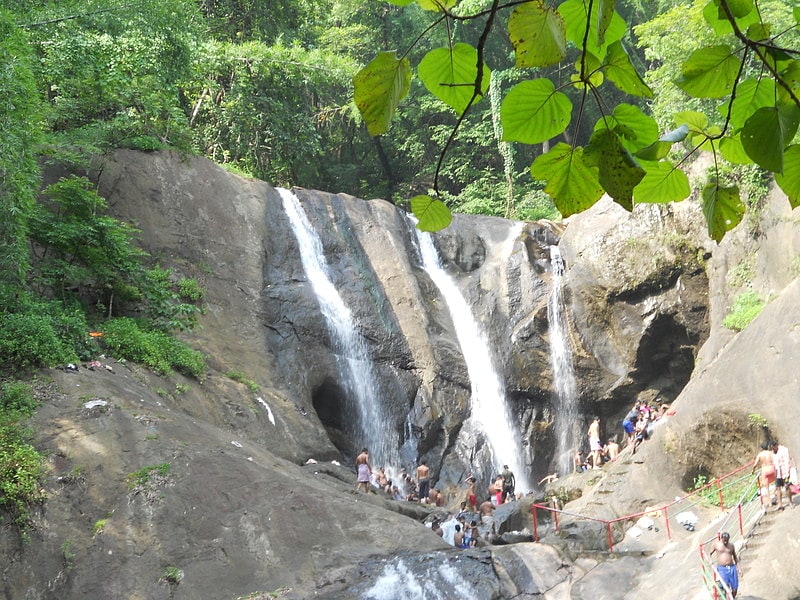
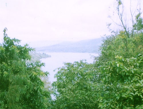
Waterfall in India. Kumbhavurutty Waterfall is a famous waterfalls in South India situated near Aryankavu panchayath in Kollam district of Kerala near Tamil Nadu border. Located on the eastern area of Kollam District, Kumbhavurutty falls is one among the few crowd pulling waterfalls in Kerala. During peak times, the daily collection of this tourism spot will cross Rs. 1,50,000. It is about 6.5 km away from Achenkovil. This waterfall is a part of river Achankovil. Manalar Waterfall is another important waterfall near to this. The travelers can see wild animals also if lucky. Because the waterfall is very close to the thick Konni Forest area. Palaruvi Falls is another nearby attraction of this falls.[1]
Agastya Mala
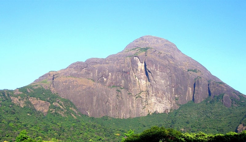
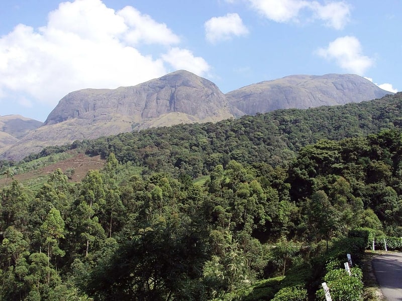
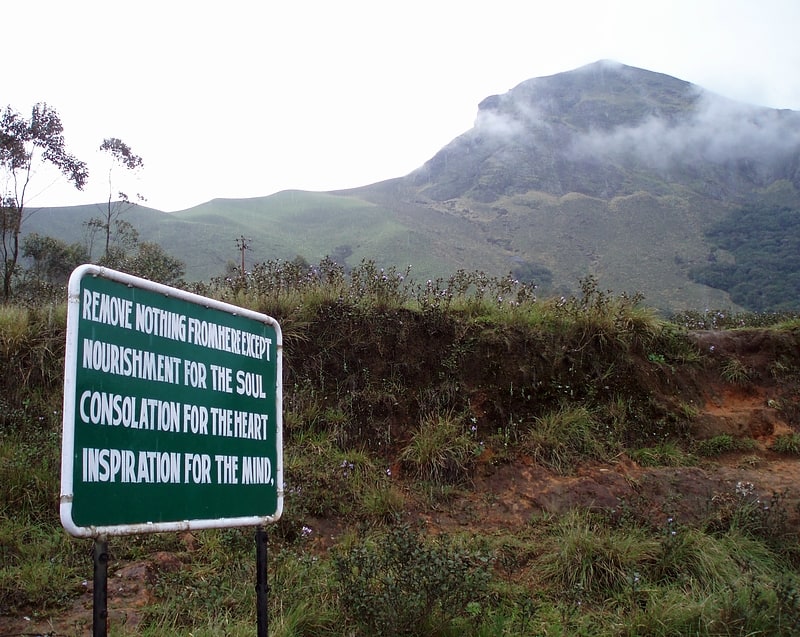
Peak in India. Agastyaarkoodam is a 1,868-metre -one of the peak in the Western Ghats, Tirunelveli District of Tamil Nadu, India. This peak is a part of the Agasthyamala Biosphere Reserve which lies on the border between the Indian states of Tamil Nadu, Tirunelveli district and Kerala, Thiruvananthapuram district. The perennial Thamirabarani River originates from the eastern side of the range and flows into the Tirunelveli district of Tamil Nadu.
Agastyaarkoodam is a pilgrimage centre for devotees of the Hindu sage Agastya, who is considered to be one of the seven rishis (Saptarishi) of Hindu Puranas. In Tamil traditions, Agastya is considered as the father of the Tamil language and the compiler of the first Tamil grammar called Agattiyam or Akattiyam. There is a small stone statue of Agathiyar at the top of the peak and the devotees can offer pujas themselves.
Agasthyamala Biosphere Reserve is among 20 new sites added by UNESCO to its World Network of Biosphere Reserves in March 2016. The International Co-ordinating Council added the new sites during a two-day meeting on 19 March 2016 in Lima, bringing the total number of biosphere reserves to 669 sites in 120 countries, including 16 transboundary sites.It includes close to 300 rare bird species and more than 200 medicinal plants found only here.[2]
Address: Neyyar Wildlife Sanctuary, Western Ghats
Periyar National Park
Also known as: पेरियार राष्ट्रीय उद्यान
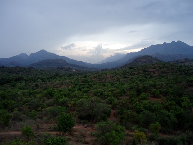
National park in India. Periyar National Park and Wildlife Sanctuary is a protected area located in the districts of Idukki and Pathanamthitta in Kerala, India. It is notable as an elephant reserve and a tiger reserve. The protected area encompasses 925 km2, of which 305 km2 of the core zone was declared as the Periyar National Park in 1982. The park is a repository of rare, endemic, and endangered flora and fauna and forms the major watershed of two important rivers of Kerala: the Periyar and the Pamba.
The park is located high in the Cardamom Hills and Pandalam Hills of the south Western Ghats along the border with Tamil Nadu. It is 4 km (2.5 mi) from Kumily, approximately 100 km (62 mi) east of Kottayam, 110 km (68 mi) west of Madurai and 120 km (75 mi) southeast of Kochi.[3]
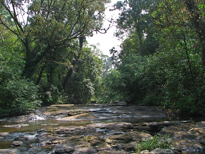
Silent Valley National Park
Also known as: साइलेंट वैली राष्ट्रीय उद्यान
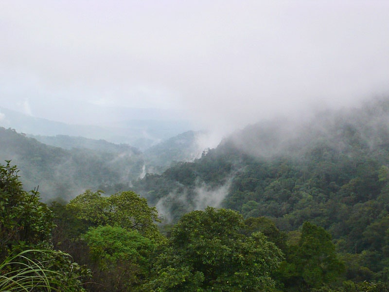
National park in India. Silent Valley National Park is a national park in Kerala, India. It is located in the Nilgiri hills, has a core area of 89.52 km2, which is surrounded by a buffer zone of 148 km2. This national park has some rare species of flora and fauna. This area was explored in 1847 by the botanist Robert Wight. It is located in the border of Mannarkkad Taluk of Palakkad district, Nilambur Taluk of Malappuram district, Kerala, and Nilgiris district of Tamil Nadu.
It is located in the rich biodiversity of Nilgiri Biosphere Reserve. Karimpuzha Wildlife Sanctuary, New Amarambalam Reserved Forest, and Nedumkayam Rainforest in Nilambur Taluk of Malappuram district, Attappadi Reserved Forest in Mannarkkad Taluk of Palakkad district, and Mukurthi National Park of Nilgiris district, are located around Silent Valley National Park. Mukurthi peak, the fifth-highest peak in South India, and Anginda peak are also located in its vicinity. Bhavani River, a tributary of Kaveri River, and Kunthipuzha River, a tributary of Bharathappuzha river, originate in the vicinity of Silent Valley. The Kadalundi River has also its origin in Silent Valley.
The national park is one of the last undisturbed tracts of South Western Ghats mountain rain forests and tropical moist evergreen forest in India. Contiguous with the proposed Karimpuzha National Park (225 km2 (87 sq mi)) to the north and Mukurthi National Park (78.46 km2) to the north-east, it is the core of the Nilgiri Biosphere Reserve (1,455.4 km2), and is part of the Nilgiri Sub-Cluster (6,000+ km2), Western Ghats World Heritage Site, recognised by UNESCO in 2007.
Plans for a hydroelectric project that threatened the park's biodiversity stimulated an environmentalist social movement in the 1970s, known as the Save Silent Valley movement, which resulted in cancelling the project and creating the park in 1980. The visitors' centre for the park is at Sairandhri.[4]
Anamudi
Also known as: अनाइमुडी
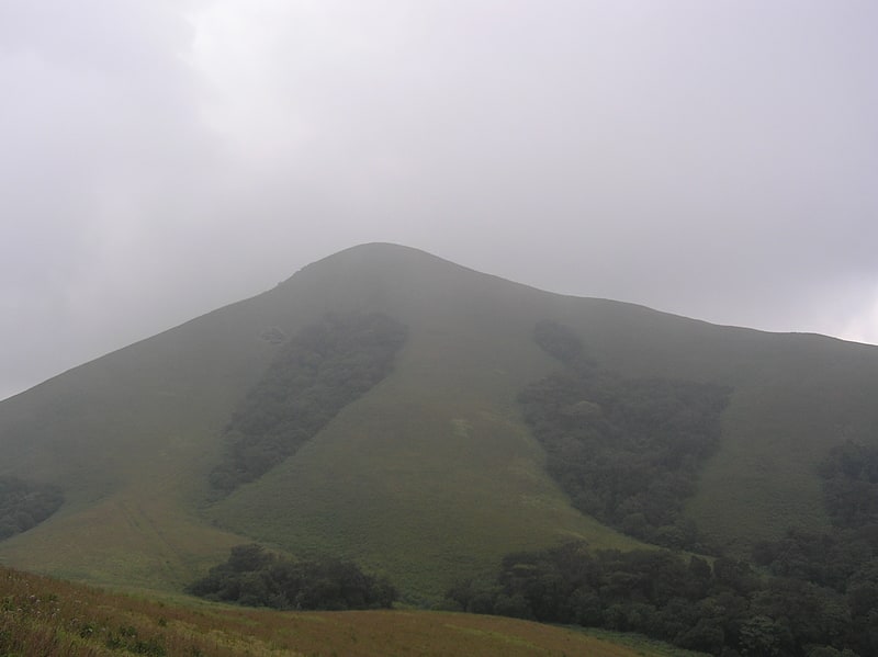
Mountain in India. Anamudi is a mountain located in Ernakulam district and Idukki district of the Indian state of Kerala. It is the highest peak in the Western Ghats and in South India, at an elevation of 2,695 metres and a topographic prominence of 2,479 metres. The name Anamudi literally translates to "elephant's head" a reference to the resemblance of the mountain to an elephant's head. Anamudi is the highest mountain in peninsular India as well as the largest mountain in Kerala. Meanwhile, the highest independent mountain in Kerala is the Cheriyam mountain in Malappuram district. Cheriyam mountain is located at an elevation of 613 m above sea level.
The first recorded ascent of Anamudi was by General Douglas Hamilton of the Madras Army on 4 May 1862, but it is likely that there had been earlier ascents by local people.
Anamudi peak is one of only three ultra prominent peaks in South India. It is also the peak with the greatest topographic isolation within India. It is the highest point in India south of Himalayas. Thus it is known as "Everest of South India". The peak is not exceptionally dramatic in term of steepness or local relief and is a fault-block mountain. It is located in the southern region of Eravikulam National Park at the junction of the Cardamom Hills, the Anaimalai Hills and the Palani Hills. The nearest town is Munnar, at a distance of 13 kilometres (8 mi). The easiest route to the summit of Anamudi is a technically easy hike on grass slopes, starting from a rolling hill plateau with a base elevation of about 2,000 metres (6,600 ft). The north and south slopes are gentle, while the east and west slopes are steeper, with more difficult rock faces.
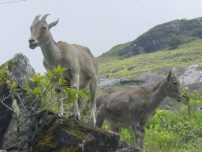
Anamudi and the Eravikulam National Park surrounding it is home to the largest surviving population of the Nilgiri tahr (Nilgiritragus hylocrius). Asian elephants, gaur, Bengal tigers, and the Nilgiri marten (Martes gwatkinsii) are some of the species of animals found here. The Anamudi peak area is also habitat of a unique frog Raorchestes resplendens. This newly discovered species is located in the Eravikulam National Park and is restricted to less than three km2 on the summit of Anamudi. The summit of the Anamudi is vegetated with patches of stunted Arundinaria densifolia and Gaultheria fragrantissima (wintergreen), Anaphalis sp. Impatiens and some species of Eriocaulon.[5]
Chinnar Wildlife Sanctuary
Also known as: चिन्नार अभयारण्य
State park in India. Chinnar Wildlife Sanctuary is located 18 km north of Marayoor on State Highway 17 in the Marayoor and Kanthalloor panchayats of Devikulam taluk in the Idukki district of Kerala state in South India. It is one of 18 wildlife sanctuaries among the protected areas of Kerala.
It has earned the name for being the only rehabilitation centre for the Indian star tortoise in India.
It is under the jurisdiction of and contiguous with Eravikulam National Park to the south. Indira Gandhi Wildlife Sanctuary is to the north and Kodaikanal Wildlife Sanctuary is to the east. It forms an integral part of the 1,187 km2 (458 sq mi) block of protected forests straddling the Kerala-Tamil Nadu border in the Anaimalai Hills. The Western Ghats, Anamalai Sub-Cluster, including all of Chinnar Wildlife Sanctuary, is under consideration by the UNESCO World Heritage Committee for selection as a World Heritage Site.[6]
Mukurthi National Park
Also known as: मुकुर्थी राष्ट्रीय उद्यान
State park in Padavayal, India. Mukurthi National Park is a 78.46 km2 protected area located in the western corner of the Nilgiris Plateau west of Ootacamund hill station in the northwest corner of Tamil Nadu state in the Western Ghats mountain range of South India. The park was created to protect its keystone species, the Nilgiri tahr.
The park is characterised by montane grasslands and shrublands interspersed with sholas in a high altitude area of high rainfall, near-freezing temperatures and high winds. It is home to an array of endangered wildlife, including royal Bengal tiger and Asian elephant, but its main mammal attraction is the Nilgiri tahr. The park was previously known as Nilgiri Tahr National Park.
The park is a part of Nilgiri Biosphere Reserve, India's first International Biosphere Reserve. As part of the Western Ghats, it is a UNESCO World Heritage Site since 1 July 2012.[7]
Brahmagiri
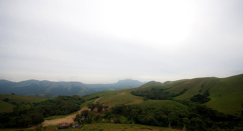
Mountain range in India. Brahmagiri, is a mountain range in the Western Ghats of south India. It is situated on the border between Kodagu district in Karnataka state in the north and Wayanad district of Kerala state on the south. Brahmagiri Hill, at 1608 m height, is a scenic tourist attraction. The top of Brahmagiri Hill is well forested and has much wildlife.[8]
Koyna Wildlife Sanctuary
Also known as: कोयना वन्यजीव अभयारण्य
Nature reserve in India. Koyna Wildlife Sanctuary is a wildlife sanctuary and natural World Heritage Site, which is located in Satara district of the Indian state of Maharashtra. Further, this wildlife sanctuary is designated as an Important Bird area. The sanctuary is nested in the Western Ghats, covering an area of around 423.55 km2, and elevations ranging from 600 to 1,100 m. It was notified in 1985 as a wildlife sanctuary situated in Maharashtra. It forms the northern portion of the Sahyadri Tiger Reserve, with Chandoli National Park forming the southern part of the reserve.[9]
Eravikulam
Also known as: एराविकुलम राष्ट्रीय उद्यान
National park in the Kannan Devan Hills, India. Eravikulam National Park is a 97 km2 national park located along the Western Ghats in the Idukki and Ernakulam districts of Kerala in India. Situated between 10º05'N and 10º20' north, and 77º0' and 77º10' east, it is the first national park in Kerala.
Eravikulam National Park is administered by the Kerala Department of Forests and Wildlife, Munnar Wildlife Division, which also runs the nearby Mathikettan Shola National Park, Anamudi Shola National Park, Pambadum Shola National Park, Chinnar Wildlife Sanctuary and the Kurinjimala Sanctuary.[10]
Pushpagiri Wildlife Sanctuary
Hiking area in Kumarahalli, India. Pushpagiri Wildlife Sanctuary is one of 21 Wildlife Sanctuaries of India's Karnataka state.
This sanctuary is located in Somwarpet taluk of the Kodagu district. It is home to rare and endangered birdlife. The Kadamakkal reserve forest is a part of the sanctuary. Pushpagiri (Kumara Parvatha) is the highest peak in it. The sanctuary adjoins Bisle reserve forest to the north and Kukke Subramanya forest range to the west.
Mandalpatti peak, Kote betta and Makkalagudi betta are mountains fall in the sanctuary. Mallalli falls and Kote abbe waterfalls (also called as Mukkodlu falls) are located inside the sanctuary. The Pushpagiri Wildlife Sancutuary has been proposed as one of the World Heritage Site.[11]
Talakaveri
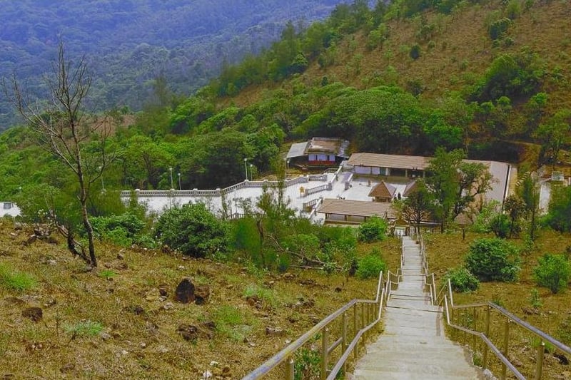
Sacred and religious sites, Body of water, Temple, Park
Brahmagiri Wildlife Sanctuary
Also known as: ब्रह्मगिरि
Wildlife park in India. The Brahmagiri Wildlife Sanctuary is located in Kodagu District, Karnataka State, India, within the Western Ghats and about 250 km from Bangalore. The sanctuary covers an area of about 181 km and derives its name from the highest point of the mountain range, Brahmigiri Peak. It was declared a sanctuary on June 5, 1974.[12]
Radhanagari Wildlife Sanctuary
Wildlife park in India. Radhanagari Wildlife Sanctuary is a wildlife sanctuary and natural World Heritage Site of category ix and x since 2012, located in Kolhapur district, Maharashtra State, India. It lies at the southern end of the Sahyadri hills in the Western Ghats. It is notable as the first declared wildlife sanctuary in Maharashtra, notified in 1958, as "Dajipur Wildlife Sanctuary" and is popularly known as the "Bison Sanctuary". Indian bison or gaur with a population around 1091 in 2014, is the flagship species of the area. It was notified as Radhanagari wildlife sanctuary vide notification No. WLP/1085/CR/588/ V/F-5,Dt.16.9.1985.The area around the Sanctuary was declared as Eco sensitive zone by Govt. of India on 15th October 2020[13]
Kas Plateau Reserved Forest
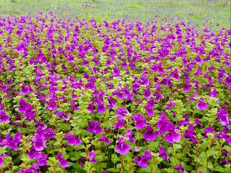
Plateau in India. The Kas Plateau Reserved Forest, also known as the Kaas Pathar, is a plateau situated 25 kilometres west from Satara city in Maharashtra, India. It falls under the Sahyadri Sub Cluster of the Western Ghats, and it became a part of a UNESCO World Natural Heritage Site in 2012.
It is a biodiversity hotspot known for various types of seasonal wild flowers bloom and numerous species of endemic butterflies annually in the months of August and September. The plateau is situated at an altitude of 1200 metres and is approximately 10 square kilometers in area. Kaas has more than 850 different species of flowering plants. These include orchids, shrubs such as the Karvy, and carnivorous plants such as Drosera Indica. Kaas Pathar is a plateau made from volcanic rocks in the Satara district of Maharashtra, and comes under the biosphere of the Western Ghats. The flora of kaas i.e. the entire flowering plants and their related plants are typically restricted to that particular locality only. This is because the plateau is largely formed of basalt which is directly exposed to atmosphere. The basalt is almost covered entirely by a thin cover of soil formed due to erosion and has accumulated a layer of not more than 25 mm or so.[14]