Discover 9 hidden attractions, cool sights, and unusual things to do in Sisters State Park (United States). Don't miss out on these must-see attractions: Three Sisters, Proxy Falls, and Broken Top. Also, be sure to include Black Crater in your itinerary.
Below, you can find the list of the most amazing places you should visit in Sisters State Park (Oregon).
Table of Contents
Three Sisters
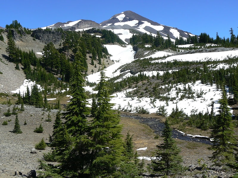
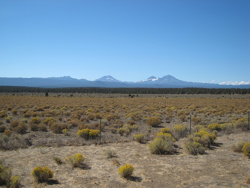
The Three Sisters are closely spaced volcanic peaks in the U.S. state of Oregon. They are part of the Cascade Volcanic Arc, a segment of the Cascade Range in western North America extending from southern British Columbia through Washington and Oregon to Northern California. Each more than 10,000 feet in elevation, they are the third-, fourth- and fifth-highest peaks in Oregon. Located in the Three Sisters Wilderness at the boundary of Lane and Deschutes counties and the Willamette and Deschutes national forests, they are about 10 miles south of the nearest town, Sisters. Diverse species of flora and fauna inhabit the area, which is subject to frequent snowfall, occasional rain, and extreme temperature variation between seasons. The mountains, particularly South Sister, are popular destinations for climbing and scrambling.
Although they are often grouped together as one unit, the three mountains have their own individual geology and eruptive history. Neither North Sister nor Middle Sister has erupted in the last 14,000 years, and it is considered unlikely that either will ever erupt again. South Sister last erupted about 2,000 years ago and could erupt in the future, threatening life within the region. After satellite imagery detected tectonic uplift near South Sister in 2000, the United States Geological Survey improved monitoring in the immediate area.[1]
Proxy Falls
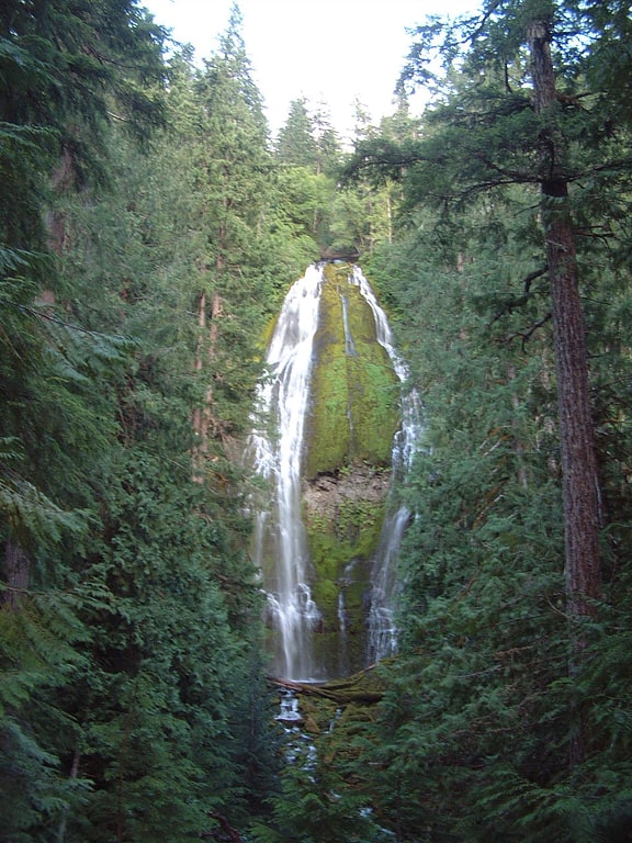
Waterfall in Oregon. Proxy Falls, also known as Lower Proxy Falls, is a cascade and plunge waterfall from a collection of springs on the shoulder of North Sister, that plunges into a gaping canyon near McKenzie Pass in the Willamette National Forest, near Belknap Springs, Oregon. The waterfall is notable for its main drop of 226 feet which makes it one of the highest plunge waterfalls in Oregon.[2]
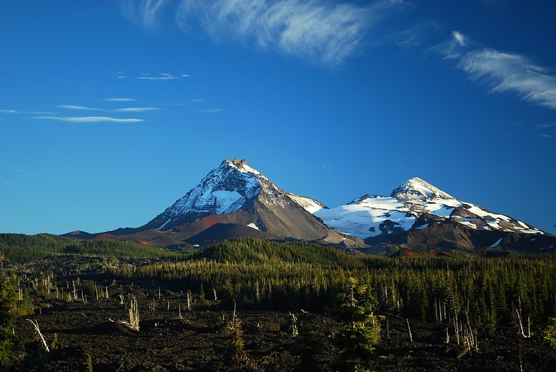
Broken Top
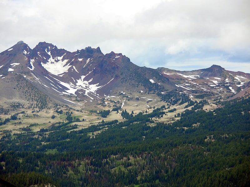
Stratovolcano in Oregon. Broken Top is a glacially eroded complex stratovolcano. It lies in the Cascade Volcanic Arc, part of the extensive Cascade Range in the U.S. state of Oregon. Located southeast of the Three Sisters peaks, the volcano, residing within the Three Sisters Wilderness, is 20 miles west of Bend, Oregon in Deschutes County. Eruptive activity stopped roughly 100,000 years ago, and currently, erosion by glaciers has reduced the volcano's cone to where its contents are exposed. There are two named glaciers on the peak, Bend and Crook Glacier.
Diverse species of flora and fauna inhabit the area, which is subject to frequent snowfall, occasional rain, and extreme temperature variation between seasons. Broken Top and its surrounding area constitute popular destinations for hiking, climbing, and scrambling.[3]
Black Crater
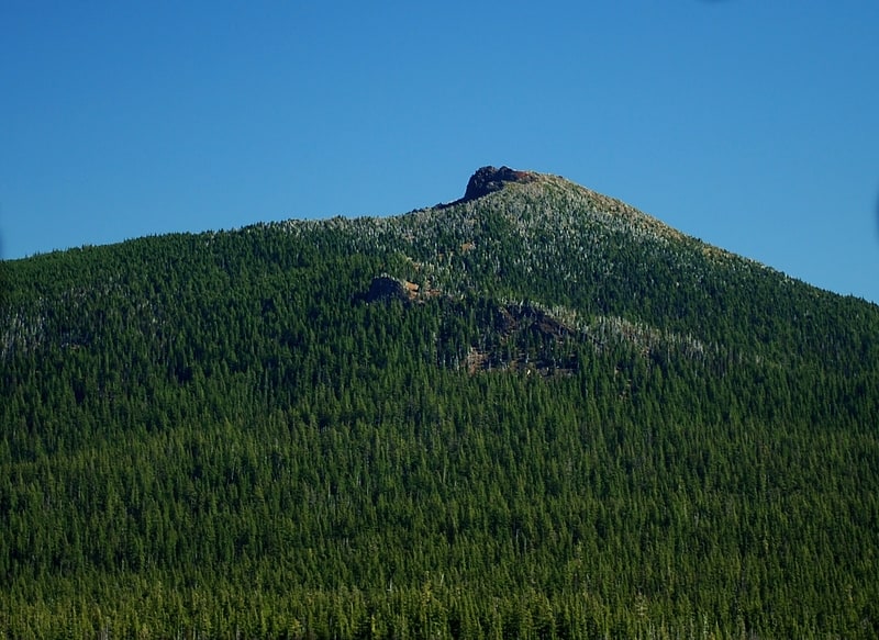
Shield volcano in Oregon. Black Crater is a steep-sided shield volcano in the Cascade Range of central Oregon, located north of the Three Sisters and east of McKenzie Pass. Ice Age glaciers carved a large cirque into the northern flank of the mountain, and snow often lingers in its shady depths until late summer. A United States Forest Service fire lookout tower was built on the summit in 1925, but was eventually destroyed and only remnants of the foundation remain today. A 3.7-mile trail leads for the summit from the northwest on Oregon Route 242, eventually wrapping around to the northeast side for the upper part of the ascent.[4]
Devils Lake
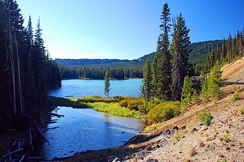
Lake in Oregon. Devils Lake is a lake located in Deschutes County, Oregon, along the Cascade Lakes Scenic Byway and found at an elevation of 5,446 feet.[5]
Mink Lake
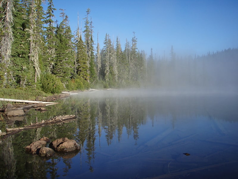
Lake in Oregon. Mink Lake is the second-largest wilderness lake in the US state of Oregon. Mink Lake lies at about 5,000 feet above sea level on a Cascade Range lava plateau in the Three Sisters Wilderness in eastern Lane County. One of many lakes in the Mink Lake Basin, it covers 139 acres.
Hiking trails enter the Mink Lake Basin, at the headwaters of the South Fork McKenzie River, from many directions. The Pacific Crest Trail runs roughly north–south about 1 mile (1.6 km) east of the lake. Natural campsites abound in the area, but in warm weather mosquitoes can be a problem.
So few chemicals and nutrients enter this lake that it is classified as ultraoligotrophic, and it is thought to be among the most pristine lakes in Oregon. Fishing is possible here mainly because of stocking. Rainbow and cutthroat trout range in size from 6 to 12 inches (15 to 30 cm).[6]
Collier Glacier
Collier Glacier is in the U.S. state of Oregon. The glacier is situated in the Cascade Range at an elevation generally above 8,000 feet. Collier Glacier is on the west slopes of North Sister, an extinct shield volcano. Since its last maximum extent during the Little Ice Age the glacier has retreated over a mile.[7]
Crook Glacier

Glacier in Oregon. Crook Glacier is located in the U.S. state of Oregon. The glacier is situated in the Cascade Range at an elevation between 8,700 and 8,000 feet, nestled within a cirque to the immediate south of Broken Top, an extinct stratovolcano.[8]
Eastern Cascades Slopes and Foothills
The Eastern Cascades Slopes and Foothills ecoregion is a Level III ecoregion designated by the United States Environmental Protection Agency in the U.S. states of Oregon, Washington, and California. In the rain shadow of the Cascade Range, the eastern side of the mountains experiences greater temperature extremes and receives less precipitation than the west side. Open forests of ponderosa pine and some lodgepole pine distinguish this region from the Cascades ecoregion, where hemlock and fir forests are more common, and from the lower, drier ecoregions to the east, where shrubs and grasslands are predominant. The vegetation is adapted to the prevailing dry, continental climate and frequent wildfire. Volcanic cones and buttes are common in much of the region.
The Eastern Cascades Slopes and Foothills ecoregion has been subdivided into ten Level IV ecoregions, as described below. Level IV mapping is not yet complete in California, and the information below includes only the sections in Washington and Oregon.[9]