Discover 15 hidden attractions, cool sights, and unusual things to do in Deschutes National Forest (United States). Don't miss out on these must-see attractions: Sparks Lake, Black Butte, and Dee Wright Observatory. Also, be sure to include Elliott Corbett Memorial State Recreation Site in your itinerary.
Below, you can find the list of the most amazing places you should visit in Deschutes National Forest (Oregon).
Table of Contents
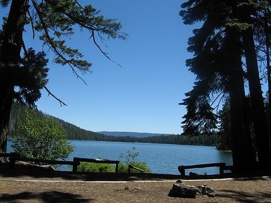
Sparks Lake
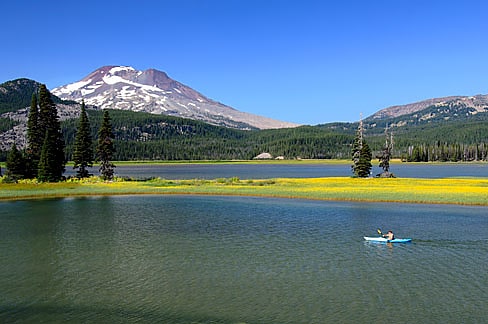
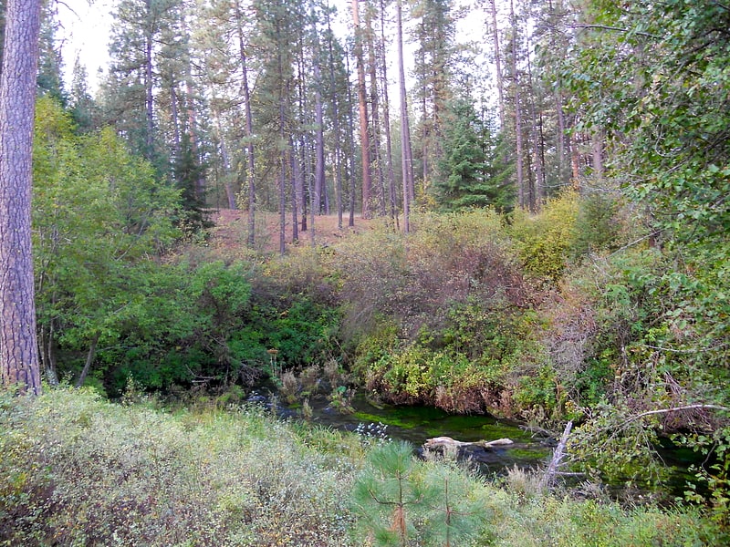
Body of water in Oregon. Sparks Lake is a natural body of water near the crest of the central Cascade Range in Deschutes County in the U.S. state of Oregon. The lake is about 26 miles west-southwest of Bend along the Cascade Lakes Scenic Byway in Deschutes National Forest. Named for a 19th-century rancher, "Lige" Sparks, the water body is a remnant of a bigger lake that has partly filled with sediment and vegetation.
Many of the region's mountain peaks, such as Mount Bachelor, Three Sisters, and Broken Top, are visible from the lake. Other lakes in the vicinity include Todd, Elk, Hosmer, Blow, and Doris.[1]
Black Butte
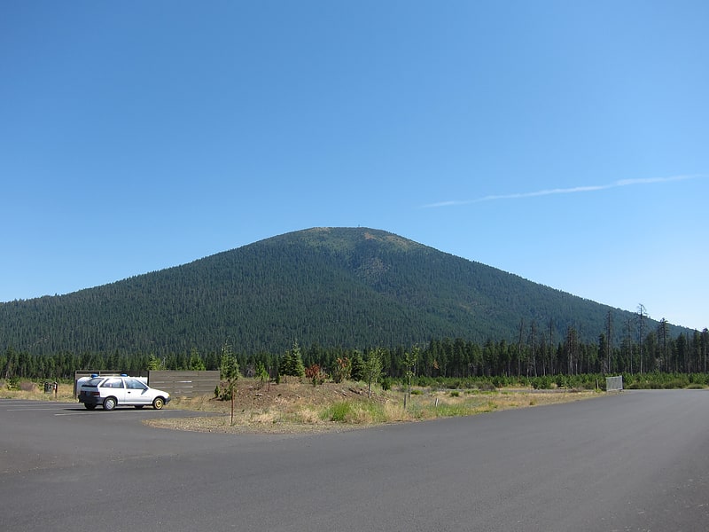
Butte in Oregon. Black Butte is an extinct stratovolcano in the U.S. state of Oregon. Located in Jefferson County, it is part of Deschutes National Forest. Black Butte forms part of the Cascade volcanic arc. The butte lies just south of the Metolius Springs, which merge to form the headwaters of the Metolius River. The Metolius River's basin sustains a wide array of plant life, large and small mammals, and more than 80 bird species.
Black Butte last erupted during the Pleistocene; geologists have estimated its age at 0.4, 0.5, and 1.43 ± 0.33 million years ago. The duration of the eruptions that built the volcano remains unclear, though the activity likely coincided with large-scale block faulting in the vicinity of the Metolius Springs. Black Butte has a prominent volcanic cone and is made up of mafic (rich in magnesium and iron) basaltic andesite lava. Despite having a well-preserved, symmetrical shape and an unexposed pyroclastic core, the butte has undergone moderate erosion, with shallow ravines, deep gullies on its sides, and rocks with weathering rinds. A number of cinder cones and a volcanic field also lie nearby the butte.
There was a fire lookout ground house on the butte, which was burned down by the United States Forest Service in 2016. A white cupola structure sits on the top of the butte as well as a more modern fire lookout tower. The resort community Black Butte Ranch lies nearby and offers recreational activities like horseback riding, biking, hiking, canoeing, kayaking, and paddleboarding; during the winter, activities include Nordic skiing and snowshoeing.[2]
Address: Deschutes National Forest, 97730 Camp Sherman
Dee Wright Observatory
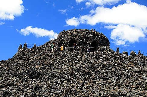
Observatory in Deschutes County, Oregon. Dee Wright Observatory is an observation structure at the summit of McKenzie Pass in the Cascade Mountains of Oregon. The structure is an open shelter constructed with lava stone. It is located in the midst of a large lava flow, and offers an exceptional view of numerous Cascade peaks.[3]
Address: McKenzie Hwy, 97413 Blue River
Elliott Corbett Memorial State Recreation Site
State park in Jefferson County, Oregon. Elliott Corbett Memorial State Recreation Site is a state park along the south shore of Blue Lake Crater in Jefferson County, Oregon, United States. The park is named in honor of Elliott R. Corbett II, who was killed while serving in the United States Army during World War II. It includes 63 acres of wilderness land with very few park facilities. Corbett State Park is administered by the Oregon Parks and Recreation Department.[4]
Metolius Springs
Spring in Oregon. Metolius Springs are located just north of Black Butte near the small unincorporated town of Camp Sherman in central Oregon, United States. The springs are the source of the Metolius River, which flows 29 miles through the Deschutes National Forest emptying into Lake Billy Chinook. The flow from Metolius Springs is sufficient to create a full-flowing river, making the Metolius River one of the largest spring-fed rivers in the United States. The name of the springs comes from the Warm Springs or Sahaptin word mitula, meaning white salmon and referring to a light colored Chinook salmon and not a whitefish.[5]
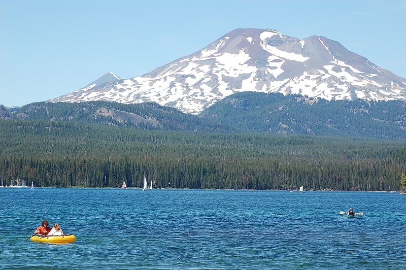
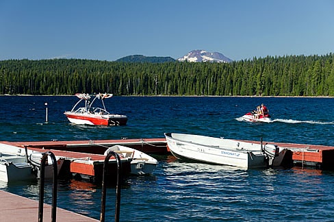
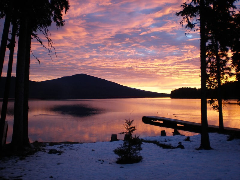
Hosmer Lake
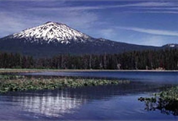
Body of water in Oregon. Hosmer Lake is a natural body of water in the central Cascade Range in the U.S. state of Oregon. Nearly 5,000 feet above sea level, the lake is part of a volcanic landscape about 20 miles west-southwest of Bend along the Cascade Lakes Scenic Byway. In 1962, the United States Board on Geographic Names changed the name from Mud Lake to Hosmer Lake in honor of Paul Hosmer, a naturalist from Bend.
Hosmer Lake is about 5 miles (8 km) west of Mount Bachelor in Deschutes National Forest. Nearby lakes include Elk, Sparks, Blow, Doris, Lava, and Little Lava.
Encroaching vegetation is gradually turning Hosmer Lake into a marsh. The lake bottom consists of mud and peat, and mosses and aquatic plants restrict the open water. Water lilies and bullrushes are prevalent.[6]
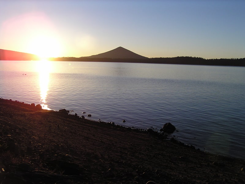
Little Lava Lake
Lake in Oregon. Little Lava Lake lies in the Cascade Range about 26 miles west-southwest of Bend in the U.S. state of Oregon. A close neighbor of Lava Lake, from which it is separated by solidified lava, Little Lava Lake is at an elevation of 4,744 feet in the Deschutes National Forest. Generally considered the source of the Deschutes River, the lake covers 138 acres to an average depth of 8 feet.
Lava Lake, Little Lava Lake, and other nearby lakes formed after lava flows from Mount Bachelor altered drainage patterns in the area. Solidified lava flows are visible along the shorelines of both lakes, and the volcanic peaks Broken Top and South Sister can be seen to the north.[7]
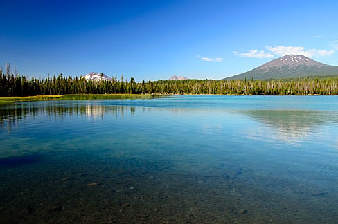
Elk Lake
Body of water in Oregon. Elk Lake is a natural body of water in the central Cascade Range in the U.S. state of Oregon. Nearly 4,900 feet above sea level, the lake is part of a volcanic landscape about 25 miles west-southwest of Bend along the Cascade Lakes Scenic Byway.
Elk Lake is about 6 miles (10 km) west of Mount Bachelor in Deschutes National Forest. Nearby lakes include Hosmer, Sparks, Blow, Doris, Devils, Lava, and Little Lava.
Heavily used for recreation, the lake is among the most popular of the Cascade Lakes. Its name stems from the large number of elk that formerly frequented the area in summer. During winter, Elk Lake freezes, and access roads are usually closed by snow until late May.[8]
Suttle Lake
Lake in Oregon. Suttle Lake is a natural lake near the crest of the Cascade Range in central Oregon, United States, covering 253 acres. It was named in honor of John Settle, whose name was misspelled when the lake was officially recorded as a geographic feature. Today, the lake is located within the Deschutes National Forest and serves as one of central Oregon's most popular outdoor recreation sites, with three large campgrounds and two day-use areas along the south shore of the lake. The Oregon Department of Fish and Wildlife regularly stocks the lake with rainbow trout.[9]
Pine Mountain Observatory
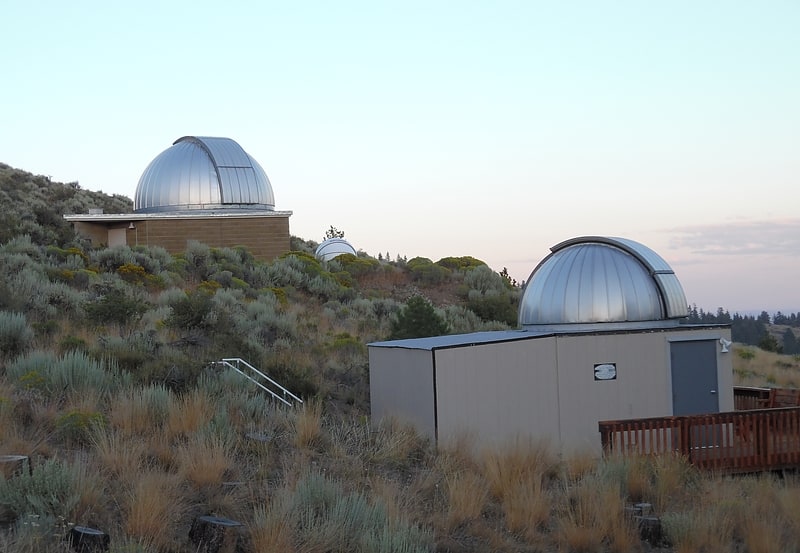
Astronomical observatory. Pine Mountain Observatory is an astronomical observatory owned and operated by University of Oregon Department of Physics. The facility is located 26 miles southeast of Bend, Oregon in the Deschutes National Forest near the summit of Pine Mountain.
PMO supports a wide variety of programs with an emphasis on projects that allow undergraduate students to be involved with many aspects of facility operations. PMO also has robust programs centered on K-12 education and public outreach.
The site was discovered and characterized by professors Russ Donnelly and E.G. Ebbinghausen in 1965 when they determined that the sky conditions were excellent and worthy of an observatory being built on Pine Mountain. The first telescope became operational in 1967.
Former programs gave high-school students the opportunity to not only observe at PMO, but also analyze data and prepare of a paper for publication. Early programs at PMO helped develop older software programs that allowed K-12 teachers to perform observations remotely and process the data for classroom use.
Past research projects included research on white dwarf stars and examining the large-scale structure of galaxies.[10]
Cultus Lake
Lake in Oregon. Cultus Lake is a natural lake in Deschutes County in the U.S. state of Oregon. Formed by a glacier, it is located in the high Cascade Range in the Deschutes National Forest. The name is from the Chinook Jargon and means variously bad or worthless, or simply "in vain". In the early 19th century, the lakes in this area abounded with beavers. The earliest explorers to this area were primarily on a quest for furs.[11]
Lava Lake
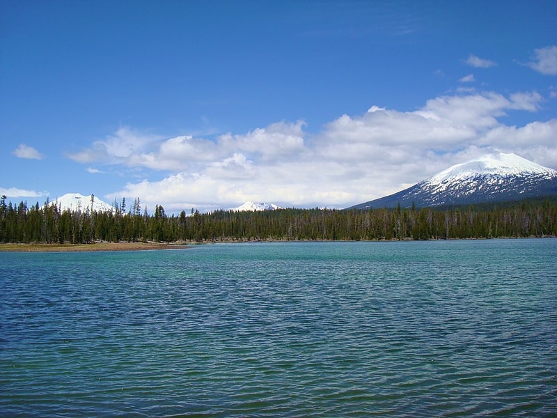
Lake in Oregon. Lava Lake lies in the Cascade Range about 25 miles west-southwest of Bend in the U.S. state of Oregon. It is a close neighbor of Little Lava Lake, from which it is separated by solidified lava. Lava Lake is at an elevation of 4,740 feet in the Deschutes National Forest. The lake covers 368 acres to an average depth of 20 feet.
Lava Lake, Little Lava Lake, and other nearby lakes are volcanogenic, having formed after lava flows from Mount Bachelor altered drainage patterns in the area. Solidified lava flows are visible along the shorelines of both lakes, and the volcanic peaks Broken Top and South Sister can be seen to the north.[12]
Skeleton Cave
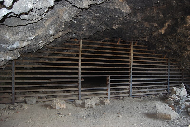
Tourist attraction in Deschutes County, Oregon. Skeleton Cave is a lava tube within Deschutes County, Oregon, of the United States. The cave is within Deschutes National Forest and is located on the northern flank of Newberry Volcano near the city of Bend. The cave is between 75,000 and 400,000 years old.[13]
Odell Lake
Lake in Oregon. Odell Lake is located near Willamette Pass in the northwest corner of Klamath County, Oregon, United States. It is one of several lakes in the Cascade Range in Central Oregon, and lies within the Deschutes National Forest. It was named for Oregon Surveyor General William Holman Odell by Byron J. Pengra, in July 1865, while they were making a preliminary survey for the Oregon Central Military Road, which would later become Oregon Route 58. The lake fills a basin carved by a glacier, and the resulting terminal moraine confines the water along the lake's southeast shore.[14]
Crescent Lake
Lake in Oregon. Crescent Lake is a natural lake on the eastern side of the Cascade Range in the northwest corner of Klamath County, Oregon, United States. The unincorporated community of Crescent Lake Junction on Oregon Route 58 and Crescent Lake State Airport are located 2.5 miles northeast of the lake. The lake was named for its shape by Byron J. Pengra and William Holman Odell in July 1865.[15]