Discover 20 hidden attractions, cool sights, and unusual things to do in San Isabel National Forest (United States). Don't miss out on these must-see attractions: Mount Elbert, Bishop Castle, and Mount Antero. Also, be sure to include West Spanish Peak in your itinerary.
Below, you can find the list of the most amazing places you should visit in San Isabel National Forest (Colorado).
Table of Contents
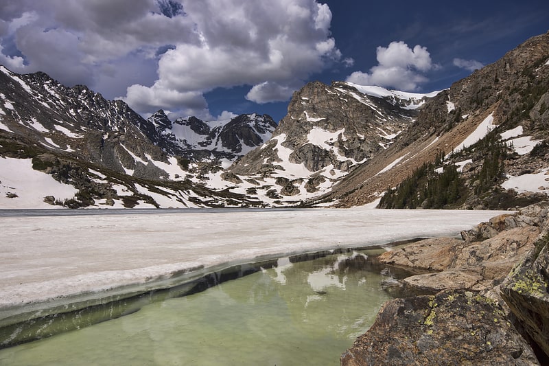
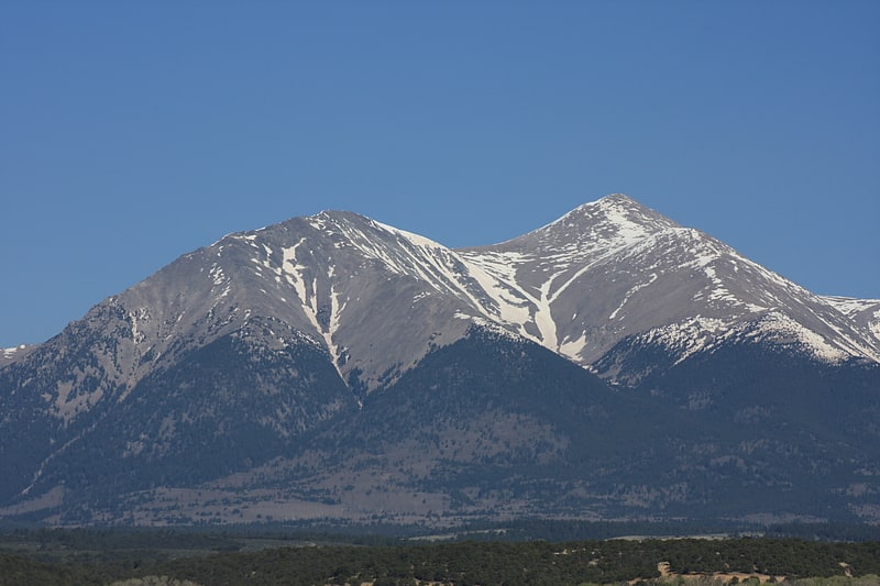
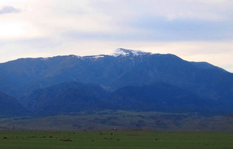
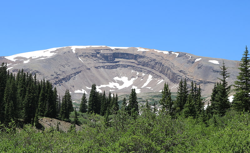
Mount Elbert
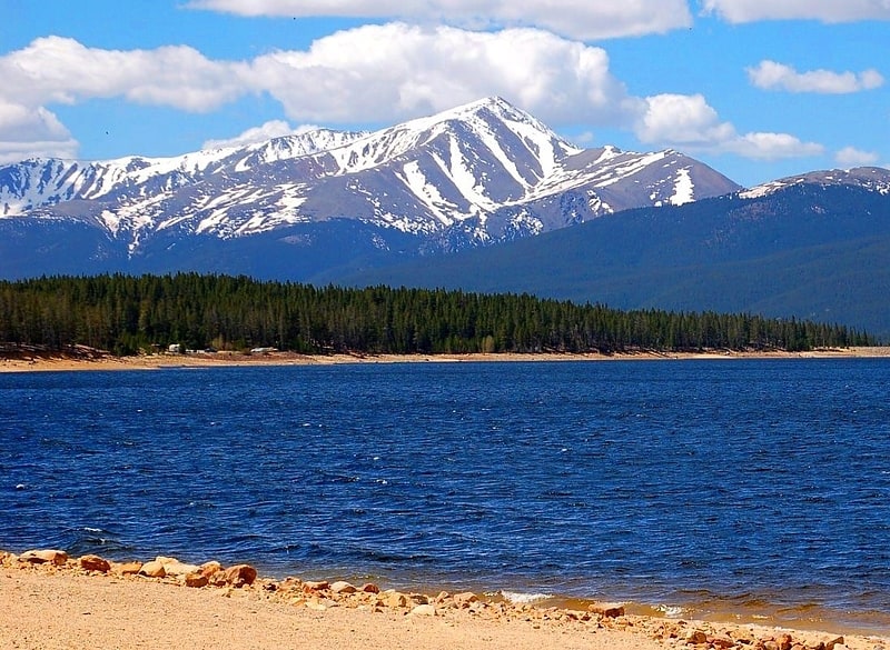
Summit in Colorado. Mount Elbert is the highest summit of the Rocky Mountains, the highest point in the U.S. state of Colorado, and the second-highest summit in the contiguous United States. The ultra-prominent 14,440-foot fourteener is the highest peak in the Sawatch Range, as well as the highest point in the entire Mississippi River drainage basin. Mount Elbert is located in San Isabel National Forest, 12.1 miles southwest of the City of Leadville in Lake County, Colorado.
The mountain was named in honor of a Colorado statesman, Samuel Hitt Elbert, who was active in the formative period of the state and Governor of the Territory of Colorado from 1873 to 1874. Henry W. Stuckle of the Hayden Survey was the first to record an ascent of the peak, in 1874. The easiest and most popular climbing routes are categorized as Class 1 to 2 or A+ in mountaineering parlance. Mount Elbert is therefore often referred to as the "gentle giant" that tops all others in the Rocky Mountains.[1]
Bishop Castle
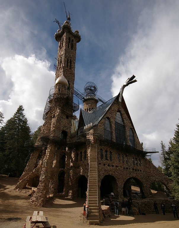
Castle in Custer County, Colorado. Bishop Castle is an "elaborate and intricate" "one-man project" named after its constructor, Jim Bishop, that has become a roadside attraction in central Colorado.
The "castle" is located in south central Colorado on State Highway 165 in the Wet Mountains of Southern Colorado in the San Isabel National Forest, southwest of Pueblo, Colorado.[2]
Address: 12705 State Highway 165, 81069-8634 Rye
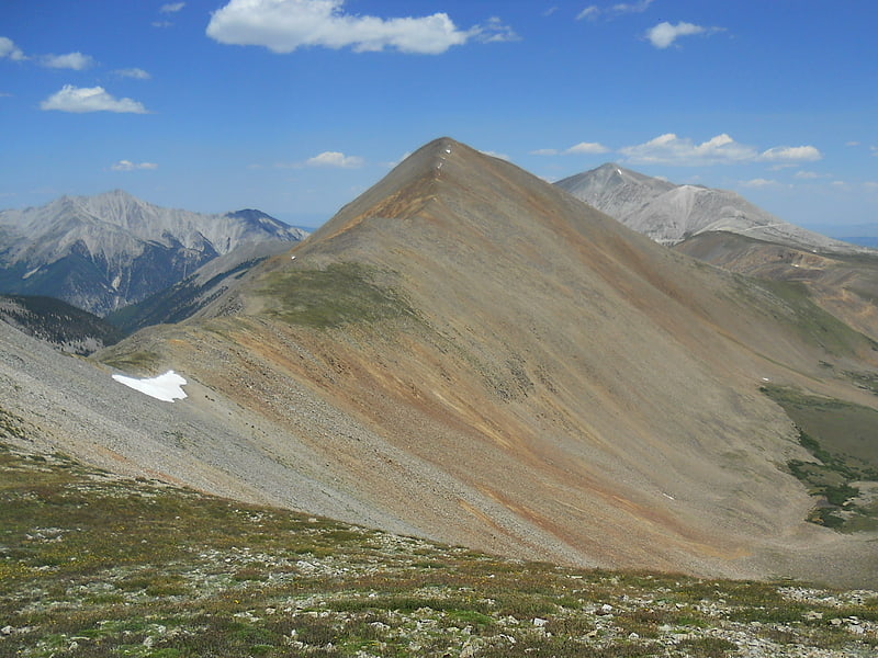
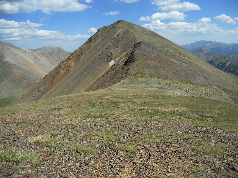
Mount Antero
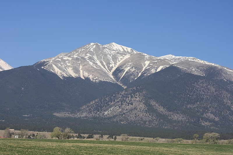
Summit in Colorado. Mount Antero is the highest summit of the southern Sawatch Range of the Rocky Mountains of North America. The prominent 14,276-foot fourteener is located in San Isabel National Forest, 12.2 miles southwest by south of the Town of Buena Vista in Chaffee County, Colorado, United States. The mountain is named in honor of Chief Antero of the Uintah band of the Ute people.[3]
West Spanish Peak
Mountain in Colorado. West Spanish Peak is a high and prominent mountain summit that is the higher of the two Spanish Peaks in the Rocky Mountains of North America. The prominent 13,631-foot peak is located in the Spanish Peaks Wilderness of San Isabel National Forest, 9.1 miles south of the Town of La Veta, Colorado, United States, on the drainage divide between Huerfano and Las Animas counties. The summit of West Spanish Peak is the highest point in Las Animas County, Colorado.
The Spanish Peaks are two large igneous stocks which form an eastern outlier of the Culebra Range, a subrange of the Sangre de Cristo Mountains. West Spanish Peak is the easternmost 4000 meter (13,123 ft) mountain peak in the United States. Due to its position well east of the Culebra Range and on the edge of the eastern plains of Colorado, West Spanish Peak enjoys great local vertical relief in almost all directions. For example, it rises over 6,000 ft (1,828 m) in less than 6.5 miles (10.5 km) on both its north and south flanks. Though not a fourteener, West Spanish Peak is the twelfth most topographically prominent peak in the state.[4]
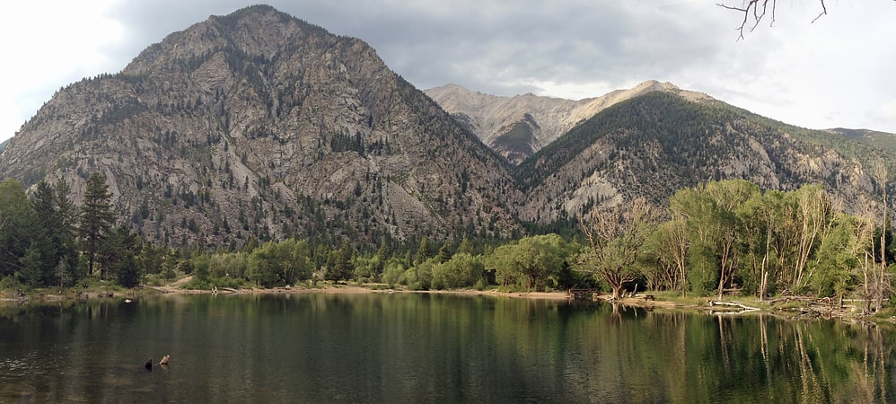
Lake Isabel
Reservoir in Colorado. Lake Isabel is a reservoir located in the San Isabel National Forest in Pueblo and Custer counties, in Colorado, United States. The lake is in the Wet Mountains. The lake is open to fishing year round and is regularly stocked by Colorado Parks and Wildlife. Available activities include fishing, hiking, camping and sledding in the winter.
The community of San Isabel lies on the north side of the lake, in Custer County. The border between Pueblo and Custer counties runs north–south through the east side of the lake, such that most of the dam is in Pueblo County (on the east side), and most of the reservoir itself is in Custer County (on the west side).[5]
Agnes Vaille Falls
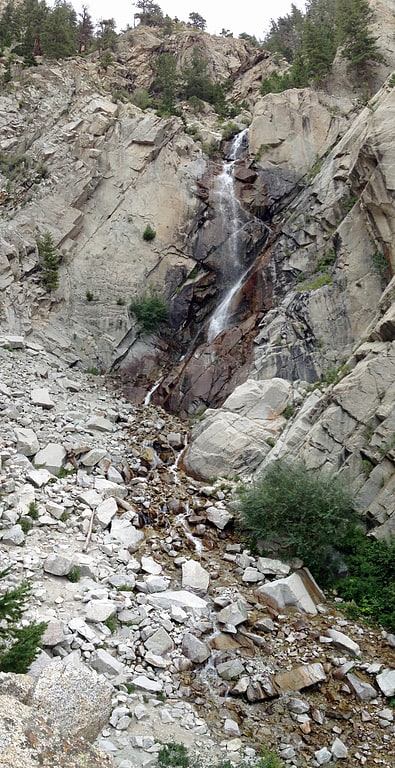
Waterfall in Colorado. Agnes Vaille Falls is a waterfall on the southern slopes of Mount Princeton just above Chalk Creek in San Isabel National Forest, Chaffee County, Colorado, United States. The falls has been a popular half mile hike from county road 162 near Chalk Lake.
On September 30, 2013 five hikers were killed and another injured at the falls by a rockslide that was likely triggered in part by the 2013 Colorado floods. The trail to the falls was closed by the U.S. Forest Service following the accident, and recovery of the bodies was hampered by the United States federal government shutdown of 2013, which began the following day. This trail is, however, still being taken today, as there are no officials signs stating it is still closed. Social media shows much activity on the once closed trail. “Trail will be rerouted due to rock slide danger. Use extreme caution if hiking to the falls until the reroute is completed.” https:www.fs.usda.gov/recarea/psicc/recarea/?recid=12629[6]
Chalk Lake
Lake in Colorado. Chalk Lake is a small lake in Chaffee County, Colorado, United States adjacent to Chalk Creek in San Isabel National Forest. The lake and surrounding area is a day-use area along road 162 across Chalk Creek from the Chalk Creek Campground, and a fee is charged for use of the lake. Chalk Lake is directly north of Mount Antero and directly south of Mount Princeton. The Denver, South Park and Pacific Railroad grade is above the south side of the lake below Mount Antero.[7]
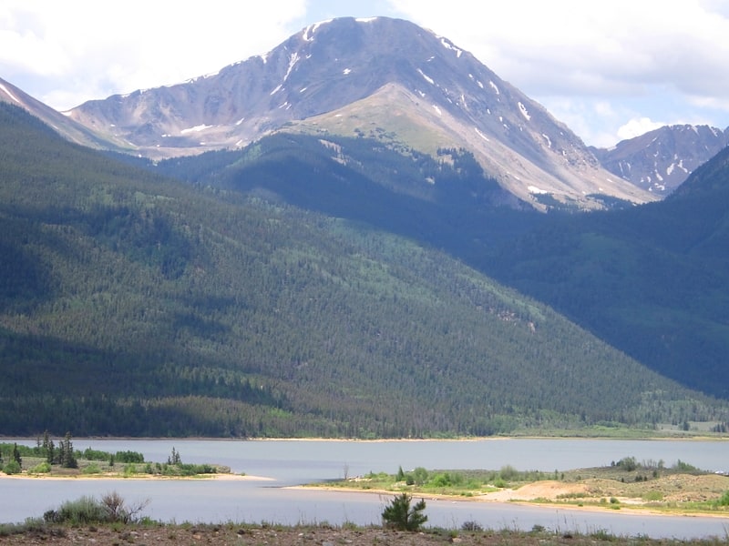
Mount Princeton
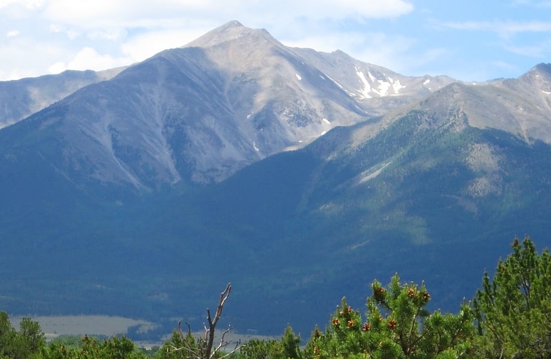
Mountain in Colorado. Mount Princeton is a high and prominent mountain summit of the Collegiate Peaks in the Sawatch Range of the Rocky Mountains of North America. The 14,204 feet fourteener is located in San Isabel National Forest, 7.8 miles southwest of the Town of Buena Vista in Chaffee County, Colorado, United States. The mountain was named in honor of Princeton University.[8]
Mount Shavano
Mountain in Colorado. Mount Shavano is a high mountain summit in the southern Sawatch Range of the Rocky Mountains of North America. The 14,231-foot fourteener is located in San Isabel National Forest, 6.5 miles north by west of the community of Maysville in Chaffee County, Colorado, United States. The mountain was named in honor of Ute Chief Shavano.[9]
Rocky Mountains
Mountain range in North America. The Rocky Mountains, also known as the Rockies, are a major mountain range and the largest mountain system in North America. The Rocky Mountains stretch 3,000 mi in straight-line distance from the northernmost part of western Canada, to New Mexico in the southwestern United States. Depending on differing definitions between Canada and the United States, its northern terminus is located either in northern British Columbia's Terminal Range south of the Liard River and east of the Trench, or in the northeastern foothills of the Brooks Range/British Mountains that face the Beaufort Sea coasts between the Canning River and the Firth River across the Alaska-Yukon border. Its southernmost point is near the Albuquerque area adjacent to the Rio Grande Basin and north of the Sandia–Manzano Mountain Range. Being the easternmost portion of the North American Cordillera, the Rockies are distinct from the tectonically younger Cascade Range and Sierra Nevada, which both lie farther to its west.
The Rocky Mountains formed 80 million to 55 million years ago during the Laramide orogeny, in which a number of plates began sliding underneath the North American plate. The angle of subduction was shallow, resulting in a broad belt of mountains running down western North America. Since then, further tectonic activity and erosion by glaciers have sculpted the Rockies into dramatic peaks and valleys. At the end of the last ice age, humans began inhabiting the mountain range. After explorations of the range by Europeans, such as Sir Alexander Mackenzie, and Anglo-Americans, such as the Lewis and Clark expedition, natural resources such as minerals and fur drove the initial economic exploitation of the mountains, although the range itself never experienced a dense population.
Of the 100 highest major peaks of the Rocky Mountains, 78 (including the 30 highest) are located in Colorado, ten in Wyoming, six in New Mexico, three in Montana, and one each in Utah, British Columbia, and Idaho. Of the 50 most prominent summits of the Rocky Mountains, 12 are located in British Columbia, 12 in Montana, ten in Alberta, eight in Colorado, four in Wyoming, three in Utah, three in Idaho, and one in New Mexico. Public parks and forest lands protect much of the mountain range, and they are popular tourist destinations, especially for hiking, camping, mountaineering, fishing, hunting, mountain biking, snowmobiling, skiing, and snowboarding.[10]
Southern Rocky Mountains
Mountain range. The Southern Rocky Mountains are a major subregion of the Rocky Mountains of North America located in the southeastern portion of the U.S. state of Wyoming, the central and western portions of Colorado, the northern portion of New Mexico, and extreme eastern portions of Utah. The Southern Rocky Mountains are also commonly known as the Southern Rockies, and since the highest peaks are located in the State of Colorado, they are sometimes known as the Colorado Rockies, although many important ranges and peaks rise in the other three states. The Southern Rockies include the highest mountain ranges of the Rocky Mountains and include all 30 of the highest major peaks of the Rockies.
The Southern Rocky Mountains are generally divided from the Western Rocky Mountains by the Green River and the Colorado River below the Green River. The Southern Rockies are divided from the Central Rocky Mountains by South Pass in Wyoming and the drainage running east from the pass down the Sweetwater River and the North Platte River; and the drainage running southwest from the pass down Pacific Creek and Sandy Creek to the Green River. This divide between the Southern Rockies and the Central Rockies provided the lowest elevation traverse of the Rocky Mountain region for the historic Oregon Trail, the Mormon Trail, and the California Trail. The southern end of the Rocky Mountains are considered to be the Jemez Mountains and the southern Sangre de Cristo Mountains of New Mexico. Mountains south of here in N.M. are classified as the Arizona/New Mexico Mountains using the EPA Level III Ecoregions System.
This article defines a significant summit as a summit with at least 100 meters (328.1 feet) of topographic prominence, and a major summit as a summit with at least 500 meters (1640.4 feet) of topographic prominence. An ultra-prominent summit is a summit with at least 1500 meters (4921.3 feet) of topographic prominence.
All elevations in this article include an elevation adjustment from the National Geodetic Vertical Datum of 1929 (NGVD 29) to the North American Vertical Datum of 1988 (NAVD 88). For further information, please see this United States National Geodetic Survey note.[11]
Spanish Peaks
Mountain in Colorado. East Spanish Peak is a prominent mountain summit that is the lower of the two Spanish Peaks in the Rocky Mountains of North America. The 12,688-foot peak is located in the Spanish Peaks Wilderness of San Isabel National Forest, 9.3 miles southeast by south of the Town of La Veta, Colorado, United States, on the drainage divide between Huerfano and Las Animas counties. The Spanish Peaks are two large igneous stocks which form an eastern outlier of the Culebra Range, a subrange of the Sangre de Cristo Mountains. East Spanish Peak is higher than any point in the United States east of its longitude; it is also the easternmost point in the United States over 12,000 feet, 11,000 feet, and 10,000 feet feet above sea level.[12]
Greenhorn Mountain
Summit in Colorado. Greenhorn Mountain is the highest summit of the Wet Mountains range in the Rocky Mountains of North America. The prominent 12,352-foot peak is located in the Greenhorn Mountain Wilderness of San Isabel National Forest, 5.2 miles southwest by west of the Town of Rye, Colorado, United States, on the boundary between Huerfano and Pueblo counties. The summit of Greenhorn Mountain is the highest point in Pueblo County, Colorado. The peak's summit rises above timberline, which is about 11,500 feet in south-central Colorado.[13]
Mount Hope
Mountain in Colorado. Mount Hope is a high mountain summit of the Collegiate Peaks in the Sawatch Range of the Rocky Mountains of North America. The 13,939-foot thirteener is located in San Isabel National Forest, 20.1 miles northwest of the Town of Buena Vista in Chaffee County, Colorado, United States.[14]
Wet Mountains
Mountain range in Colorado. The Wet Mountains are a small mountain range in southern Colorado, named for the amount of snow they receive in the winter. They are a sub-range of the Sangre de Cristo Mountains, in the southern Rocky Mountains System. There are three variant names of mountain range: Cuerno Verde, Greenhorn Mountains, and Sierra Mojada.[15]
Spanish Peaks Wilderness

Tourist attraction in Huerfano County, Colorado. The Spanish Peaks Wilderness is a 19,226 acres wilderness area in Huerfano County and Las Animas County, Colorado, United States, located 20 miles southwest of Walsenburg. All of the wilderness area is located within San Isabel National Forest, which is managed by the U.S. Forest Service.[16]
Tabeguache Peak
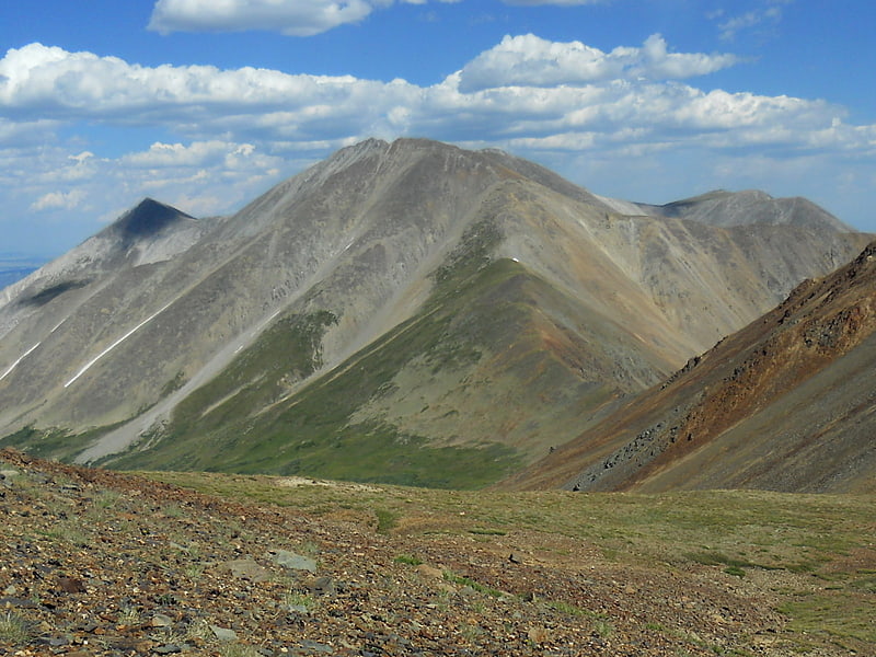
Peak in Colorado. Tabeguache Peak is one of the fourteeners of the US state of Colorado. It is a near neighbor of the higher peak Mount Shavano, which lies approximately 1/2 mile to the southeast, and is close to being a subpeak of the latter. According to William Bright an American Linguist specialized in Native American and South Asian languages and descriptive linguistics it is pronounced "TAB-uh-wahch". According to Mountaineer Louis Dawson the name is pronounced "tab-uh-wash," with the accent on the first syllable. It lies just east of the Continental Divide and just west of the Arkansas River, in the south-central part of the Sawatch Range. It is located within the San Isabel National Forest and is in Chaffee County.
The mountain is named for the Tabeguache band of the Utes. "Tabaguache" means 'People of Sun Mountain', from "Tava" meaning 'sun.'[17]
Horseshoe Mountain
Mountain in Colorado. Horseshoe Mountain is a high mountain summit in the Mosquito Range of the Rocky Mountains of North America. The 13,905-foot thirteener is located 7.1 miles southeast by east of the City of Leadville, Colorado, United States, on the drainage divide separating San Isabel National Forest and Lake County from Pike National Forest and Park County.[18]
Cronin Peak
Mountain in Colorado. Cronin Peak is a high mountain summit in the southern Sawatch Range of the Rocky Mountains of North America. The 13,877-foot thirteener is located in San Isabel National Forest, 12.9 miles southwest by west of the community of Nathrop in Chaffee County, Colorado, United States. Cronin Peak was named in honor of Mary Cronin, who in 1934 become the first woman to climb all 53 Colorado fourteeners.[19]
Carbonate Mountain
Mountain in Colorado. Carbonate Mountain is a high mountain summit in the southern Sawatch Range of the Rocky Mountains of North America. The 13,670-foot thirteener is located in San Isabel National Forest, 5.4 miles north of the community of Garfield in Chaffee County, Colorado, United States.[20]