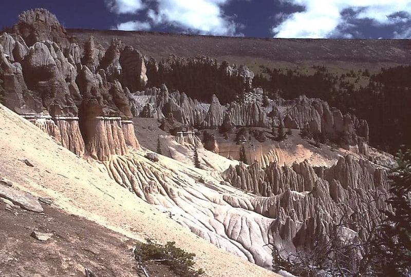
Discover 9 hidden attractions, cool sights, and unusual things to do in Rio Grande National Forest (United States). Don't miss out on these must-see attractions: Kit Carson Peak, Challenger Point, and Columbia Point. Also, be sure to include Ellingwood Point in your itinerary.
Below, you can find the list of the most amazing places you should visit in Rio Grande National Forest (Colorado).
Table of Contents
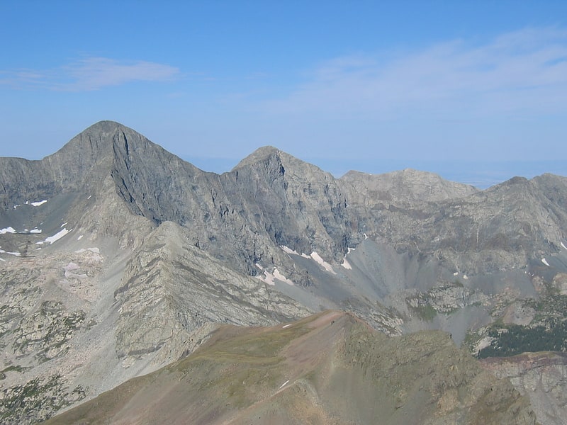
Kit Carson Peak
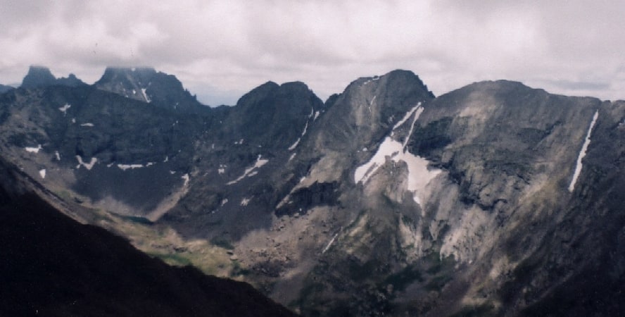
Mountain in Colorado. Kit Carson Peak is a high mountain summit of the Crestones in the Sangre de Cristo Range of the Rocky Mountains of North America. Officially designated Kit Carson Mountain, the 14,171-foot fourteener is located 5.2 miles east by south of the Town of Crestone in Saguache County, Colorado, United States. The name Kit Carson Mountain is used for both the massif with three summits, or to describe the main summit only. The mountain is named in honor of frontiersman Christopher Houston "Kit" Carson. The Crestones are a cluster of high summits in the Sangre de Cristo Range, comprising Crestone Peak, Crestone Needle, Kit Carson Peak, Challenger Point, Humboldt Peak, and Columbia Point. They are usually accessed from common trailheads.[1]
Challenger Point
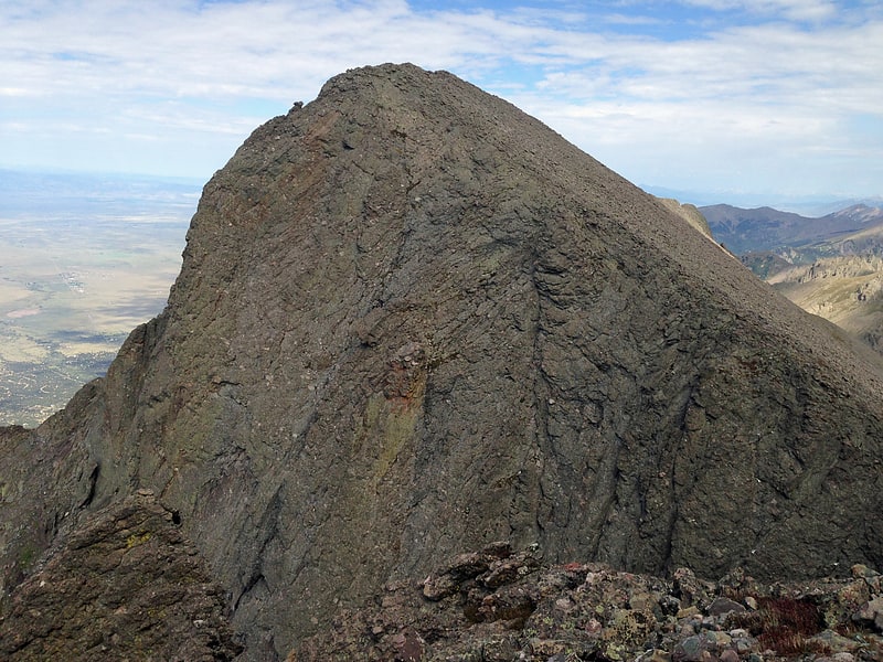
Mountain in Colorado. Challenger Point is a high mountain summit of the Crestones in the Sangre de Cristo Range of the Rocky Mountains of North America. The 14,087-foot fourteener is located 5.0 miles east by south of the Town of Crestone in Saguache County, Colorado, United States. The summit is on the northwest shoulder of Kit Carson Mountain, and is a subpeak of the latter. It was renamed in memory of the seven astronauts who died when the Space Shuttle Challenger disintegrated shortly after liftoff on January 28, 1986.[2]
Columbia Point

Mountain in Colorado. Columbia Point is a high mountain summit of the Crestones in the Sangre de Cristo Range of the Rocky Mountains of North America. The 13,986-foot thirteener is located 5.5 miles east by south of the Town of Crestone in Saguache County, Colorado, United States. The Crestones are a cluster of high summits in the Sangre de Cristo Range, comprising Crestone Peak, Crestone Needle, Kit Carson Peak, Challenger Point, Humboldt Peak, and Columbia Point.
Columbia Point is subpeak of Kit Carson Mountain. It was known informally as Kat Carson, but was officially named Columbia Point in 2003 to honor the seven astronauts who died when the Space Shuttle Columbia disintegrated during re-entry on February 1, 2003. With a topographic prominence over 300 ft (91 m), it qualifies as a separate summit under the standard cutoff, but it is not a well-known peak.[3]
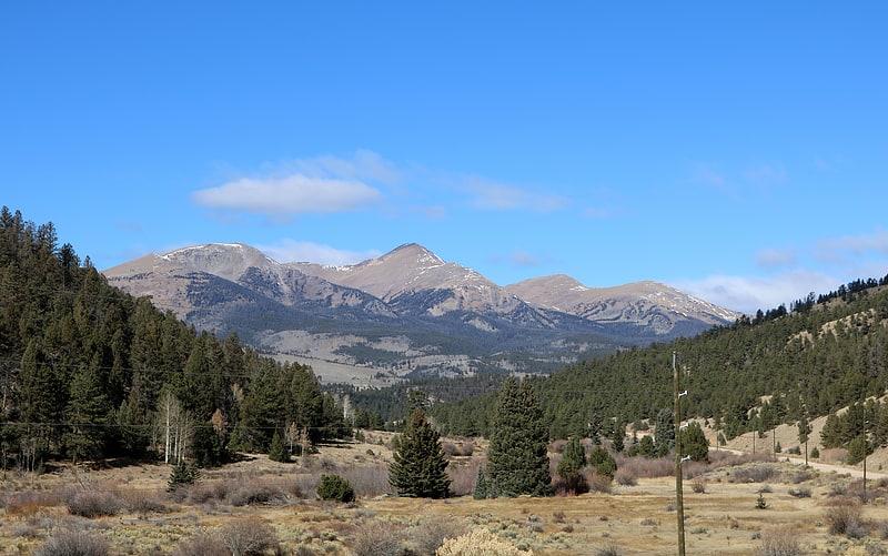
Ellingwood Point
Mountain in Colorado. Ellingwood Point is a high mountain summit in the Sangre de Cristo Range of the Rocky Mountains of North America. The 14,048-foot fourteener is located on the Sierra Blanca Massif, 9.9 miles north by east of the Town of Blanca, Colorado, United States, on the drainage divide separating the Rio Grande National Forest and Alamosa County from the San Isabel National Forest and Huerfano County. Ellingwood Point was named in honor of Albert Russell Ellingwood, an early pioneer of mountain climbing in the Western United States and in Colorado in particular.[4]
Antora Peak
Mountain in Colorado. Antora Peak is a high and prominent mountain summit in the southern Sawatch Range of the Rocky Mountains of North America. The 13,275-foot thirteener is located in Rio Grande National Forest, 4.6 miles west-northwest of the Town of Bonanza in Saguache County, Colorado, United States.[5]
La Garita Caldera
Caldera in Colorado. La Garita Caldera is a large supervolcanic caldera in the San Juan volcanic field in the San Juan Mountains near the town of Creede in southwestern Colorado, United States. It is west of La Garita, Colorado. The eruption that created the La Garita Caldera is among the largest known volcanic eruptions in Earth's history, as well as being one of the most powerful known supervolcanic events.[6]
Fish Canyon Tuff

The Fish Canyon Tuff is the large volcanic ash flow deposit resulting from one of the largest known explosive eruptions on Earth, estimated at 1,200 cu mi. The eruption was centered at La Garita Caldera in southwest Colorado. The tuff can be assumed to belong to one eruption due to its high chemical consistency (SiO2=bulk 67.5–68.5%, matrix 75–76% and consistent phenocryst content and composition. This tuff and eruption is part of the larger San Juan volcanic field and Mid-Tertiary ignimbrite flare-up.[7]
Platoro Dam
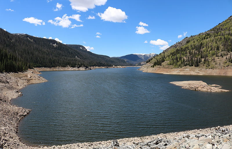
Platoro Dam is a dam in Conejos County, Colorado.
The earthen dam was constructed between 1949 and 1951 by the United States Bureau of Reclamation with a height of 165 feet (50 m), and 1,475 feet (450 m) long at its crest. It impounds the Conejos River, a tributary of the Rio Grande, for irrigation water storage as part of the larger San Luis Valley Project. The dam is owned by the Bureau, and operated by the local Conejos Water Conservancy.
The reservoir it creates, Platoro Reservoir, has a normal water surface of 1.5 square miles (3.9 km2), and a maximum capacity of 53,506 acre-feet (65,999,000 m3). Recreation includes fishing, camping, boating and hunting, although use is light because of the remote, high mountain valley location and the short season.[8]
Sevenmile Bridge
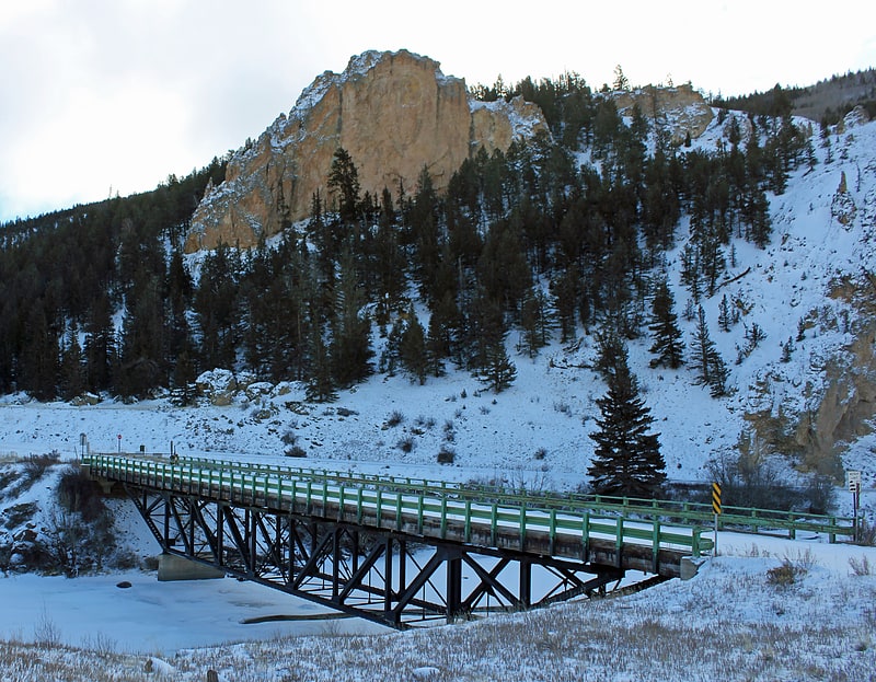
Truss bridge in Mineral County, Colorado. The Sevenmile Bridge is a Pratt deck truss bridge bringing a county road over the Rio Grande, 6 miles southwest of Creede, Colorado, United States. It was designed by engineer King Burghardt and is unusual for its cantilevered ends. It was built in 1935; it then carried State Highway 149. It has also been known as Bridge over Rio Grande River. It was listed on the National Register of Historic Places in 1985.
In 1981 ownership of the bridge was transferred to Mineral County. The bridge provides access to Marshall Park Campground.[9]