Discover 5 hidden attractions, cool sights, and unusual things to do in La Garita Wilderness (United States). Don't miss out on these must-see attractions: San Luis Peak, Wheeler Geologic Area, and San Juan volcanic field. Also, be sure to include Stewart Peak in your itinerary.
Below, you can find the list of the most amazing places you should visit in La Garita Wilderness (Colorado).
Table of Contents
San Luis Peak
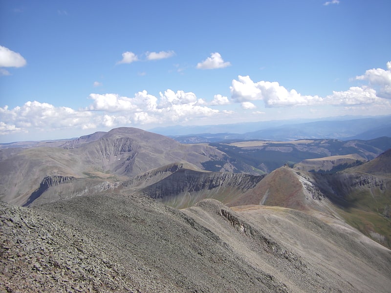
Summit in Colorado. San Luis Peak is the highest summit of the La Garita Mountains range in the Rocky Mountains of North America. The prominent 14,022-foot fourteener is located in the Gunnison National Forest portion of the La Garita Wilderness in Saguache County approximately 10 miles north of Creede. It is situated rather far to the east of the other fourteeners in the San Juans, and has more of a wilderness setting than many of the others.
San Luis Peak is a relatively straightforward climb, with two hiking routes to the summit. The Northeast Ridge route begins at the Stewart Creek Trailhead and is 13.5 mi (21.7 km) round trip. The South Ridge route begins at the West Willow Creek Trailhead north of Creede. This route is almost entirely above treeline and is 12.3 mi (19.8 km) round trip.[1]
Wheeler Geologic Area
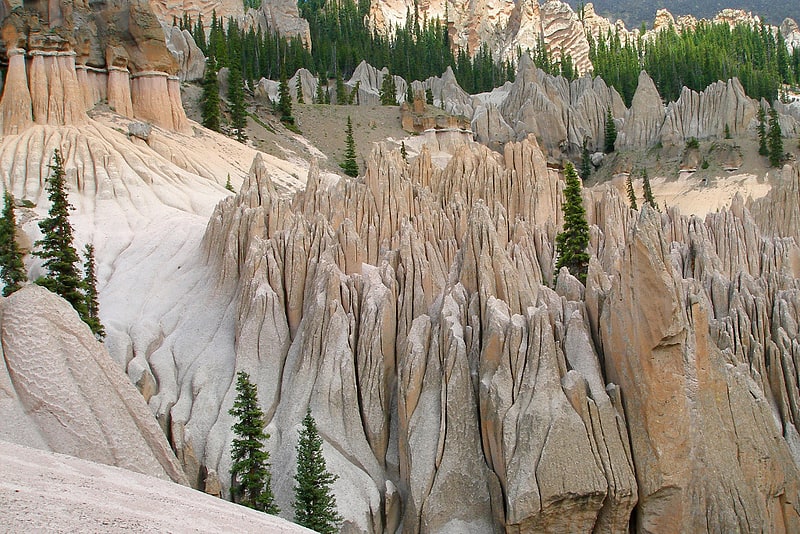
The Wheeler Geologic Area is a highly eroded outcropping of layers of volcanic ash, in the La Garita Mountains of Mineral County, in southern Colorado in the western United States about 10 miles east north-east of Creede. The ash is the result of eruptions from the La Garita Caldera approximately 25 million years ago.
The area was designated a national monument from 1908 until 1950 and was Colorado's first National Monument. It is now part of the La Garita Wilderness and administered by the Rio Grande National Forest. Lying just below the crest of the range at an elevation of 11,960 feet, it can be reached by an 8.4-mile hike on the East Bellows Trail, or by a difficult 14 mile four-wheel drive road.
The formations are named after Captain George M. Wheeler, who explored and surveyed this area in 1874 for the U.S. Army.[2]
San Juan volcanic field
Volcano in Colorado. The San Juan volcanic field is part of the San Juan Mountains in southwestern Colorado. It consists mainly of volcanic rocks that form the largest remnant of a major composite volcanic field that covered most of the southern Rocky Mountains in the Middle Tertiary geologic time. There are approximately fifteen calderas known in the San Juan Volcanic Fields; however, it is possible that there are two or even three more in the region.
The region began with many composite volcanoes that became active between 35 and 40 million years ago, with peak activity in the time period around 35-30 million years ago. Around this time the activity began to include explosive ash-flow eruptions. Many of these volcanoes experienced caldera collapse, resulting in the fifteen to eighteen caldera volcanoes in the region today.[3]
Stewart Peak
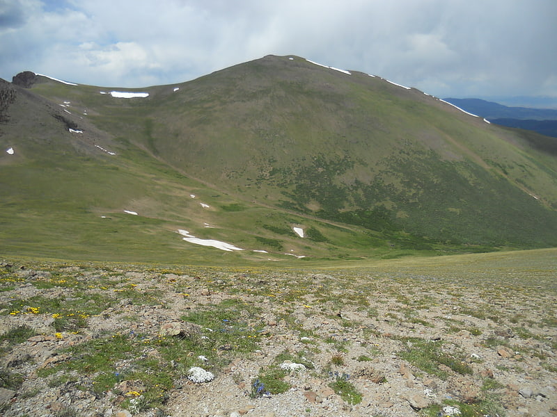
Summit in Colorado. Stewart Peak, elevation 13,983 ft, is a summit in Colorado. The peak is the second highest thirteener in the state. It is located in the La Garita Mountains, sub-range of the San Juan Mountains, in Saguache County, within the La Garita Wilderness. Stewart Peak is the 55th highest peak in Colorado by most standard definitions, just missing the list of Colorado fourteeners. At one time, the peak's elevation was measured to be over 14,000 ft and it was believed to be a fourteener, but more recent and accurate surveys have dropped it below that threshold.[4]
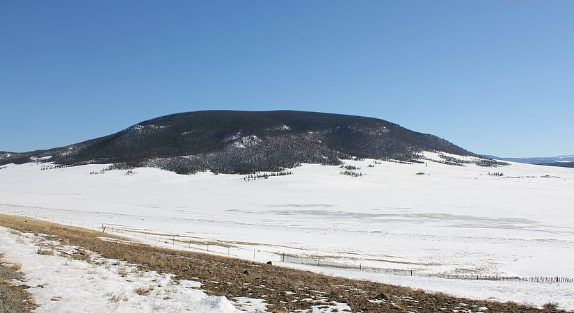
La Garita Mountains
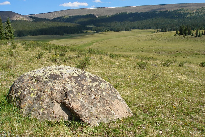
Mountain range in Colorado. The La Garita Mountains are a high mountain range in the San Juan Mountains, a sub-range of the Rocky Mountains. The mountains are located in Saguache and Mineral counties in southwestern Colorado and are almost entirely managed as public land within the Gunnison National Forest and the Rio Grande National Forest.
The La Garita Mountains lie within the La Garita Wilderness, one of Colorado's lesser known, but more picturesque, wilderness areas. "La Garita means "the lookout" in Spanish, and this wilderness amply deserves the name. From the summit of this wilderness's single fourteener (14,014 foot San Luis Peak), climbers can gaze across the upper Rio Grande Valley and down the long stretch of the San Luis Valley. About 35 miles of the Continental Divide lie well above a sprawling forestland that provides ideal habitats for huge numbers of elk and mule deer.[5]