Discover 6 hidden attractions, cool sights, and unusual things to do in Pictured Rocks National Lakeshore (United States). Don't miss out on these must-see attractions: Sable Falls, Grand Sable Lake, and Au Sable Light. Also, be sure to include Bridalveil Falls in your itinerary.
Below, you can find the list of the most amazing places you should visit in Pictured Rocks National Lakeshore (Michigan).
Table of Contents
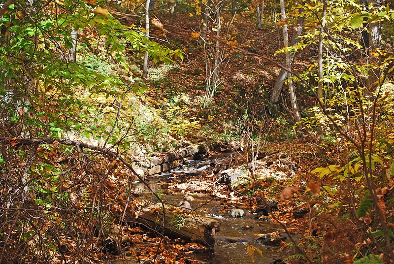
Sable Falls
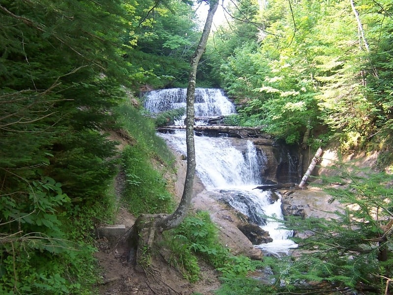
Waterfall in Michigan. Sable Falls is a waterfall located on Sable Creek in the easternmost portion of the Pictured Rocks National Lakeshore in Alger County, Michigan. The main access road to the falls is H-58 west of Grand Marais, Michigan. The falls tumbles 75 feet over Munising and Jacobsville sandstone formations. The waterfall is approximately one-half mile from Lake Superior. Stairs allow for relatively easy access to the falls. Between 2007 and 2010, the park service extended the boardwalk along the falls to include a portion of Sable Creek downstream from the major falls to allow visitors to take in the minor falls and rapids downstream. There is no handicap accessibility to the site.[1]
Address: H-58 West of Grand Marais, 55604 Grand Marais
Grand Sable Lake
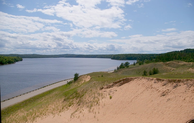
Lake in Michigan. Grand Sable Lake is an undeveloped lake in Michigan's Upper Peninsula near the town of Grand Marais, Michigan. It lies within the boundaries of the Pictured Rocks National Lakeshore.
County Highway H-58 runs along the northwestern shore of the lake and provides access to the Grand Sable Dunes which overlook the lake. Additionally, there is a sandy beach and picnic area available to visitors. There is a concrete boat access site on the eastern shore of the lake.
The soils around Grand Sable Lake are very sandy and the shoreline is mostly wooded[2]
Au Sable Light
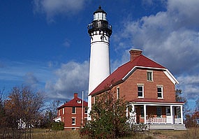
Lighthouse in Alger County, Michigan. Au Sable Light is an active lighthouse in the Pictured Rocks National Lakeshore west of Grand Marais, Michigan off H-58. Until 1910, this aid to navigation was called "Big Sable Light".[3]
Address: County Road H-58, Pictured Rocks National Lakeshore
Bridalveil Falls
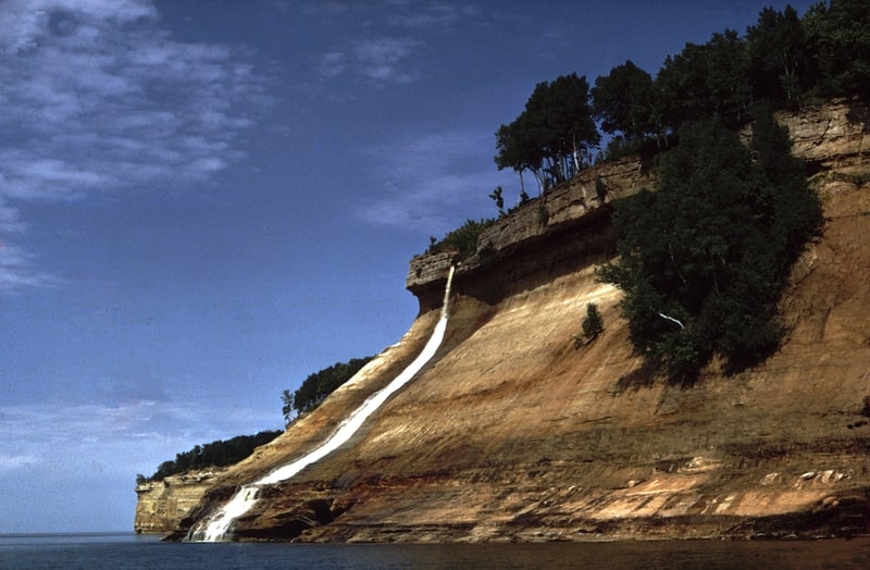
Waterfall in Michigan. Bridalveil Falls is a seasonal waterfall located at Pictured Rocks National Lakeshore, Michigan. Directions: From H-58 from Munising go east 4.5 miles to Miners Castle Road, then 5 miles to the Castle. You can see this from afar from here. You can also see it from the Lake in a boat, or hiking on the Lakeshore Trail[4]
Schoolcraft Furnace Site
The Schoolcraft Furnace Site is an abandoned iron furnace site located just east of Munising, Michigan within the Pictured Rocks National Lakeshore near the Munising Falls Visitor Center. It was listed on the National Register of Historic Places in 1977. It is also known as the Munising Furnace.[5]
Grand Sable Dunes
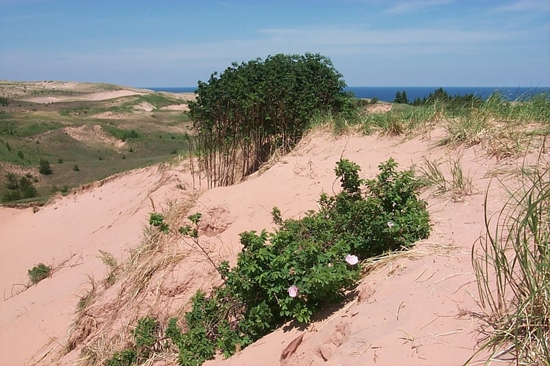
National park in Alger County, Michigan. Pictured Rocks National Lakeshore is a U.S. National Lakeshore in the Upper Peninsula of Michigan, United States. It extends for 42 miles along the shore of Lake Superior and covers 73,236 acres. The park has extensive views of the hilly shoreline between Munising and Grand Marais in Alger County, Michigan, with picturesque rock formations, waterfalls, and sand dunes.
Pictured Rocks derives its name from the 15 miles (24 km) of colorful sandstone cliffs northeast of Munising. The cliffs reach up to 200 feet (60 m) above lake level. They have been naturally sculptured into a variety of shallow caves, arches, and formations resembling castle turrets and human profiles. Near Munising, visitors can also visit Grand Island, most of which is included in the separate Grand Island National Recreation Area.
The U.S. Congress designated Pictured Rocks the first National Lakeshore in the United States in 1966. It is governed by the National Park Service (NPS), with 22 year-round NPS employees as of May 2006, and received 476,888 visitors in 2005.[6]