Discover 15 hidden attractions, cool sights, and unusual things to do in Ouachita National Forest (United States). Don't miss out on these must-see attractions: Albert Pike Recreation Area, Charlton Public Use Area, and Lake Ouachita. Also, be sure to include Shady Lake Recreation Area in your itinerary.
Below, you can find the list of the most amazing places you should visit in Ouachita National Forest (Arkansas).
Table of Contents
Albert Pike Recreation Area
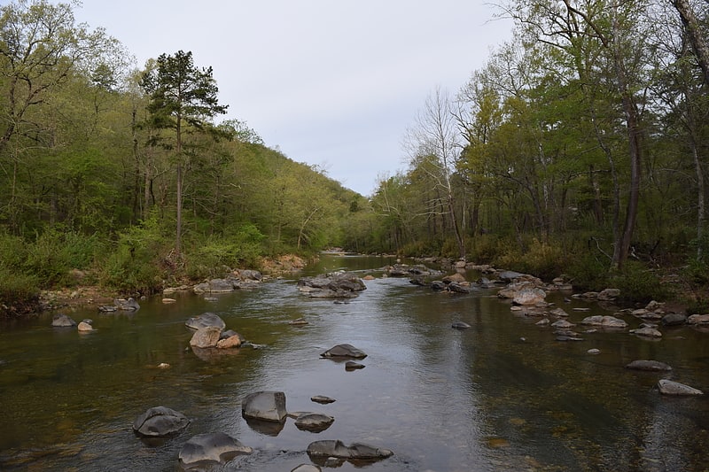
Picnic ground in Umpire, Arkansas. Albert Pike Recreation Area is a recreational area located in the Ouachita National Forest about 6 miles north of Langley, Arkansas in southern Montgomery County, Arkansas featuring swimming and camping areas on the Little Missouri River.[1]
Charlton Public Use Area
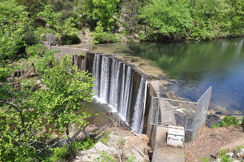
Campground in Royal, Arkansas. The Charlton Recreation Area is a public use area of the Ouachita National Forest, located just north of United States Route 270 between Crystal Springs and Mount Ida, Arkansas. The area includes a campground and day use facilities for water-related activities on Walnut Creek, including fishing and swimming. The facilities are organized around a small artificial lake created in 1938 by a crew of the Civilian Conservation Corps by damming the creek. The stone Charlton Dam and Spillway, about 100 feet in length, was listed on the National Register of Historic Places 1993, as was the stone Charlton Bathhouse, also built by the CCC in 1938.[2]
Lake Ouachita
Reservoir in Arkansas. Lake Ouachita is a reservoir created by the damming of the Ouachita River by Blakely Mountain Dam.
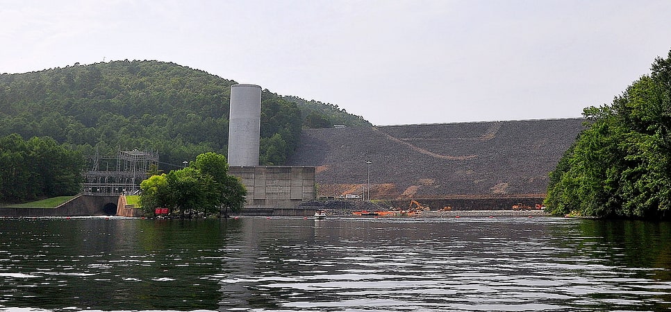
Blakely Mountain Dam was built by the United States Army Corps of Engineers from 1948 to 1953 for hydroelectric power, recreation, water supply and wildlife conservation. The dam is 231 feet (70 m) tall, 21,100 feet (6,400 m) long at the crest, and is capable of 75 megawatts.
The lake is located near Hot Springs, Arkansas. Lake Ouachita is the largest lake completely in Arkansas, as the larger Bull Shoals Lake extends into Missouri. Lake Ouachita has over 690 miles (1,110 km) of shoreline and over 66,324 acres (26,840 ha) of water. It is completely surrounded by the Ouachita National Forest. Lake Ouachita is located near two other lakes, Lake Hamilton and Lake Catherine. These three lakes, DeGray Lake to the near south, and the thermal springs of Hot Springs National Park make Hot Springs a popular tourist getaway.
Largemouth Bass, Small Mouth Bass, Spotted Bass, Bream, Crappie, Catfish, Walleye and world class Trophy Striped Bass await the angler. Lake Ouachita has rare jellyfish (non-stinging) and sponges found in very few freshwater lakes. Scuba divers from all over the world enjoy the underwater experience as well as the special spear fishing season.
The original purpose of Lake Ouachita was flood control and hydroelectricity. One feature by the Corps of Engineers is the Geo-Float Trail, a marked trail which can be followed with a brochure which details prominent geological features along the route. Lake Ouachita features one of the largest crystal veins in the world.
Vegetation covers 10% of the lake. Lake Ouachita's vegetation is being addressed by the U.S. Army Corps of Engineers, the Arkansas Game and Fish Commission, and the Lake Ouachita Association to control the hydrilla and Eurasian watermilfoil. The goal of the project is to contain and reduce — not to eradicate — the vegetation, since the presence of aquatic vegetation in moderate amounts is beneficial to the lake's fishery. Treatment will be concentrated on high recreational use areas, such as swimming beaches, around marinas and popular boating areas. Areas of the lake with good fish habitat will not be treated.[3]
Shady Lake Recreation Area
Campground in Polk County, Arkansas. Shady Lake Recreation Area is a campground and public recreation area in southwestern Ouachita National Forest, southwest of Mena, Arkansas and west of Glenwood, Arkansas. The area is oriented around Shady Lake, a body of water on the South Fork Saline River impounded by a dam built c. 1940 by the Civilian Conservation Corps. The area is administered by the United States Forest Service.[4]
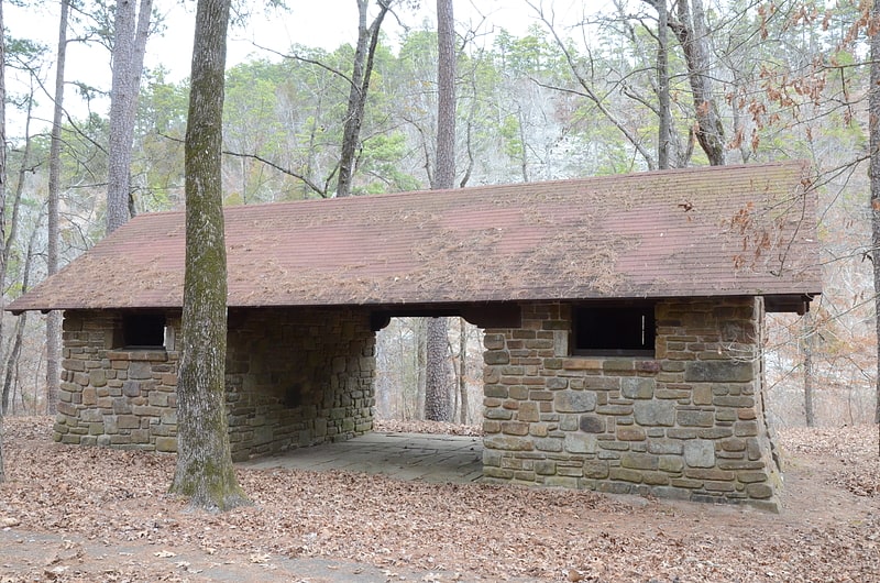
Collier Springs Picnic Area
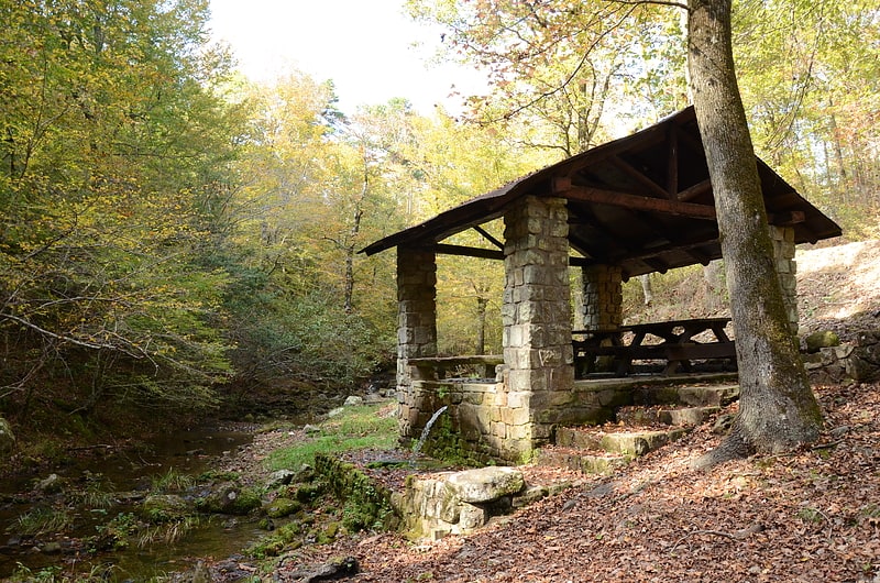
The Collier Springs Picnic Area is located on Forest Road 177 in Ouachita National Forest, northeast of Norman, Arkansas. The picnic area is notable for the presence of the Collier Springs Shelter, which was built by crews of the Civilian Conservation Corps in 1939. It is a rectangular open-air stone structure, with stone columns topped by hewn log beams that support the gabled roof. The shelter also acts as a protective cover for the eponymous spring, which is fed via a pipe to the nearby creek. Facilities at the picnic area also include a vault toilet.[5]
Queen Wilhelmina State Park
Park. Queen Wilhelmina State Park is a unit of Arkansas Department of Parks and Tourism in the Ouachita Mountains.
The original "Castle in the Sky" lodge was built in 1898 on 2,681-foot Rich Mountain, in Polk County, Arkansas. The park is on Talimena Scenic Drive — northwest of Mena, Arkansas and east of the Oklahoma state line. It is the only lodge open on the 235 mile Ouachita Trail. It is located on Arkansas’ second highest peak, Rich Mountain.
The lodge has 38 guest rooms, a restaurant, lobby and meeting room. The campground and trails remained open during the renovation. The park is one of the park system's eight mountain parks.[6]
Address: 3877 Highway 88 W, 71953-8317 Mena
Lum & Abner Jot-em-Down Store & Museum
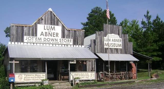
Historical place, Museum
Address: 4562 W Highway 88, 71961-8056 Pine Ridge
Parks Baptist Church
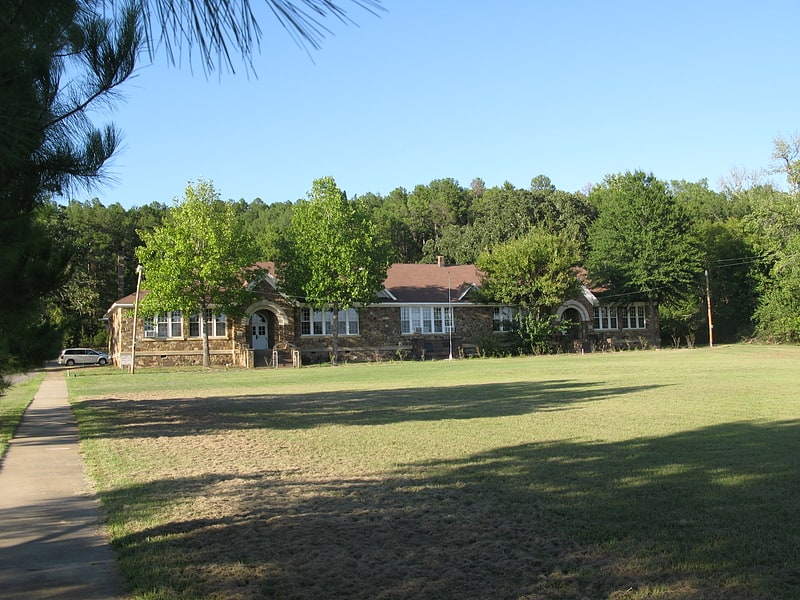
The Parks School is a historic former school building just north of Arkansas Highway 28 in the center of Parks, Arkansas. It is a single-story fieldstone structure, with a gable-on-hip roof, and several small gabled dormers on the long front facade. Two entrances are set in round-arch openings with keystones. The building has retained most of its original windows, doors, and other original hardware. It was built in 1940 with funding from the Works Progress Administration, and served as a school into the 1960s. It is now a local senior center.
The building was listed on the National Register of Historic Places in 2002.[7]
Address: 8605 Brush Creek Rd, Ouachita National Forest
Buckville Cemetery
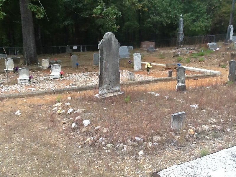
Cemetery in Garland County, Arkansas. Buckville Cemetery is a historic cemetery in rural Garland County, Arkansas. It is one of the few surviving remnants of the town of Buckville, which was inundated by the creation of Lake Ouachita; the other is the nearby Buckville Baptist Church, which was moved to its present location above the lake's planned water level in 1951. The cemetery, located near the end of Buckville Road on the north side of the lake, the cemetery has more than 300 burials, include graves of some of the area's earliest settlers. The oldest documented burial is dated 1861.
The cemetery was listed on the National Register of Historic Places in 2007.[8]
Wilton Mountain
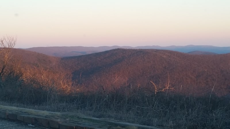
Summit in Oklahoma. Wilton Mountain, in Ouachita National Forest, is a summit in the Ouachita Mountains in Le Flore County, Oklahoma, approximately 2 miles from U.S. Route 59 and approximately 6 miles west of the Arkansas state line. Wilton Mountain is 2,543 feet above mean sea level[9]
Crystal Recreation Area
The Crystal Campground is located on Forest Road 177 in Ouachita National Forest, northeast of Norman, Arkansas. The campground has nine campsites and a picnic shelter, and provides access to outdoor recreational activities including hiking, swimming, and fishing. The swimming area is made possible by the Crystal Springs Dam, a 30-foot fieldstone dam built in 1935 by the Civilian Conservation Corps, that impounds Montgomery Creek to provide a swimming hole. The campground's main picnic shelter was also built by the CCC at that time. Both the dam and the shelter were listed on the National Register of Historic Places in 1993.[10]
Bard Springs Dam No. 2
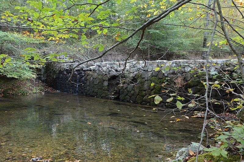
The Bard Springs Dam No. 2 is a historic recreational support facility in Ouachita National Forest. It is located at the Bard Springs recreation site, southeast of Mena and north of Athens in Polk County, off County Road 82 and Forest Road 106 on the banks of Blaylock Creek. This dam is located at the eastern end of the recreation area, and is about 75 feet long and 15 feet high at its center. It is made of fieldstone, and has a series of staggered steps at its base to reduce erosion. It was built in 1936 by a crew of the Civilian Conservation Corps, and is one of four surviving CCC structures in the immediate area.
The dam was listed on the National Register of Historic Places in 1993.[11]
Norman Town Square
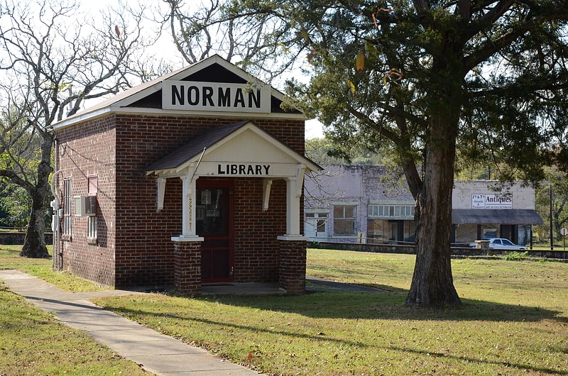
Plaza in Norman, Arkansas. The Norman Town Square is a public park at the center of Norman, Arkansas. It is bounded by 9th Street and Golf Course Road to the north and south, and Arkansas Highway 8 and Gurdon Avenue to the east and west. The park is about 1.5 acres in size, and is mostly open lawn, with a low stone retaining wall on the street-facing edges. The town library, built in 1935 with funding from the Works Progress Administration, stands at the center of the park, and there are four diamond-shaped flower planting areas located near the corners of the park, built in 1937 with WPA funding. It is the only known Depression-era town square laid out and built in Montgomery County.
The park was listed on the National Register of Historic Places in 1993.[12]
Jack Creek Bathhouse
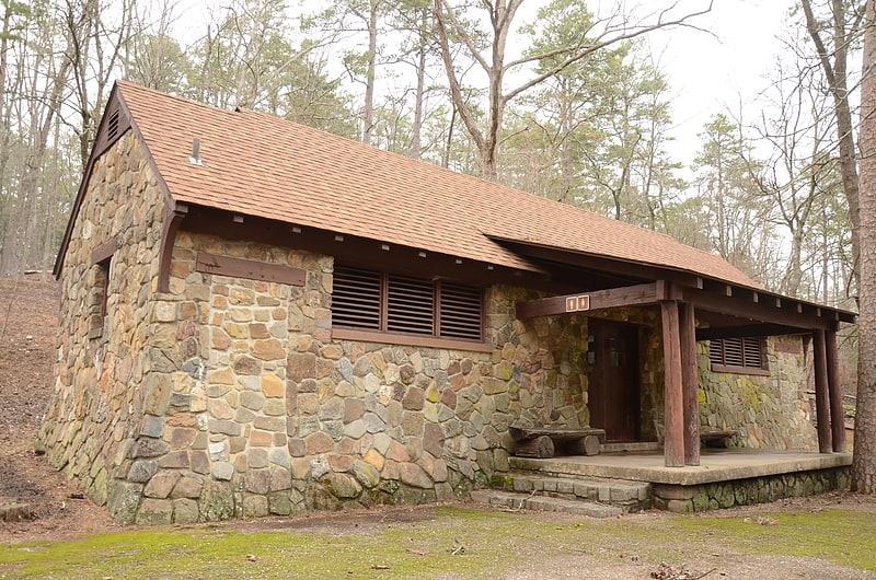
The Jack Creek Bathhouse is a historic recreational facility in Ouachita National Forest, Logan County, Arkansas. It is located south of Booneville, at the Jack Creek Recreation Area in the northern part of the national forest. It is a single-story masonry structure, built out of rustic stone, with a gabled roof supported by logs. It has two dressing rooms, separated by an open breezeway. It was built in 1936 by a crew of the Civilian Conservation Corps, and is a well-preserved example of the Rustic architecture the CCC is well known for producing.
The building was listed on the National Register of Historic Places in 1993.[13]
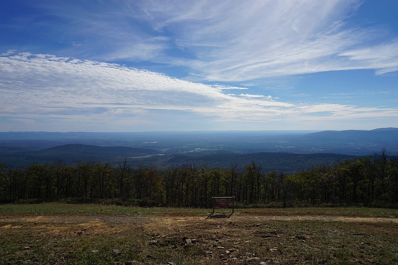
Flatside Wilderness
National recreation area in Perry County, Arkansas. The Flatside Wilderness is a 9,507-acre protected area in the U.S. state of Arkansas. It is one of six wilderness areas in the Ouachita National Forest and also the easternmost. Outdoor enthusiasts can enjoy the area in a number of ways, including an 8.9-mile section of the Ouachita National Recreation Trail.[14]