Discover 8 hidden attractions, cool sights, and unusual things to do in Mount Magazine State Park (United States). Don't miss out on these must-see attractions: Mount Magazine, Ouachita Mountains, and Cove Lake Spillway Dam-Bridge. Also, be sure to include Cove Creek Bridge in your itinerary.
Below, you can find the list of the most amazing places you should visit in Mount Magazine State Park (Arkansas).
Table of Contents
Mount Magazine
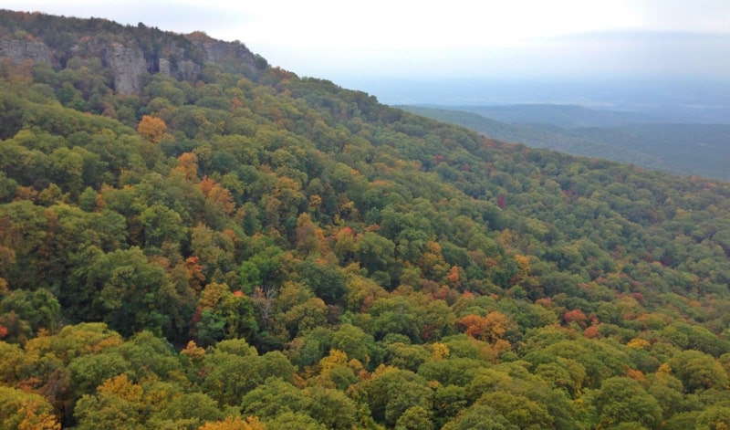
Mount in Arkansas. Mount Magazine, officially named Magazine Mountain, is the highest point of the U.S. Interior Highlands and the U.S. state of Arkansas, and is the site of Mount Magazine State Park. It is a flat-topped mountain or mesa capped by hard rock and rimmed by precipitous cliffs. There are two summits atop the mountain: Signal Hill, which reaches 2,753 feet, and Mossback Ridge, which reaches 2,700 ft.
Mount Magazine is often called "the highest point between the Alleghenies and the Rockies", however, there are mountains located in far west Texas, that exceed Mount Magazine in elevation and prominence.[1]
Address: 16878 S State Highway 309, Mount Magazine State Park
Ouachita Mountains
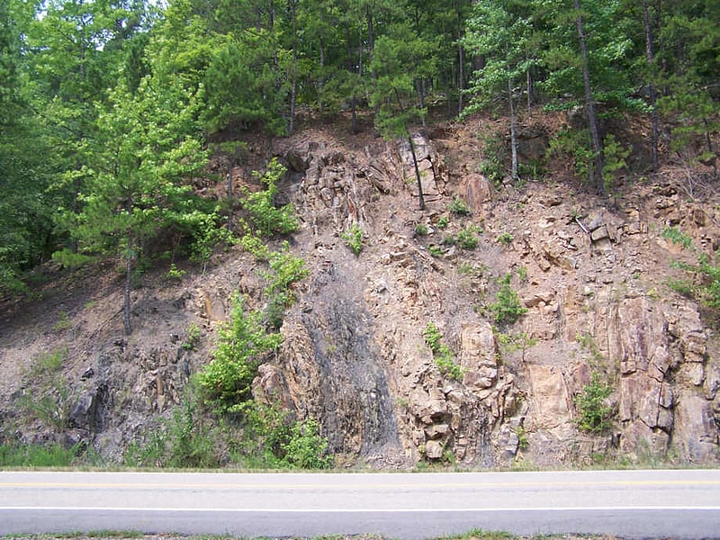
Mountain range in Oklahoma. The Ouachita Mountains, simply referred to as the Ouachitas, are a mountain range in western Arkansas and southeastern Oklahoma. They are formed by a thick succession of highly deformed Paleozoic strata constituting the Ouachita Fold and Thrust Belt, one of the important orogenic belts of North America. The Ouachitas continue in the subsurface to the northeast, where they make a poorly understood connection with the Appalachians and to the southwest, where they join with the Marathon uplift area of West Texas. Together with the Ozark Plateaus, the Ouachitas form the U.S. Interior Highlands. The highest natural point is Mount Magazine at 2,753 feet.
The Ouachita Mountains is a Level III ecoregion designated by the Environmental Protection Agency (EPA). The region has been subdivided into six Level IV ecoregions.[2]
Cove Lake Spillway Dam-Bridge
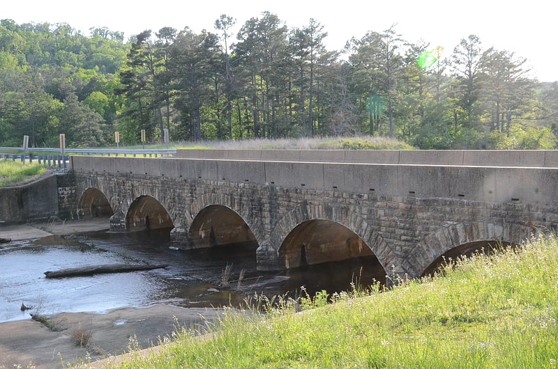
Bridge. The Cove Lake Spillway Dam and Bridge are historic structures in Ozark-St. Francis National Forest, north of Corley, Arkansas. The dam is built of earth and stone, and impounds Cove Lake, location of a recreation area in the national forest. The bridge is a five-span masonry arch structure, built across the dam spillway, where it carries Arkansas Highway 309. The dam and bridge were built in 1937 with funding from the Works Progress Administration, and is a fine example of the Rustic architecture WPA projects were known for.
The structures were listed on the National Register of Historic Places in 1995.[3]
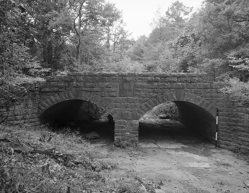
Cove Creek Bridge
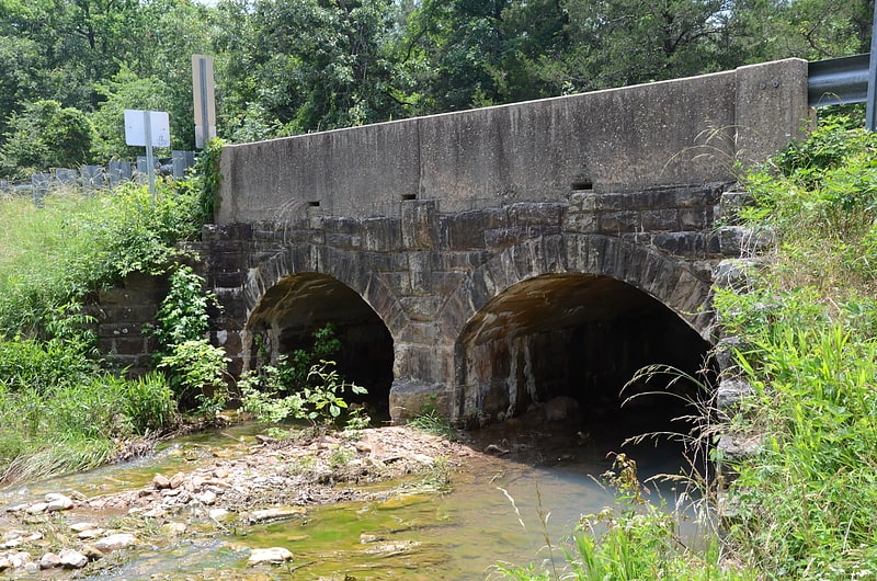
Bridge in Logan County, Arkansas. The Cove Creek Bridge is a historic bridge, carrying Arkansas Highway 309 across Cove Creek, south of the hamlet of Corley, Arkansas in the Ozark-St. Francis National Forest. It is a two-span closed-spandrel masonry arch structure, with each span measuring 13 feet and an overall structure length of 26 feet. It is built entirely out of stone, with a concrete and asphalt deck, and concrete barriers at the sides. It was built in 1936 with funding support from the Works Progress Administration.
The bridge was listed on the National Register of Historic Places in 1995.[4]
Cove Lake Bathhouse
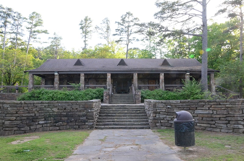
Building. The Cove Lake Bathhouse is a historic recreational facility at the Cove Lake Recreation Area, north of Corley, Arkansas in the Ozark-St. Francis National Forest. It is a T-shaped stone structure, built of fieldstone with a gabled roof. A porch extends across the front, supported by stone piers. The roof is pierced by three triangular dormers with vents in them. It was built in 1937 with funding from the Works Progress Administration, and represents a distinctive departure from the more typical Rustic architecture produced by WPA projects.
The building was listed on the National Register of Historic Places in 1995.[5]
Spring Lake Bridge
Bridge in Yell County, Arkansas. The Spring Lake Bridge is a historic bridge in the eastern part of Ozark-St. Francis National Forest, carrying County Road 35 across an inlet of Spring Lake known as Bob Barnes Branch, in the Spring Lake Recreation Area. It is a two-span closed-spandrel stone arch bridge with a total length of 36 feet. Each arch is 10 feet long and 6 feet high. Built in 1936 with federal funding, it is one of the state's finest examples of a stone arch bridge.
The bridge was listed on the National Register of Historic Places in 1990.[6]
Cove Creek Tributary Bridge
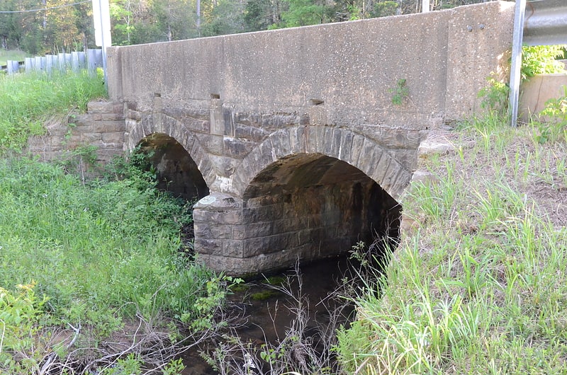
Bridge. The Cove Creek Tributary Bridge is a historic bridge in rural Logan County, Arkansas. It is a two-span closed-spandrel stone arch bridge, carrying Arkansas Highway 309 across a tributary of Cove Creek north of Corley in Ozark-St. Francis National Forest. Each of its arches is 11 feet long, and the structure is an overall 23 feet in length. Concrete barriers form the sides of the bridge on either side of the roadway. The bridge was built in 1936 under the auspices of the Arkansas Highway Commission.
The bridge was listed on the National Register of Historic Places in 1995.[7]
Burnett Springs
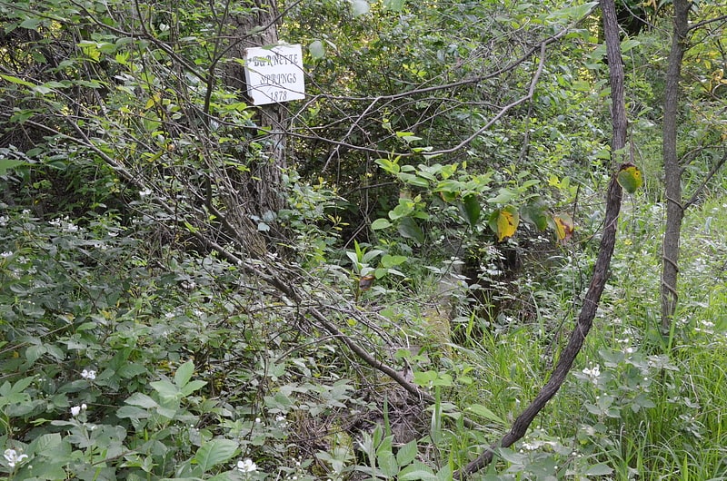
Burnett Springs is the site of a former resort community in rural Logan County, Arkansas. It is located at the end of County Road 704, about 1 mile west of the community of Corley. The area was developed as a spring-based spa resort by Captain John Burnette in the 1870s. A small town sprang around a three-story spa hotel, which fell into decline after 1915. The hotel burned in 1930, and all of the other buildings have succumbed to the elements. The only surviving above-ground feature is one of the spring sites, which is set in a stone reservoir box shelter from erosion by stone walls.
The site was listed on the National Register of Historic Places in 1995.[8]