Discover 11 hidden attractions, cool sights, and unusual things to do in Narragansett (United States). Don't miss out on these must-see attractions: The Towers, Town Beach, and Point Judith Light. Also, be sure to include Bonnet Shores Beach Club in your itinerary.
Below, you can find the list of the most amazing places you should visit in Narragansett (Rhode Island).
Table of Contents
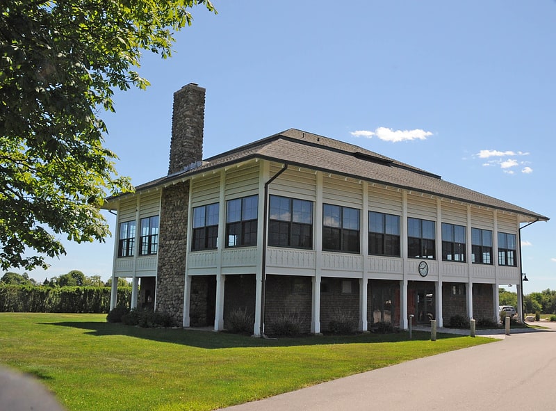
The Towers
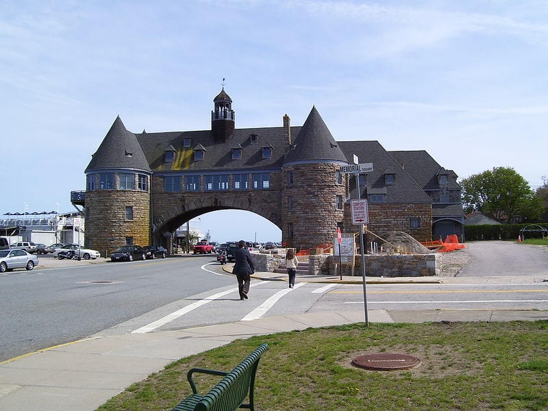
Historical landmark in Narragansett, Rhode Island. The Towers is a historic structure located at 35 Ocean Road in Narragansett, Rhode Island, USA. It is the only remnant of the Narragansett Pier Casino built in the 1880s. On November 25, 1969, it was added to the National Register of Historic Places.[1]
Address: 35 Ocean Rd, 02882-1321 Narragansett
Town Beach
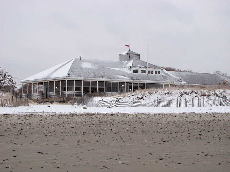
Recreation center in Narragansett, Rhode Island. Narragansett Town Beach is a public recreation area encompassing 19 acres on the eastern edge of the town of Narragansett, Rhode Island, and south of the western passage that connects the Narragansett Bay to the open waters of Rhode Island Sound. The southern shoreline is rocky with a concrete sea wall constructed upland, while the northeast end of the beach is characterized by the entrance to Narrow River and Cormorant Point.
The state beach offers picnicking, ocean swimming, changing rooms, surfing, and beach activities for approximately the first half mile of the beach, while the northeast end remains privately owned. The beach and dunes provide an important wildlife habitat for certain species of shorebirds, including piping plovers.[2]
Address: 77 Boston Neck Rd, Narragansett
Point Judith Light
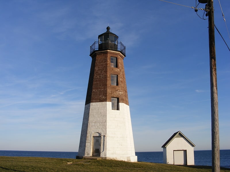
Lighthouse in Narragansett, Rhode Island. The Point Judith Light is located on the west side of the entrance to Narragansett Bay, Rhode Island as well as the north side of the eastern entrance to Block Island Sound. The confluence of two waterways make this area busy with water traffic and the waters around Point Judith are very cold and dangerous. Historically, even with active lighthouses, there have been many shipwrecks off these coasts.
Three light structures have been built on this site. The original 35-foot (11 m) tower, built in 1810, was destroyed by a hurricane in 1815. It was replaced in 1816, by another 35-foot stone tower with a revolving light and ten lamps. The present octagonal granite tower was built in 1856. The upper half of the tower is painted brown and the lower half white to make the light structure a more effective daymark for maritime traffic. In 1871, ship captains asked that Point Judith's fog signal be changed from a horn to whistle. This change distinguished the Point Judith light from the Beavertail Lighthouse, which used a siren to announce fog. A whistle could also be heard more distinctly over the sounds of the surf in the area. Point Judith Light was automated in 1954, and was listed on the National Register of Historic Places in 1988.[3]
Address: 1460 Ocean Rd, 02882-6200 Narragansett
Bonnet Shores Beach Club
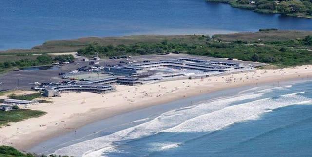
Beach
Address: 175 Bonnet Point Road, Narragansett
South County Museum
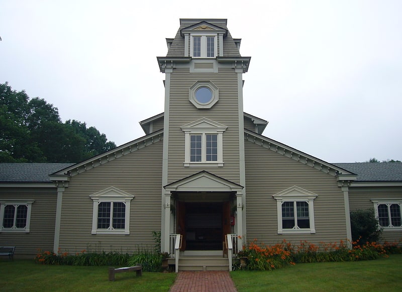
Museum in Narragansett, Rhode Island. The South County Museum is a non-profit museum in Narragansett, Rhode Island.[4]
Address: 115 Strathmore St, 02882-3351 Narragansett
Narragansett Baptist Church
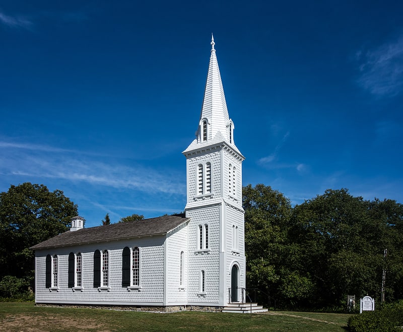
Church building in Narragansett, Rhode Island. Narragansett Baptist Church is an historic Baptist church building located at 170 South Ferry Road, in Narragansett, Rhode Island.[5]
Address: 170 S Ferry Rd, 02882 Narragansett
Narragansett Pier
Narragansett Pier is an unincorporated village and a census-designated place in the town of Narragansett in Washington County, Rhode Island, United States. The population was 3,409 at the 2010 census.[6]
Maury Loontjens Memorial Library
Library
Address: 35 Kingstown Rd, 02882 Narragansett
Kinney Bungalow
The Anthony–Kinney Farm is a historic farm and resort complex at 505 Point Judith Road in Narragansett, Rhode Island. The property, now a town-owned recreation area known as Sunset Farm, saw agricultural use for over 300 years, and was converted into a private resort around the turn of the 20th century. The Point Judith area was among the first in Rhode Island to be purchased from the local Narragansett people, in 1657. The farm was acquired by James E. Anthony in 1850, who sold it to Francis Kinney in 1897. Kinney maintained much of the land in agricultural use, but built an extravagant resort complex, including a distinctive East Indian bungalow as a clubhouse, and built a private nine-hole golf course. Kinney died in 1908, and the property was owned by the Chase family until 1991, when most of it was purchased by the town.It is managed by the town as an active farm, and the restored clubhouse is available for rent as function space.
The farm was listed on the National Register of Historic Places in 2013.[7]
Address: 505 Point Judith Road, Narragansett
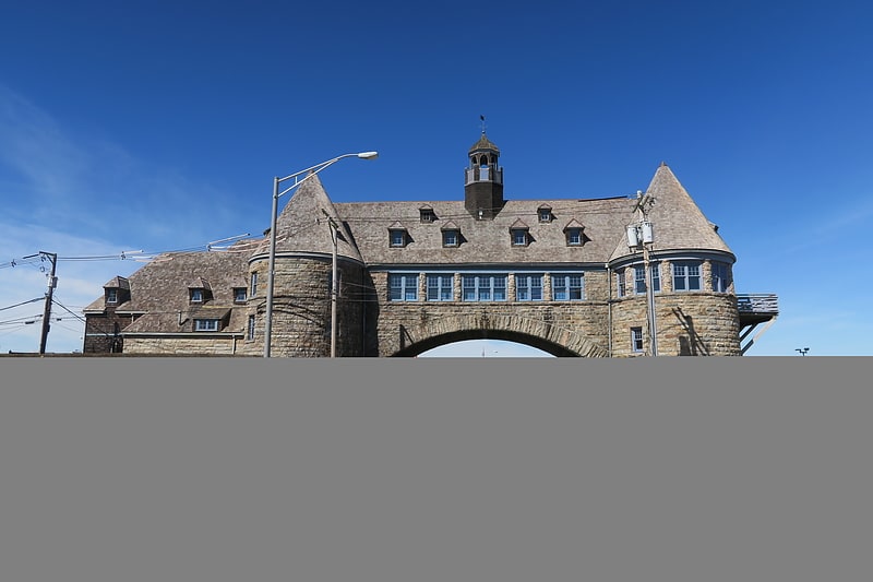
Towers Historic District

The Towers Historic District is a historic district in Narragansett, Rhode Island, encompassing a city block bounded by the Atlantic Ocean, Exchange Place, Mathewson and Taylor Streets. It is centered on The Towers, the surviving remnant of the Narragansett Casino, built 1883-86 to a design by McKim, Mead & White. This area was always near the center of resort-oriented development in Narragansett from the mid-19th century on, including four summer cottages on Taylor and Mathewson Streets built in the 1860s and 1870s. Most of the casino was destroyed by fire in 1900, leaving its stone towers, and the nearby Coast Guard station, also designed by McKim, Mead & White. The oldest building in the district is an 1822 2+1⁄2-story house at 18 Mathewson Street.
The district was added to the National Register of Historic Places in 1982.[8]
Earlscourt Historic District
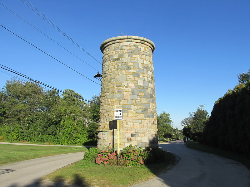
Park in Narragansett, Rhode Island. Earlscourt Historic District is a residential historic district in Narragansett, Rhode Island, United States. It is centered on a stretch of Earles Court, between Gibson Avenue and Noble Street, and includes a few properties on the adjacent Gibson Avenue and Woodward and Westminster Streets. It includes nine residential properties developed in the 1880s and 1890s, during the height of Narragansett Pier's popularity as a summer resort community. All are in the then-popular Shingle Style, and most were designed by well-known architects. The Sherry Cottages, a series of four buildings on Gibson Avenue, were all designed by McKim, Mead & White, who also designed The Towers. The other development is that on Earles Court, designed by D. J. Jardine and Constable Brothers for Edward Earle, a New York lawyer. The central focus of this development is a stone water tower which bisects the roadway.
The district was listed on the National Register of Historic Places in 1982.[9]