Discover 35 hidden attractions, cool sights, and unusual things to do in Grand Canyon National Park (United States). Don't miss out on these must-see attractions: Grand Canyon, Bright Angel Trail, and South Kaibab Trail. Also, be sure to include Desert View in your itinerary.
Below, you can find the list of the most amazing places you should visit in Grand Canyon National Park (Arizona).
Table of Contents
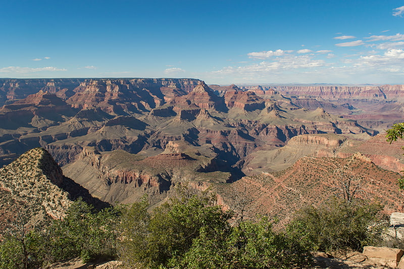
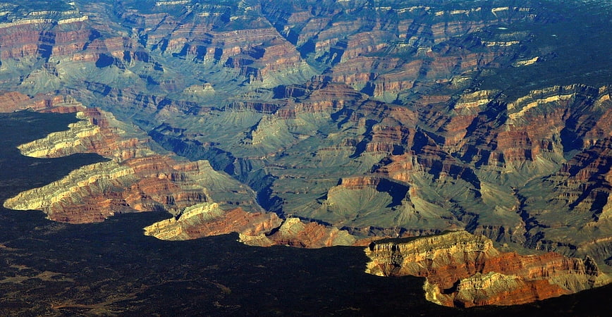
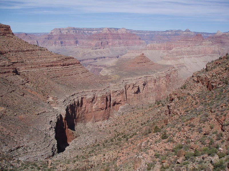
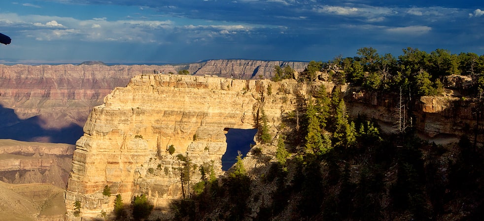
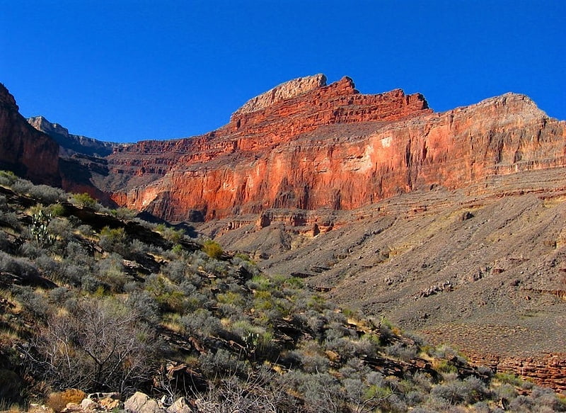
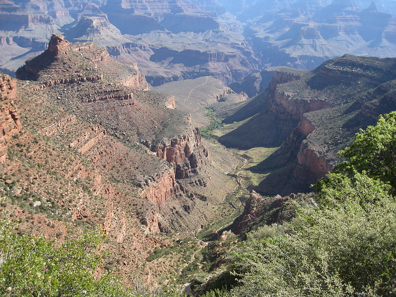
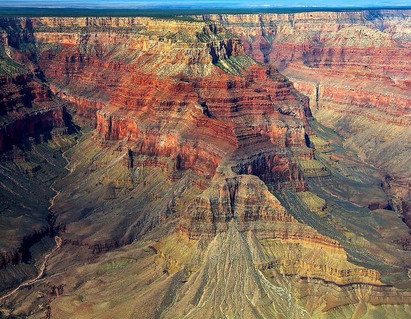
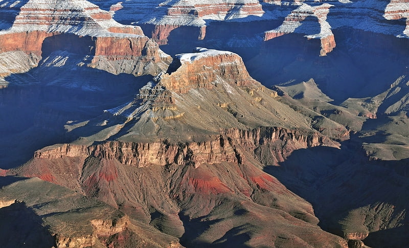
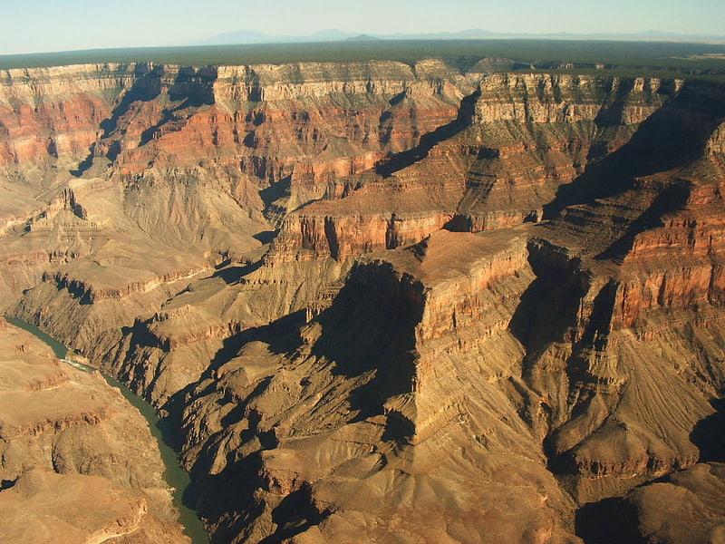
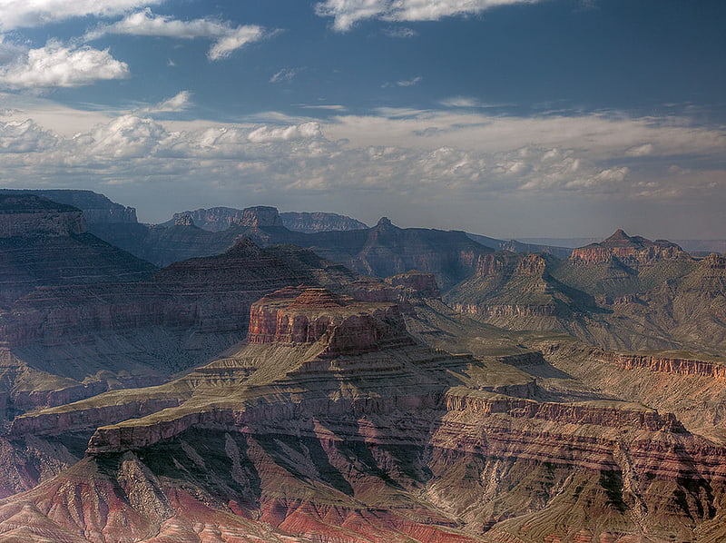
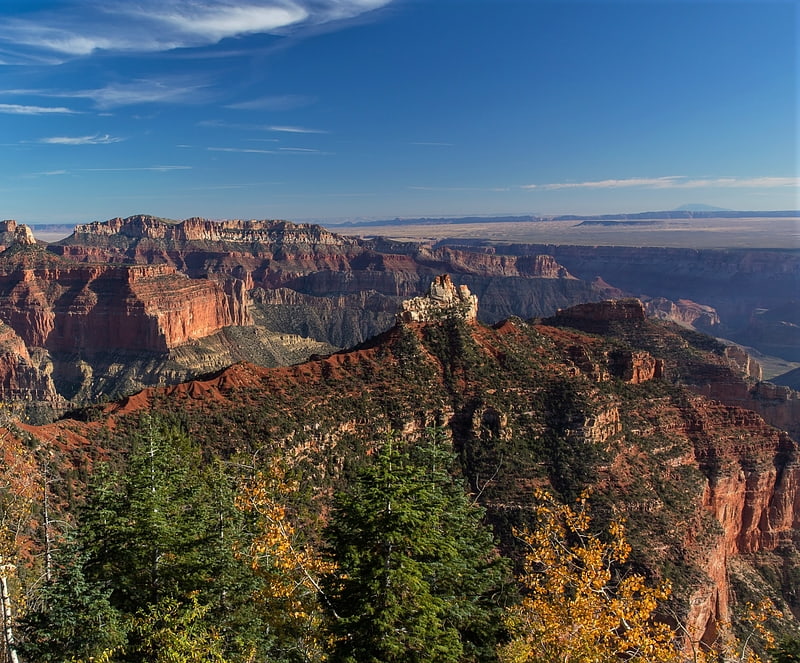
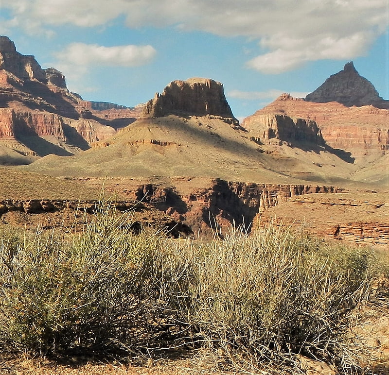
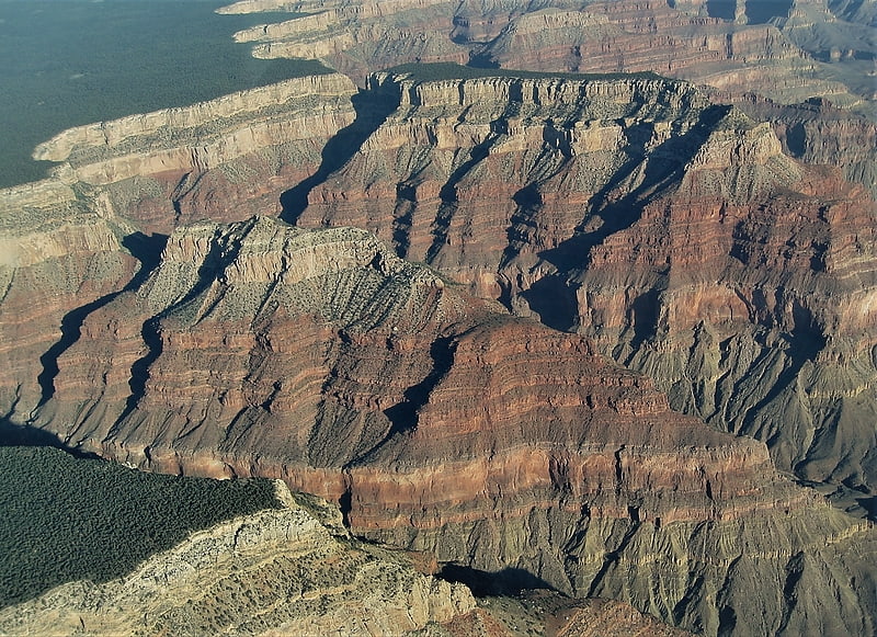
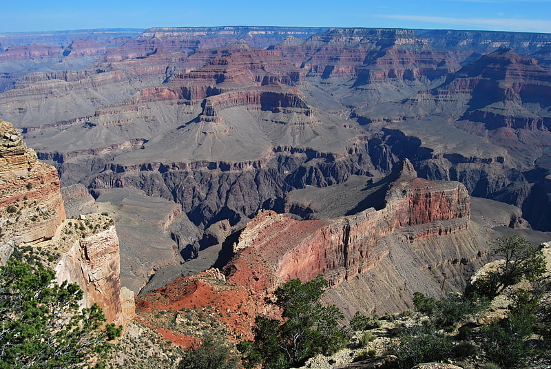
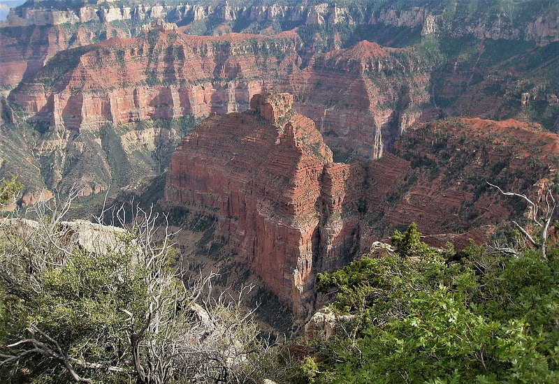
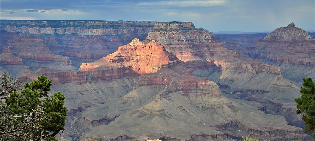
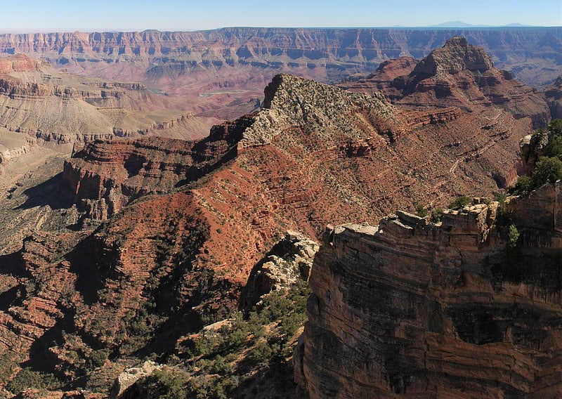
Grand Canyon
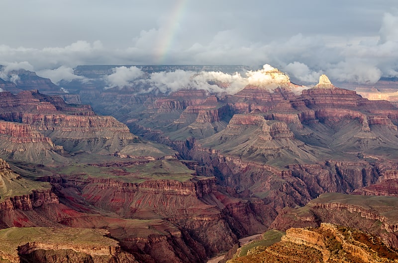
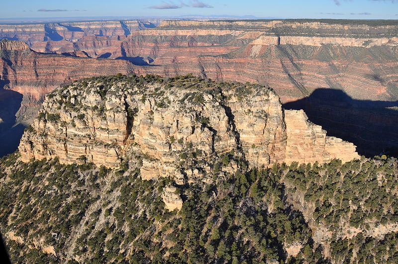
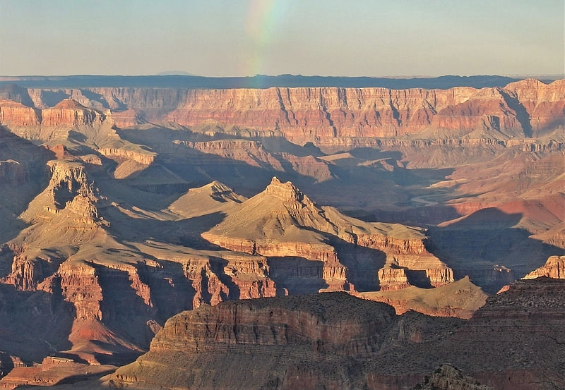
Canyon. The Grand Canyon is a steep-sided canyon carved by the Colorado River in Arizona, United States. The Grand Canyon is 277 miles long, up to 18 miles wide and attains a depth of over a mile.
The canyon and adjacent rim are contained within Grand Canyon National Park, the Kaibab National Forest, Grand Canyon–Parashant National Monument, the Hualapai Indian Reservation, the Havasupai Indian Reservation and the Navajo Nation. President Theodore Roosevelt was a major proponent of the preservation of the Grand Canyon area and visited it on numerous occasions to hunt and enjoy the scenery.
Nearly two billion years of Earth's geological history have been exposed as the Colorado River and its tributaries cut their channels through layer after layer of rock while the Colorado Plateau was uplifted. While some aspects about the history of incision of the canyon are debated by geologists, several recent studies support the hypothesis that the Colorado River established its course through the area about 5 to 6 million years ago. Since that time, the Colorado River has driven the down-cutting of the tributaries and retreat of the cliffs, simultaneously deepening and widening the canyon.
For thousands of years, the area has been continuously inhabited by Native Americans, who built settlements within the canyon and its many caves. The Pueblo people considered the Grand Canyon a holy site, and made pilgrimages to it. The first European known to have viewed the Grand Canyon was García López de Cárdenas from Spain, who arrived in 1540.[1]
Bright Angel Trail
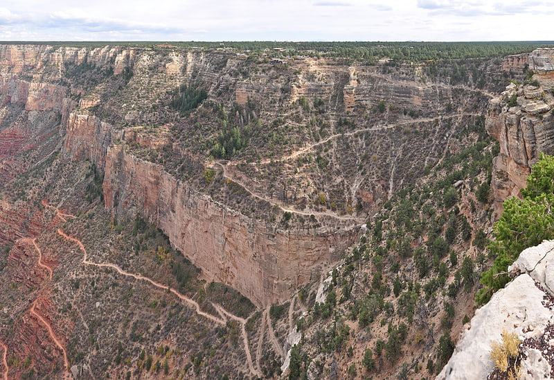
The Bright Angel Trail is a hiking trail located in Grand Canyon National Park in the U.S. state of Arizona.[2]
Address: 36.0553°N 112.1433°W, 86023 Grand Canyon Village
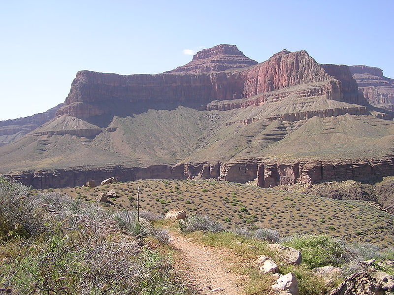
South Kaibab Trail
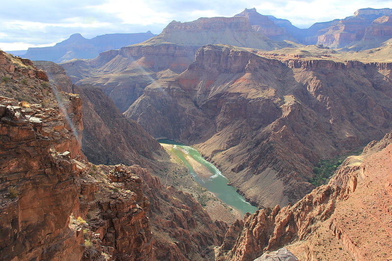
The South Kaibab Trail is a hiking trail in Grand Canyon National Park, located in the U.S. state of Arizona. Unlike the Bright Angel Trail which also begins at the south rim of the Grand Canyon and leads to the Colorado River, the South Kaibab Trail follows a ridge out to Skeleton Point allowing for 360-degree views of the canyon.[3]
Address: Along the side road to Yaki Point, Grand Canyon National Park
Desert View
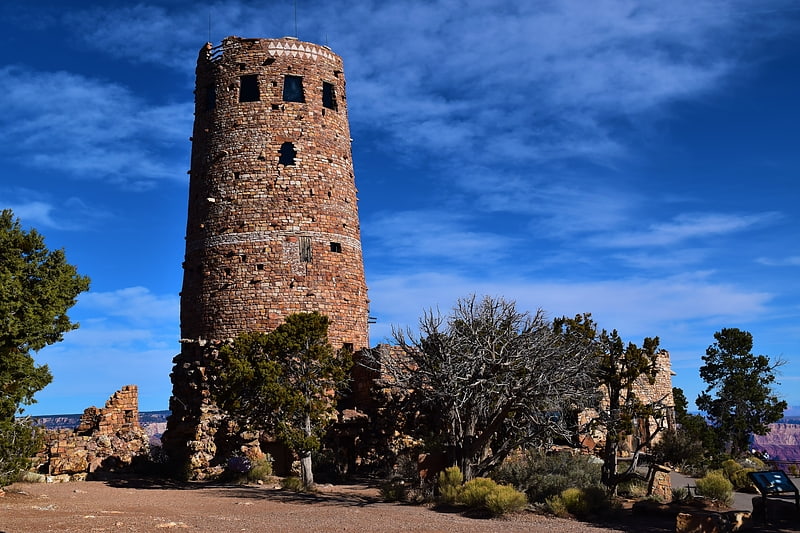
7-story tower by noted architect Colter. Desert View Watchtower, also known as the Indian Watchtower at Desert View, is a 70-foot -high stone building located on the South Rim of the Grand Canyon within Grand Canyon National Park in Arizona, United States. The tower is located at Desert View, more than 20 miles to the east of the main developed area at Grand Canyon Village, toward the east entrance to the park. The four-story structure, completed in 1932, was designed by American architect Mary Colter, an employee of the Fred Harvey Company who also created and designed many other buildings in the Grand Canyon vicinity including Hermit's Rest and the Lookout Studio. The interior contains murals by Fred Kabotie.[4]
Address: Desert View, E Rim Rd, 86023 Grand Canyon
Hermit Trail
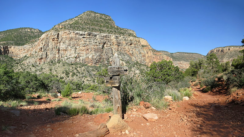
The Hermit Trail is a hiking trail in Grand Canyon National Park, located in the U.S. state of Arizona. This trail provides access to a historic area of Grand Canyon and offers a more challenging route to the Colorado River for more experienced canyon hikers.[5]
Address: Trailhead near Hermit's Rest, 86023 Tusayan
Grandview Trail
The Grandview Trail is a hiking trail located on the South Rim of the Grand Canyon National Park, located in the U.S. state of Arizona.It was built in 1893 by miners and is noted for its cobblestone and cribbing sections.[6]
Kolb Studio
The Kolb Studio is a historic structure situated on the edge of the South Rim of the Grand Canyon in Grand Canyon Village within Grand Canyon National Park in Arizona. It was operated from 1904 until 1976 as the photographic studio of brothers Ellsworth and Emery Kolb.[7]
Address: Grand Canyon Village, 86034 Grand Canyon
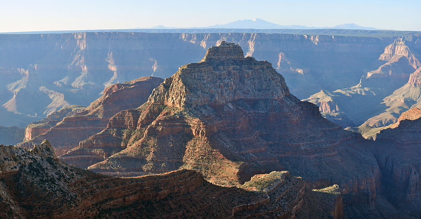
O'Neill Butte
Summit in Arizona. O'Neill Butte is a 6,071-foot -elevation summit located in the Grand Canyon, in Coconino County of northern Arizona, United States. It is situated 2.5 miles east-northeast of Grand Canyon Village, one mile northeast of Mather Point, and one mile immediately northwest of Yaki Point. Cedar Ridge connects O'Neill Butte with Yaki Point on the South Rim. Topographic relief is significant as O'Neill Butte rises 3,600 feet above the Colorado River in two miles. Access to this prominence is via the South Kaibab Trail which traverses the east slope of the peak. According to the Köppen climate classification system, O'Neill Butte is located in a cold semi-arid climate zone.[8]
Tonto Trail

The Tonto Trail is a hiking trail on the South Rim of the Grand Canyon in Grand Canyon National Park, located in the U.S. state of Arizona.[9]
Address: South Rim, at Red Canyon, Grand Canyon National Park
Tuna Canyon
Tuna Canyon is a short, high-angle, descending, narrow canyon in western Grand Canyon, below the North Rim. It lies across Granite Gorge in a region of four canyons, and a fifth smaller canyon, as the Colorado River courses westward around the Point Sublime, ridgelines. The high-angle of Tuna Canyon, Tuna Creek, creates the Tuna Creek Rapids at the outfall. Tuna Canyon is a short canyon, nestled between the ridges, but just east is the very long drainage of Crystal Creek, which drains from the Kaibab Plateau. The Crystal Rapid is adjacent upstream from the Tuna Creek Rapids.
Tuna Canyon lies about 1.5 miles northeast of the Scorpion Ridge landform on the Colorado River. Point Sublime is directly south up-canyon about 1.5 miles, and the headwater Grama Point, traverses up-canyon, northeast, about 2.0 miles from Point Sublime, the canyon total length being more than 3.0 miles.[10]
Boucher Trail
The Boucher Trail is a hiking trail of the South Rim in Grand Canyon National Park, located in the U.S. state of Arizona.[11]
Address: Trailhead begins 8 miles from Boucher Rapids, 86023 Grand Canyon National Park
Cape Royal Trail
The Cape Royal Trail is a hiking trail on the North Rim of the Grand Canyon National Park, located in the U.S. state of Arizona.[12]
Pollux Temple
Summit in Arizona. Pollux Temple is a 6,251-foot-elevation summit in the Grand Canyon, in Coconino County of northern Arizona, US. It is situated ten miles northwest of Grand Canyon Village, and less than one mile northeast of Jicarilla Point. Castor Temple is one mile northwest, and Diana Temple is one mile southeast. Topographic relief is significant as Pollux Temple rises nearly 4,000 feet above the Colorado River in less than two miles. Pollux Temple is named for Pollux, the divine son of Zeus according to Greek mythology. Clarence Dutton began the practice of naming geographical features in the Grand Canyon after mythological deities. According to the Köppen climate classification system, Pollux Temple is located in a Cold semi-arid climate zone.[13]
The Battleship
The Battleship is a 5,850-foot -elevation summit located in central Grand Canyon, in Coconino County of northern Arizona, United States. The ridgeline, Battleship landform forms part of the western border of Garden Creek Canyon, which contains the Bright Angel Trail down to the Colorado River, and across it to Phantom Ranch. The east border of Garden Creek Canyon is the South Rim, with the overlooks of Grandeur Point and Yavapai Point. The Battleship is 1.5 miles northwest of Yavapai Point, 1.5 miles due-north of Grand Canyon Village, and roughly 2.0 miles southwest of the Colorado River.
The long ridgeline of "the battleship", is oriented slightly southwest-by-northeast, with the "conning tower", (The Battleship prominence), at the southwest, making up about one fourth of the battleship landform. The striking west Redwall Limestone cliffs, surmounted by the orange-reddish slopes of Supai Group “redbeds”, of The Battleship landform, is offset at the east, by the same Redwall cliffs and orange-red "redbeds", of the cliffs of the South Rim.[14]
Zoroaster Temple
Summit in Arizona. Zoroaster Temple is a 7,123-foot-elevation summit located in the Grand Canyon, in Coconino County of Arizona, USA. It is situated 5.5 miles northeast of the Yavapai Point overlook on the canyon's South Rim, from which it can be seen towering over 4,600 feet above the Colorado River and Granite Gorge. Its nearest higher neighbor is Brahma Temple, less than one mile to the north-northeast. Zoroaster Temple is named for Zoroaster, an ancient Iranian prophet. This name was used by George Wharton James and Clarence Dutton. Dutton began the tradition of naming geographical features in the Grand Canyon after mythological deities. This geographical feature's name was officially adopted in 1906 by the U.S. Board on Geographic Names. The first ascent of the summit was made by Rick Tidrick and Dave Ganci in September 1958 via the NE Arete. Other climbing routes include Screaming Sky Crack, and SE Face, a challenging class 5.11+ route that was first climbed in 2012. The 1958 Zoroaster ascent was the first technical climb in the Grand Canyon, transforming the Grand Canyon into a climbing mecca and setting off a rush to climb the many summits. According to the Köppen climate classification system, Zoroaster Temple is located in a Cold semi-arid climate zone.[15]
Mount Hayden
Summit in Arizona. Mount Hayden is an 8,362-foot -elevation summit located in the Grand Canyon, in Coconino County of Arizona, United States. It is situated one-half mile southeast of the Point Imperial viewpoint, on the canyon's North Rim, where it towers 5,000 feet above the bottom of Nankoweap Canyon. Mount Hayden, also known as Hayden Peak, is named for Charles T. Hayden, an Arizona pioneer influential in the development of the Arizona Territory where he was known as the "Father of Tempe", and he established Arizona State University. He was also the father of US Senator Carl Hayden, as well as a probate judge. This geographical feature's name was officially adopted in 1932 by the U.S. Board on Geographic Names. The first ascent of the summit was made May 1978 by Joe Sharber, George Bain, and Abra Watkins via the north side. Pegasus, a challenging class 5.10+ route on the East Face, was first climbed by Paul Davidson and Jim Haisley in 1982. The most popular climbing route is the class 5.8 South Face. According to the Köppen climate classification system, Mount Hayden is located in a Cold semi-arid climate zone.[16]
Topaz Canyon
Topaz Canyon is a linear, narrow canyon in western Grand Canyon, below the South Rim. It lies in a region of four canyons, and a fifth smaller canyon, all trending mostly northeasterly towards the west-flowing Colorado River, in western Grand Canyon National Park. The name of Topaz Canyon was named by the Board of Geographical Names for precious stones of the region. Topaz Canyon is the southeast border of the linear, and major, forested-landform, Diana Temple;.The northeast terminus of Topaz Canyon intersects with the outfall of Boucher Canyon and the tract of the Tonto Trail. The Boucher Trail starting in Hermit Canyon, ends at the termini of both Topaz and Boucher Canyons.
The middle and lower regions of Topaz Canyon are in slopes and rocks of the Tonto Group. The major visible section of Topaz Canyon are the dull-greenish slopes of the Bright Angel Shale. Northeast and closer to the Colorado River are short, erosion-resistant cliffs of Tapeats Sandstone. The sandstone is the Tonto Platform, (also the Great Unconformity, of lost time, ~1,000 million years, and probable lost eroded rock units), the horizontal platform that the Tonto Trail traverses. The upper cliffs of the canyon are rock units of Kaibab Limestone, Toroweap Formation, Coconino Sandstone, and Hermit Shale, down to Supai Group on red-cliffs of Redwall Limestone. These are the rock units northwest on Diana Temple. Vesta Temple southeast between Topaz Canyon and Boucher Canyon, has the upper units of rock mostly removed; but Vesta Temple has a remainder, eroded cliff of Kaibab Limestone, on a shelf of Toroweap Formation, on the upper platform of the non-erosive cliff-former, Coconino Sandstone.[17]
Cheops Pyramid
Summit in Arizona. Cheops Pyramid is a 5,401-foot-elevation summit located in the Grand Canyon, in Coconino County of Arizona, US. This butte is situated four miles north of Grand Canyon Village, 2.5 miles south-southwest of Buddha Temple, and 1.7 mile south-southeast of Isis Temple, which is the nearest higher neighbor. Topographic relief is significant as it rises 3,000 feet above the Colorado River in 1.5 mile. It was named by George Wharton James for the fanciful resemblance to the famous pyramid constructed by Egyptian Pharaoh Cheops. This was in keeping with Clarence Dutton's tradition of naming geographical features in the Grand Canyon after mythological deities. This butte's name was officially adopted in 1906 by the U.S. Board on Geographic Names. According to the Köppen climate classification system, Cheops Pyramid is located in a Cold semi-arid climate zone.[18]
Cocopa Point

Cliff in Arizona. Cocopa Point is a 6,627 foot -cliff-elevation Point located in the central, Grand Canyon, Coconino County of northern Arizona, United States. Cocopa Point is 1.1 miles from its closest highest scenic viewpoint, Yuma Point, located east at Eremita Mesa, at the northeast, overlooking Central Hermit Canyon. Cocopa Point is in a region of points, at the headwaters of canyons, and landforms below the South Rim. Mimbreno Point lies ~1.7 miles west, and Hermit Canyon and Pima Point, at the west-terminus of West Rim Drive, are about 1.5 mi and 2.0 miles due-east. Cocopa Point is at the northwest of Eremita Mesa; Yuma Point is at the northeast; the mesa lies between Hermit Canyon, east, and Upper Boucher Canyon, west. Cocopa Point is a sheer-walled cliff, sitting at the northwest headwaters of short, Travertine Canyon. At the west of Lower Travertine Canyon, adjacent the Colorado River, sits Whites Butte, about 1.2 miles distant from Cocopa Point.[19]
Whites Butte
Whites Butte is a 4,860-foot prominence adjacent the course of the Colorado River near the beginning of the Western Grand Canyon,. The butte lies at the terminus of Travertine Canyon, the adjacent canyon west of Hermit Canyon. The Boucher Trail which begins at Upper Hermit Canyon, courses the east base of Whites Butte to reach the Tonto Trail-, on the Tonto Platform, south side of the Colorado River.[20]
Ochoa Point
Cliff in Arizona. Ochoa Point is a 4,761-foot-elevation cliff-summit located in the eastern Grand Canyon, in Coconino County of northern Arizona, US. The landform is on a southeast ridgeline from Apollo Temple, with the Ochoa Point prominence on its southeast terminus. Ochoa Point is 1.0 mi from Apollo Temple, 1.5 mi northwest from the southeast-flowing Colorado River, and 3.5 miles due-west from the south terminus of the East Rim, Grand Canyon. Ochoa Point’s southwest cliff-flank, and Apollo Temple’s southwest arm, contain the dp-black Basalt Cliffs; the Cardenas Basalt lies upon brilliantly colored reddish Dox Formation low-angle, erosion-slopes of five Unkar Group members. What makes Ochoa Point distinctive, the next rock unit above is the colorful, layered, Nankoweap Formation. These rock layers all slope at approximately 15 degrees, and are topped by the short-cliff, horizontal Tapeats Sandstone.[21]
Brady Peak
Summit in Arizona. Brady Peak is an 8,121-foot -elevation summit located in the Grand Canyon, in Coconino County of northern Arizona, United States. It is situated one mile northeast of the Vista Encantada viewpoint on the canyon's North Rim, where it towers 4,800 feet above the bottom of Nankoweap Canyon. Its nearest higher neighbor is Mount Hayden, two miles to the north, Kibbey Butte is one mile to northwest, and Alsap Butte lies one mile to the northeast. Brady Peak is named after Peter Rainsford Brady, a pioneer and politician of the Arizona Territory. This geographical feature's name was officially adopted in 1932 by the U.S. Board on Geographic Names. According to the Köppen climate classification system, Brady Peak is located in a cold semi-arid climate zone.[22]
Newberry Butte
Summit in Arizona. Newberry Butte is a 5,105-foot-elevation summit located in the Grand Canyon, in Coconino County of northern Arizona, US. It is situated 4.5 miles north of the South Rim's Grandview Point, three miles southwest of Vishnu Temple, and 2.5 miles south of Wotans Throne. Topographic relief is significant as it rises over 2,500 feet above the Colorado River and Granite Gorge in one mile. According to the Köppen climate classification system, Newberry Butte is located in a Cold semi-arid climate zone.
Newberry Butte is named for John Strong Newberry (1822–1892), the geologist for an 1858 expedition headed by Lieutenant Joseph Christmas Ives which explored the Colorado River up to the lower Grand Canyon. After returning, Newberry convinced fellow geologist John Wesley Powell that a boat run through the Grand Canyon to complete the survey would be worth the risk. Powell would later lead the Powell Geographic Expedition of 1869 to explore the region. This geographical feature's name was officially adopted in 1906 by the U.S. Board on Geographic Names.
This butte is an erosional remnant composed of Mississippian Redwall Limestone, which overlays the Cambrian Tonto Group. Precipitation runoff from Newberry Butte drains southwest to the Colorado River via Vishnu Creek.[23]
Vesta Temple
Summit in Arizona. Vesta Temple is a 6,299-foot-elevation summit located in the Grand Canyon, in Coconino County of northern Arizona, US. It is situated eight miles west-northwest of Grand Canyon Village, and immediately northeast of Mimbreno Point. Marsh Butte is one mile northeast, Eremita Mesa immediately southeast, and nearest higher neighbor Diana Temple is one mile north. Topographic relief is significant as Vesta Temple rises 3,900 feet above the Colorado River in 2.5 miles. Vesta Temple is named for Vesta, the goddess of the hearth, home, and family according to Roman mythology. Clarence Dutton began the practice of naming geographical features in the Grand Canyon after mythological deities. This geographical feature's name was officially adopted in 1908 by the U.S. Board on Geographic Names. According to the Köppen climate classification system, Vesta Temple is located in a Cold semi-arid climate zone.[24]
Dana Butte
Dana Butte is a 4,964-foot prominence, adjacent the course of the Colorado River, in the Grand Canyon and sits on the south side of Granite Gorge. The butte is roughly 2.5 miles north-northwest of Grand Canyon Village of the central Grand Canyon, and lies about 2.0 miles due north of Pima Point.
The butte lies at the end of a higher elevation bright-red, very narrow Supai Group ridgeline, and the spire of Dana Butte sits on the cliff-former Redwall Limestone that creates not only massive cliffs, but platforms that support younger rock units above. Dana Butte's prominence spire is dull gray, sitting on gray debris on the platform, and is composed of weathered Supai Group Manakacha Formation, also a cliff-former rock. Dana Butte drains west into the Salt Creek (Grand Canyon) drainage, and east into the adjacent canyon of the terminus of Salt Creek.[25]
Hancock Butte
Summit in Arizona. Hancock Butte is a 7,683-foot-elevation summit located in the Grand Canyon, in Coconino County of northern Arizona, US. It is situated one mile south of the Point Imperial viewpoint on the canyon's North Rim, where it towers 3,700 feet above Nankoweap Canyon. Its nearest higher neighbor is Mount Hayden, one mile to the north-northeast, Kibbey Butte is one mile to the south-southwest, and Brady Peak is 1.5 mile to the southeast. Hancock Butte is named after William A. Hancock, a pioneer and politician of the Arizona Territory known for performing the survey work required to create the town of Phoenix and erecting the first building there in 1870. This geographical feature's name was officially adopted in 1932 by the U.S. Board on Geographic Names. According to the Köppen climate classification system, Hancock Butte is located in a Cold semi-arid climate zone.[26]
Tusayan Ruins
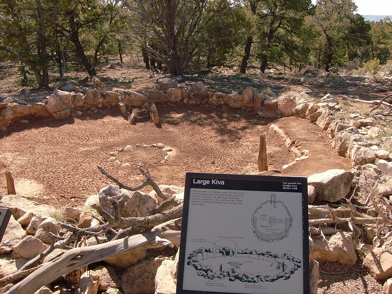
Museum in the Coconino County, Arizona. The Tusayan Ruins is an 800-year-old Pueblo Indian site located within Grand Canyon National Park, and is considered by the National Park Service to be one of the major archeological sites in Arizona. The site consists of a small, u-shaped pueblo featuring a living area, storage rooms, and a kiva. Tree ring studies indicate that the site was occupied for about twenty years, beginning around 1185. It is found on the Desert View Drive portion of Arizona State Route 64, 3 miles west of the Desert View Watchtower. The site was listed on the National Register of Historic Places in 1974.
The site was excavated in 1930 by members of the Gila Pueblo of Globe, Arizona. Preservation work took place in 1948 and 1965. The site represents the survival of an isolated Pueblo II culture into the Pueblo III era.
The Tusayan Ruin and Museum is a NPS interpreted location, which includes a trail from the museum thru part of the ruin. Tours may be ranger lead or self-guided. The Tusayan Museum was built in 1928 to a design by National Park Service architect Herbert Maier and sponsored by Laura Spelman Rockefeller as a trailside museum. It was expanded in 1934, and represents an interpretation of a Hopi structure.[27]
Address: 3 Miles West of Desert View Visitor Center, Grand Canyon National Park
Dragon Head
Dragon Head is a 7,765-foot elevation summit located in the Grand Canyon, in Coconino County of Arizona, US. It is situated in the north of the Hindu Amphitheater, ~2.0 miles west of Shiva Temple, and ~2.5 mi southeast of Grama Point. Unlike the extensive Ponderosa Pine forest of Shiva Temple, tableland/plateau prominence, Dragon Head’s flat-topped, is only populated with a marginal non-Ponderosa forest. Shiva Temple is approximately 275 acres, where Dragon Head is an ~5 acre prominence platform.[28]
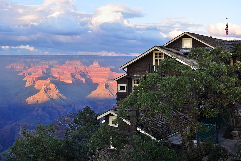
Bright Angel Lodge
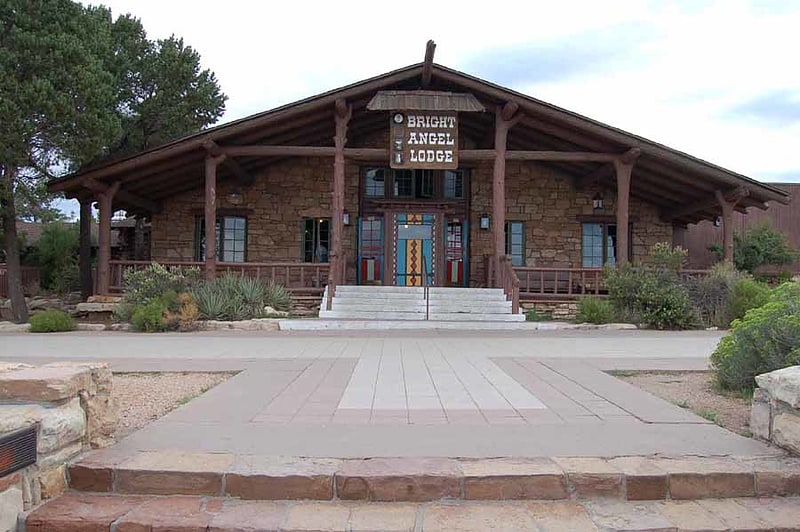
Hotel. Bright Angel Lodge is a hotel complex at the South Rim of the Grand Canyon in Grand Canyon National Park, Arizona. Designed by architect Mary Jane Colter, the lodge is a complex of cabins around a central lodge building, directly on the edge of the canyon. The rustic lodge complex is a major contributing structure in the Grand Canyon Village National Historic Landmark District.[29]
Address: Grand Canyon, 86023 Grand Canyon Village
Sheba Temple
Sheba Temple is a 4,990-foot -elevation summit located in the eastern Grand Canyon, in Coconino County of northern Arizona, United States. The landform is 1.0 mile west of Solomon Temple, 1.0 mile south of Rama Shrine, and about one mile north-northeast of the west-flowing Colorado River. The west of Sheba Temple's drainage is the short Asbestos Canyon which drains Krishna Shrine, northwest, Vishnu Temple, northwesterly, and Rama Shrine, north; the east side of Sheba Temple's drainage are short north drainages to the Colorado.
Sheba Temple is composed of extreme cliff-erosion-remnants of Redwall Limestone, (very vertical and very narrow, ~north-south aligned), upon a platform of Muav Limestone; as unit three of the 3-member Cambrian Tonto Group, the Muav is also upon wide slope-former slopes of the dull-greenish Bright Angel Shale. Sheba Temple is a narrow ridgeline trending slightly north-northeast-by-south-southwest and has been geologically detached from the Redwall cliff extending south from Rama Shrine. Of note, the remnant, white prominence, is the same elevation as Solomon Temple east, Solomon's is an actual small platform of a white cliff-former. Sheba Temple's prominence is only a remainder of that cliff-former (Redwall interlayer).[30]
Angels Gate
Summit in Arizona. Angels Gate is a 6,761-foot -elevation summit located in the Grand Canyon, in Coconino County of Arizona, United States. It is situated seven miles due north of the Grandview Point overlook on the canyon's South Rim, three miles west of Vishnu Temple, and three point five miles southeast of Zoroaster Temple. Topographic relief is significant as it rises over 4,200 feet above the Colorado River in three miles. Angels Gate is the place in Paiute mythology where the gods would return to earth by descending from the shadow world above. George Wharton James applied the "Angel Gate" name to this geographical feature in his book, In & Around the Grand Canyon, in 1900. This feature's name was officially adopted in 1906 by the U.S. Board on Geographic Names. Angels Gate has four peaks composed of Coconino Sandstone. The main highest summit and three spires are known as "Snoopy and his Doghouse" for a resemblance to Snoopy, and the first ascent was made April 1972 by Chuck Graf and Dave Ganci. According to the Köppen climate classification system, Angels Gate is located in a cold semi-arid climate zone.[31]
Tower of Set
Summit in Arizona. Tower of Set is a 6,012-foot-elevation summit located in the Grand Canyon, in Coconino County of Arizona, US. This butte is situated four miles north of Hopi Point overlook on the canyon's South Rim, two miles southeast of Tower of Ra, and three miles south-southwest of Shiva Temple, where it towers 3,600 feet above the Colorado River. Tower of Set was originally named Temple of Sett in 1879 by Thomas Moran, for the Egyptian deity of war, Set, because a niche worn into its wall evoked temples in the valley of the Nile. Another source states it was named by George Wharton James, in keeping with Clarence Dutton's tradition of naming geographical features in the Grand Canyon after mythological deities. This mountain's name was officially adopted in 1906 by the U.S. Board on Geographic Names. In 1919, Harriet Williams Russell Strong proposed connecting Hopi Point and Tower of Set across the river via an aerial tramway, an idea that never came to fruition. The first ascent was made in November 1977 by Bruce Grubbs and Jim Haggart. According to the Köppen climate classification system, Tower of Set is located in a cold semi-arid climate zone.[32]
Vishnu Temple
Summit in Arizona. Vishnu Temple is a 7,533-foot-elevation summit located in the Grand Canyon, in Coconino County of Arizona, US. It is situated two miles south-southeast of the Cape Royal overlook on the canyon's North Rim, 1.5 mile south of Freya Castle, and two miles east-southeast of Wotans Throne, its nearest higher neighbor. It towers 4,900 feet above the Colorado River. According to explorer Frederick Samuel Dellenbaugh, Vishnu Temple is "without doubt the most stupendous mass of nature's carving in the known world." Vishnu Temple is named for Vishnu, the Hindu deity, redeemer of the universe. This name was applied in 1880 by Clarence Dutton who thought this mountain resembled an oriental pagoda, and who began the tradition of naming geographical features in the Grand Canyon after mythological deities. This geographical feature's name was officially adopted in 1906 by the U.S. Board on Geographic Names. The first ascent of the summit was made by Merrel Clubb and his son on July 13, 1945. According to the Köppen climate classification system, Vishnu Temple is located in a cold semi-arid climate zone.[33]
Marsh Butte
Summit in Arizona. Marsh Butte is a 4,721-foot-elevation summit located in the Grand Canyon, in Coconino County in the northern part of the U.S. state of Arizona. It is situated eight miles northwest of Grand Canyon Village, immediately east-northeast of Diana Temple, and Tower of Ra stands directly opposite across Granite Gorge. Topographic relief is significant, as Marsh Butte rises over 2,300 feet above the Colorado River in half a mile.
Marsh Butte is composed of Mississippian Redwall Limestone, overlaying the Cambrian Tonto Group, and finally granite of the Paleoproterozoic Vishnu Basement Rocks at river level in Granite Gorge. According to the Köppen climate classification system, Marsh Butte is located in a cold semi-arid climate zone.[34]
Freya Castle
Summit in Arizona. Freya Castle is a 7,288-foot-elevation summit located in the Grand Canyon, in Coconino County of northern Arizona, US. It is situated one mile southeast of the Cape Royal overlook on the canyon's North Rim, 1.5 mile north of Vishnu Temple, and 1.7 mile northeast of Wotans Throne. Topographic relief is significant as it rises 3,400 feet above the Unkar Valley in one mile.
Freya Castle is named for Freya, the Norse goddess of love, beauty, fertility, sex, war, gold, and seiðr. This name was applied by geologist François E. Matthes, in keeping with Clarence Dutton's practice of naming geographical features in the Grand Canyon after mythological deities. This geographical feature's name was officially adopted in 1906 by the U.S. Board on Geographic Names.
The first ascent of the summit was made by Harvey Butchart and Allyn Cureton on June 24, 1962. According to the Köppen climate classification system, Freya Castle is located in a Cold semi-arid climate zone.[35]