Discover 11 hidden attractions, cool sights, and unusual things to do in National Park of the Gulf of Orosei and Gennargentu (Italy). Don't miss out on these must-see attractions: Gusana, Punta La Marmora, and Grotta del Fico. Also, be sure to include Gennargentu in your itinerary.
Below, you can find the list of the most amazing places you should visit in National Park of the Gulf of Orosei and Gennargentu (Sardinia).
Table of Contents
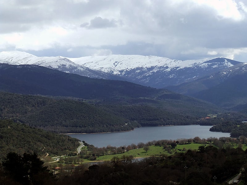
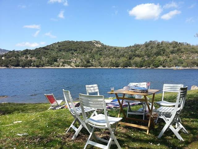
Gusana

Lake in Italy. Gusana is the name of an artificial lake and of the surrounding area, in the territory of Gavoi, Sardinia, Italy.
The lake was built in the 1930s to store water for an electricity generator (central of Coghinadordza), and it covered an ancient Roman bridge as well as an ancient archaeological site of the Nuragici people.
It is now a tourist destination.[1]
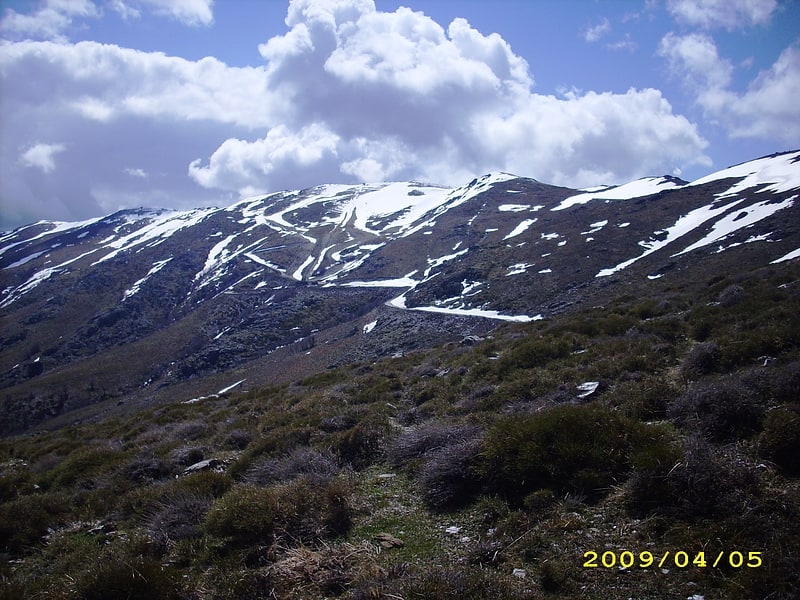
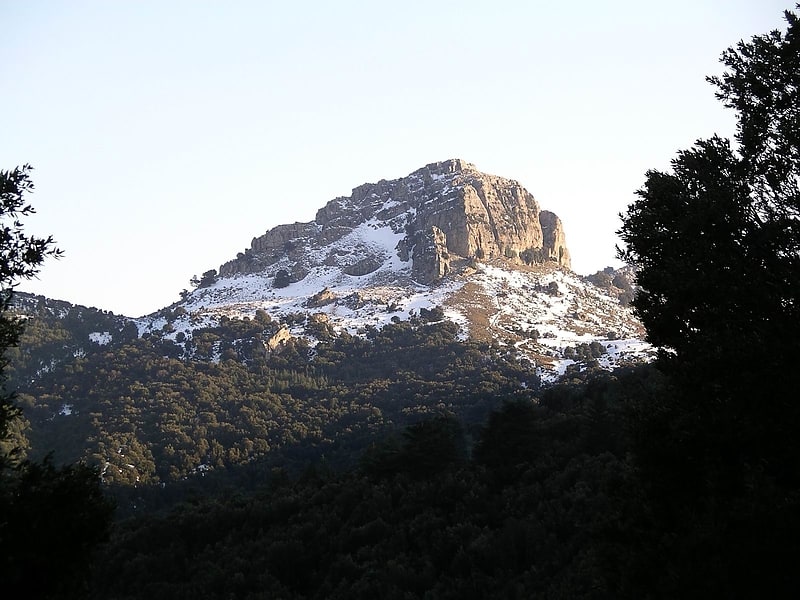
Punta La Marmora
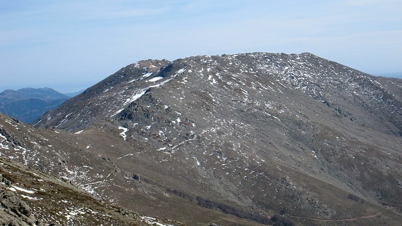
Mountain in Italy. Punta La Marmora is a mountain in the Gennargentu range, Sardinia.[2]
Grotta del Fico
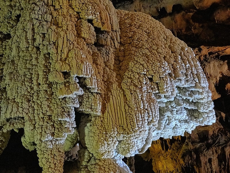
The Fig Cave are coastal caves located in the territory of the municipality of Baunei in the eastern part of Sardinia; more precisely between the beaches of cala Mariolu and cala Biriala.
The caves were formerly frequented by monk seals, the last sightings being in the late 1980s. The known portion so far is 3,200 meters. The caves have been open for guided tours since 2003. And only 890 meters are visible to visitors.
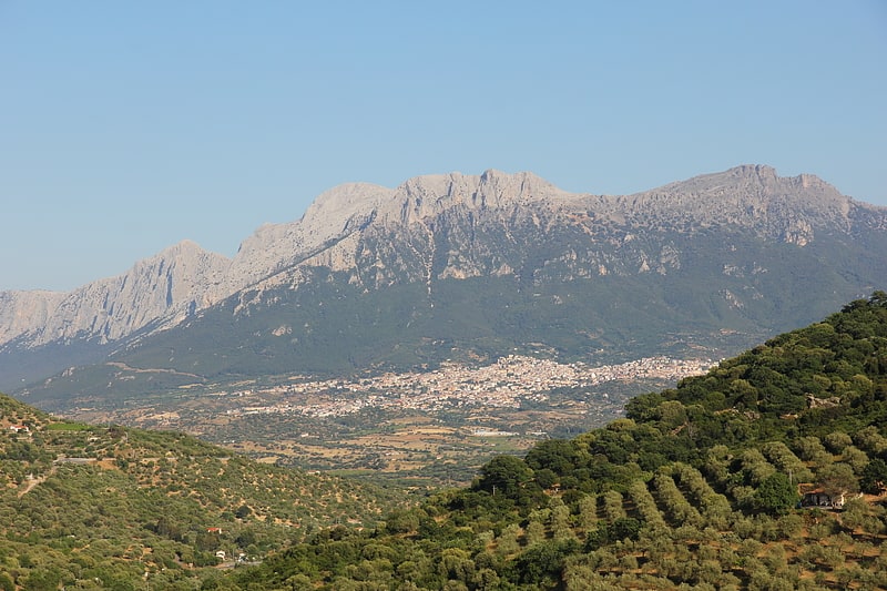
Gennargentu
Massif in Italy. Gennargentu is a large massif in central-southern Sardinia, Italy, encompassing the provinces of Nuoro and Ogliastra. It includes the highest peaks on the island, such as Punta La Marmora, Monte Spada, Punta Erbas Virdes, Bruncu Spina and Punta Paulinu.
The range forms part of the Gennargentu National Park. Geologically, its rocks are amongst the oldest in Europe, and are therefore smooth shaped: rock types include schist, limestone and granite.[3]
Supramonte
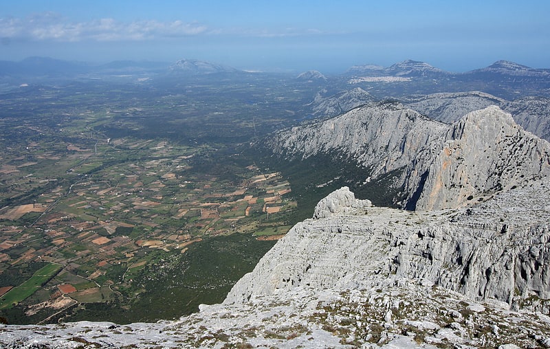
Mountain range in Italy. The Supramonte is a mountain range located in central-eastern Sardinia, Italy. It lies northeast of the Gennargentu massif, traveling eastwards until it reaches the Tyrrhenian Sea at the Gulf of Orosei. It has an area of about 35,000 hectares, encompassing most of the territories of the comuni of Baunei, Dorgali, Oliena, Orgosolo and Urzulei. The populated areas of these comuni lie at the borders of the Supramonte, which, for the most part, is a largely uninhabited area of sharp limestone cliffs and deep, lush canyons.[4]
Chiesa di Nostra Signora della Pietà
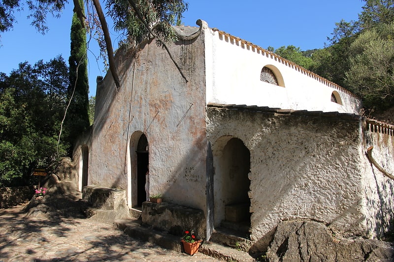
The church of Nostra Signora della Pietà is a religious building located in the territory of Oliena, in central-eastern Sardinia. Located within the Su Gologone park, it is not far from the churches of San Giovanni and Santa Lucia.
The church is consecrated to Catholic worship and is part of St. Ignatius Parish, Diocese of Nuoro.
Address: Sorgente Carsica di Su Gologone, 08025 Oliena
Monumento naturale Perda 'e Liana
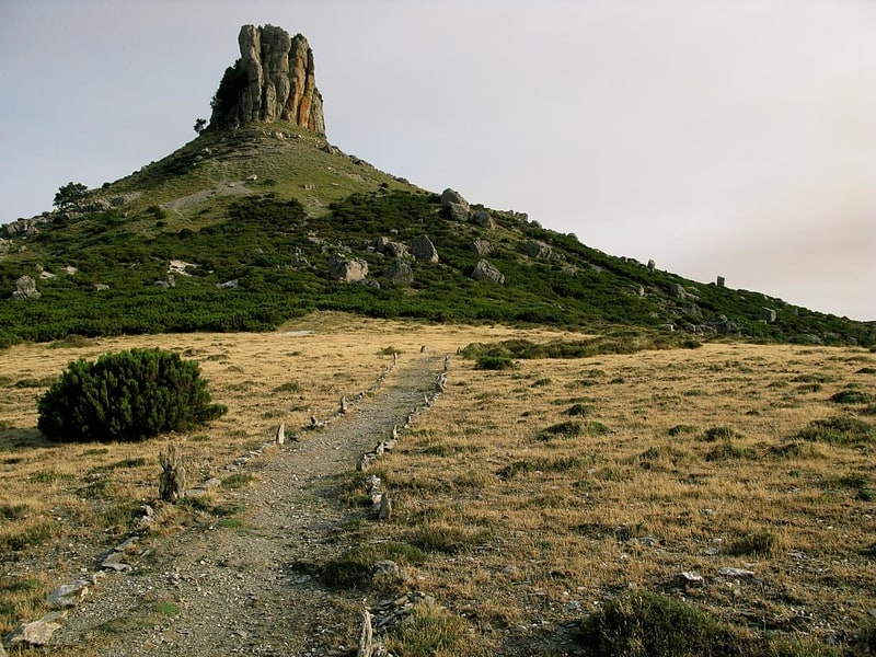
The natural monument Perda 'e Liana is a protected natural area in Sardinia. It is located in the territory of the municipality of Gairo, in the province of Nuoro. It was established in 1993 by a decree of the regional councilor for Environmental Defense.
Comune di Lodine
City hall
Address: Via Dante, National Park of the Gulf of Orosei and Gennargentu
Bruncu Spina
Bruncu Spina, at 1,829 meters is the second highest peak in Sardinia after punta La Marmora. It is located in the Gennargentu massif, in the province of Nuoro, in the administrative territory of the municipalities of Villagrande Strisaili and Desulo. The territorial portion in the head of the municipality of Villagrande Strisaili has been granted in perpetual emphyteusis to the municipality of Fonni.
On the top of the mountain was an astronomical observatory, currently reduced to the state of ruins.
Monte Fumai
Mt. Fumai is a 1316-meter-high relief located in the territory of Orgosolo, in central-eastern Sardinia. After Mount Corrasi, which is 1463 meters high, and Punta Sa Pruna, it is the highest peak in the Supramonte.
Monte Corrasi
Mountain in Italy. Monte Corrasi is a mountain in the territory of Oliena, Province of Nuoro, eastern Sardinia, Italy.
It is a massif formed by white limestone and dolomite.[5]