Discover 12 hidden attractions, cool sights, and unusual things to do in Faroe Islands. Don't miss out on these must-see attractions: Tórshavn Cathedral (Tórshavn), Listasavn Føroya (Tórshavn) or Mariukirkjan (Tórshavn).
Below, you can find the list of the most amazing places you should visit in Faroe Islands.
Table of Contents
Tórshavn Cathedral, Tórshavn
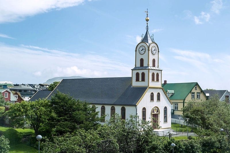
Also known as: Havnar Kirkja
Striking local church, built in 1609. Tórshavn Cathedral is the second oldest received church of the Faroe Islands, on Tinganes in the old town of Tórshavn. Painted white, and roofed with slate, it was established in 1788. The cathedral lies in the north of the peninsula of Tinganes and is one of the main attractions of the town. Like most churches of the country it belongs to the Evangelical-Lutheran national church of the Faroe Islands. Since 1990, it has been the seat of the Bishop of the Faroes and is therefore known as a cathedral.[1]
Address: Tinghúsvegur 8, Tórshavn
Listasavn Føroya, Tórshavn
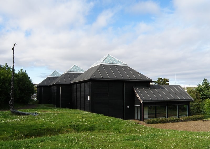
Local art and history in a modern space. Listasavn Føroya is an art museum in Tórshavn, Faroe Islands for mostly permanent exhibits of Faroese arts.
Established in 1989, it consists of a gallery called Listaskáli (since 1970) and another for historic arts (since 1993) with an area of 1,600 m2.
The museum is located at the northern end of the Park of Tórshavn nearby the Nordic House in the Faroe Islands.
Architect of the building was J.P. Gregoriussen. The building hosts the Faroe Islands Artist's Association Listafelag Føroya.
The museum is independently managed by a board of four, representing a person of the state government, the artist's association named above, the artist's union and the city council of Tórshavn (one of each).
Listasavn Føroya is open year-round. From May 1 to 31 of August the museum is open all days of the week from 11 to 17. From 1 September to 30 April the museum is open Tuesday to Sunday from 13 to 16. The building hosts a coffee shop and a book and art store.[2]
Address: Gundadalsvegur 9, 100 Torshavn
Mariukirkjan, Tórshavn
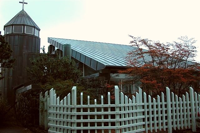
Catholic church in Tórshavn, Faroe Islands. The St. Mary's Church is a parish of the Roman Catholic Church located in Mariugøta 4 in the city of Tórshavn, the capital of the Faroe Islands, in the Diocese of Copenhagen.
While Catholicism was present in the Faroes from 999 AD, after the Danish Reformation, the last Catholic bishop in the islands was executed in 1538. In 1931 two young priests, E. G. Boekenoogen and Thomas King, undertook the task of restoring the Catholic presence in the Faroe Islands. In a rented house to the Franciscan sisters who came to the Faroes in 1931, a small church was consecrated on May 23 the same year. Along with the new school of St. Francis, the sisters had built the new St. Mary's Church was consecrated on June 1, 1933.[3]
Address: Mariugota 4, 100 Torshavn
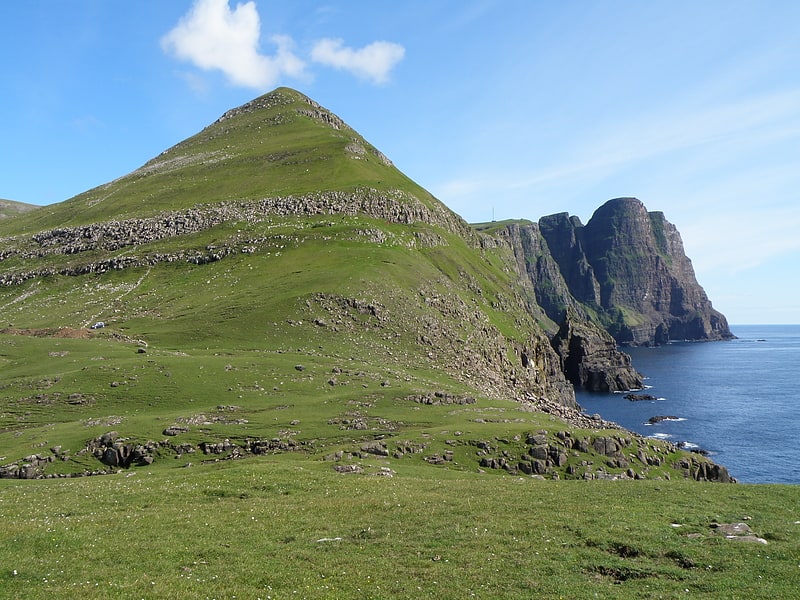
Slættaratindur, Eysturoy
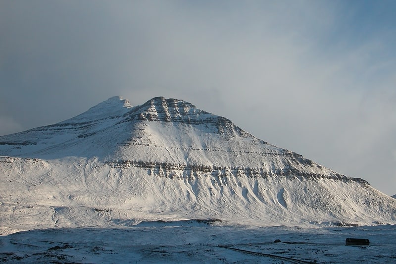
Faroe Islands' highest peak, with hiking. Slættaratindur is the highest mountain in the Faroe Islands, at an elevation of 880 metres. It is located in the northern part of Eysturoy, between the villages of Eiði, Gjógv, and Funningur. Funningur lies at the foot of the mountain, however, the summit is not visible from the village.
Its name means "flat summit". It can be climbed in about four hours, and although the routes are steep, technical climbing skills are not necessary to reach the summit. In clear weather, the summit gives views over the entire archipelago. Slættaratindur is one of ten mountains in the Faroe Islands which rise to over 800m above sea level. Gráfelli, the second-highest peak at 856 m, lies just to the north-east of Slættaratindur.[4]
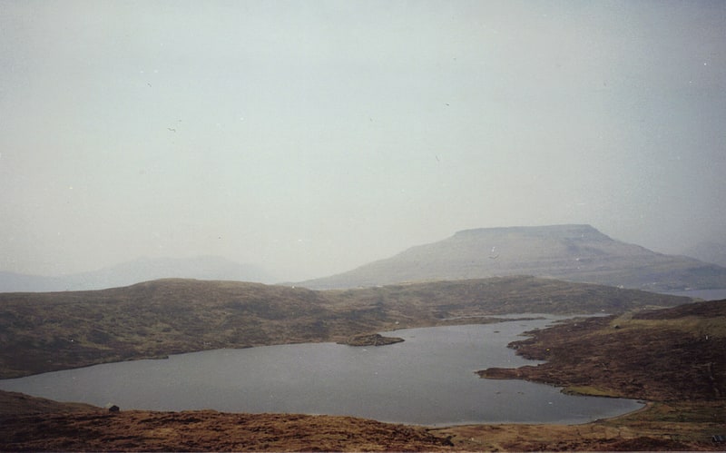
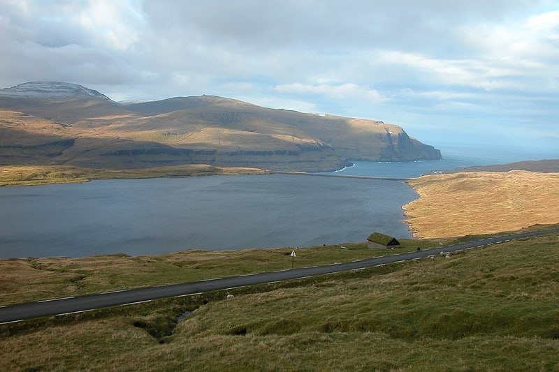
Sørvágsvatn, Vágar
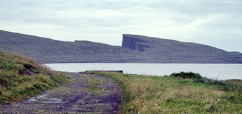
Lake in the Faroe Islands. Sørvágsvatn or Leitisvatn is the largest lake in the Faroe Islands. It is situated on the island of Vágar between the municipalities of Sørvágur and Vágar. Its area is 3.4 km2, more than three times the size of Fjallavatn, the second largest lake, also located on Vágar.[5]
Lake Toftir, Eysturoy
Also known as: Toftavatn
Lake in the Faroe Islands. Lake Toftir is a lake on the island of Eysturoy in the Faroe Islands.
Lake Toftir is located between the villages of Toftir and Rituvík. It is the fourth-largest natural lake in the Faroe Islands and it measures 51 hectares (130 acres). The lake is noted for its rich bird life.[6]
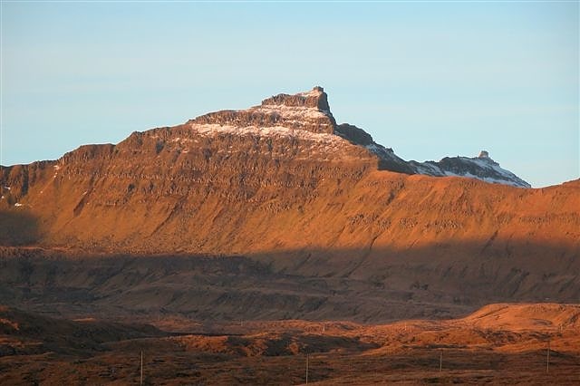
Kirvi, Suðuroy
Mountain in the Faroe Islands. Kirvi is a mountain in Suðuroy, near the village Lopra. Kirvi is 236m high and its shape resembles that of a pyramid. The mountain is visible from the villages Lopra and Nes, between Vágur and Porkeri. The top of the mountain is called Kirviskollur. The mountain is located in the municipality of Sumba.[7]
Borgarknappur, Suðuroy
Mountain in the Faroe Islands. Borgarknappur is a mountain in Suðuroy, Faroe Islands. The mountain is 574 metres high. It is located in the center of the island, west of the village Hov and south-east of Fámjin, south-west of Øravík and north of Vágur. Another mountain peak, which is called Borgin is just west of Borgarknappur, and a mountain called Hvannafelli is further south. Before the roads were made between the villages in Suðuroy, there were paths between the villages over the mountains. Several of these paths met near Borgarknappur, in Mannaskarð and near a mountain called Laðanfelli. To help people find their way up in the mountains there were cairns along the paths. Most of these cairns are still there and now mostly used for hiking trips for people and tourists. The paths which meet in Mannaskarð, near Borgarknappur come from the villages: Øravík, Fámjin, Porkeri, Hov and Vágur.
Geocode for Borgarknappur, Faroe Islands: Latitude: 61.5 / Longitude: -6.833333[8]
Lake Eiði, Eysturoy
Also known as: Eiðisvatn
Lake in the Faroe Islands. Lake Eiði is a lake on the island of Eysturoy in the Faroe Islands.
Lake Eiði is located between the villages of Eiði and Ljósá. It is the fifth-largest natural lake in the Faroe Islands, with a natural size of 47 hectares (120 acres) that has been increased to 1.14 square kilometers (0.44 sq mi). The size of the lake was increased by walls 22 and 13 m high, constructed by the SEV company in connection with the Eiði power plant, which uses the lake as a reservoir. Electricity production was started in 1987. Two tunnels redirect water from adjacent valleys to Eiði.[9]
Gluggarnir, Suðuroy
Mountain in the Faroe Islands. Gluggarnir is a mountain in the Faroe Islands. At 610 metres, it is the highest mountain on the southernmost island, Suðuroy. The mountain is located between the villages of Fámjin and Trongisvágur.[10]
Vørðufelli, Vágar
Mountain in the Faroe Islands. Vørðufelli is a mountain overlooking the village of Sørvágur on the Faroe Islands. Its height is 284 metres above sea level. It is situated between Húsadalur, Vága, Vatnsdalur, and close to Klovin.
The latter part of the name – felli – is Faroese for a small mountain, related to the English word 'fell' as in fell walking. 'Vørða' is a phrase used by Faroese regarding birdwatching. A 'Vørða' consists of five puffins, and since Vørðufelli is the fifth mountain on the north side of Sørvágsfirði, that explains how the mountain got its name.[11]
Gásadalstunnilin, Vágar
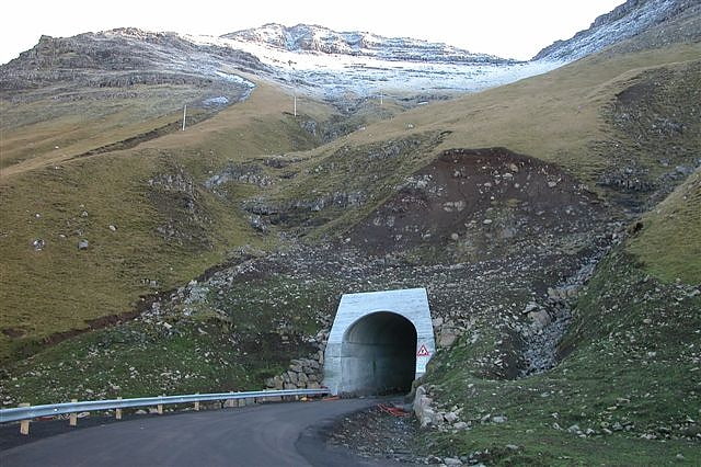
The Gásadalur Tunnel, Gásadalstunnilin, is a 1.4 kilometre long, single-lane tunnel in the west of the Faroe Islands, on the island of Vágar. It connects the villages of Bøur in the east with Gásadalur in the west, which are separated by the Knúkarnir mountain.
The tunnel was initially open to pedestrians in 2003 but it was not until 2006 that it was officially open and available to vehicles.[12]