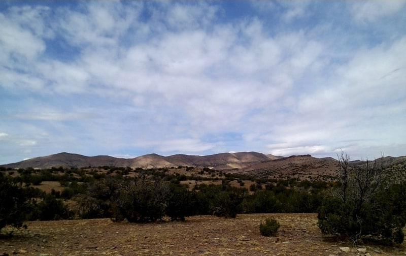
Discover 11 hidden attractions, cool sights, and unusual things to do in Cibola National Forest (United States). Don't miss out on these must-see attractions: Sandia Crest, Sandia Peak Tramway, and Sandia Cave. Also, be sure to include Mount Taylor in your itinerary.
Below, you can find the list of the most amazing places you should visit in Cibola National Forest (New Mexico).
Table of Contents
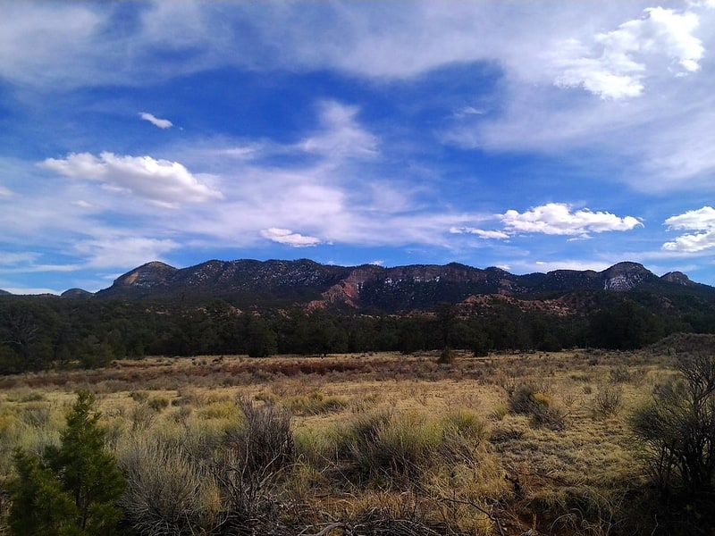
Sandia Crest
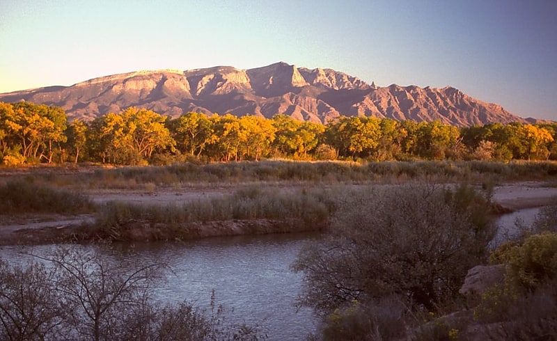
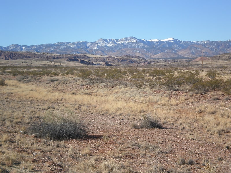
Mountain range in New Mexico. The Sandia Mountains are a mountain range located in Bernalillo and Sandoval counties, immediately to the east of the city of Albuquerque in New Mexico in the southwestern United States. The mountains are just due south of the southern terminus of the Rocky Mountains, and are part of the Sandia–Manzano Mountains. This is largely within the Cibola National Forest and protected as the Sandia Mountain Wilderness. The highest point is Sandia Crest, 10,678 feet.[1]
Sandia Peak Tramway
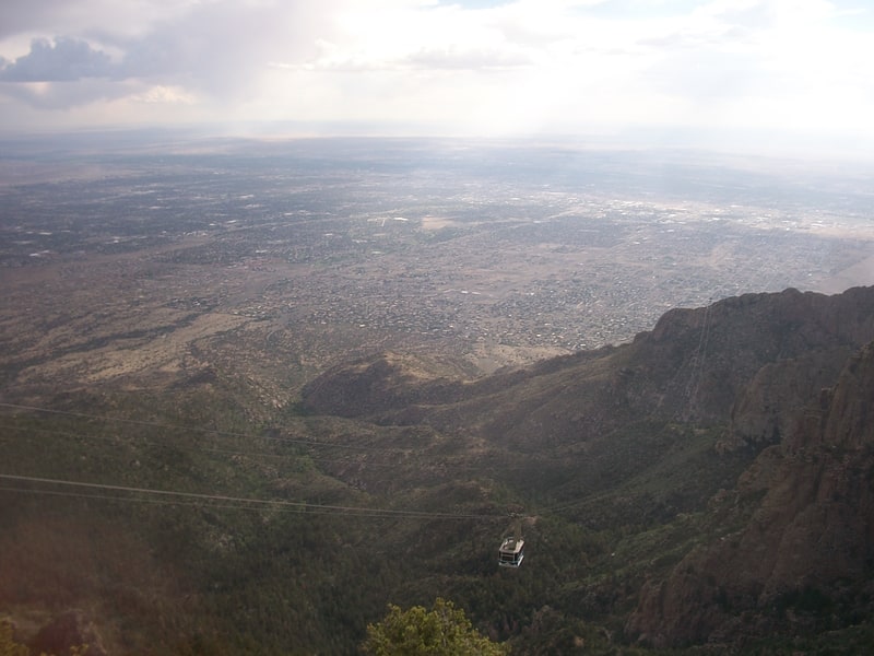
Tourist attraction in Bernalillo County, New Mexico. The Sandia Peak Tramway is an aerial tramway located adjacent to Albuquerque, New Mexico. It stretches from the northeast edge of the city to Sandia Peak on the ridge line of the Sandia Mountains and has the world's third longest single span. It is the longest aerial tram in the Americas, and was the longest in the world from 1966 until being surpassed in 2010.[2]
Sandia Cave
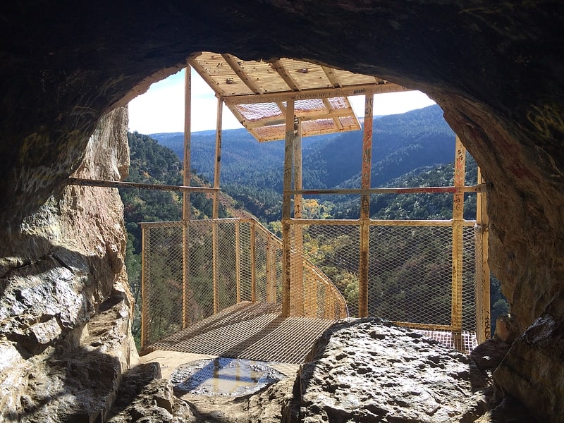
Sandia Cave, also called the Sandia Man Cave, is an archaeological site near Bernalillo, New Mexico, within Cibola National Forest. First discovered and excavated in the 1930s, the site exhibits evidence of human use from 9,000 to 11,000 years ago. It was declared a National Historic Landmark in 1961. The site is open to the public, up a difficult half-mile trail off New Mexico State Road 165.[3]
Mount Taylor
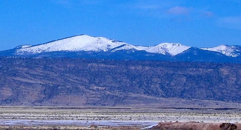
Stratovolcano in New Mexico. Mount Taylor is a dormant stratovolcano in northwest New Mexico, northeast of the town of Grants. It is the high point of the San Mateo Mountains and the highest point in the Cibola National Forest.
It was renamed in 1849 for then-president Zachary Taylor. Previously, it was called Cebolleta (tender onion) by the Spaniards; the name persists as one name for the northern portion of the San Mateo Mountains, a large mesa. The Navajo, for whom the mountain is sacred, still call it Turquoise Mountain (Tsoodził).
Mount Taylor is largely forested with some meadows, rising above the desert below. The mountain is heavily eroded to the east. Its slopes were an important source of lumber for neighboring pueblos.[4]
South Baldy
Mountain in New Mexico. South Baldy is the highest point of the Magdalena Mountains in central New Mexico, in the United States. It is in the Magdalena Ranger District of the Cibola National Forest, about 9 mi south of Magdalena and 18 mi west-southwest of Socorro. It lies just north of the Langmuir Laboratory for Atmospheric Research of the New Mexico Institute of Mining and Technology, and site of the Magdalena Ridge Observatory Interferometer.
South Baldy can be accessed easily from the dirt road leading to Langmuir. Alternately, it can be accessed by trail from below. From a campground in Water Canyon (accessed from the northeast side of the range), a trail follows Forest Road 406 and then Trail 10 up Copper Canyon to the main crest of the range, where it joins Trail 8, the North Baldy Trail, which follows the crest. A short hike south on this trail and a little off-trail ascent leads to the summit of South Baldy.
The peak is the site of an annual mountain bike ascent race up the Langmuir Road as part of the Tour of Socorro.
While not of exceptional height for New Mexico mountains, South Baldy is surrounded by low terrain, and hence is a highly visible landmark and the sixth most topographically prominent peak in the state.[5]
Tijeras Canyon
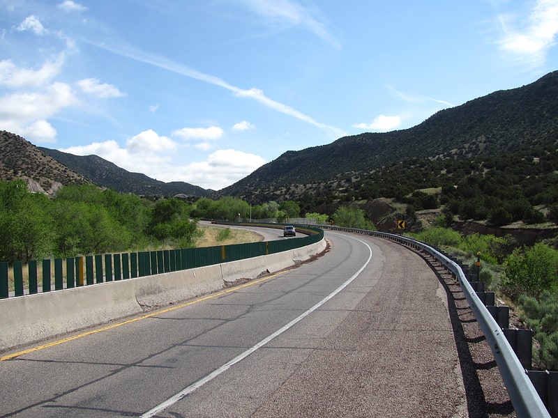
Tijeras Canyon is a prominent canyon in the central part of the U.S. state of New Mexico. It separates the Sandia Mountains subrange to the north from the Manzano Mountains subrange to the south. These subranges are part of the larger Sandia–Manzano Mountains; Tijeras Canyon forms a pass through this range. Elevations along the bottom of the canyon range from 5,600 feet to 7,000 feet above sea level. The canyon drains to the west, into a large dry wash known as Tijeras Arroyo, which runs through Kirtland Air Force Base, passes just south of the Albuquerque International Airport, and then joins the Rio Grande. The arroyo heads at the historically important pass, and this pass and the entire canyon are traversed by Interstate 40, following the path of historic U.S. Route 66.
A railroad, the Albuquerque Eastern Railway, was proposed to run through the Canyon in 1901, connecting to the New Mexico Central at Moriarity, with a branch to the coalfields around Hagan. Some grading for the trackbed was done (still visible at places near the western mouth) but tracks were never laid in the canyon, and the project was abandoned in 1908.
The name Tijeras means "scissors" in Spanish, and the name is said to come from the junction of two tributary canyons, or perhaps of two roads. The name is most properly applied only to the small village, Tijeras, at the junction, as the original name of the canyon was Cañon de Carnué. However the name Tijeras is now almost universally applied to the canyon.
The original inhabitants of the canyon were Pueblo people, occupying Tijeras Pueblo near the site of the present-day town of Tijeras, but the site has long been deserted.
The largest employer in the Canyon is a cement plant which opened in the late 1950s. Its buildings and excavations dominate the portion of the canyon and surrounding hills southwest of the town of Tijeras.
In 1950, the Tijeras Canyon job was the largest road project ever let in the State of New Mexico. It also carried the honor of being the first U. S. Route 66 four-lane divided highway built in New Mexico. Skousen, Isbell & Johnston Contracting Company was awarded the contract. The job reached completion in 1951. The project extended from Albuquerque's eastern city limits to roughly a mile east of Tijeras.[6]
Magdalena Mountains
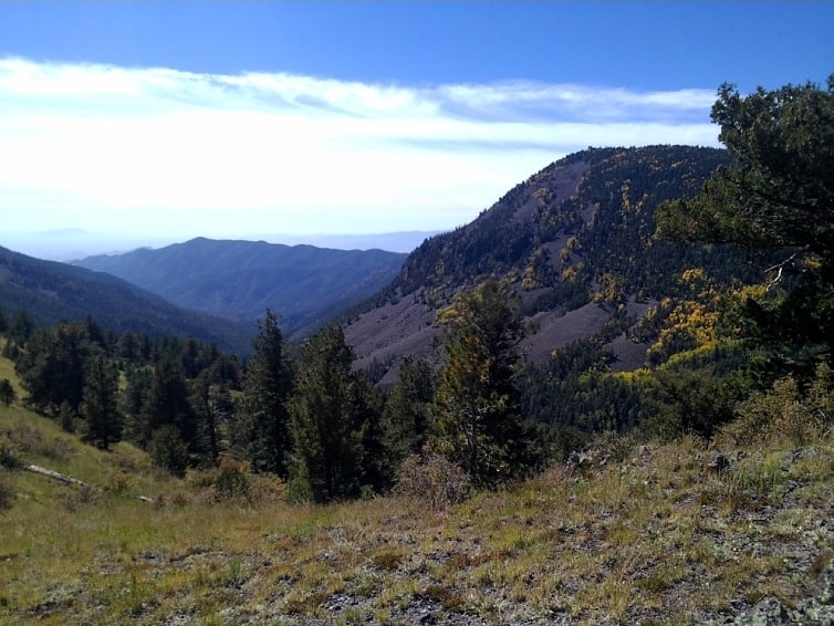
Mountain range in New Mexico. The Magdalena Mountains are a regionally high, mountain range in Socorro County, in west-central New Mexico in the southwestern United States. The highest point in the range is South Baldy, at 10,783 ft, which is also the tallest peak in Socorro County. The range runs roughly north-south and is about 18 miles long. The range lies just south of the village of Magdalena, and about 18 miles west of Socorro. The Magdalena Mountains are an east-tilted fault-block range, superimposed on Cenozoic calderas. The complex geologic history of the range has resulted in spectacular scenery, with unusual and eye-catching rock formations. They form part of the western edge of the Rio Grande Rift Valley, fronting the La Jencia Basin. The mountains remain isolated and natural due to the absence of any significant human development within or near the range.
The range takes its name from a volcanic peak on the west side, named Magdalena Peak, after Mary Magdalene. A talus formation and shrub growth on the east slope of Magdalena Peak is said to resemble a woman's face. According to Julyan's Place Names of New Mexico, one legend about the mountain purports that "a group of Mexicans were besieged by Apaches on the mountain, when the face of Mary Magdalene miraculously appeared, frightening the Indians away."[7]
Starfire Optical Range
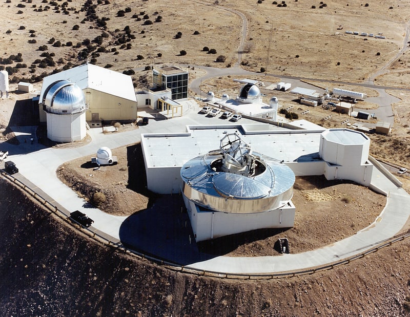
Federal government office in Bernalillo County, New Mexico. Starfire Optical Range is a United States Air Force research laboratory on the Kirtland Air Force Base in Albuquerque, New Mexico. Its primary duty, according to the official website, is to "develop and demonstrate optical wavefront control technologies." The range is a secure lab facility and is a division of the Directed Energy Directorate of the Air Force Research Laboratory.
SOR's optical equipment includes a 3.5 meter telescope which is "one of the largest telescopes in the world equipped with adaptive optics designed for satellite tracking" according to the Air Force, a 1.5 meter telescope, and a 1-meter beam director.[8]
Datil Mountains
The Datil Mountains are a small range on the northern edge of the Mogollon-Datil volcanic field, just northwest of the Plains of San Agustin in the U.S. state of New Mexico. The range lies in Socorro and Catron Counties, north of the town of Datil, New Mexico and takes its name from the Spanish word for “date,” dating back over two hundred years. In The Place Names of New Mexico, Robert Julyan suggests two possible explanations for the name: 1) that “the seedpods of the broad-leafed yucca sufficiently resembled dates” or 2) “the Spanish applied the name to the fruit of the prickly pear cactus.” The area includes the major ridgeline of Madre Mountain, which is sacred ground to the Acoma, Laguna, and Zuni tribes, as well as several other unnamed peaks and ridges.
The majority of the Datil Mountains are part of the Magdalena Ranger District of the Cibola National Forest. There are two Inventoried Roadless Areas (IRAs) within the Datil Mountains: the Datil (13,974 acres) and Madre Mountain (19,855 acres) IRAs. The landscape is expansive and natural with steep-sided hills cloaked with dense conifer forest. The jagged Sawtooth Mountains can be seen to the west.[9]
Bear Mountains
Wildlife refuge in Socorro County, New Mexico. The Bear Mountains lie just north of the village of Magdalena and north of the Magdalena Mountains in New Mexico. The Bear Mountains are located within the Magdalena Ranger District of the Cibola National Forest. There are two Inventoried Roadless Areas within the Bear Mountains: the Scott Mesa IRA and the Goat Spring IRA. The Bureau of Land Management’s Sierra Ladrones Wilderness Study Area stretches to the northeast of the Bear Mountains and connects the Bear Mountains with the 230,000-acre Sevilleta National Wildlife Refuge to the east. The world-renowned Very Large Array lies to the southwest of the Bear Mountains.
Robert Julyan's The Place Names of New Mexico notes that "bear" names throughout New Mexico frequently come from a particular incident with a bear rather than a general abundance of bears because "any encounter with a bear likely would have been memorable." Even so, the range is currently home to black bears, and grizzly bears were once found the area as well.[10]
San Mateo Mesa
San Mateo Mesa is located in McKinley County, New Mexico, approximately 5 miles northwest of San Mateo. There are two large mesas, called San Mateo Mesa South and San Mateo Mesa North.[11]