Discover 11 hidden attractions, cool sights, and unusual things to do in Chichibu-Tama-Kai National Park (Japan). Don't miss out on these must-see attractions: Mount Mizugaki, Mount Kobushi, and Mount Kinpu. Also, be sure to include Mount Ryōkami in your itinerary.
Below, you can find the list of the most amazing places you should visit in Chichibu-Tama-Kai National Park (Yamanashi).
Table of Contents
Mount Mizugaki
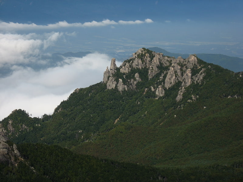
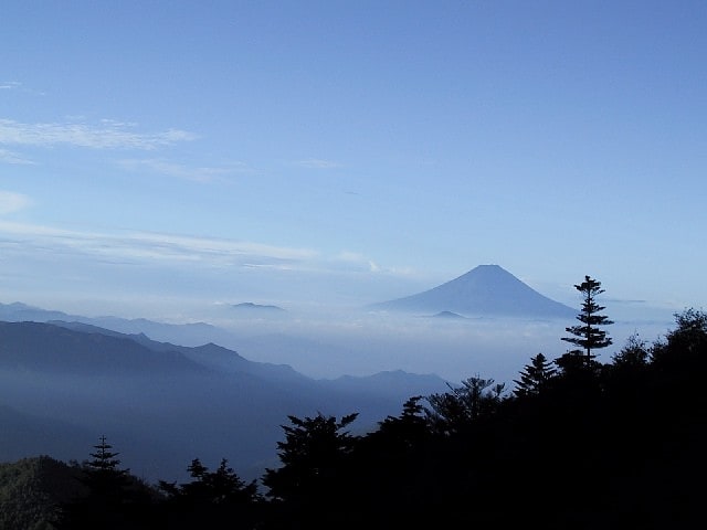
Mountain in Japan. Mount Mizugaki is a mountain located in Hokuto-city, in the Yamanashi Prefecture, within Chichibu-Tama-Kai National Park. It is one of the 100 Famous Japanese Mountains. It is part of the Okuchichibu Mountains. It has an altitude of 2230m. The mountain is located just across from Mt. Kinpu/Kinpō.
The mountain is composed mainly of granite, and has beautiful flowers in summer. Mt. Mizugaki has a unique shape consisting of a number of granite rocks, strangely shaped rocks and huge rocks that is opposite to Chichibu mountains covered with rich woods. The view from the peak is magnificent and hiking routes are in good condition. Many hikers walk here especially in the seasons of fresh green and autumn leaves.[1]
Mount Kobushi
Mountain in Japan. Mount Kobushi is a mountain on the border of Saitama, Yamanashi, and Nagano prefectures in Japan. The mountain is the source of the Arakawa and Shinano Rivers. It is one of the 100 Famous Japanese Mountains.[2]
Mount Kinpu
Also known as: 金峰山
Mountain in Japan. Mount Kinpu, or Mount Kinpō is a mountain of the Okuchichibu Mountains, and located on the boundary of Nagano Prefecture and Yamanashi Prefecture, Japan. It is one of the 100 Famous Japanese Mountains. At 2599m tall, it is the second highest peak of the Okuchichibu Mountains.[3]
Mount Ryōkami
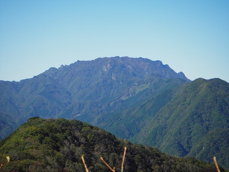
Also known as: 両神山
Mountain in Japan. Mount Ryōkami is a mountain located in the Saitama Prefecture, at the northern end of the Okuchichibu Mountains.[4]
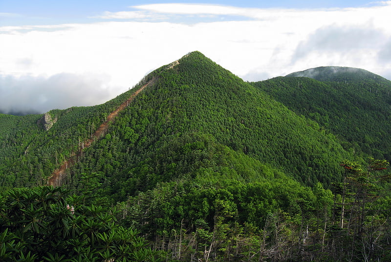
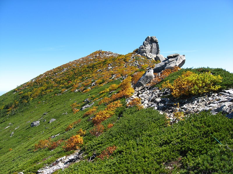
Okuchichibu Mountains
Also known as: 奥秩父山塊
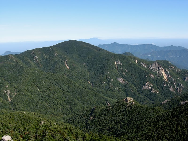
Mountain range. Okuchichibu Mountains or the Okuchichibu Mountainous Region is a mountainous district in the Kantō region and Kōshin'etsu region, Japan. It covers the western part of Tokyo, the western part of Saitama Prefecture, the southwestern part of Gunma Prefecture, the southeastern part of Nagano Prefecture, and the northern part of Yamanashi Prefecture. Oku means the interior, Okuchichibu means the interior of Chichibu. The meaning of the word Okuchichibu is based on the point of view from the Kantō region. This mountain area consists of folded mountains and ranges from 1000 to 2600 meters in height. Mount Kita Okusenjō is the highest at 2601m. Most of the range lies in the Chichibu Tama Kai National Park.
Some of the mountains in the Okuchichibu Mountains include:
- Mt. Kumotori
- Mt. Hiryū
- Mt. Karamatsuo
- Mt. Kasatori
- Mt. Suisho
- Karisaka Pass
- Mt. Tokusa
- Mt. Kobushi
- Mt. Sanpō
- Mt. Kokushi
- Mt. Kita Okusenjō
- Mt. Asahi
- Mt. Kimpu
- Mt. Mizugaki
- Mt. Ogawa
- Mt. Yokō
- Mt. Meshimori
- Mt. Azumaya
- Mt. Ryōkami
- Mt. Nanten
- Mt. Chichibu-ontake
- Nakatsu Valley
- Mt. Mitsumine
- Mt. Hakutai
- Mt. Myōhō
- Mt. Kirimo
- Mt. Shiraiwa
- Mt. Kumakura
- Mt. Wanakura
- Mikuni Pass
- Jūmonji Pass
- Mt. Gorō
- Nishizawa Gorge
- Higashizawa Gorge
- Mt. Kurogane
- Mt. Kentoku
- Mt. Kurakake
- Mikubo Plateau
Ogawayama
Also known as: 小川山
Mountain in Japan. Ogawayama is a 2,418m tall mountain on the border of Nagano and Yamanashi prefectures in Japan. It is a famous rock climbing area. The rock in Ogawayama consists of granite.
Some famous boulders can be found in Ogawayama. Such as Captain Ahab, the first boulder problem opened in Japan in 1980, and the notorious Banshousha slab boulder. There is multipitch climbing up to 9 pitches. The routes are generally not bolted.[6]
Tochimoto Barrier
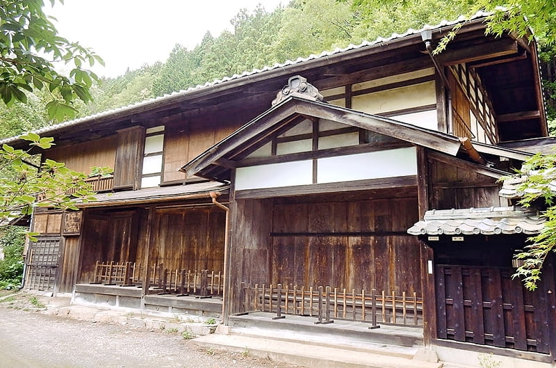
The Tochimoto Barrier was a security checkpoint on the road connecting Kai Province with Musashi Province via the Karisaka Pass in the Okuchichibu Mountains in Edo period Japan. In 1970, the surviving building of the checkpoint on the Musashi side of the pass was recognized as a National Historic Site.[7]
Odaki Yama
Mt. Otake is a 1,266.5-meter-high mountain located in the Okutama mountain range at the boundary of Hinohara Village and Okutama Town, Nishitama County, Tokyo. Although not very high, it is a famous peak in Okutama with a unique mountain shape. It is one of Japan's 200 most famous mountains and one of the 100 most famous mountains for flowers. With a variety of climbing courses, this mountain can be enjoyed by beginners and experienced climbers alike.
Urayamaguchi Station
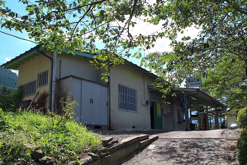
Also known as: 浦山口駅
Railway station. Urayamaguchi Station is a passenger railway station located in the city of Chichibu, Saitama, Japan, operated by the private railway operator Chichibu Railway.[8]
Address: Chichibu-Tama-Kai National Park, 3895 Arakawakuna, Chichibu, Saitama
Bangno ling
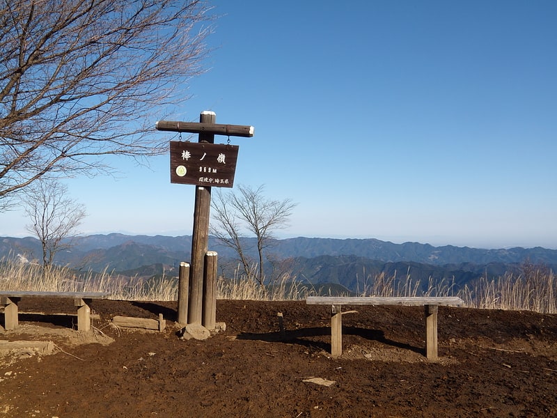
Benno-Oriyama is a 969-meter-high mountain located on the border between Okutama-cho, Nishitama-gun, Tokyo and Hanno City, Saitama Prefecture. It is on the border of the Okutama and Okumusashi mountain ranges.
Also called Bo-no-Ori-mine, Bo-no-Mine, and Bo-no-Ridge. Also called Bo-no-Ridge, Bo-no-Mine, and Bo-no-Ridge.
One of the origins of Bo-no-Ori is said to be that Hatakeyama Shigetada, a Chichibu warlord of the Kamakura period (1192-1333), broke a stone stick he was carrying as a walking stick when crossing this mountain, thus giving it its name. A stone pillar about one foot long is enshrined at a shrine along the trail leading up from Hyakkenchaya on the Okutama side of the mountain, said to be a broken piece of the broken stone stick.
The summit is very wide, with an open space that looks like a park or a small field (but there are no restrooms or stores). It used to be a field of thatch (material for thatched roofs).
Mount Gozen
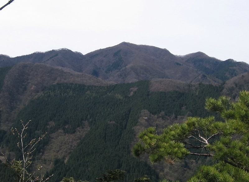
Gozenzan is a 1405-meter-high mountain located in the Okutama mountain range, on the boundary of Okutama Town and Hinohara Village, Nishitama County, Tokyo.
Mt. Otake, Mt. Gozen, and Mt. Mitou on the south bank of the Tama River are called Okutama Sanzan (three mountains in Okutama).
The mountain rises in the center of the main vein of Okutama on the southern shore of Okutama Lake. The shape and appearance of the mountain seen from afar is beautiful. The mountain is a place where katakuris (dogtooth violet) grow wild. In autumn, when the larch leaves turn yellow, the summit area turns golden. The Hinohara Village side to the south is particularly heavily planted with trees. The summit is wide, but there is not much of a view. Ishi Ridge is located on the opposite side of the mountain. At the weir of the Ogouchi Dam, there is the entrance to the Oobuna Ridge, one of the trails. On the way, you can look down on Lake Okutama from the southeast. The Okutama Citizens' Forest (a.k.a. Experience Forest) is also located on the northern slope.