Discover 11 hidden attractions, cool sights, and unusual things to do in Tanzawa-Ōyama Quasi-National Park (Japan). Don't miss out on these must-see attractions: Mount Ōyama, Mount Tanzawa, and Mount Ōno. Also, be sure to include Mount Hiru in your itinerary.
Below, you can find the list of the most amazing places you should visit in Tanzawa-Ōyama Quasi-National Park (Kanagawa).
Table of Contents
Mount Ōyama
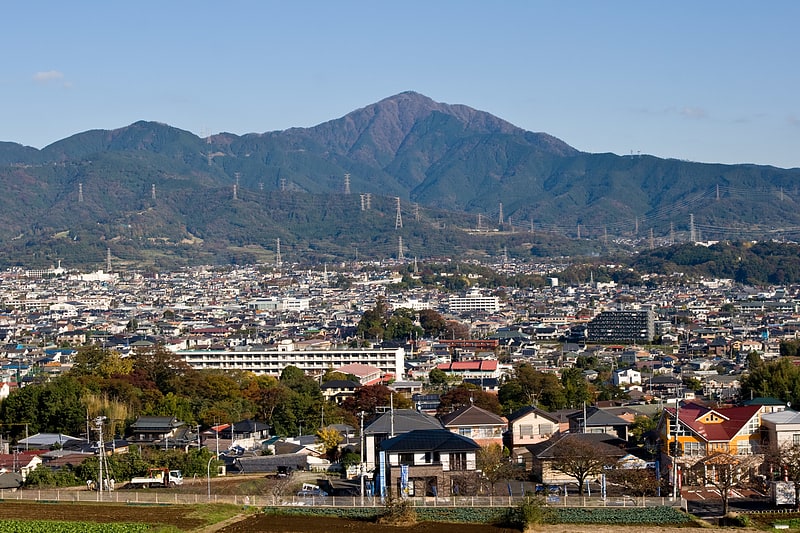
Also known as: 大山
Mountain in Japan. Mount Ōyama, also Mount Afuri or Mount Kunimi, is a 1,252-metre-high mountain situated on the border of Isehara, Hadano and Atsugi in Kanagawa Prefecture, Japan. Together with Mount Tanzawa and other mountains in the Tanzawa Mountains it forms the Tanzawa-Ōyama Quasi-National Park. Mount Ōyama is a popular sightseeing spot in Kanagawa Prefecture.[1]
Mount Tanzawa
Also known as: 丹沢山
Mountain in Japan. Mount Tanzawa is a mountain of the Tanzawa Mountains, with an elevation of 1,567.1 metres. Its summit marks the border between Sagamihara, Kiyokawa in Aikō District, and Yamakita in Ashigarakami District.[2]
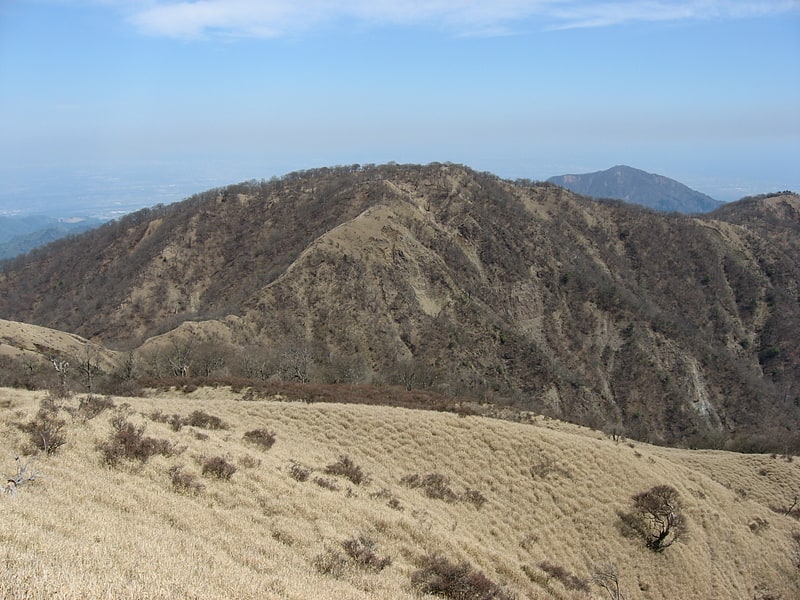
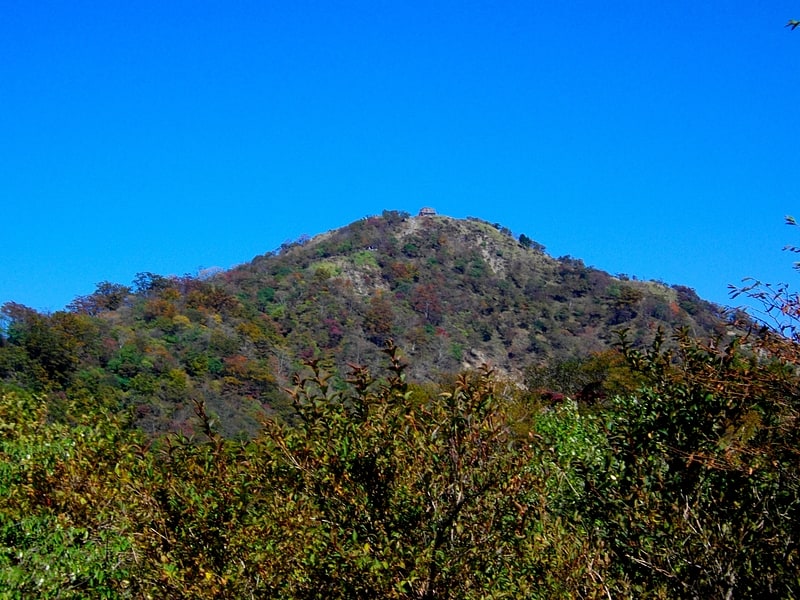
Mount Ōno
Mount Ōno is a mountain located in Yamakita, Kanagawa.
It belongs to Tanzawa-Ōyama Quasi-National Park. The area around the mountaintop had been used as a Kanagawa Prefectural Onoyama dairy cow breeding ranch (completed in 1968), but it was abolished as a prefectural ranch on March 31, 2016.[3]
Mount Hiru
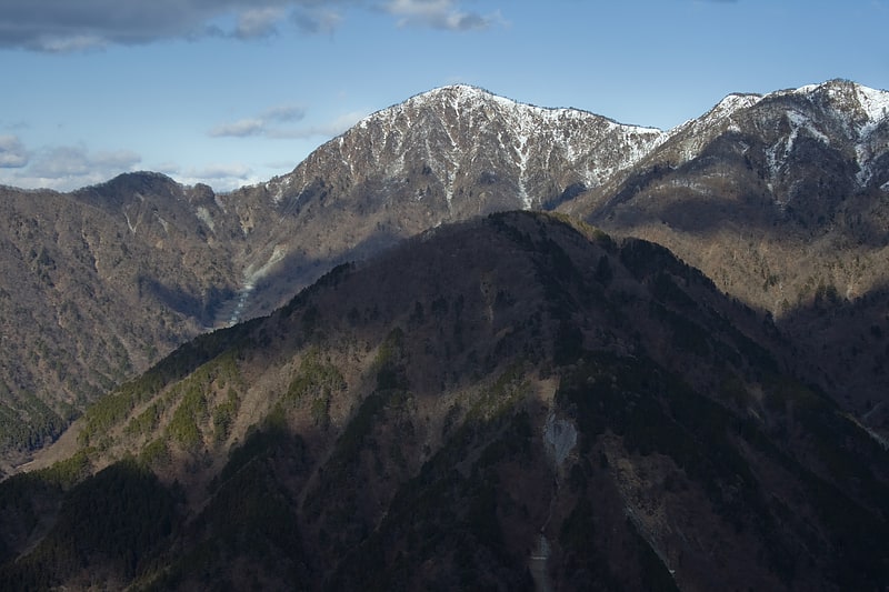
Also known as: 蛭ヶ岳
Mountain in Japan. Mount Hiru is the tallest mountain of the Tanzawa Mountains with a height of 1,675 metres.[4]
Mount Tō
Also known as: 塔ノ岳
Mountain in Japan. Mount Tō is a 1,490.9 m mountain of Tanzawa Mountains, located on the border of Kiyokawa, Hadano and Yamakita in Kanagawa, Japan.[5]
Hayato Great Falls
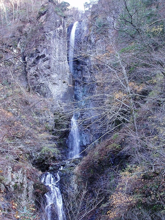
Also known as: 早戸大滝
Tourist attraction in Sagamihara, Japan. Hayato Great Falls is a waterfall on the Hayato River within the boundaries of the Tanzawa-Ōyama Quasi-National Park, in Sagamihara, Kanagawa Prefecture, Japan.
The Hayato Great Falls has a large volume of water, and drops in two separate plunges with a total height of 50 metres (160 ft). The upper falls has a height of 40 meters, and the lower has a height of 10 meters. The view is blocked by a great rock protruding from the middle of the upper fall, so that the whole waterfall can be seen clearly only from the bottom. The Hayato Great Falls is located deep within Tanzawa Mountains, and is accessible only by a two-hour hike on poorly marked and maintained mountain trails from the nearest road. It is inaccessible during inclement weather, and thus has few visitors.
The Hayato Great Falls is listed as one of "Japan’s Top 100 Waterfalls", in a listing published by the Japanese Ministry of the Environment in 1990.[6]
Mount Chigogabaka
Also known as: 稚児ヶ墓山
Mountain in Japan. Mount Chigogabaka is a 596.3 m mountain of Tanjō Mountains, located Iwatani, Yamada, Kita-ku, Kobe, Hyōgo, Japan.[7]
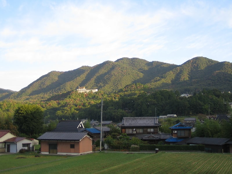
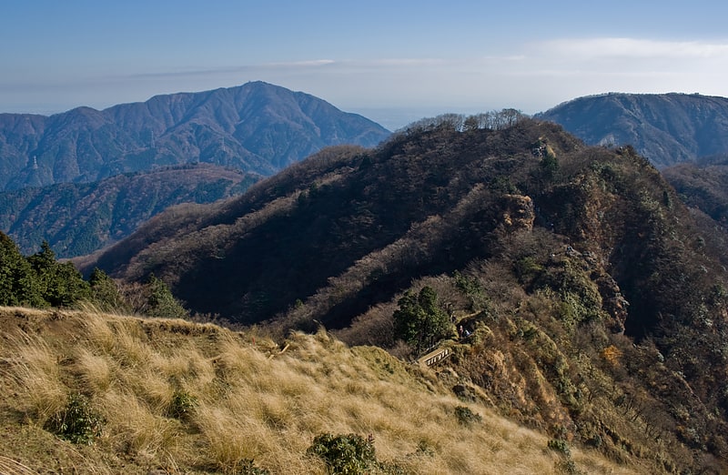
Tanzawa Mountains
Also known as: 丹沢山地
Mountain range. The Tanzawa Mountains are a mountain range in the Kantō region in Japan. The mountain range covers the northwestern part of Kanagawa Prefecture and touches the prefecture borders of Shizuoka Prefecture to the west and the Yamanashi Prefecture to the north.[8]
A fu li shen she xia she
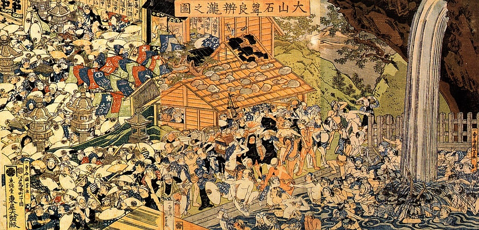
Oyama Aburi Shrine is located in Oyama, Isehara City, Kanagawa Prefecture. It is one of the thirteen shrines listed in the Engishiki Shinmeicho (the Engishiki Shinto name book) of the 5th year of the Enki era, and is classified as a prefectural shrine under the former shrine ranking.
Daisen, with the head shrine (including Okusha and Mae-sha) located at the top of the mountain and the Shimo-sha located in the middle of the mountain, accessible by Daisen cable car to the Shimo-sha (see also #Transportation Access).
Gyoja Dake
Gyoja-dake is a 1,180-meter-high mountain on the Tanzawa Omote Ridge. It is located between Shin-Dainichi and Karasuboyama. Gyoja-dake is 300 m northwest of the 1,209 m peak from which the Seijiro Ridge descends.
Gyoja-dake area is the most collapsed area on Omote-one, and the chain-link is intermittent.
Higashi-Yamakita Station
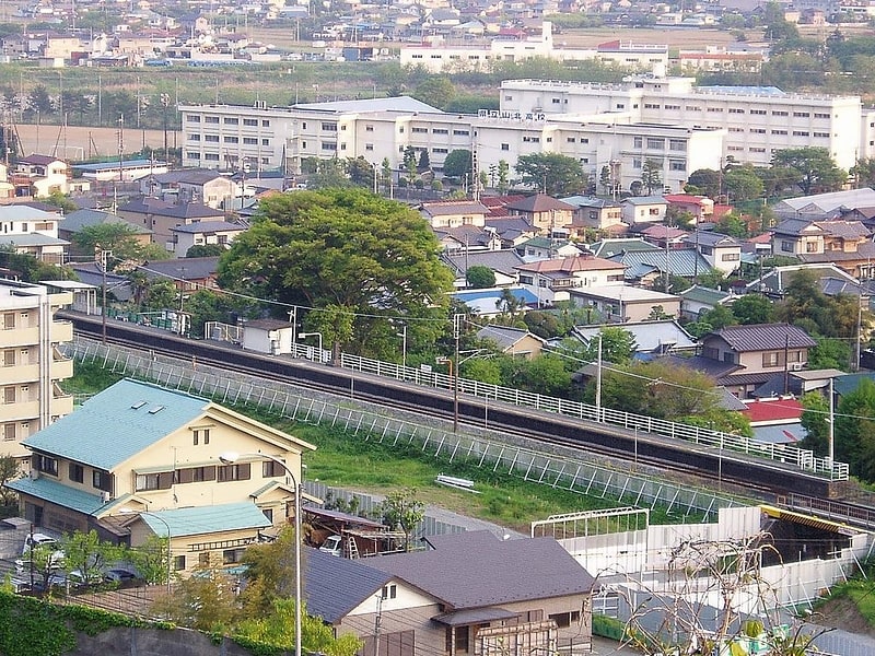
Also known as: 東山北駅
Railway station. Higashi-Yamakita Station is a passenger railway station located in the town of Yamakita, Kanagawa, Japan, operated by Central Japan Railway Company.[9]
Address: Tanzawa-Ōyama Quasi-National Park, Mukōhara, Yamakita, Ashigarakami, Kanagawa