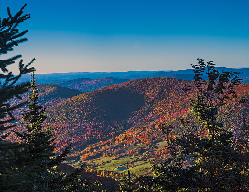
Discover 35 hidden attractions, cool sights, and unusual things to do in Catskill Park (United States). Don't miss out on these must-see attractions: North–South Lake, Hunter Mountain, and Frank D. Layman Memorial. Also, be sure to include Balsam Lake Mountain in your itinerary.
Below, you can find the list of the most amazing places you should visit in Catskill Park (New York).
Table of Contents
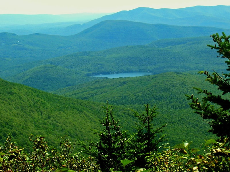
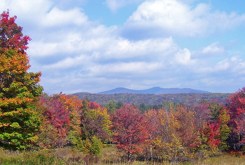
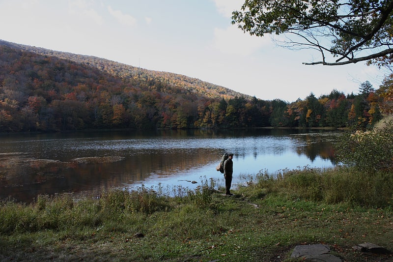
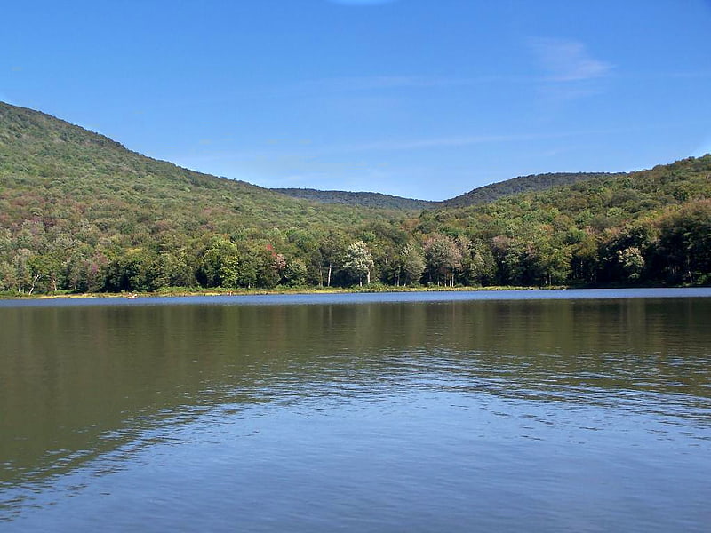
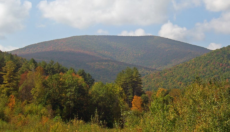
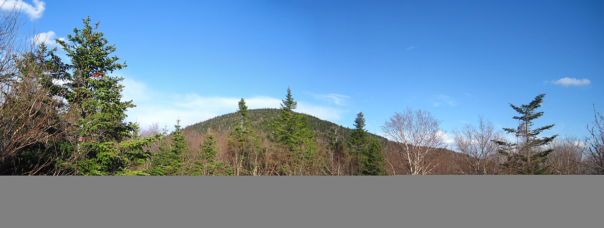
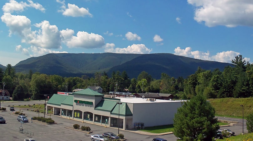
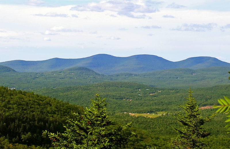
North–South Lake
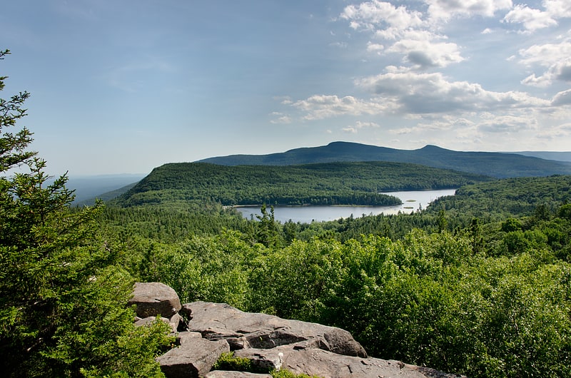
Lake in New York. North–South Lake is an 1,100-acre state campground in the Catskill Forest Preserve near Palenville, New York operated by the New York State Department of Environmental Conservation near the site of the historic Catskill Mountain House overlooking the Hudson River. The escarpment on which the lakes are located is at 2,250 feet, 1,700 feet above the valley floor, providing a view of five states in clear weather.
The area is rich in history. It was a favorite subject of painters in the Hudson River school, particularly Thomas Cole. For a long time, the prestigious resort hotels in the area made it synonymous with the Catskills.
Today, the area provides hiking, swimming, boating (no motors), and fishing.[1]
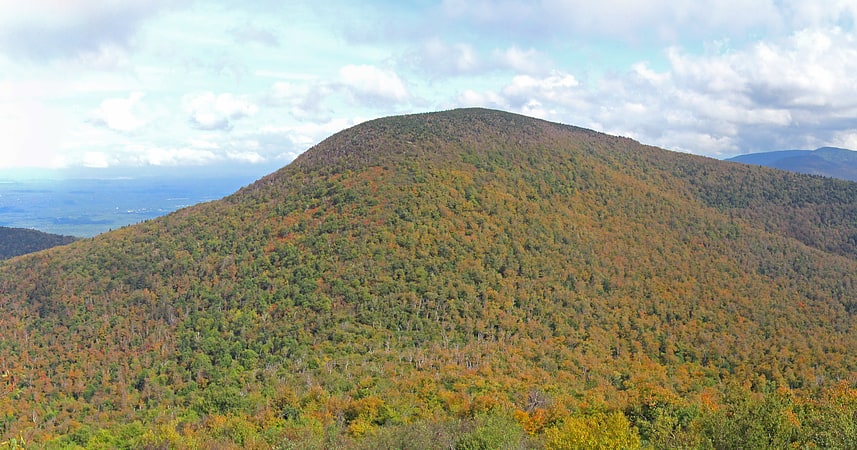
Hunter Mountain
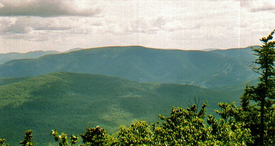
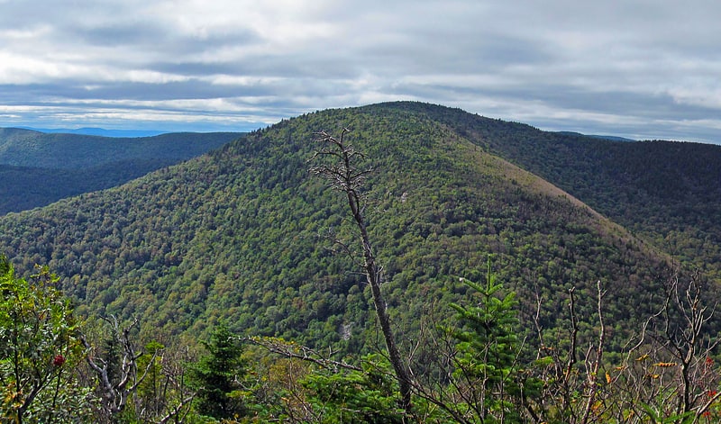
Peak in New York State. Hunter Mountain is in the towns of Hunter and Lexington, just south of the village of Hunter, in Greene County, New York, United States. At approximately 4,040 feet in elevation, it is the highest peak in the county and the second-highest peak in the Catskill Mountains.
While the mountain is closely associated with the eponymous ski area built around the Colonel's Chair ridge at the mountain's northwest corner, that takes up only a small portion of the mountain. The actual summit, some distance from the ski area, is graced with a fire lookout tower, the highest in the state and second-highest in the Northeast. The former road to it is open to hikers, horses (and possibly mountain bikers in the future). It is the most popular route to the mountain's summit.[2]
Frank D. Layman Memorial
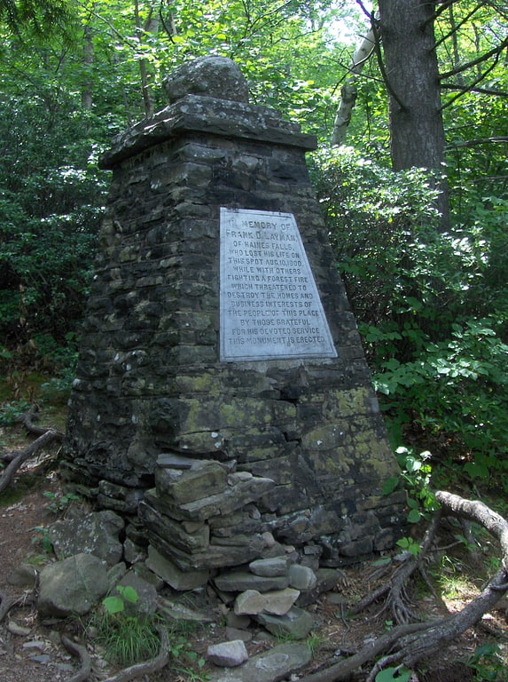
Frank D. Layman Memorial is a historic monument located at Hunter in Greene County, New York. It was erected in 1901 to commemorate Frank D. Layman, who died on the site of the memorial on August 10, 1900, while fighting a forest fire. It is pyramidal in shape, four sided, and rises upward from a base approximately seven feet in diameter to approximately 11 feet.
It was listed on the National Register of Historic Places in 2003.[3]
Balsam Lake Mountain
Mountain in New York State. Balsam Lake Mountain is one of the Catskill Mountains, located in the Town of Hardenburgh, New York, United States. It is the westernmost of the range's 35 High Peaks. Its exact height has not been determined, but the highest contour line on topographic maps, 3,720 feet, is usually given as its elevation.
Located within the Balsam Lake Mountain Wild Forest management unit of the Catskill Park Forest Preserve, in the late 19th century its summit became the site of the first fire lookout tower in the state, operated by members of a nearby sportsmen's club. It was later taken over by the state's conservation agencies, which built several improved towers on the site, one of which remains, along with its accessory buildings and has been listed on the National Register of Historic Places, although it has not been used for fire detection since 1988. The summit is also the site of a rare sphagnum bog that has been affected by acid rain since a mid-20th century windstorm blew down many of the trees sheltering it at the time.
The tower and the views it commands, as well as its ease of access by the old truck road to the tower, have made it a popular attraction for hikers despite the mountain's remote location. Many are peakbaggers aspiring to membership in the Catskill Mountain 3500 Club, for which Balsam Lake is a required peak.[4]
Cooper Lake
Lake in New York State. Cooper Lake, located near Lake Hill in the Town of Woodstock, Ulster County, New York, is the largest natural lake in the Catskill Mountains. However, it has been expanded somewhat over the years since it serves as the main reservoir for the nearby City of Kingston and Town of Ulster, which stores water there that it pipes from Mink Hollow Stream in addition to the water that reaches the lake from its 8.6-square mile drainage basin.
It holds roughly 1.2 billion US gallons (4,500,000 m3) to the city a year; providing an average of 4.6 million US gallons (17,000 m3) a day to Kingston and Ulster.
Swimming and fishing in Cooper Lake are prohibited.
The area of Cooper Lake and the surrounding grounds is owned by City of Kingston Water Department.[5]
Address: Cooper Lake Road, Catskill Park
Blackhead
Mountain in New York. Blackhead is a mountain located in Greene County, New York.
The mountain is part of the Blackhead range of the Catskill Mountains. Blackhead is flanked to the northeast by Black Dome and Acra Point is located north.
Blackhead stands within the watershed of the Hudson River, which drains into New York Bay. The southwest side of Blackhead drains into East Kill, thence into Schoharie Creek, the Mohawk River, and the Hudson River. The north side of Blackhead drains into the headwaters of Batavia Kill, and thence into Schoharie Creek. The east side of Blackhead drains into Trout Brook, thence into Shingle Kill, Catskill Creek, and the Hudson River.
Blackhead is within New York's Catskill Park. The Long Path, a 350-mile (560 km) long-distance hiking trail from New York City to Albany, is contiguous with the Escarpment Trail.[6]
Evergreen Mountain
Mountain in New York State. Evergreen Mountain is a mountain located in Greene County, New York north of Spruceton, New York. Herdman Brook drains the southeastern portion of the mountain and flows south before converging with West Kill. West Kill flows westwards, south of Evergreen Mountain and the Schoharie Creek flows eastwards, north of the mountain.[7]
Hunter Mountain Fire Tower
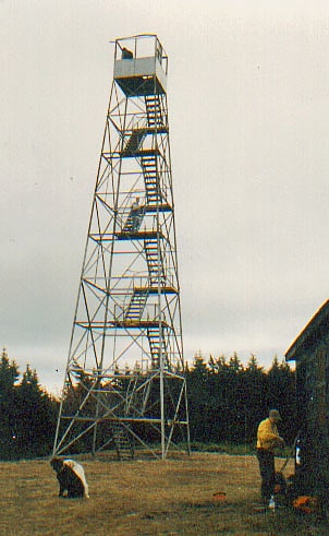
The Hunter Mountain Fire Tower is located on the summit of the eponymous mountain, second highest of the Catskill Mountains in the U.S. state of New York. It was the first of 23 fire lookout towers built by the state in the region, and the next-to-last of the five still standing to be abandoned.
Today it remains a popular attraction for hikers climbing the mountain. After it fell into disrepair in the 1990s and was recommended for removal by the New York State Department of Environmental Conservation (DEC), which had operated the tower, it was added to the National Register of Historic Places in 1997. Local enthusiasts were able to raise money, matched by DEC, to restore the tower and adjacent observer's cabin to serve as a museum, with volunteers in the cab on some weekends.
Panoramic views of not only the mountains but the adjacent Hudson Valley, Massachusetts, Connecticut and sometimes southwestern Vermont are available from it. Likewise, it can be seen from many of the surrounding mountains, the village of Hunter and the upper slopes of the ski area. It is the highest fire tower still standing in the state and the second-highest in the entire Northeast.[8]
Address: 84 spruce st, Catskill Park
Denning
Denning is an isolated town in Ulster County, New York, United States. The population was 551 at the 2010 census. The town is named after an early landowner, William Denning. Denning is located in the western part of the county, deep inside the Catskill Mountains. The location of the town in the Catskill State Park accounts in part for its low population.[9]
North Mountain
Peak in New York State. North Mountain is a peak in the Catskill Mountains of New York, on the border between the towns of Catskill and Hunter, in Greene County. It is part of the Catskill Escarpment. Cairo Round Top is located northeast and Artists Rock is located southeast of North Mountain.
It overlooks the North-South Lake State Campground, an area where resort hotels such as the Catskill Mountain House were once located, and thus has long been a popular climb with hikers. It can be reached by several trails from the campground area, all of which eventually lead to the Escarpment Trail, which crosses the summit. The Long Path, a 350-mile (560 km) long-distance hiking trail from New York City to Albany, is contiguous with the Escarpment Trail.
North Point is an area with many open ledges located at 2,900 feet (880 m), along the trail about a half-mile (800 m) below the summit. From North Point, the views of the lakes, other mountains such as Kaaterskill High Peak and the Hudson River and its valley are expansive. They were sometimes the subject of paintings by members of the Hudson River School.
The summit is also one of the lowest in elevation in the Catskills to feature a boreal forest of red spruce and balsam fir.[10]
Echo Lake
Lake in New York State. Echo Lake is a mountain lake within the Indian Head Wilderness of the Catskill Mountains, located in the valley between the two mountains Plattekill and Overlook, near Woodstock, New York, United States of America.
Echo Lake was historically named Shens Lake in state law defining the borders of Ulster County, circa. 1777-1801, or Shoes Lake in the Beer's 1875 Ulster County Atlas.[11]
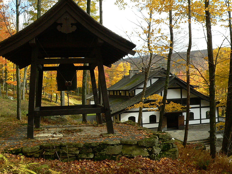
Zen Mountain Monastery
Monastery in Mount Tremper, New York. Zen Mountain Monastery is a Zen Buddhist monastery and training center on a 230-acre forested property in the Catskill Mountains in Mount Tremper, New York. It was founded in 1980 by John Daido Loori originally as the Zen Arts Center. It combines the Rinzai and Sōtō Zen traditions, in both of which Loori received Dharma transmission. Loori's first dharma heir was Bonnie Myotai Treace, Sensei, who received shiho, or dharma transmission, from him in 1996. From Loori's death in October 2009 until January 2015, Zen Mountain Monastery had two teachers: Geoffrey Shugen Arnold and Konrad Ryushin Marchaj, who received Dharma transmission from Loori in 1997 and 2009, respectively. Since January 2015, the training at the Monastery has been led by Shugen Roshi, assisted by Ron Hogen Green, Sensei; Jody Hojin Kimmel, Sensei; and Vanessa Zuisei Goddard, Sensei.[12]
Alder Lake
Lake in New York State. Alder Lake is a body of water that is located in Hardenburgh, Ulster County in the lower Hudson Valley region of New York. It is located in the Balsam Lake State Forest Preserve, which is a part of the Catskill Forest Preserve. The lake was man made by the Coykendall family in the 1900s. It is most often used for recreational uses and family day trips.[13]
Neversink Reservoir
Reservoir in New York State. Neversink Reservoir is a reservoir in the New York City water supply system. It is located in the Catskill Mountain town of Neversink in Sullivan County, New York, 75 miles northwest of the City.
It is fed by the Neversink River, the longest tributary of the Delaware River. Water collected in the reservoir in turn goes through the Neversink Tunnel a short distance east to Rondout Reservoir to be pooled with that from Pepacton and Cannonsville reservoirs which form the west-of-the-Hudson River components of the Delaware Aqueduct. Together, they provide nearly half of the city's daily consumption.[14]
Sugarloaf Mountain
Mountain in New York State. Sugarloaf Mountain is a mountain located in Greene County, New York. The mountain is part of the Devil's Path range of the Catskill Mountains. To the northwest, Sugarloaf is separated from Plateau Mountain by Mink Hollow Notch; to the southeast, Sugarloaf is separated from Twin Mountain by Pecoy Notch.
Sugarloaf Mountain stands within the watershed of the Hudson River, which drains into New York Bay. The northeastern slopes of Sugarloaf Mtn. drain into Schoharie Creek, thence into the Mohawk River, and the Hudson River. The northwestern slopes of Sugarloaf drain into Roaring Kill, thence into Schoharie Creek. The southwestern and southeastern slopes of Sugarloaf drain into Beaver Kill, thence into Esopus Creek, and the Hudson River.
Sugarloaf Mountain is within New York's Catskill State Park. The Devil's Path hiking trail traverses the summit ridge of Sugarloaf. The Long Path, a 357 mi (575 km) long-distance hiking trail through southeastern New York, is contiguous with this stretch of the Devil's Path.[15]
Halcott Mountain
Mountain in New York State. Halcott Mountain is one of the Catskill Mountains of the U.S. state of New York. It is mostly located in Greene County, with some of its lower slopes in Delaware and Ulster counties. Its exact summit elevation has not been officially determined, but the highest contour line on the mountain is 3,520 feet. It is one of the peaks on the divide between the Delaware and Hudson watersheds.
As one of the Catskill High Peaks above 3,500 feet (1,100 m) in elevation, a successful ascent of Halcott is required for peakbaggers seeking to join the Catskill Mountain 3500 Club. It is on public land, part of the Catskill Park Forest Preserve, but has no trail. Hikers bushwhack through the relatively open woods to sign the canister at the summit and prove their climb. It is considered one of the easiest of the 13 trailless High Peaks.[16]
Beaverkill Bridge
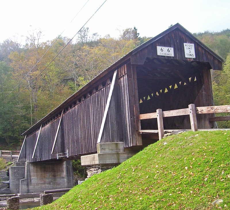
Covered bridge in Sullivan County, New York. Beaverkill Bridge, also known as Conklin Bridge, is a wooden covered bridge over the Beaver Kill north of the hamlet of Roscoe in the Town of Rockland, New York, United States, that carries Conklin Road through Beaverkill State Campground. It was erected in 1865, one of the first bridges over the river in what was then still a largely unsettled region of the Catskill Mountains.
It uses an unusual modification of the lattice truss design perfected earlier in the 19th century by Ithiel Town. There is some dispute over which of three men claimed as its builder actually did; it is likely that all of them had some role. It is one of the 29 historic covered bridges in New York State. After undergoing some repairs over the course of the late 20th century, in 2007 it was listed on the National Register of Historic Places, the northernmost property listed in Sullivan County and the only one of four covered bridges in it to be listed. Repair and maintenance efforts continue.[17]
Eagle Mountain
Mountain in New York State. Eagle Mountain is a mountain located in Ulster County, New York. The mountain is part of the Catskill Mountains. Eagle Mountain is flanked to the north by Haynes Mountain, to the southwest by Doubletop Mountain and Graham Mountain, and to the southeast by Big Indian Mountain.
The east and northeast sides of Eagle Mountain drain into Esopus Creek, thence into the Hudson River, which drains into New York Bay. The north, west and south sides of Eagle Mtn. drain into Dry Brook, thence into the East Branch of the Delaware River, and into Delaware Bay.
Eagle Mountain is within the Big Indian Wilderness of New York's Catskill State Park.[18]
Graham Mountain
Peak in New York State. Graham Mountain is the seventh highest of the Catskill High Peaks and the highest privately owned mountain in the range. It is located in the town of Hardenburgh, New York, United States.
Its summit is unique in the Catskills for its pygmy hardwood forest cover and absence of evergreen boreal species that normally dominate at that elevation in the range, despite the presence of balsam fir on the slopes below the summit. In the early 1960s a relay station was built there for Instructional Television, a predecessor to today's Public Broadcasting Service. The relay station was abandoned after a few years and its ruins can be seen from the slopes and summits of neighboring peaks.
Graham is within the Catskill Park. Only part of it is in the state-owned Forest Preserve; the summit and the most common access route are owned by descendants of railroad magnate Jay Gould, a native of the region, who closed the peak to the public indefinitely in January 2021. Prior to then, a successful ascent was required for membership in the Catskill Mountain 3500 Club.[19]
Rusk Mountain
Peak in New York State. Rusk Mountain is a peak located in the towns of Jewett and Lexington in Greene County, New York, United States. At 3,680 feet in elevation, it is the 20th-highest peak in the Catskill Mountains and considered a member of the Catskill High Peaks. While there is no maintained trail, a bushwhack to the summit is considered relatively easy, and required for membership in the Catskill Mountain 3500 Club.[20]
Balsam Mountain
Peak in New York State. Balsam Mountain is one of the High Peaks of the Catskill Mountains in the U.S. state of New York. Its exact height has not been determined, so the highest contour line, 3,600 feet, is usually given as its elevation. It is located in western Ulster County, on the divide between the Hudson and Delaware watersheds. The summit and western slopes of the peak are within the Town of Hardenburgh and its eastern slopes are in Shandaken. The small community of Oliverea is near its base on that side. Most of the mountain is publicly owned, managed by the New York State Department of Environmental Conservation as part of the state Forest Preserve, part of the Big Indian-Beaverkill Range Wilderness Area in the Catskill Park. The summit is on a small corner of private land.
As one of the High Peaks it is a popular destination for hikers, especially peakbaggers seeking membership in the Catskill Mountain 3500 Club, since along with Slide, Panther and Blackhead it is one of four peaks that members must climb twice, at least once in winter. The Pine Hill-West Branch Trail (PHWB) crosses its summit; hikers usually approach from either side via the Oliverea-Mapledale Trail, which intersects the PHWB south of the summit, and make the ascent from there. The northwestern approach makes a loop route possible via the Mine Hollow Trail; the southeastern ascent, from McKenley Hollow, has the steepest stretch of trail on any ascent of a Catskill High Peak.[21]
Notch Lake
Lake in New York State. Notch Lake is an artificial lake in Edgewood, New York, in the Town of Hunter in the Catskill Mountains. It is located near the Stony Clove Notch, and is located near the edge of the Devil's Tombstone Campsite, bordering New York State Route 214. There is also a parking lot near the shore. It is the beginning of the Stony Clove Creek.
One thing unusual about it is that it is one of the few places in the Catskills where there is a patch of Boreal Forest growing below 3,000 feet above sea level. A fire occurred near the northern shore in the 1990s.
Camping is not allowed at the day-use area next to the parking lot and Pond, however, camping is allowed a short walk South along Route 214 at the Devil's Tombstone Campground.[22]
Winnisook Lake
Lake in New York State. Winnisook Lake is an artificial lake located in Oliverea, New York, United States. It is the source of Esopus Creek and the highest lake in the Catskill Mountains at 2,664 feet above sea level.
The lake is the private property of the Winnisook Club, which expanded it with a dam so they could have a place to fish. This created some problems with hikers in the past, who would park along the neighboring stretch of Ulster County Route 47 and cross the club's property to reach state-owned Forest Preserve lands and climb the Catskills' highest peak, neighboring Slide Mountain. Crowds of hikers steadily increased throughout the 1970s, causing the club to consider closing what had long been one of the easiest ways to ascend the peak. New York's Department of Environmental Conservation (DEC) solved the problem in the early 1980s by buying some land to the south of the club and building a new access trail over it.
The stretch of Route 47 next to the lake has the distinction of being the highest elevation improved public through road in the state.
The name, one of the few Indian place names in the Catskills, comes from Winnisook, the same legendary figure from whom the nearby hamlet of Big Indian and Big Indian Mountain draw their names.[23]
Barkaboom Mountain
Mountain in New York State. Barkaboom Mountain is a mountain located in the Catskill Mountains of New York southwest of Margaretville. Touchmenot Mountain is located southwest of Barkaboom Mountain and Cross Mountain is located northeast.[24]
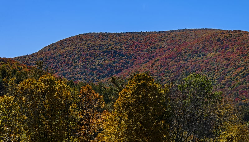
Thomas Cole Mountain
Mountain in New York State. Thomas Cole Mountain is a mountain in Greene County, New York. The mountain is named after the artist Thomas Cole, who lived in the area and is regarded as the founder of the Hudson River School.
Thomas Cole Mountain is part of the Blackhead range, and is the fourth highest peak of the broader Catskill Mountains. Thomas Cole is flanked to the east by Black Dome (3,990 feet or 1,220 metres), and to the west by Camel's Hump (3,530 feet or 1,080 metres).
Thomas Cole Mountain stands within the watershed of Schoharie Creek, which drains into the Mohawk River, the Hudson River, and into New York Bay. The south side of Thomas Cole drains into East Kill, and thence into Schoharie Creek. The north side of Thomas Cole drains into Batavia Kill, and thence into Schoharie Creek.
Thomas Cole Mountain is within New York's Catskill Park.[25]
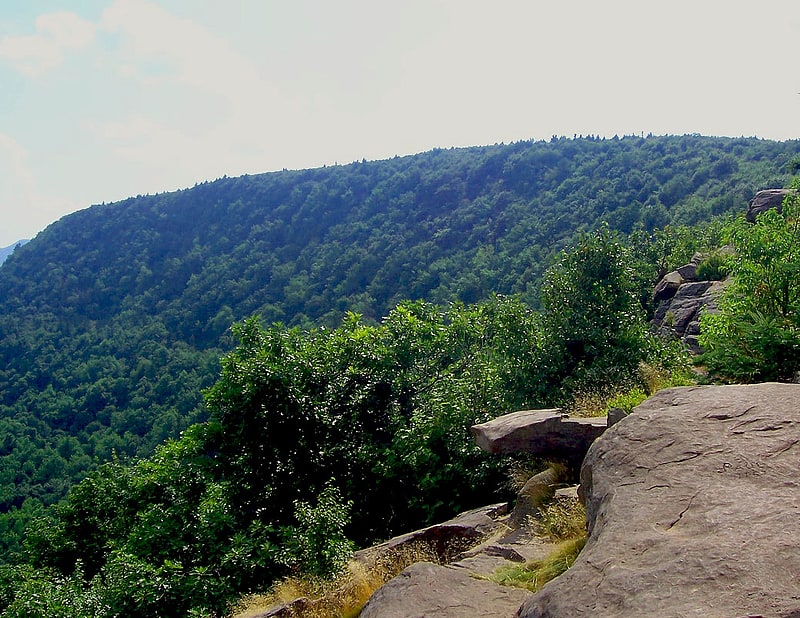
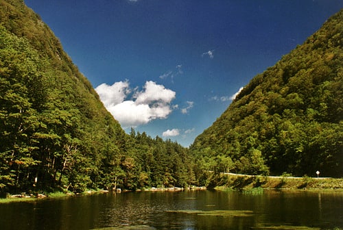
Platte Clove
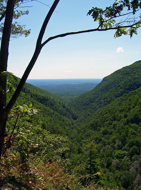
Platte Clove, sometimes Plattekill Clove, is a narrow and steep valley in the Catskill Mountains of New York.
The valley is situated between Kaaterskill High Peak and Roundtop Mountain to the north and Plattekill Mountain and Indian Head Mountain to the south. It is mostly in Greene County, although the lowest, eastern portions are in Ulster County. The stream that runs below is called Plattekill Creek.
A few hiking trails go through the Clove including Devil's Path and Huckleberry Point Trail. The area hosts bicycle racing events.[26]
Red Hill Fire Observation Station
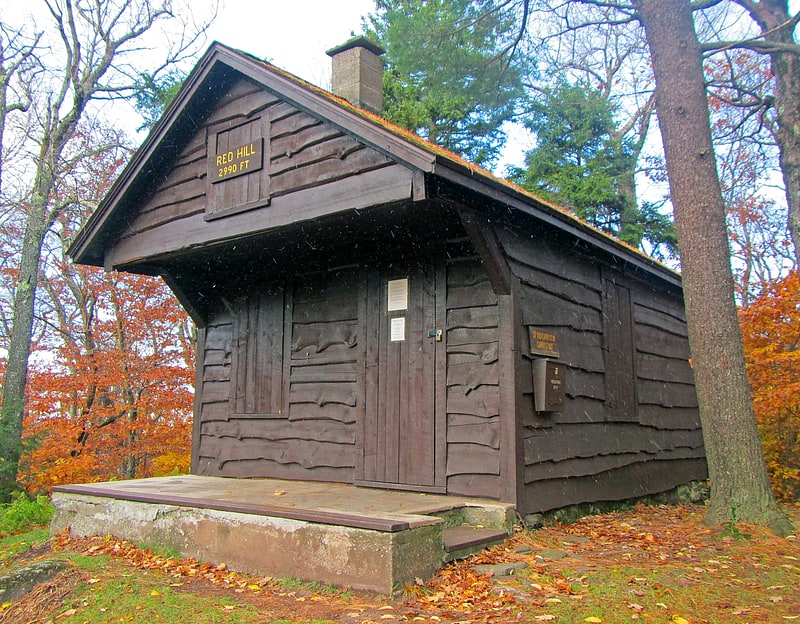
The Red Hill Fire Observation Station consists of a fire lookout tower, cabin and pit privy located on the summit of Red Hill, a 2,990-foot Catskill Mountain peak in Denning, New York, United States. It is the southernmost fire tower in the Catskill Park.
One of the last state towers built, in 1920, it filled a missing link in the Catskills' forest fire detection network. Except for a few brief periods of closure, observers working for the state conservation agencies manned the tower through 1990, making it the last fire tower closed in the Catskills. The abandoned tower and its views of the region remained a popular destination for local hikers, and it was slated to be torn down in accordance with state policy prohibiting nonessential structures on Forest Preserve land. Preservationists and forest historians campaigned to save and restore it and four other Catskill fire towers, and in the early 21st century they were listed on the National Register of Historic Places (NRHP). Red Hill's observer's cabin, included as part of the listing, is one of the oldest such buildings in New York.
A short trail was constructed to provide access to hikers, since the road used by the observers was later closed by the private landowner. Hikers continue to climb the peak and tower for its views of the Catskill High Peaks to the north.[27]
Mount Sherrill
Mountain in New York State. Mount Sherrill is a mountain located in Greene County, New York, and is named after Eliakim Sherrill, and is part of the Catskill Mountains. Mount Sherrill is flanked to the east by North Dome, and to the west by Balsam Mountain.
Mount Sherrill stands within the watershed of the Hudson River, which drains into New York Bay. The northern slopes of Mt. Sherrill drain via Bennett Brook and Newton Brook into the West Kill, then into Schoharie Creek, the Mohawk River, and, finally, the Hudson River. The west side of Mt. Sherrill drains into Bushnellsville Creek, thence into Esopus Creek, and the Hudson River. The southeast side of Mt. Sherrill drains through Peck Hollow into Esopus Creek.
Mount Sherrill is contained within the Westkill Mountain Wilderness Area of New York's Catskill State Park. There is no hiking trail over the mountain, although an extension of the Devil's Path west from West Kill Mtn. has been contemplated.[28]
Plateau Mountain
Mountain in New York State. Plateau Mountain is located in the town of Hunter in Greene County, New York, United States. It is part of the Devil's Path range of the Catskill Mountains. Plateau has a two-mile-long summit ridge above 3,500 feet. The highest point, at least 3,840 feet, is at the southeast end, facing Sugarloaf Mountain to the east across Mink Hollow Notch. It is the 12th-highest peak in the range Devils Tombstone is located west of Plateau Mountain. The northwest end faces Hunter Mountain to the west across 1,400-foot deep Stony Clove Notch.
Plateau Mountain stands within the watershed of the Hudson River, which drains into New York Bay. It feeds the Hudson by way of Esopus Creek through Stony Clove Creek from its western slopes, and through Beaver Kill from its southeast end. Its southwest slopes drain into Warner Creek, thence into Stony Clove Creek. The northeastern slopes of Plateau drain into Schoharie Creek, thence into the Mohawk River, and the Hudson River.
Plateau Mountain is within New York's Catskill State Park. The Devil's Path hiking trail traverses the summit ridge of Plateau. A section of the Long Path, a 350-mile (560 km) long-distance hiking trail through southeastern New York, climbs up the ridge from Silver Hollow Notch to the Devil's Path midway along the ridge. The Long Path then follows the Devil's Path east to the slopes of Indian Head Mountain on the Catskill Escarpment.[29]
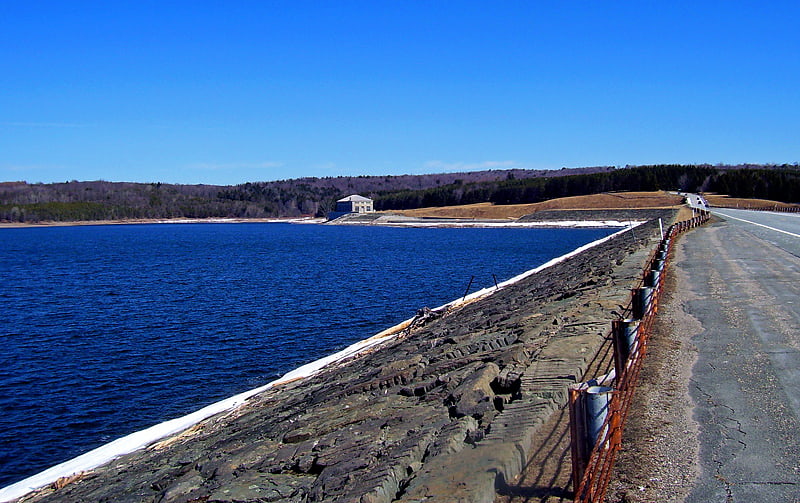
Ashokan Reservoir
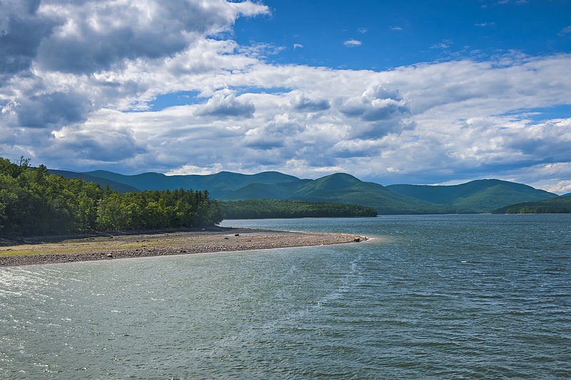
Reservoir in New York State. The Ashokan Reservoir is a reservoir in Ulster County, New York. It is at the eastern end of the Catskill Park, and is one of several in the region created to provide the City of New York with water. It is the city's deepest reservoir at 190 feet near the dam at the former site of Bishop Falls.[30]
Black Dome
Mountain in New York State. Black Dome is a mountain located in Greene County, New York. The mountain is the highest peak of the Blackhead Mountains range of the Catskills. Black Dome is flanked to the east by Blackhead, and to the west by Thomas Cole Mountain.
Black Dome stands within the watershed of Schoharie Creek, which drains into the Mohawk River, the Hudson River, and into New York Bay. The south side of Black Dome drains into East Kill, and thence into Schoharie Creek. The north side of Black Dome drains into Batavia Kill, and thence into Schoharie Creek.
Black Dome is within New York's Catskill Park.[31]
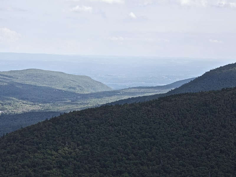
Kaaterskill High Peak
Mountain in New York State. Kaaterskill High Peak is one of the Catskill Mountains, located in the Town of Hunter in Greene County, New York, United States. It was once believed to be the highest peak in the entire range, but its summit, at 3,655 feet in elevation, places it only 23rd among the Catskill High Peaks. It is, however, the fourth most prominent peak in the range. Due to its situation as the easternmost High Peak, its summit is just outside the watersheds of New York City's reservoirs in the region.
Along with Round Top to the west, its distinctive ridgeline is a visual signature of the Catskills. Even today, it dominates the view of the range from the Hudson Valley. In the early 19th century, it was a frequent subject of works by Thomas Cole and other artists of the Hudson River school. Their works helped establish the Catskill Mountain House and other hotels around North-South Lake as the fashionable summer vacation spot for wealthy Americans of the era.
Despite that popularity, the mountain was admired from afar more often than it was climbed. Although it boasts the earliest recorded ascent of any Catskill peak, today it seems somewhat neglected, lacking an official trail to its summit. However, a well-used path does exist, and perhaps because of the light use the mountain gets it is very popular with the area's serious hikers, due to the views available from Hurricane Ledge south of the summit, and several other points of interest in the vicinity of the mountain.[32]
Blackhead Mountains
Mountain range in New York State. The Blackhead Mountains range is located near the northern end of the Catskill Mountains, in Greene County, New York, United States, where it divides the towns of Windham and Jewett. The three named peaks in the range — Thomas Cole Mountain, Black Dome, and Blackhead Mountain — are the fourth-, third-, and fifth-highest peaks in the Catskills, respectively. The gap between Thomas Cole and Black Dome is, at 3,700 feet, the highest in the Catskills.
To the west of Thomas Cole are two lesser, officially unnamed summits known locally as Camel's Hump (3,520 feet; 1,073 m) and Caudal (3,320 feet; 1,012 m). All except Blackhead can be climbed via the popular Black Dome Range Trail; a short spur from that trail leads to the Escarpment Trail atop Blackhead.
The range's distinctive rooster-comb profile is a visual signature of the Catskills. It can be easily seen from as far north as Albany and its suburbs, if there are views to the south to the range.
Van Loan Hill is located west of the Blackhead Mountains.[33]
Twin Mountain
Mountain in New York State. Twin Mountain is a mountain located in Greene County, New York. Twin gets its name from its two summits; the lower, 3,590-ft peak is about.5 miles to the southeast of the higher. The mountain is part of the Devil's Path range of the Catskill Mountains. To the northwest, Twin Mtn. is separated from Sugarloaf Mountain by Pecoy Notch; to the southeast, Twin Mtn. is separated from Indian Head Mountain by Jimmy Dolan Notch.
Twin Mountain stands within the watershed of the Hudson River, which drains into New York Bay. The northwest end and northeast side of Twin Mtn. drain into the headwaters of Schoharie Creek, thence into the Mohawk River, and the Hudson River. The southeast end of Twin Mtn. drains into Saw Kill, thence into Esopus Creek, and the Hudson River. The southwest side of Twin drains into Beaver Kill, thence into Esopus Creek.
Twin Mountain is contained within New York's Catskill State Park. The Devil's Path hiking trail traverses the summit ridge of Twin. The Long Path, a 350-mile (560 km) long-distance hiking trail through southeastern New York, is contiguous with this stretch of the Devil's Path.[34]
Dai Bosatsu Zendo Kongo-ji
Dai Bosatsu Zendo Kongo-ji, or International Dai Bosatsu Zendo Kongo-ji, is a Rinzai monastery and retreat center located in the Catskill Mountains of upstate New York. Maintained by the Zen Studies Society, Dai Bosatsu Zendo Kongo-ji is led by Shinge-Shitsu Roko Sherry Chayat Roshi. It is part of the Zen Studies Society, founded in 1956 to support the work of D.T. Suzuki.[35]