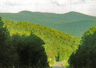
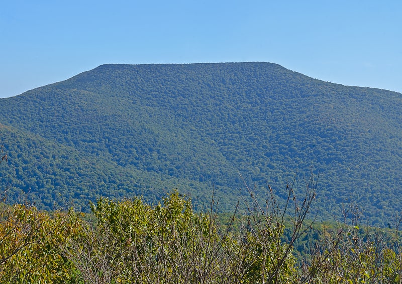
Discover 6 hidden attractions, cool sights, and unusual things to do in Slide Mountain Wilderness Area (United States). Don't miss out on these must-see attractions: Wittenberg Mountain, Peekamoose Mountain, and Slide Mountain. Also, be sure to include Cornell Mountain in your itinerary.
Below, you can find the list of the most amazing places you should visit in Slide Mountain Wilderness Area (New York).
Table of Contents
Wittenberg Mountain
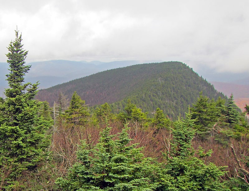
Mountain in New York State. Wittenberg Mountain, locally "the Wittenberg," is a mountain located in Ulster County, New York. The mountain is part of the Burroughs Range of the Catskill Mountains. Wittenberg is flanked to the southwest by Cornell Mountain and to the northeast by Terrace Mountain.
Wittenberg Mountain stands within the watershed of Esopus Creek, which drains into the Hudson River, and into New York Bay. The northwest and northeast slopes of Wittenberg Mtn. drain into Woodland Creek, thence into Esopus Creek. The southeast side of Wittenberg drains into Wittenberg Brook, thence into Maltby Hollow Brook, Bush Kill, and Esopus Creek at Ashokan Reservoir.
Wittenberg Mountain is within the Slide Mountain Wilderness of New York's Catskill State Park. The Long Path, a 350-mile (560 km) long-distance hiking trail from New York City to Albany, is contiguous with the section of the Burroughs Range Trail crossing the summits of Slide, Cornell, and Wittenberg. Wittenberg Mountain is one of the 35 peaks in the Catskills greater than 3,500 feet elevation, and is a required ascent for membership in the Catskill Mountain 3500 Club.[1]
Peekamoose Mountain
Mountain in New York State. Peekamoose Mountain is a mountain located in Ulster County, New York. The mountain is part of the Catskill Mountains. Peekamoose Mountain is flanked to the north by Table Mountain. The name Peekamoose is possibly an anglicization of an Algonquin word meaning 'broken off smooth', cf. Poke-O-Moonshine Mountain.
Peekamoose Mountain stands within the watershed of Rondout Creek, a tributary of the Hudson River, which drains into New York Bay. The east and southeast slopes of Peekamoose Mtn. drain into Rondout Creek. The southwest end of Peekamoose drains into Buttermilk Falls Brook, thence into Rondout Creek. The west side of Peekamoose drains into Bear Hole Brook, thence into Rondout Creek.
Peekamoose Mountain is within the Slide Mountain Wilderness of New York's Catskill State Park. The Long Path, a 350-mile (560 km) long-distance hiking trail from New York City to Albany, crosses the summits of Peekamoose and Table.[2]
Slide Mountain
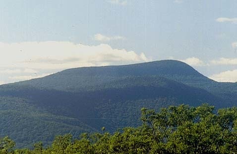
Peak in New York State. Slide Mountain is the highest peak in the Catskill Mountains of the U.S. state of New York. It is located in the town of Shandaken in Ulster County. While the 4,180-foot contour line on topographic maps is generally accepted as its height, the exact elevation of the summit has never been officially determined by the U.S. Coast and Geodetic Survey, and many informal surveys suggest the mountain may actually top 4,200 feet above sea level.
While it was not identified as the range's highest peak until the late 19th century, it has played a prominent role in Catskill history. Renowned naturalist John Burroughs wrote memorably of his climbs up Slide, and it helped get the Catskills added to New York's Forest Preserve. Bicknell's thrush was first identified on its summit.[3]
Cornell Mountain
Mountain in New York State. Cornell Mountain is a mountain located in Ulster County, New York. The mountain is part of the Burroughs Range of the Catskill Mountains. Cornell Mountain is flanked to the northeast by Wittenberg Mountain, to the southwest by Friday Mountain, and to the west by 4,180-foot Slide Mountain — the highest peak in the Catskills.
The northwest side of Cornell Mountain drains into Woodland Creek, thence into Esopus Creek, the Hudson River, and into New York Bay. The east and southeast sides of Cornell Mtn. drain into the Wittenberg Brook, thence into Maltby Hollow Brook, Bush Kill, and Esopus Creek. The southwest side of Cornell Mtn. drains into the headwaters of the east branch of the Neversink River, thence into the Delaware River, and into Delaware Bay.
Cornell Mountain is within the Slide Mountain Wilderness of New York's Catskill State Park. The Long Path, a 350-mile (560 km) long-distance hiking trail from New York City to Albany, is contiguous with the section of the Burroughs Range Trail crossing the summits of Slide, Cornell, and Wittenberg. Cornell Mountain is one of the 35 peaks in the Catskills greater than 3,500 feet elevation, and is a required ascent for membership in the Catskill Mountain 3500 Club.[4]
Panther Mountain
Peak in New York State. Panther Mountain is one of the Catskill High Peaks, located in the Town of Shandaken in Ulster County, New York. At approximately 3,720 feet in elevation, it is the 18th highest in the range. A combination of factors has led some geologists to believe the mountain is on the site of an ancient meteorite impact crater.
Its proximity to Slide Mountain, the highest Catskill peak, the relatively short distance required to climb the mountain from the south and the excellent views available from the mountain and nearby Giant Ledge have made Panther one of the most popular hikes in the range. Aspiring members of the Catskill Mountain 3500 Club must climb it twice, at least once during winter.[5]
Table Mountain
Mountain in New York State. Table Mountain is located in Ulster County, New York. The mountain is part of the Catskill Mountains. Table Mountain is flanked to the south by Peekamoose Mountain, and to the northeast by Lone Mountain.
The east end of Table Mountain drains into Rondout Creek, thence into the Hudson River, and into New York Bay. The south side of Table Mtn. drains into Bear Hole Brook, thence into Rondout Creek. The west end of Table Mtn. drains into Tray Mill Brook, thence into the East Branch of the Neversink River, the Delaware River, and into Delaware Bay. The north side of Table Mtn. drains into Donovan Brook, thence into the East Branch of the Neversink.
Table Mountain is within the Slide Mountain Wilderness of New York's Catskill State Park. The Long Path, a 350-mile (560 km) long-distance hiking trail from New York City to Albany, crosses the summits of Peekamoose and Table.[6]