Discover 8 hidden attractions, cool sights, and unusual things to do in Buckhorn Wilderness (United States). Don't miss out on these must-see attractions: Mount Mystery, Mount Walkinshaw, and Warrior Peak. Also, be sure to include Mount Townsend in your itinerary.
Below, you can find the list of the most amazing places you should visit in Buckhorn Wilderness (Washington).
Table of Contents
Mount Mystery
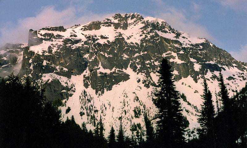
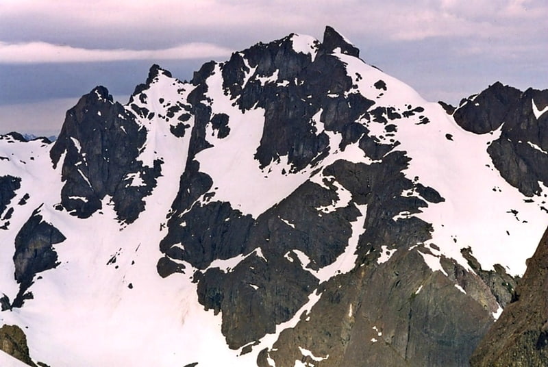
Mount Mystery is a prominent 7,639-foot mountain summit located in the Olympic Mountains in Jefferson County of Washington state. It is located within Olympic National Park on the Olympic Peninsula. Mount Mystery is the sixth-highest peak of the Olympic Mountains, after Mount Olympus, Mount Deception, Mount Constance, Mount Johnson, and Inner Constance. Its nearest higher neighbor is Mount Deception, 1.32 mi to the north-northwest. Little Mystery is a subsidiary summit south of Mount Mystery.
Mount Mystery is located in the eastern portion of the Olympic Mountains just south of Mount Deception at the headwaters of Deception Creek. This location puts it in the rain shadow of the Olympic Range, resulting in far less precipitation than Mount Olympus and the western Olympics receive.
Mount Mystery sits on the boundary between the drainage basins of the Dungeness River, to the north, and the Dosewallips River to the east. Deception Creek, a tributary of the Dosewallips River, drains the east and west slopes of Mount Mystery, including a small melting glacier on the east side referred to colloquially as Mystery Glacier.
Mount Mystery was given its name circa 1915 by G.A. Whitehead of the U.S. Forest Service because he admired its regal appearance in foggy weather.[1]
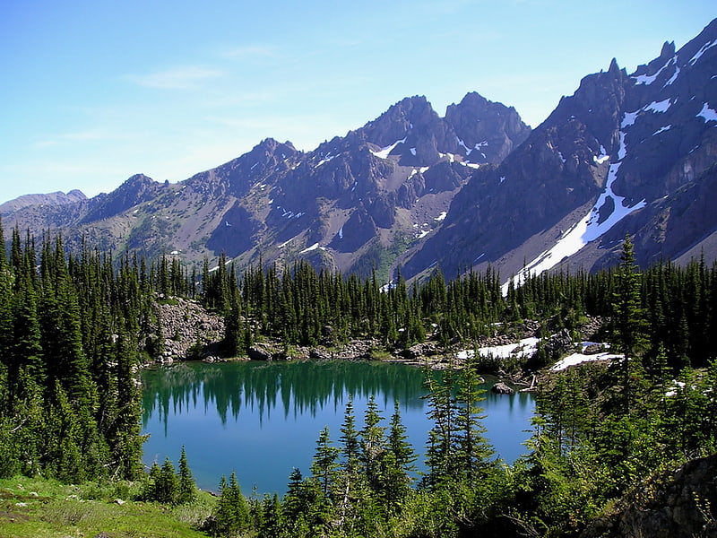
Mount Walkinshaw
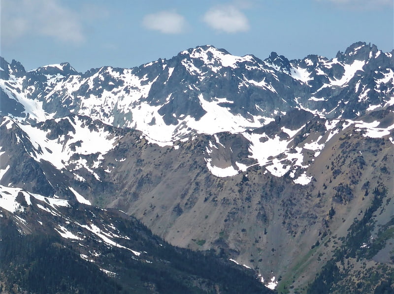
Mount Walkinshaw is a 7,378 feet mountain summit located in the Olympic Mountains, in Jefferson County of Washington state. It is situated within Olympic National Park, and is the northernmost peak in The Needles range, which is a subset of the Olympic range. Its nearest higher peak is Mount Clark, 0.9 mi to the south, and Gray Wolf Ridge arcs to the northeast. Mount Walkinshaw is set in the eastern portion of the Olympic Mountains within the drainage basin of the Dungeness River. This position puts it in the rain shadow of the Olympic Range, resulting in less precipitation than Mount Olympus and the western Olympics receive.[2]
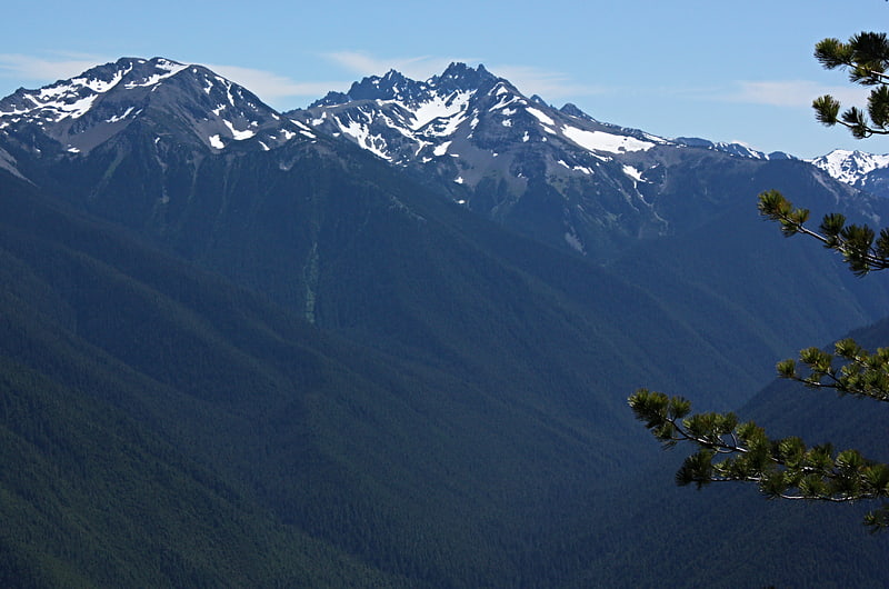
Warrior Peak
Warrior Peak is a 7,320+ ft double summit mountain located in Olympic National Park in Jefferson County of Washington state. Warrior is the 11th highest peak in the Olympic Mountains Range. The southeast summit is the slightly higher of the two summits, the northwest peak is estimated at 7285 feet elevation. Warrior Peak is easy to identify from Seattle, since it appears as the first prominent peak immediately north of Mount Constance, which is the dominant peak on the skyline. Warrior's nearest higher peak is in fact Mount Constance, 0.8 mi to the south-southeast. The first ascent of the mountain was made in 1945 by Fred Beckey, who solo climbed both summits, and named the mountain.[3]
Mount Townsend
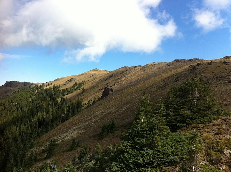
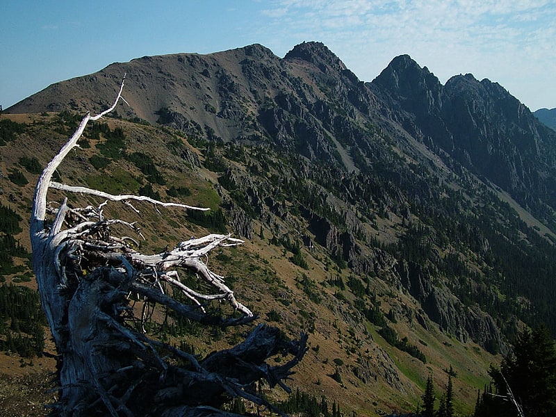
Mountain in Washington State. Mount Townsend is a mountain in the U.S state of Washington located within the Buckhorn Wilderness near Quilcene.[4]
Inner Constance
Inner Constance is a summit of the Olympic Mountains and is located in Jefferson County of Washington state. It's located near the eastern edge of Olympic National Park on the Olympic Peninsula. At 7,667 feet high, Inner Constance is the fifth highest peak of the Olympic Mountains, after Mount Olympus, Mount Deception, Mount Constance, and Mount Johnson. Its nearest higher peak is Mount Constance at 0.9 mi to the east. Within this nearly mile-wide separation resides a deep glacially carved canyon called Avalanche Canyon. Precipitation runoff on the north side of the peak drains into tributaries of the Dungeness River, whereas the south side drains into tributaries of the Dosewallips River.[5]
Buckhorn Mountain
Peak in Washington State. Buckhorn Mountain is a peak in the Olympic Mountains in the U.S. state of Washington. It is in Olympic National Forest on the Olympic Peninsula.[6]
Gilhooley Tower
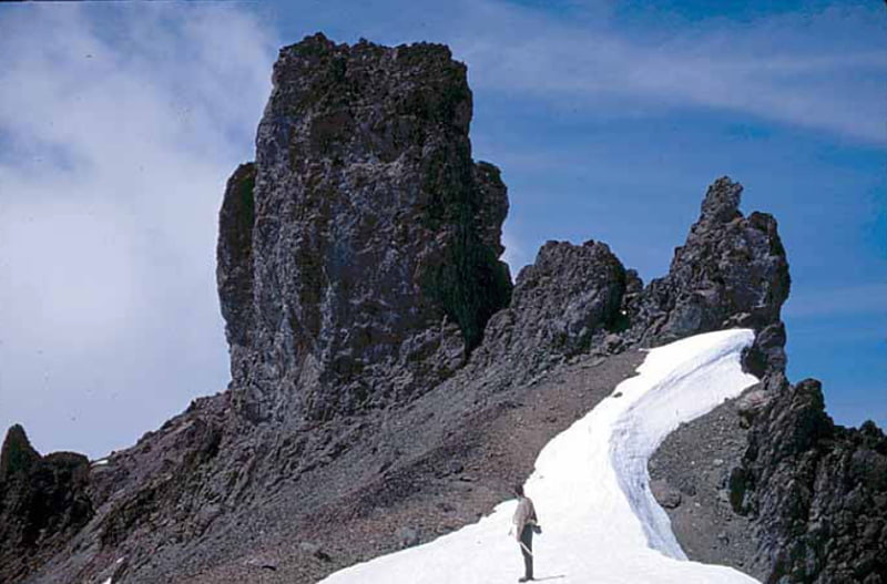
Gilhooley Tower is a basalt spire in the Olympic Mountains and is located in Jefferson County of Washington state. It is situated in Olympic National Park on the Olympic Peninsula. Its nearest higher peak is Mount Deception at 0.13 mi to the southeast. Precipitation runoff drains into tributaries of the Dungeness River and Dosewallips River.[7]
Martin Peak
Martin Peak is a mountain summit in the Olympic Mountains and is located in Jefferson County of Washington state. It is located within Olympic National Park. At 7,638 feet high, Martin Peak is the seventh-highest peak of the Olympic Mountains, and the second-highest peak in The Needles range, which is a subset of the Olympic range. Its nearest higher neighbor is Mount Johnson, 0.53 mi to the north-northwest. Precipitation runoff from this peak drains west into headwaters of Gray Wolf River, or east into Royal Creek, both of which are part of the Dungeness River drainage basin. Martin Peak was given its name based on the first ascent in 1940 by George W. Martin, and Elvin Johnson.[8]