Discover 20 hidden attractions, cool sights, and unusual things to do in Olympic National Park (United States). Don't miss out on these must-see attractions: Marymere Falls, Obstruction Peak, and Madison Creek Falls. Also, be sure to include Steeple Rock in your itinerary.
Below, you can find the list of the most amazing places you should visit in Olympic National Park (Washington).
Table of Contents
Marymere Falls
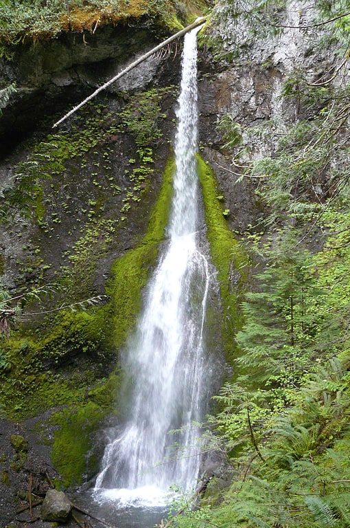
Marymere Falls is located in Olympic National Park near Lake Crescent in Washington, United States. The falls are accessed by a one-mile, well maintained, dirt trail through old-growth lowland forest consisting of fir, cedar, hemlock, and alder trees. Falls creek descends from Aurora Ridge and tumbles over Marymere Falls and then flows into Barnes Creek. It has a height of 90 feet. The falls is one of the more popular attractions in the area, due to ease of access and proximity to U.S. Highway 101.[1]
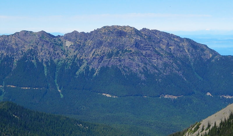
Obstruction Peak
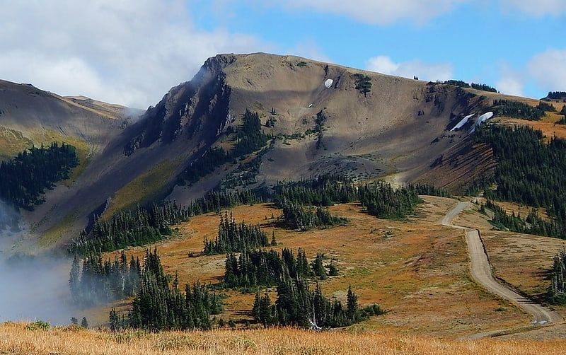
Summit in Washington State. Obstruction Peak is a 6,450 feet summit in the Olympic Mountains and is located in Clallam County of Washington state. It is set within Olympic National Park and is situated at the eastern end of Obstruction Point Road which is a narrow eight mile dirt road on Hurricane Ridge. The road ends below the south slope of Obstruction Peak, and a short hike leads to the summit. Its nearest higher peak is Elk Mountain, 0.46 mi to the northeast. Obstruction Peak is a major triple divide point such that precipitation runoff drains into tributaries of the Elwha River, Dungeness River, and Morse Creek. All three thence empty into the Strait of Juan de Fuca.[2]
Madison Creek Falls
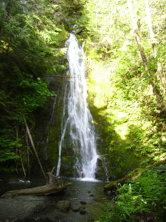
Madison Creek Falls is located within the Olympic National Park near the Elwha River, west of Port Angeles, Washington. The falls is about 50 feet high and has a light flow in a horsetail shape. Another higher falls is located above the first, but is completely inaccessible. The paved trail to the falls is very short and is wheelchair accessible.[3]
Address: Olympic Hot Springs Road, Olympic National Park
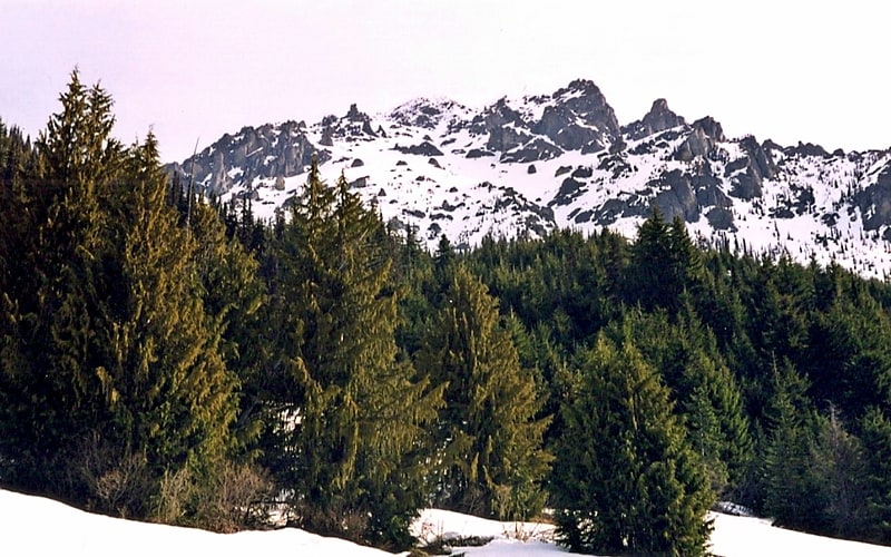
Steeple Rock
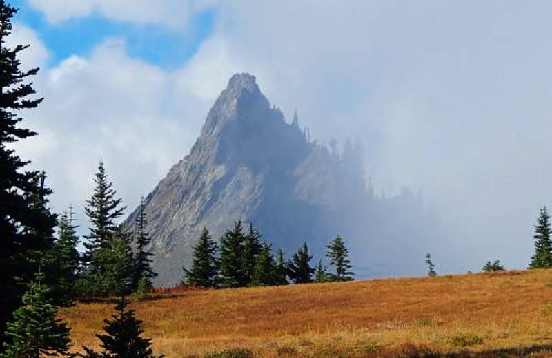
Steeple Rock is a 200 feet basalt pillar in the Olympic Mountains, and is located in Clallam County of Washington state. It sets next to the Obstruction Point Road on Hurricane Ridge within Olympic National Park. It's situated midway between Eagle Point and the Hurricane Ridge Visitor Center. Precipitation runoff drains into tributaries of the Elwha River and Morse Creek, thence into the Strait of Juan de Fuca.[4]
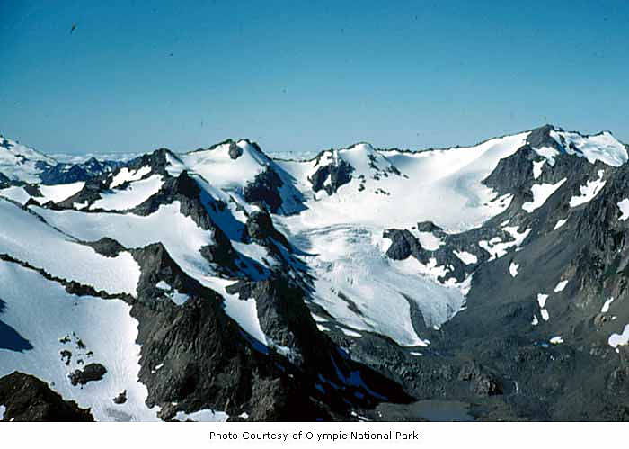
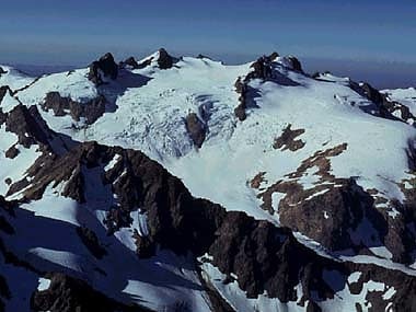
Mount Mathias
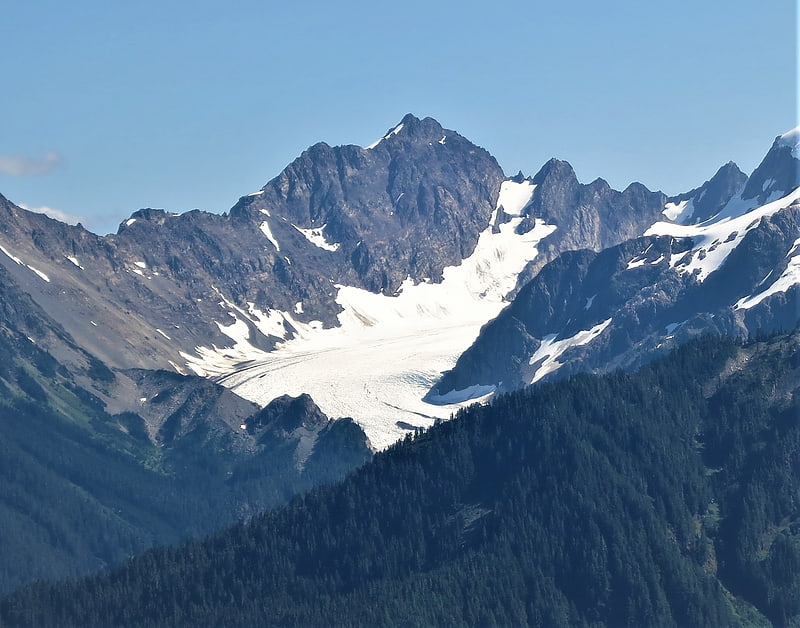
Mount Mathias is a 7,156-foot mountain summit located within Olympic National Park in Jefferson County of Washington state. Its nearest higher neighbor is Mount Olympus, 1.76 mi to the east. Mount Mathias is wedged between the massive Blue Glacier below its west slope, and the Hoh Glacier on the east side. Precipitation runoff from the mountain drains into the Hoh River.[5]
Mount Fairchild
Mount Fairchild, also known as Mount William Fairchild, is a 6,900-foot glaciated mountain summit located within Olympic National Park in Clallam County of Washington state. Mt. Fairchild is the second-highest peak in the Bailey Range, which is a subrange of the Olympic Mountains. Its nearest higher neighbor is Mount Carrie, 0.84 mi to the southwest, and Ruth Peak is set 0.92 mi to the south. In clear weather, the mountain can be seen from the visitor center at Hurricane Ridge. Precipitation runoff from the mountain drains into tributaries of the Elwha River.[6]
Mount Appleton
Summit in Washington State. Mount Appleton is a 6,000+ ft double summit mountain located in the Olympic Mountains, in Clallam County of Washington state. It is set within Olympic National Park and is situated northwest of Appleton Pass. Its nearest higher peak is South Appleton, 0.33 mi to the south. Precipitation runoff from Mount Appleton drains into the Sol Duc River, and Boulder Creek which is a tributary of the Elwha River, thence into the Strait of Juan de Fuca.[7]
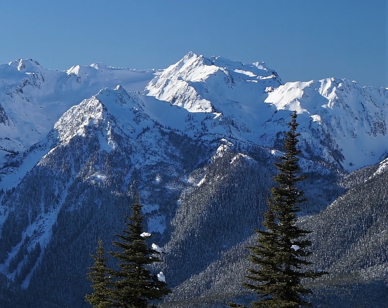
Mount Carrie
Mountain in Washington State. Mount Carrie is a 6,995-foot mountain summit located within Olympic National Park in Clallam County of Washington state. Mt. Carrie is the highest point in the Bailey Range which is a subrange of the Olympic Mountains. With a good eye and clear weather, the mountain can be seen from the visitor center at Hurricane Ridge. Its nearest higher peak is Mount Mathias which is an outlier of Mount Olympus, 6.24 mi to the south. Due to heavy winter snowfalls, Mount Carrie supports the Carrie Glacier in its northeast cirque, and Fairchild Glacier on the east slope. Precipitation runoff from the mountain drains into tributaries of the Elwha River and Hoh River. There is a scrambling route via the High Divide Trail and Cat Walk.[8]
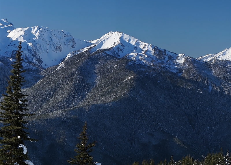
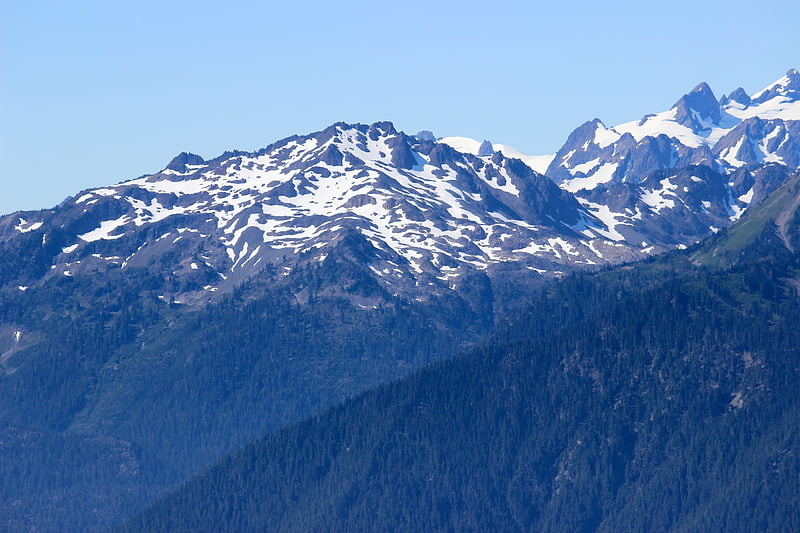
Olympic Mountains
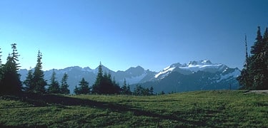
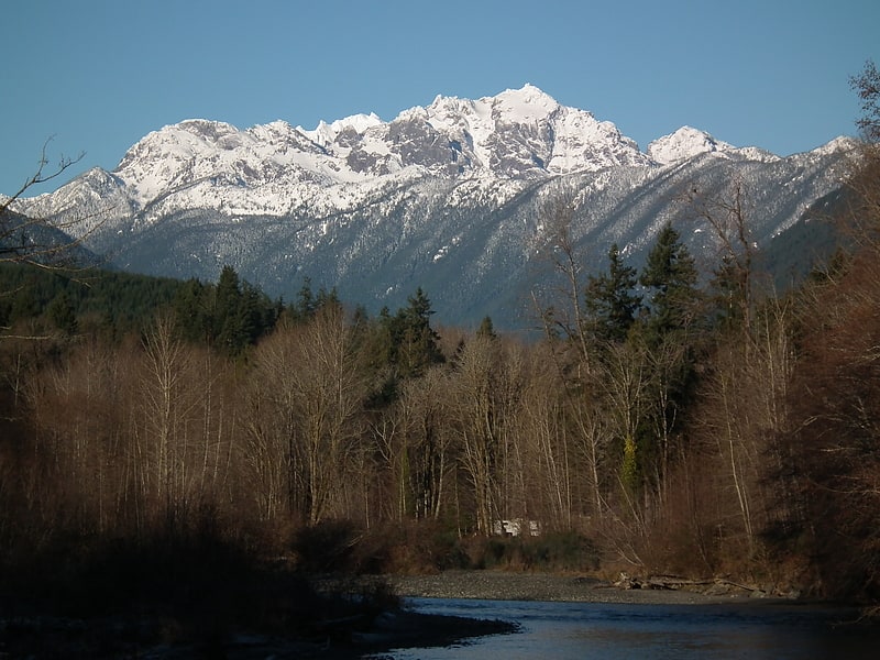
Mountain range in Washington State. The Olympic Mountains are a mountain range on the Olympic Peninsula of the Pacific Northwest of the United States. The mountains, part of the Pacific Coast Ranges, are not especially high – Mount Olympus is the highest at 7,965 ft; however, the eastern slopes rise out of Puget Sound from sea level and the western slopes are separated from the Pacific Ocean by the low-lying 20 to 35 km wide Pacific Ocean coastal plain. The western slopes are the wettest place in the 48 contiguous states. Most of the mountains are protected within the bounds of Olympic National Park and adjoining segments of the Olympic National Forest.
The mountains are located in western Washington in the United States, spread out across four counties: Clallam, Grays Harbor, Jefferson and Mason. Physiographically, they are a section of the larger Pacific Border province, which is in turn a part of the larger Pacific Mountain System.[9]
Mount Fitzhenry
Mount Fitzhenry is a 6,050-foot mountain summit located within Olympic National Park in Clallam County of Washington state. Mt. Fitzhenry is in the Bailey Range, which is a subrange of the Olympic Mountains. In clear weather, the mountain can be seen from the visitor center at Hurricane Ridge. Its nearest higher neighbor is Mount Fairchild, 1.57 mi to the south. Precipitation runoff from the mountain drains into tributaries of the Elwha River. Mount Fitzhenry is situated at the head of Fitzhenry Creek, and both are named for Edward Allen Fitzhenry, Clallam County surveyor from 1892-1900. President Woodrow Wilson appointed Fitzhenry as Washington Surveyor General in 1913, and he later served as Deputy State Land Commissioner.[10]
Hoh Rainforest
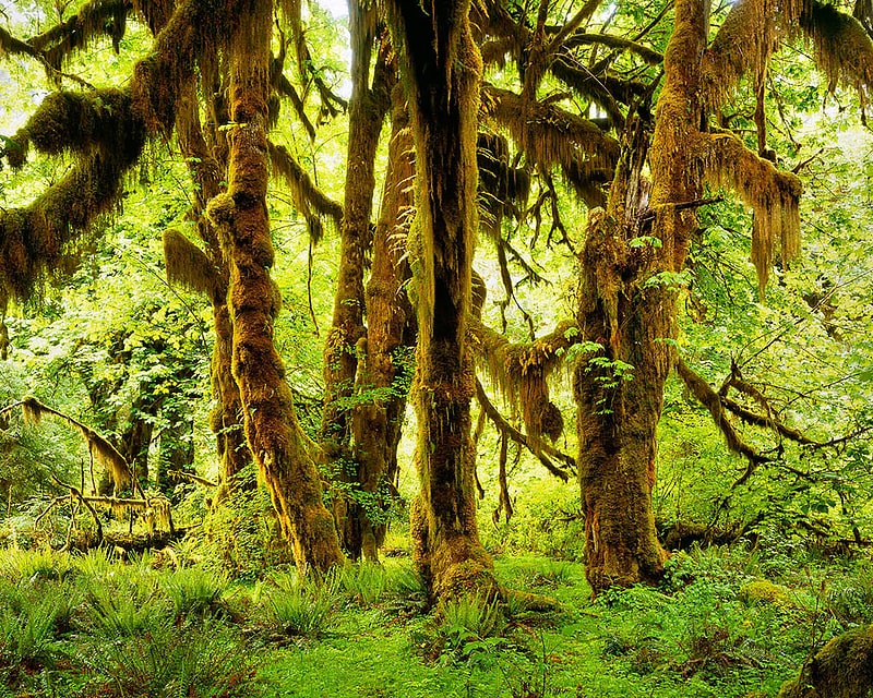
Info facility with rainforest exhibits. Hoh Rainforest is one of the largest temperate rainforests in the U.S. located on the Olympic Peninsula in western Washington state. It includes 24 miles of low elevation forest 394 to 2,493 feet along the Hoh River. The Hoh River valley was formed thousands of years ago by glaciers.
Within Olympic National Park, the forest is protected from commercial exploitation. Between the park boundary and the Pacific Ocean, 48 km (30 mi) of river, much of the forest has been logged within the last century, although many pockets of forest remain.[11]
Stephen Peak
Stephen Peak is a 6,418-foot mountain summit located within Olympic National Park in Jefferson County of Washington state. Stephen Peak is the fifth-highest peak in the Bailey Range, which is a subrange of the Olympic Mountains. In clear weather, the mountain can be seen from the visitor center at Hurricane Ridge, appearing to the left of Mount Olympus. Mount Ferry is set 2.26 mi to the southeast, and Stephen's nearest higher neighbor is Ruth Peak which is an outlier of Mount Carrie, 2.1 mi to the northwest. Precipitation runoff from the mountain drains into tributaries of the Elwha River and Hoh River. The first ascent of this peak was made in 1961 by Kent Heathershaw, Doug Waali, and Robert Wood.[12]
Mount Olympus
Highest peak in the Olympic Mountains. Mount Olympus, at 7,980 feet, is the tallest and most prominent mountain in the Olympic Mountains of western Washington state. Located on the Olympic Peninsula, it is also the central feature of Olympic National Park. Mount Olympus is the highest summit of the Olympic Mountains; however, peaks such as Mount Constance and The Brothers, on the eastern margin of the range, are better known, being visible from the Seattle metropolitan area.[13]
Rocky Peak
Summit in Washington State. Rocky Peak is a 6,218 feet summit in the Olympic Mountains and is located in Clallam County of Washington state. It is situated eight miles south of Port Angeles, Washington within Olympic National Park. Its nearest higher peak is Mount Angeles, 1.87 mi to the west. Klahhane Ridge connects these two peaks. Travelers on the scenic Hurricane Ridge Road traverse the lower south slope of Rocky Peak en route to the Hurricane Ridge visitor center. The mountain was named Rocky Peak by local people from the time of the earliest settlers in the area. Precipitation runoff from the north side of the peak drains into Rocky Creek, whereas the south slope drains into Morse Creek, thence into the Strait of Juan de Fuca.[14]
Mount Deception
Peak in Washington State. Mount Deception is a peak in the Olympic Mountains of Cascadia. It is in Olympic National Park on the Olympic Peninsula in the U.S. state of Washington.[15]
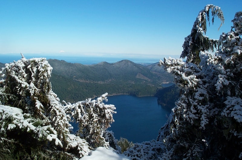
Lake Crescent
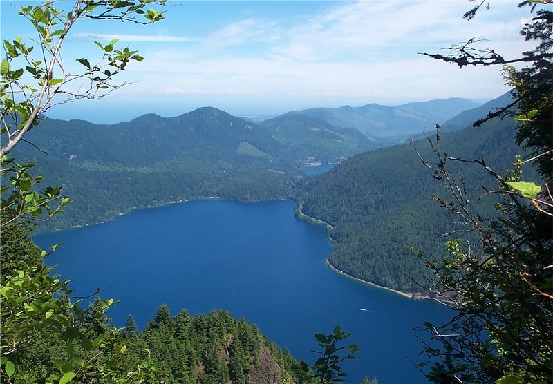
Mountain lake with trails and camping. Lake Crescent is a deep lake located entirely within Olympic National Park in Clallam County, Washington, United States, approximately 17 miles west of Port Angeles on U.S. Route 101 and nearby to the small community of Piedmont. At an official maximum depth of 624 feet it is officially the second deepest lake in Washington. Unofficial depth measurements of more than 1,000 feet have been rumored in the region for years, although this figure has recently been proven false after a lake-wide bathymetric survey was performed from 2013 to 2014 by Eian Ray and Jeff Enge. The results of this survey showed the maximum depth as being 596 feet. Using GIS statistical analysis, this survey also showed the lake contains approximately 0.5 cubic miles of fresh water.
Lake Crescent is known for its brilliant blue waters and exceptional clarity, caused by a lack of nitrogen in the water which inhibits the growth of algae. It is located in a popular recreational area which is home to a number of trails, including the Spruce Railroad Trail, Pyramid Mountain trail, and the Barnes Creek trail to Marymere Falls. The Spruce Railroad Trail follows the grade of what was once the tracks of a logging railroad along the shores of the lake. Following this trail on the north side of the lake, one can find the entrance to an old railroad tunnel as well as "Devils Punch Bowl", a popular swimming and diving area.[16]
Pyramid Mountain
Mountain in Washington State. Pyramid Mountain is located high above Lake Crescent's north shore. Once known as Sugarloaf Mountain, it received its present name in 1928. It contains the ruins of an old fire lookout at the summit. It dominates the view from Barnes Point and Lake Crescent Lodge. It is accessible by trail from the Spruce Railroad Trail. On a clear day, Mount Baker is visible in the Cascade Range across the Puget Sound.
From the summit, it is easy to see the landslide that blocked Indian Creek and dammed Lake Crescent. Below the landslide is Lake Sutherland and the Indian Creek valley down to the Elwha River.[17]
Mount Constance
Peak in Washington State. Mount Constance is a peak in the Olympic Mountains of Washington and the third highest in the range. It is the most visually prominent peak on Seattle's western skyline. Despite being almost as tall as the ice-clad Mount Olympus to the west, Mount Constance has little in the way of glaciers and permanent snow because the eastern, and particularly this northeastern, portion of the Olympics receives far less precipitation. However the narrow and steep Crystal Glacier still exists on the mountain's north face, shaded by the bulk of the main peak and with a small lake at its terminus. In addition, the treeline is higher here than mountains to the west, also hinting at the drier alpine conditions.
By virtue of its position at the eastern edge of the Olympics, Mount Constance also enjoys spectacular vertical relief. For example, it rises over 6,900 feet (2,100 m) above the Dosewallips River to the south in only 3 horizontal miles (5 km). It is also only 12 miles (20 km) from the tidewater of Hood Canal. The summit of Mount Constance lies on the boundary between Olympic National Park and Buckhorn Wilderness. The Constance massif includes Mount Constance, Inner Constance, the twin peaks of Warrior to the north, as well as numerous subsidiary summits on rocky southern ridges enclosing the cirque basin that contains Lake Constance.[18]
Destruction Island Light
Lighthouse in Jefferson County, Washington. Destruction Island Lighthouse is a decommissioned lighthouse on Destruction Island, a rocky island that is part of the Quillayute Needles National Wildlife Refuge lying about 3 miles off the coast of Jefferson County, Washington, in the northwest of the United States.[19]
Goblins Gate
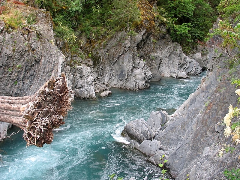
Goblins Gate, or Goblin Gates, is a narrow gorge, about 20 feet across, on the Elwha River in the U.S. state of Washington. It is located in Olympic National Park where the Elwha River enters Rica Canyon, 8.9 kilometres east-southeast of Olympic Hot Springs.
Toponymist Smitty Parratt described Goblins Gate: "...the Elwha River swerves at a severe right angle and tumbles into an extremely narrow cliffside opening. Resembling two large gates such as might have been found on a medieval castle, the rock portals appear to reach out and suck the waters of the Elwha into their grasp, only to send them plummeting down a precipitous canyon in a headlong rush to sea level."[20]