Discover 6 hidden attractions, cool sights, and unusual things to do in Bromo-Tengger-Semeru National Park (Indonesia). Don't miss out on these must-see attractions: Semeru, Ranu Pani, and Ranu Kumbolo. Also, be sure to include Mount Bromo in your itinerary.
Below, you can find the list of the most amazing places you should visit in Bromo-Tengger-Semeru National Park (East Java).
Table of Contents
Semeru
Volcanic mountain popular for climbing. Semeru, or Mount Semeru, is an active volcano in East Java, Indonesia. It is located in a subduction zone, where the Indo-Australian plate subducts under the Eurasia plate. It is the highest mountain on the island of Java. The name "Semeru" is derived from Meru, the central world mountain in Hinduism, or Sumeru, the abode of gods. This stratovolcano is also known as Mahameru, meaning "The Great Mountain" in Sanskrit.
Mount Semeru is one of the most popular hiking destinations in Indonesia.[1]
Address: Ranu Pane, Senduro, Bromo-Tengger-Semeru National Park
Ranu Pani
Lake in Indonesia. Ranu Pani or Ranupani is a volcanic lake in Ranu Pani Village, Senduro District, Lumajang Regency, East Java. Ranu Pani is part of the Bromo Tengger Semeru National Park. Initially, the area of Ranu Pani was around one hectare, but now it is estimated to be only 0.75 hectares due to the rapid sedimentation rate. The population of Ranu Pani is around 2,000 people.[2]
Ranu Kumbolo
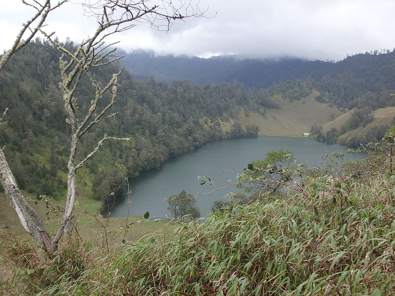
Mountain lake with camping and views. Ranu Kumbolo is a mountainous lake located in Bromo Tengger Semeru National Park, East Java, Indonesia. The lake is part of easiest route from Ranu Pani to Mount Semeru peak.[3]
Address: Taman Nasional Bromo Tengger Semeru, Bromo-Tengger-Semeru National Park
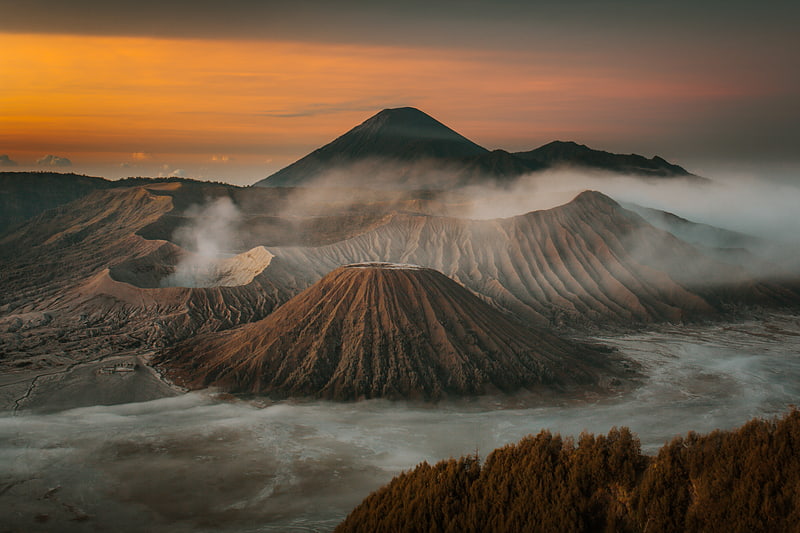
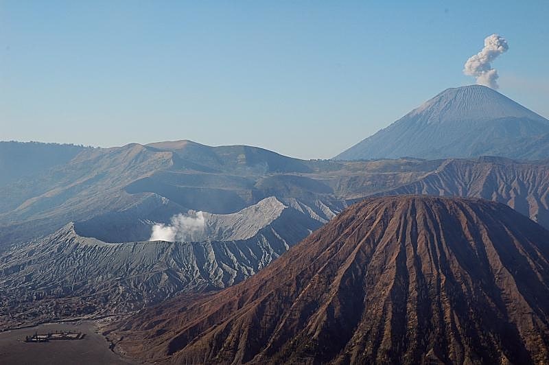
Mount Bromo
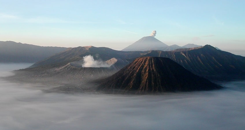
Also known as: Gunung Bromo
Volcanic mountain with stairs leading up. Mount Bromo is an active somma volcano and part of the Tengger mountains, in East Java, Indonesia. At 2,329 meters it is not the highest peak of the massif, but the most famous. The area is one of the most visited tourist destinations in East Java, and the volcano is included in the Bromo Tengger Semeru National Park. The name Bromo comes from the Javanese pronunciation of Brahma, the Hindu god of creation. Mount Bromo is located in the middle of a plain called "Sea of Sand", a nature reserve that has been protected since 1919.
A typical way to visit Mount Bromo is from the nearby mountain village of Cemoro Lawang. From there it is possible to walk to the volcano in about 45 minutes, but it is also possible to take an organized jeep tour, including stops at the viewpoint of Mount Penanjakan (2,770 m or 9,088 ft) (Indonesian: Gunung Penanjakan). The sights on Mount Penanjakan can also be reached on foot in about two hours. Depending on the level of volcanic activity, the Indonesian Center for Volcanology and Disaster Mitigation sometimes issues a warning not to visit Mount Bromo.[4]
Tengger massif
Also known as: Taman Nasional Bromo Tengger Semeru
National park in Indonesia. Bromo Tengger Semeru National Park, known locally as Taman Nasional Bromo Tengger Semeru is a national park located in East Java, Indonesia, to the east of Malang and Lumajang, to the south of Pasuruan and Probolinggo, and to the southeast of Surabaya, the capital of East Java. It is the only conservation area in Indonesia that has a sand sea, the Tengger Sand Sea, across which is the caldera of an ancient volcano from which four new volcanic cones have emerged. This unique feature covers a total area of 5,250 hectares at an altitude of about 2,100 meters. The massif also contains the highest mountain in Java, Mount Semeru, four lakes and 50 rivers. It is named after the Tengger tribe. The explosion of the volcano that created the caldera, happened ca. 45.000 years ago, in an event similar to the Krakatau eruption.
The Tengger Sand Sea has been protected since 1919. The Bromo Tengger Semeru National Park was declared a national park in 1982.[5]
Ranu Tompe
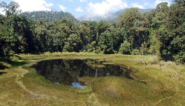
Lake in Indonesia. Ranu Tompe is a mountain lake located in Bromo Tengger Semeru National Park, East Java, Indonesia. Geographically, Ranu Tompe is isolated and far from human access. Ranu Tompe is only known from satellite images and maps of the area.[6]