Discover 5 hidden attractions, cool sights, and unusual things to do in Bears Ears National Monument (United States). Don't miss out on these must-see attractions: Indian Creek, Goosenecks State Park, and Valley of the Gods. Also, be sure to include Dark Canyon Wilderness in your itinerary.
Below, you can find the list of the most amazing places you should visit in Bears Ears National Monument (Utah).
Table of Contents
Indian Creek
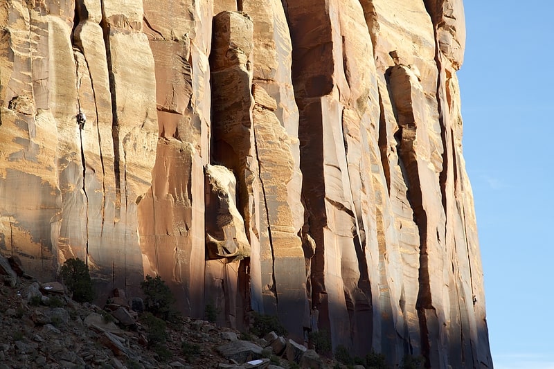
Indian Creek is a prominent climbing area in the northern part of the Bears Ears National Monument in the canyonlands area of San Juan County, Utah, United States that is renowned for its sandstone crack climbing. It has an elevation of 5,765 feet.[1]
Goosenecks State Park
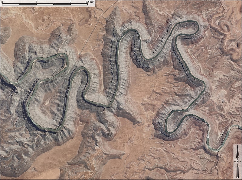
Primitive rock formations and hiking. Goosenecks State Park is a state park in the U.S. state of Utah, overlooking a deep meander of the San Juan River. The park is located near the southern border of the state a short distance from Mexican Hat, Utah. Millions of years ago, the Monument Upwarp forced the river to carve incised meanders over 1,000 feet deep as the surrounding landscape slowly rose in elevation. Eroded by water, wind, frost, and gravity, this is a classic location for observing incised meanders.
Goosenecks State Park is largely undeveloped. Primitive campsites with picnic tables are scattered back from the edge of the cliff, and vault toilets are available. Campers are advised to bring their own water, food, and other necessary gear.
The park received International Dark Sky Park designation by The International Dark-Sky Association in March, 2021. Night photography and stargazing are popular activities because there is little light pollution due to its remoteness.
There are no developed hiking trails in the park, but the Honaker Trail, a few miles to the northwest, provides access to the San Juan River.[2]
Valley of the Gods
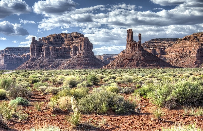
Valley in Utah. The Valley of the Gods is a scenic sandstone valley near Mexican Hat in San Juan County, southeastern Utah, United States. Formerly part of Bears Ears National Monument, Valley of the Gods is located north of Monument Valley across the San Juan River and has rock formations similar to those in Monument Valley with tall, reddish brown mesas, buttes, towers and mushroom rocks, remnants of an ancient landscape. On December 4, 2017, President Donald Trump issued a proclamation that reduced the area of Bears Ears National Monument, proclaimed by President Barack Obama in December 2016, with new monument boundaries that exclude the Valley of the Gods. The area remains protected public land administered as an Area of Critical Environmental Concern and managed by the Bureau of Land Management, as it was before the monument designation.[3]
Dark Canyon Wilderness
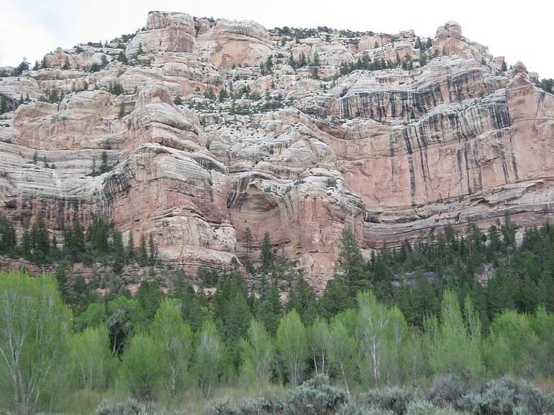
National monument in San Juan County, Utah. Dark Canyon Wilderness is a designated Wilderness Area in the heart of southeast Utah's canyon country, part of the Bears Ears National Monument. The wilderness is named for its high steep walls that narrow in the lower section so that they block the light in the morning and late afternoon. The roughly horseshoe-shaped wilderness is made up of the upper part of 40-mile-long Dark Canyon and two major tributaries, Woodenshoe Canyon and Peavine Canyon in the Manti-La Sal National Forest. These canyons all descend from pine-covered Elk Ridge northeast of Natural Bridges National Monument. Dark Canyon continues west within a U.S. Bureau of Land Management primitive area that is recommended for wilderness designation. The last four miles of the main canyon drop steeply through Glen Canyon National Recreation Area into Lake Powell.
On December 28, 2016 President Barack Obama proclaimed the 1.35 million acre Bears Ears National Monument, that includes both the Dark Canyon Wilderness and the adjacent Dark Canyon Primitive Area.
Life zones range from ponderosa pine and aspen-covered high country to desert vegetation in the bottom of Dark Canyon. High terraced castle-like sandstone walls tower 3,000 feet (910 m) above the canyon floors. Wildlife species include mule deer, some mountain lions, black bear and bighorn sheep. This diverse canyon country contains arches, springs, seeps and hanging gardens.
Water sources in Dark Canyon are often widely separated, and some have dried up entirely in recent drought years. Thunderstorms can result in powerful flash floods that scour the canyon streambeds.
Wilderness visitors may see evidence of the Ancestral Puebloan culture, with several ruins of cliff dwellings in the region.
All the trails dropping into the canyons are moderate but they can be difficult, if not impossible, to find and follow until you reach the bottoms of the canyons. Peavine Canyon contains a cherry-stem jeep trail. The Forest Service once recommended closing the area to vehicles but this corridor was kept open as a compromise in the Utah Wilderness Act of 1984.[4]
Moki Dugway
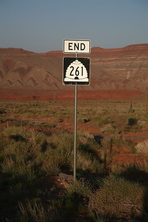
Highway in San Juan County, Utah. State Route 261 is a state highway located entirely within south-central San Juan County, Utah. It runs 34 miles north, from the junction of U.S. Route 163, to the junction with State Route 95, just east of Natural Bridges National Monument.
The highway is part of the Utah section of the Trail of the Ancients, a National Scenic Byway. It includes steep switchbacks as it traverses the Moki Dugway.[5]
Address: Hwy 261, Bears Ears National Monument