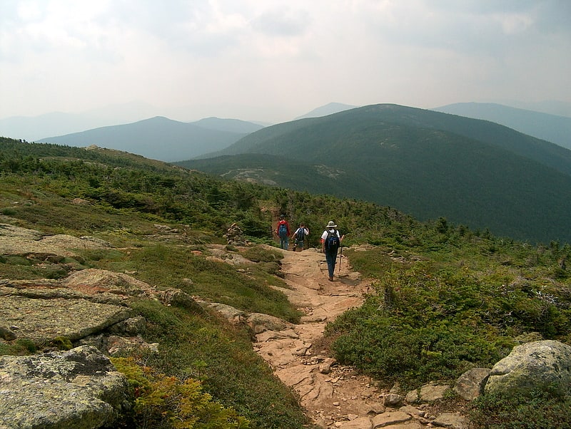
Discover 35 hidden attractions, cool sights, and unusual things to do in White Mountain National Forest (United States). Don't miss out on these must-see attractions: Mount Washington, Bretton Woods, and Diana's Baths. Also, be sure to include Rocky Gorge in your itinerary.
Below, you can find the list of the most amazing places you should visit in White Mountain National Forest (New Hampshire).
Table of Contents
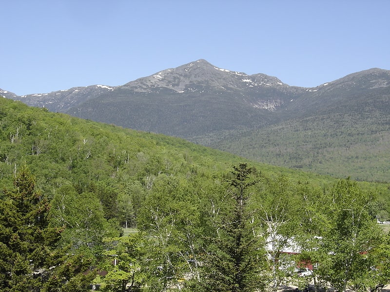
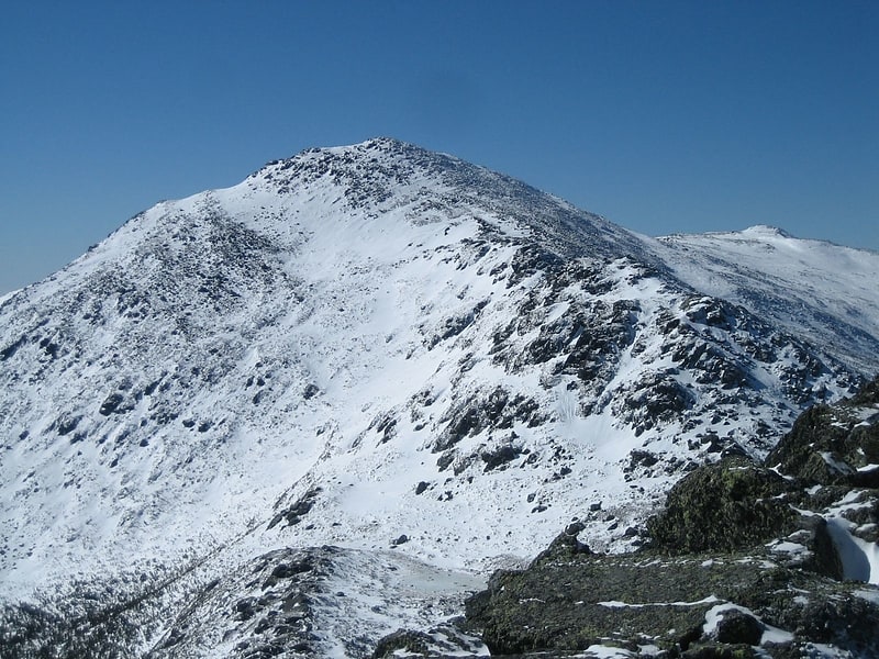
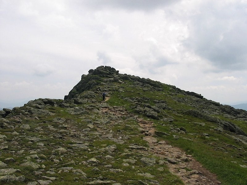
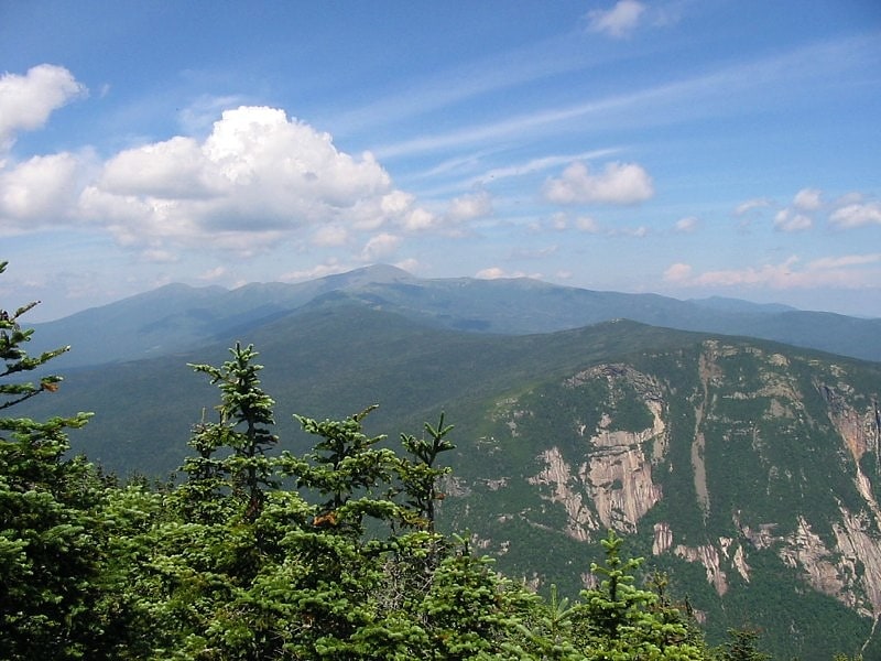
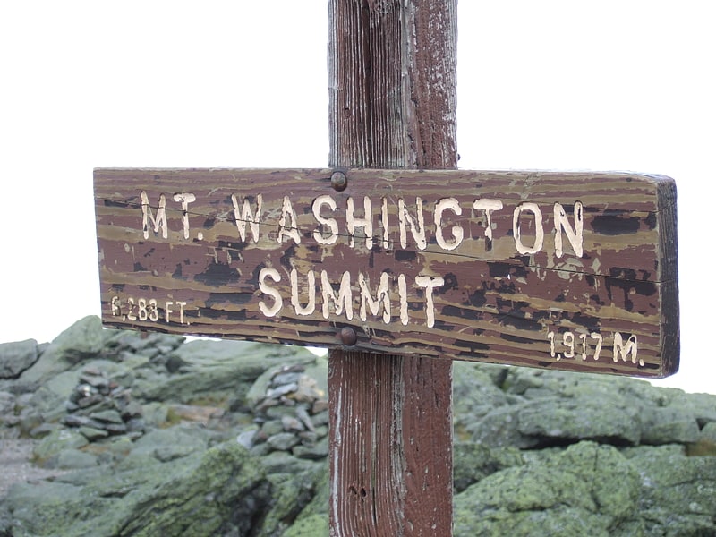
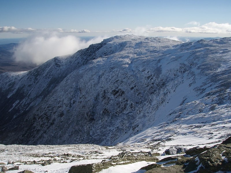
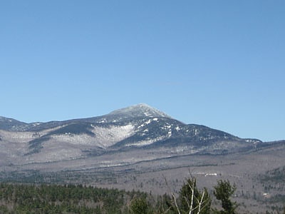
Mount Washington
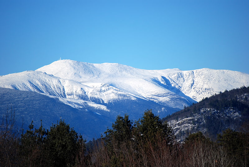
Peak in New Hampshire. Mount Washington is the highest peak in the Northeastern United States at 6,288.2 ft and the most topographically prominent mountain east of the Mississippi River.
The mountain is notorious for its erratic weather. On the afternoon of April 12, 1934, the Mount Washington Observatory recorded a windspeed of 231 miles per hour (372 km/h) at the summit, the world record from 1934 until 1996. Mount Washington still holds the record for highest measured wind speed not associated with a tornado or tropical cyclone.
The mountain is located in the Presidential Range of the White Mountains, in Coös County, New Hampshire. The mountain is in several unincorporated townships, with the summit in the township of Sargent's Purchase. While nearly the whole mountain is in the White Mountain National Forest, an area of 60.3 acres (24.4 ha) surrounding and including the summit is occupied by Mount Washington State Park.
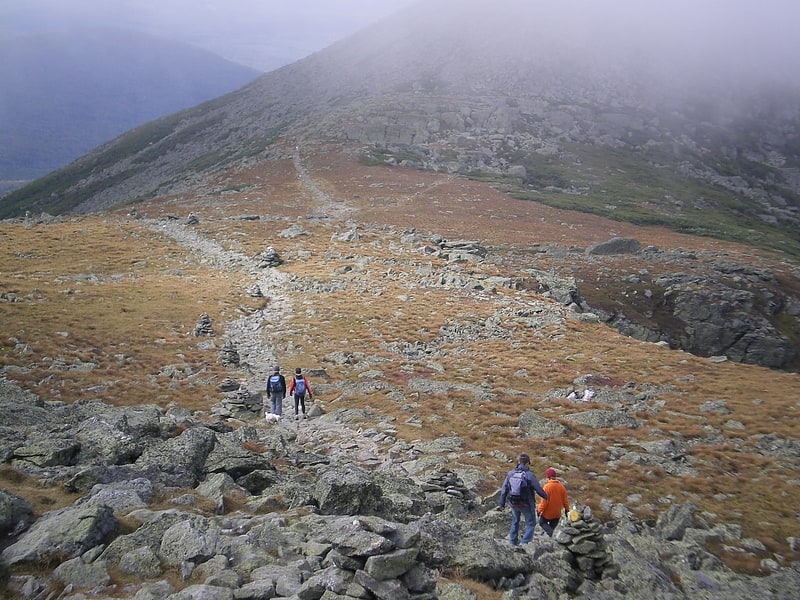
The Mount Washington Cog Railway ascends the western slope of the mountain, and the Mount Washington Auto Road climbs to the summit from the east. The mountain is visited by hikers, and the Appalachian Trail crosses the summit. Other common activities include glider flying, backcountry skiing, and annual cycle and running races such as the Auto Road Bicycle Hillclimb and Road Race.[1]
Address: Mount Washington Summit, White Mountain National Forest
Bretton Woods
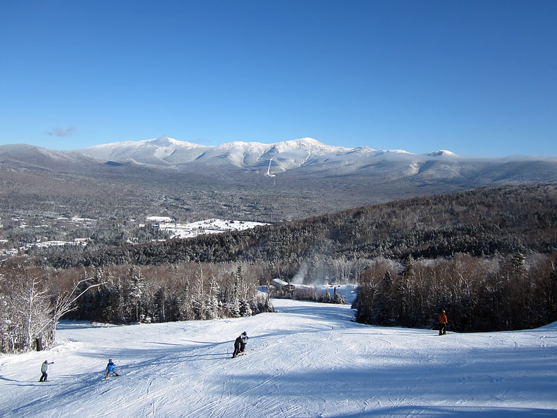
Ski area in Carroll, New Hampshire. Bretton Woods Mountain Resort is a ski area located in Bretton Woods, New Hampshire, across from the Mount Washington Hotel, which owns it.[2]
Address: 99 Ski Area Road, 03575 Bretton Woods
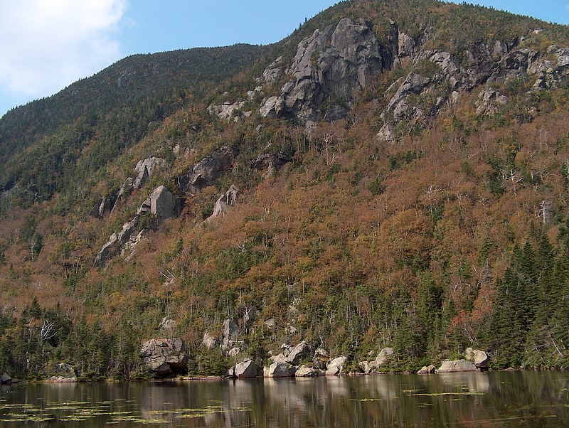
Diana's Baths
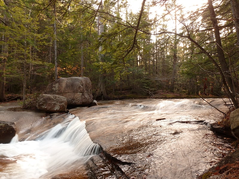
Waterfall in New Hampshire. Diana's Baths is a series of small waterfalls located in the southeastern corner of the town of Bartlett, New Hampshire, near the village of North Conway in the White Mountains of New Hampshire, United States. This historic site is within the White Mountain National Forest. The stream that flows into this waterfall is called Lucy Brook. The waterfalls were once the location of an old sawmill operation in the 1800s. After the sawmill was abandoned by the Lucy family in the 1940s, it was turned into a historic site that would be protected by the U.S. Forest Service. The total drop of the waterfalls is 75 feet, and the hike to the base of the waterfall is about 0.6 miles. Diana's Baths is now a popular family destination.
The intensity of the stream is related to the season; the stream flow is most intense in the springtime because of runoff from the winter snowmelt. Insect repellent is an essential from spring to fall.[3]
Address: Westside Rd, 03860 North Conway
Rocky Gorge
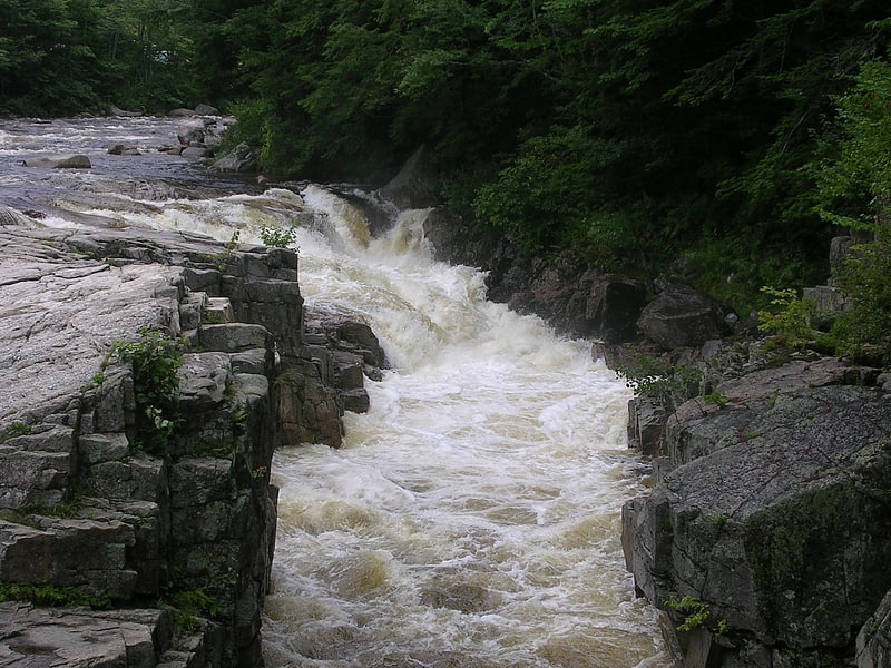
Rocky Gorge is a waterfall and the name of a scenic and picnic area along the Swift River in the White Mountain National Forest of New Hampshire, United States, next to the Kancamagus Highway. Swimming is not permitted in the falls at Rocky Gorge because of a near-fatal accident involving Dorothy Sparks in 1942. At least two other non-fatal accidents, each involving two people, have occurred since 1942.[4]
Address: Kancamagus Hwy, 03818 Albany
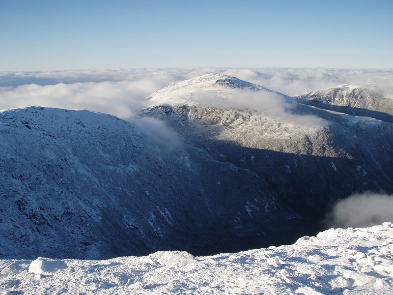
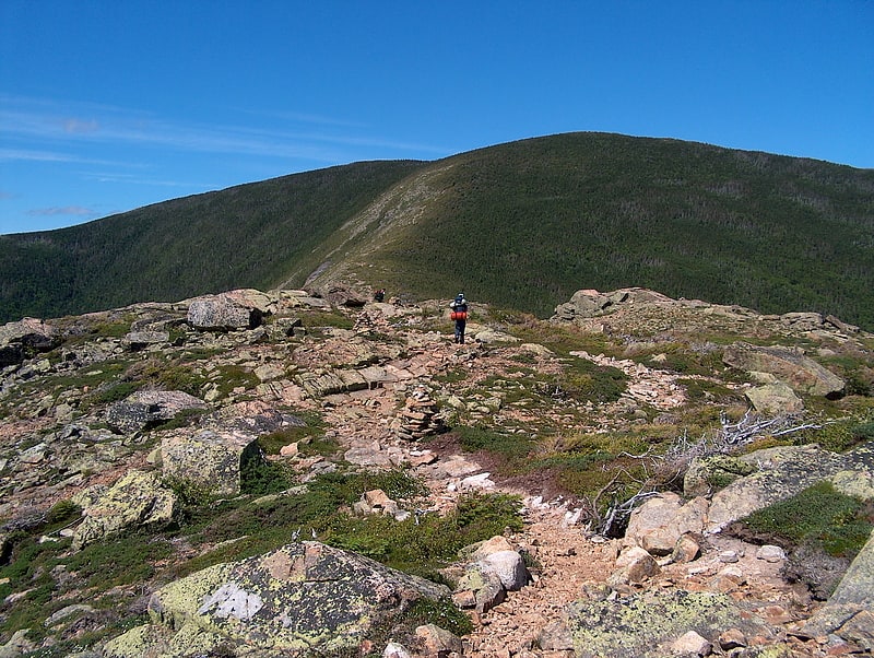
Lakes of the Clouds
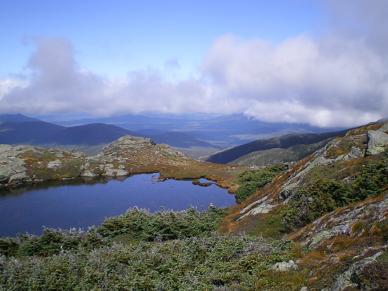
Tarn in New Hampshire. The Lakes of the Clouds are a set of tarns located at the 5,032 ft col between Mount Monroe and Mount Washington in the White Mountains of the U.S. state of New Hampshire. The lakes form the source of the Ammonoosuc River, a tributary of the Connecticut River. They are recorded by the Geographic Names Information System as the highest elevation lakes in the United States east of South Dakota.
The Lakes of the Clouds Hut, a rental hut and lodge for hikers operated by the Appalachian Mountain Club, is adjacent to the lakes, facing west. Lakes of the Clouds may be reached by hiking from Marshfield Station, on the Mount Washington Cog Railway, via the Ammonoosuc Ravine Trail (in approximately four hours). The area is also traversed by the Crawford Path (part of the Appalachian Trail) and the Dry River Trail.[5]
Address: Mount Washington, White Mountain National Forest
Lost River Reservation
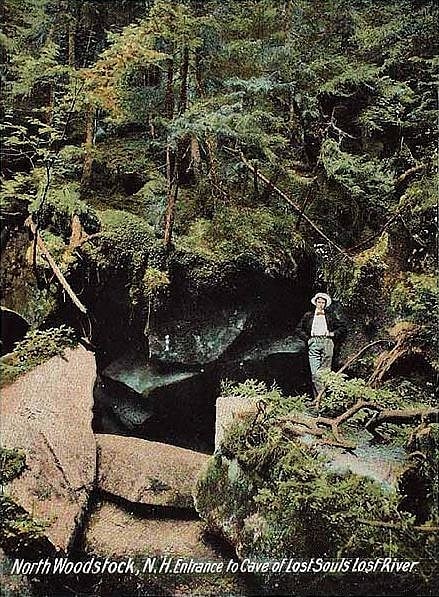
Compound grounds in Woodstock, New Hampshire. The Lost River Reservation is a protected area with a series of caves along a gorge in the White Mountains in Woodstock, New Hampshire, United States. Located 5 miles west of the village of North Woodstock on New Hampshire Route 112, Lost River Reservation is set in Kinsman Notch. One of the White Mountains' major passes, Kinsman Notch lies between Mount Moosilauke and Kinsman Ridge at just under 2,000 feet above sea level.[6]
Address: 1712 Lost River Rd, White Mountain National Forest
Mount Madison
Mountain in New Hampshire. Mount Madison is a 5,367-foot mountain in the Presidential Range of New Hampshire in the United States. It is named after the fourth U.S. President, James Madison.
Mountains in the Presidential Range are named for U.S. presidents, with the tallest (Mount Washington) named for the first president, the second tallest (Mount Adams) for the second president, and so on. However, due to a surveying error, Mount Monroe, named after the fifth president, James Monroe, is actually 22 feet (6.7 m) taller than Mount Madison.
There are many hiking trails on the mountain. A stretch of the Appalachian Trail traverses just below its summit on the Osgood Trail. The Madison Spring Hut, maintained by the Appalachian Mountain Club, is nestled between Mount Madison and Mount Adams and provides rustic lodging in the summer. Reservations generally need to be made far in advance.
Mount Madison is the northernmost peak in the Presidentials. Like most of the range, its summit is above treeline. Due to high winds and low temperatures, hypothermia is a danger even in the summer.[7]
Kearsarge North
Mountain in New Hampshire. Kearsarge North is a mountain located about 4 miles northeast of North Conway, Carroll County, New Hampshire. The U.S. Board on Geographic Names accepted the name "Pequawket Mountain" in 1915 but it was renamed Kearsarge North in 1957. The Pequawket are a subdivision of the Abenaki people who formerly lived in the area. It is sometimes referred to as Mount Kearsarge, a name officially assigned to a mountain in Merrimack County.
Kearsarge North is located on the eastern fringe of the White Mountains. It is drained by various brooks into the Saco River.
There are two hiking routes up Kearsarge. The first, and most popular, is the 3.1-mile (5.0 km) Mount Kearsarge North Trail, which ascends 2,600 feet (790 m) from the North Conway side of Hurricane Mountain Road, near Intervale. The Weeks Brook Trail, a much less-used 4.7-mile (7.6 km) route, approaches Kearsarge from the east, from a trailhead on Forest Road 317 in Chatham. It has a slightly higher vertical gain at approximately 2,740 feet.
An inn was built on the summit, only to be twice destroyed by storms. In 1909, the Appalachian Mountain Club granted the New Hampshire Forestry Commission use of the destroyed hotel for a fire lookout.[8]
Mount Adams
Mountain in New Hampshire. Mount Adams, elevation 5,793 feet above sea level, is a mountain in New Hampshire, the second highest peak in the Northeast United States after its nearby neighbor, Mount Washington. Located in the northern Presidential Range, Mount Adams was named after John Adams, the second President of the United States. It was given this name on July 31, 1820. To the northeast is Mount Madison and to the southwest is Mount Jefferson. From the summit, Mount Washington can be seen directly to the south.
There are two major subsidiary peaks of Mount Adams: Mount Sam Adams and Mount Quincy Adams, named after John Adams' cousin, Revolutionary leader Samuel Adams, and son, President John Quincy Adams, respectively, and two minor sub-peaks, Abigail Adams (named for John Adams' wife Abigail) and Adams 5. The northern side of the mountain ridge is located in Low and Burbank's Grant, and the end of Durand Ridge, and King Ravine, on the north side of Mount Adams are in the town of Randolph (formerly Durand). The entire south side of the mountain ridge is in Thompson and Meserve's Purchase.
The Appalachian Trail traverses the col between Mount Adams and Mount Sam Adams on the Gulfside Trail. The Randolph Mountain Club (RMC) maintains the trails and several huts and shelters high on Mount Adams' north side, including "The Perch", "Crag Camp", "The Log Cabin", and "Gray Knob". A large network of hiking and climbing paths lead south to the huts and ridges from several parking areas located on U.S. Highway 2.
The Aetherius Society claims that Mount Adams is one of 19 "holy mountains" around the world.[9]
Address: White Mountains, White Mountain National Forest
Mount Lincoln
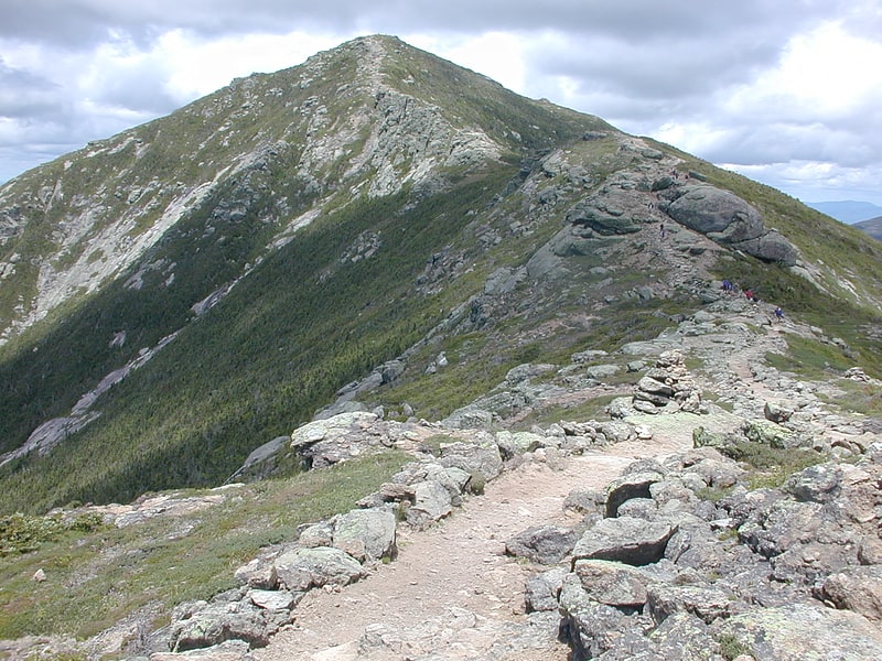
Mountain in New Hampshire. Mount Lincoln is a 5,089-foot-high mountain within the Franconia Range of the White Mountains of New Hampshire. Lincoln is located between Little Haystack and Mount Lafayette. All three overlook Franconia Notch. The west side of Lincoln drains into the main stem of the Pemigewasset River. The east side drains into Lincoln Brook, thence into the Franconia Branch of the Pemigewasset.
The Appalachian Trail, a 2,170-mile (3,490 km) National Scenic Trail from Georgia to Maine, traverses Franconia Ridge, including Lincoln.[10]
Mount Liberty
Mountain in New Hampshire. Mount Liberty is a 4,459-foot-high mountain in the White Mountains of New Hampshire. Overlooking Franconia Notch, it is part of Franconia Ridge, the second highest mountain group in the Whites after the Presidential Range. It lies south of Mount Lafayette, the highest summit along the ridge, and is listed among the Appalachian Mountain Club's "four-thousand footers".[11]
Mount Jefferson
Mountain in New Hampshire. Mount Jefferson is located in Coos County, New Hampshire, and is the third highest mountain in the state. The mountain is named after Thomas Jefferson, the third president of the United States, and is part of the Presidential Range of the White Mountains. Mount Jefferson is flanked by Mount Adams and Mount Clay.
The mountain has several interesting features, making it a popular hike. Two distinct ridges lead to its summit: Ridge of the Caps and Castle Ridge. The mountain is surrounded by the three dramatic glacial cirques of Jefferson Ravine, Castle Ravine, and the Great Gulf. Finally, Monticello Lawn is a large expanse of alpine sedge and rush near the otherwise talus-covered summit cone. When viewed from the Mount Washington Auto Road, Jefferson features an arrow-shaped bald patch pointing to its summit.
Mount Jefferson has a direct ascent along the Caps Ridge Trail, whose base, Jefferson Notch, is the highest point of any public road in New Hampshire at 3,009 feet (917 m). This route, gaining only 2,700 feet (823 m) vertically to the summit, results in it having the least distance of ascent of any Presidential mountain (about 2.5 miles). However, climbing over the "caps" involves some exposed scrambling and can be steep and challenging at times.[12]
Little Haystack Mountain
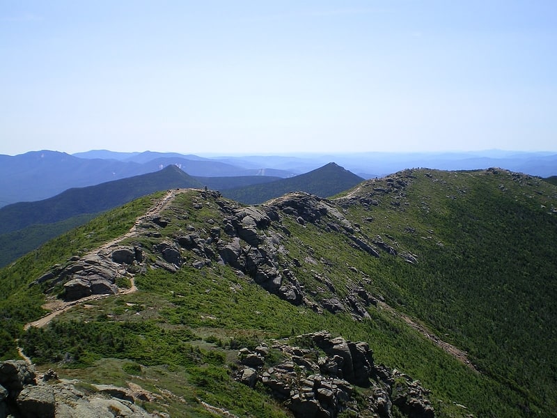
Peak in New Hampshire. Little Haystack Mountain is a peak on the Franconia Range of the White Mountains located in Grafton County, New Hampshire. It is flanked to the north by Mount Lincoln and to the southwest by Mount Liberty.
The Appalachian Trail, a 2,170-mile (3,490 km) National Scenic Trail from Georgia to Maine, traverses Franconia Ridge, including Little Haystack.
Although well over 4,000 feet (1,200 m) in height, the Appalachian Mountain Club doesn't consider Little Haystack a "four-thousand footer" because it stands less than 200 ft (61 m) above the col on the ridge from Lincoln.
The Falling Waters Trail is the most popular route up Little Haystack Mountain, leading 2.8 miles (4.5 km) from U.S. Route 3 to the summit on the crest of Franconia Ridge. One of the most popular hikes in the Northeastern United States is to traverse the summits of Little Haystack, Lincoln, and Lafayette in a 9-mile (14 km) loop.[13]
Mount Garfield
Mountain in New Hampshire. Mount Garfield is a mountain located in Grafton County, New Hampshire. The mountain is part of the White Mountains. Mt. Garfield is flanked to the east by South Twin Mountain, and to the southwest along Garfield Ridge by Mount Lafayette.
The south faces of Garfield drain into the Franconia Branch of the East Branch of the Pemigewasset River, through the Pemigewasset Wilderness, thence into the Pemigewasset and Merrimack rivers, and into the Gulf of Maine at Newburyport, Massachusetts. The north faces of Garfield drain into the north and south branches of the Gale River, thence into the Ammonoosuc and Connecticut rivers, and into Long Island Sound at Old Saybrook, Connecticut.
The Appalachian Trail, a 2,170-mile (3,500-km) National Scenic Trail from Georgia to Maine, runs along the ridge, across the summit of Garfield.[14]
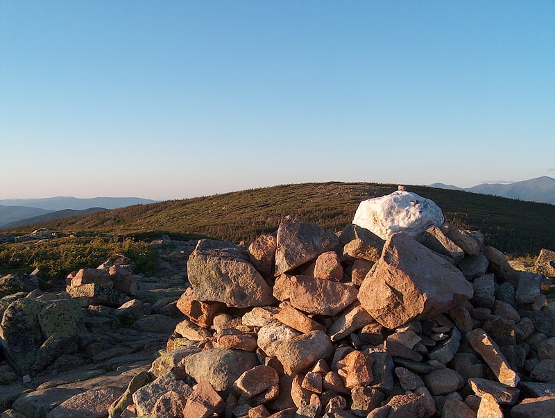
Mount Pierce
Mountain in New Hampshire. Mount Pierce is a mountain in the Presidential Range in the White Mountains of New Hampshire that is approximately 4,310 feet high. Formerly called Mount Clinton for 19th-century governor DeWitt Clinton of New York, in 1913 it was renamed after President Franklin Pierce, the only president born in New Hampshire, although it was several decades before the name was widely recognized. Its summit offers a wide view of New Hampshire's mountains.
The shortest trail route to the summit of Pierce is from a parking lot to the west of the mountain on Mount Clinton Road just off Route 302. The trail primarily follows the Crawford Path, the oldest continually used hiking trail in the United States. Crawford Path was established in 1819 by Abel and Ethan Crawford, who referred to the mountain as Bald Mountain. The Appalachian Trail and Webster Cliff Trail approach from Mount Jackson in the south and meet Crawford Path just north of the summit before continuing to the northeast. Mount Eisenhower and Mount Monroe lie on the ridge northeast of Mount Pierce. All three of these peaks are included on the peak-bagging list of four-thousand footers in New Hampshire.[15]
Mount Guyot
Mountain in New Hampshire. Mount Guyot is a mountain located in Grafton County, New Hampshire. The mountain is named after Professor Arnold H. Guyot of Princeton University, and is part of the Twin Range of the White Mountains. Mount Guyot is flanked to the northwest by South Twin Mountain, to the northeast by Mount Zealand, and to the south by Mount Bond. Guyot is on the northern boundary of the Pemigewasset Wilderness. The immediate area around the summit consists of high-altitude spruce-fir forest or krummholz.
The north face of Mount Guyot drains into the Little River, thence into the Ammonoosuc and Connecticut rivers, and into Long Island Sound in Connecticut. The southeast face of Guyot drains into Jumping Brook, thence into the North Fork of the East Branch of the Pemigewasset River, thence into the Pemigewasset and Merrimack rivers, and into the Gulf of Maine in Massachusetts. The southwest face of Guyot drains into the Franconia Branch of the East Branch of the Pemigewasset River.
The Appalachian Trail, a 2,170-mile (3,500-km) National Scenic Trail from Georgia to Maine, runs along the ridges from South Twin to Zealand, crossing the summit of Guyot. Although well over 4,000 feet (1,200 m) in height, the Appalachian Mountain Club doesn't consider Mount Guyot a "four-thousand footer" because it stands less than 200 ft (61 m) above the col separating it from South Twin Mountain.[16]
Mount Monroe
Mountain in New Hampshire. Mount Monroe is a 5,372-foot-high mountain peak southwest of Mount Washington in the Presidential Range of the White Mountains in New Hampshire, United States. It is named for American President James Monroe and is the fourth highest mountain on the 4000 footers list for New Hampshire. The Appalachian Trail skirts its summit, which is the next highest peak on or near the trail north of Mount Rogers in Virginia. The Lakes of the Clouds, and its AMC hut, lie nestled at the col between Mount Monroe and neighboring Mount Washington.
Lying between Mount Washington and Mount Eisenhower, Mount Monroe is inaccessible by road but may be reached by several hiking trails. The most direct route to its summit from the valley below is chiefly via the Ammonoosuc Ravine Trail which starts to the northwest near the base station of the Mount Washington Cog Railway. After ascending to the Lakes of the Clouds Hut, the eastern terminus of the trail, climbers proceed to Monroe's summit via the Crawford Path and then the Monroe Loop trail. Other routes to the summit ascend via the Crawford Path from Crawford Notch, singly or in combination with the Edmands Path from Mount Clinton Road to the west of the mountain, with the final ascent to the summit accomplished by the Monroe Loop. From the east, climbers can trek to Monroe via a combination of the Boott Spur, Tuckerman Ravine, or Lion Head trails, among others, traversing via intervening trails, or descend from the summit of Mount Washington, which may be reached on foot, by car or by the Cog Railway, along the Crawford Path or by other routes. Very frequently hikers will visit Monroe in combination with Washington or Eisenhower and sometimes with other nearby peaks.
Mount Monroe offers majestic views across the Lakes of the Clouds to its grand neighbor to the northeast, Mount Washington, over 900 feet (270 m) higher, to Mount Jefferson and Mount Clay north of Washington and to Boott Spur and Mount Isolation south of the dominant peak, as well as fine views to the west along the southern spine of the Presidential Range, through the Dry River valley, and out to more of the White Mountains to the south and west and to Vermont beyond.
As with Mount Washington, the upper reaches of Mount Monroe lie above tree-line in a sub-arctic tundra climate zone, characterized by highly variable and often very severe weather, especially from late fall through early spring. One distinguishing feature of the mountain is the largely flat Monroe Lawn south of the summit, traversed by the Crawford Path and home to several rare species of plant, including the endangered Robbins Cinquefoil, which survive in this harsh, outlying climate and terrain where other plants perish. Visitors traversing the Lawn are strictly limited to the trail in order to protect the many fragile flora which grow there.
Other notable features of the mountain include its subpeaks, "Little Monroe" to the west of the principal peak and approximately 175 feet (53 m) shorter, and Mount Franklin, southwest of the summit and nearly 5,000 feet (1,500 m) above sea level. The mountain, as with much of the Presidential Range, is characterized by steep walls on either side of the main ridge, to its northwest and southeast, making for strenuous climbs from the valley below and for numerous waterfalls - especially along the route followed by the Ammonoosuc Ravine Trail - and frequently scarred by landslides.[17]
Mount Bond
Mountain in New Hampshire. Mount Bond is a mountain located in Grafton County, New Hampshire, United States. The mountain is named after Professor George P. Bond of Harvard University, and is the southernmost extension of the Twin Range of the White Mountains. Mount Bond is flanked to the north by Mount Guyot.
Mount Bond has two subsidiary peaks, West Bond and Bondcliff (or "The Cliffs"). All three peaks are included on the Appalachian Mountain Club's list of "four-thousand footers".
Mount Bond is located within the Pemigewasset Wilderness Area. It drains to the east and west into the North Fork and Franconia Branch respectively of the East Branch of the Pemigewasset River, thence into the Pemigewasset and Merrimack Rivers, and into the Gulf of Maine in Massachusetts.[18]
Mount Eisenhower
Mountain in New Hampshire. Mount Eisenhower, formerly Mount Pleasant, is a mountain in the Presidential Range in the White Mountains of New Hampshire approximately 4,760 ft high. Named after President Dwight D. Eisenhower, its summit offers a 360° view. It is inaccessible by road.
The Crawford Path, carrying the Appalachian Trail, crosses the mountain near its summit. It separates from the summit loop trail at 4,400 feet (1,300 m), 0.3 mi (0.5 km) south of the summit, and rejoins it 0.3 mi (0.5 km) northeast of the summit, having made a net elevation gain of about 40 feet (12 m) and reached a maximum on Eisenhower of about 4,520 feet (1,380 m).
The mountain was known as Mount Pleasant until the New Hampshire Legislature voted in 1969 to name it after President Eisenhower, and the U.S. Board on Geographic Names agreed in 1970.
The shortest trail route to the summit of Eisenhower is from a parking lot on Mount Clinton Road, to its west-northwest, via primarily the Edmands Path. Several routes are available from points more or less southwest of it on Route 302; the most used of these (probably roughly equal in popularity to the Edmands route) is via the Crawford Path, starting from a parking lot on Mount Clinton Road, very near 302 and just north of the Highland Center in the Crawford Notch area. Mount Monroe lies on the ridge northeast of Mt. Eisenhower, and Mount Pierce to the southwest. All three of these peaks are included on the peak-bagging list of four-thousand footers in New Hampshire. Mount Franklin, an "unofficial" peak (not prominent enough to be included in the list), lies between Mount Eisenhower and Mount Monroe.[19]
Loon Mountain
Mountain in New Hampshire. Loon Mountain is a mountain in Lincoln and Livermore, New Hampshire, in Grafton County. It is in the White Mountain National Forest.
The 3,065-foot (934 m) mountain is known for Loon Mountain Ski Resort, which, like most New England mountain resorts, has expanded into an all-season recreation area.[20]
Mount Webster
Mountain in New Hampshire. Mount Webster is a mountain located on the border between Coos County and Carroll County, New Hampshire. The mountain, formerly called Notch Mountain, is named after Daniel Webster, and is the south-westernmost of the Presidential Range of the White Mountains. Mount Webster is flanked to the northeast by Mount Jackson; to the southwest it faces Mount Willey across Crawford Notch.
The west face of Mount Webster drains directly into the Saco River, thence into the Gulf of Maine at Saco, Maine. The north and southeast faces drain into the Saco via Silver Cascade and Webster Brook respectively.
Mount Webster is on the western boundary of the Presidential Range - Dry River Wilderness. The Appalachian Trail, a 2,170-mile (3,500-km) National Scenic Trail from Georgia to Maine, runs along the ridge of the Presidentials, across the summit of Webster.[21]
Mount Washington State Park
Park in Coos County, New Hampshire. Mount Washington State Park is a 60.3-acre parcel perched on the summit of Mount Washington, New Hampshire, the highest peak in the northeastern United States. Summer seasonal amenities include a cafeteria, restrooms, gift shops, the Mount Washington Observatory and its museum. The historic Tip Top House is located adjacent to the summit building and is open to visitors from early May to early October. The park is accessible by the Mount Washington Auto Road, the Mount Washington Cog Railway, the Appalachian Trail, or numerous other hiking trails from surrounding trailheads including Pinkham Notch, Crawford Notch and the Cog Railway base station.
The land forming the park was originally given to Dartmouth College in 1951 by the estate of the owner of the Cog Railway. Dartmouth sold 59 acres (240,000 m2) to the State of New Hampshire in 1964 for use as a park and then sold the final 8 acres (32,000 m2) in 2008 for $2.1M, after a long-term broadcasting lease had expired. A small segment of the summit is still owned by the Cog Railway and used as the upper terminus of the railway.[22]
Mount Whiteface
Mountain in New Hampshire. Mount Whiteface is a 4,019 ft mountain located in Grafton County, New Hampshire. The mountain is part of the Sandwich Range of the White Mountains. Whiteface is flanked to the northwest by Mount Tripyramid, and to the northeast by Mount Passaconaway. Whiteface is on the eastern border of the Sandwich Range Wilderness. To the east, between Whiteface, Passaconaway, and Mt. Wonalancet, lies The Bowl natural area, an unlogged cirque.
Mt. Whiteface lies within the watershed of the Saco River, which reaches the Gulf of Maine at Saco, Maine. The south side of Whiteface is drained by the Whiteface River, thence into the Cold River, Bearcamp River, Ossipee River, and the Saco River. The east side is drained by the Wonalancet River, thence into Swift River, and Bearcamp River. The north side is drained by Downes Brook, thence into another Swift River, and the Saco River.
The summit of Mt. Whiteface is in a wooded area along the Rollins Trail, approximately.3 miles (0.5 km) north of the top of the massive granite cliff for which the mountain is named. Many hikers reach the open area at the top of the cliff and do not realize the true summit is farther to the north.
The summit is popular among winter climbers, favoring the Blueberry Ledge trail for ascent.[23]
Address: NH Rte113A, White Mountain National Forest
Mount Clay
Peak in New Hampshire. Mount Clay is a peak located in Thompson and Meserve's Purchase in Coos County in the Presidential Range of the White Mountains of New Hampshire. It is a rise about 0.9-mile long and a few hundred feet tall, with summit elevation of 5,533 feet; it lies on the ridge joining the summits of Mount Washington, about 0.9-mile to the south-southeast, with that of Mount Jefferson, about 1.3-mile north.
The Appalachian Trail, coinciding there with the Gulfside Trail, rises about a hundred feet approaching it northbound, and passes 0.1-mile (0.16 km) from the summit, 200 feet (61 m) below it. The 1.2-mile (1.9 km) Mt. Clay Loop passes over the summit. The Jewell Trail is a popular choice as a relatively less strenuous route to Mt. Washington's summit; hikers ascending it, eastbound, from the vicinity of the cog rail base station join the Gulfside Trail about 0.4-mile (0.64 km) from Clay's summit and about 200 feet (61 m) below, and give up about 100 feet (30 m) in descending the southern tail of Clay, before resuming the ascent of Washington.
The mountain is named for Henry Clay, 19th-century senator and U.S. Secretary of State from Kentucky, known as "The Great Compromiser". In 2003, the New Hampshire state legislature, participating in a Reagan Legacy project, made it state law that Mt. Clay "shall hereafter be called and known as Mount Reagan," after President Ronald Reagan. The legal force of this is limited to actions by the state of New Hampshire. The U.S. Board on Geographic Names (BGN) voted in May 2010 not to change the name of the mountain. Maps used in connection with foot travel in the Presidentials are typically published by the U.S. Geological Survey (which adheres by law to BGN's naming), and by the Appalachian Mountain Club and two New England companies, all three of whom as of 2010 use "Clay" and make no mention of "Reagan".
Although well over 4,000 feet (1,200 m) in height above sea level, the Appalachian Mountain Club does not consider Mount Clay a "four-thousand footer" because it stands less than 200 feet (61 m) above the col on the ridge from Washington, making it a secondary summit of that peak.[24]
Wildcat Mountain
Mountain in New Hampshire. Wildcat Mountain is a mountain located in Coos County, northern New Hampshire, United States. The mountain is part of the Carter-Moriah Range of the White Mountains, on the east side of Pinkham Notch. Wildcat Mountain faces Carter Dome across Carter Notch to the northeast, and Mount Washington across Pinkham Notch to the west.
Wildcat Mountain has five summits — A, B, C, D, and E — along Wildcat Ridge, which curves two miles (3 km) to the south and west. Both A, at 4,422 feet (1,348 m), and D, at 4,062 feet (1,238 m), are considered "four-thousand footers". B, with an elevation of 4,305 feet (1,312 m), and C, at 4,285 feet (1,306 m), lack the topographic prominence to be considered more than subpeaks of Wildcat A. Likewise, the E peak, at 4,046 feet (1,233 m), is considered to be a subpeak of the higher D peak (the E peak was formerly believed to be the higher of the two, and used to appear on the official list of four-thousand footers, but current topographic maps reveal the D peak to be the higher summit).
The Appalachian Trail, which extends over 2,170 miles (3,490 km) from Georgia to Maine, climbs up from the Appalachian Mountain Club's Joe Dodge Lodge in Pinkham Notch and traverses the summits of the Wildcat Ridge, continuing on to Carter Dome.
The Wildcat Mountain Ski Area is one of the best-known alpine skiing resorts in New England, with lifts from the base on NH Route 16 in Pinkham Notch 2,112 ft (644 m) up to the D summit. The area has 49 trails on 225 acres (0.91 km2), including Polecat Trail—the longest ski trail in New Hampshire. The Wildcat Valley Trail, an ungroomed cross-country ski trail, leads from the summit down to Jackson, New Hampshire, dropping 3,240 ft (990 m) in 11.1 miles (17.9 km). Cut in 1972, it is one of the best-known routes in the extensive trail system maintained by the Jackson Ski Touring Foundation.[25]
Mount Carrigain
Mountain in New Hampshire. Mount Carrigain is a mountain located in Grafton County, New Hampshire. The mountain is named after Phillip Carrigain, NH Secretary of State, and is on the south side of the Pemigewasset Wilderness, the source of the East Branch of the Pemigewasset River in the heart of the White Mountains, between Franconia Notch and Crawford Notch. Carrigain is flanked to the northeast beyond Carrigain's Vose Spur by Mount Anderson and Mount Lowell across Carrigain Notch, and to the southwest by Mount Hancock. It has a fire tower at the summit, providing 360 degree views of the surrounding wilderness.[26]
Kinsman Mountain
Mountain in New Hampshire. Kinsman Mountain is a mountain located in Grafton County, New Hampshire. It is named after Nathan Kinsman, an early resident of Easton, New Hampshire, and is part of the Kinsman Range of the White Mountains. To the northeast, Kinsman is connected by The Cannon Balls ridge to Cannon Mountain.
The west side of Kinsman drains into Reel and Slide Brooks, thence into the Ham Branch of the Gale River, the Gale River, Ammonoosuc River, Connecticut River, and into Long Island Sound in Connecticut. The east side drains into Cascade Brook, thence into the Pemigewasset River, the Merrimack River, and into the Gulf of Maine in Massachusetts. The south face drains into Eliza Brook, thence into Harvard Brook, another tributary of the Pemigewasset.
The Appalachian Mountain Club considers both North and South Kinsman to be "four-thousand footers" because the divide between them gives the former more than 200 ft (61 m) of topographic prominence. South Kinsman is the sixth most prominent of the White Mountains, because it is the highest point between Franconia Notch and Kinsman Notch.
Hikers climbing North Kinsman Mountain, when reaching the viewless summit, should be sure to take a short bushwhack east to steep granite ledges falling off to Kinsman Pond and offering views of Cannon Mountain, South Kinsman, Franconia Ridge, and Lonesome Lake.[27]
Mount Tom
Mountain in New Hampshire. Mount Tom is a mountain located in Grafton County, New Hampshire, about 1.5 miles southwest of the height of land of Crawford Notch.
The mountain is named after Thomas Crawford, whose family ran three inns in Crawford Notch in the first half of the nineteenth century. Mount Tom is part of the Willey Range of the White Mountains. Tom is flanked to the south by Mount Field. Mt. Tom is drained on the east by Crawford Brook and on the west by the Zealand River. Both are tributaries of the Ammonoosuc River, which drains into the Connecticut and thence into Long Island Sound.
From 1829 until about 1850, Tom Crawford was the innkeeper at the Notch House, which was located at the top of the Notch. Around 1850, Tom Crawford started to build a larger hotel and ran into financial difficulty. Forced to sell out, he left the Notch at that time. The hotel he started became the Crawford House.
An alpine ski area associated with Tom Corcoran and the Crawford House was proposed for the northern slope of the mountain in the early 1970s.[28]
Boott Spur
Peak in New Hampshire. Boott Spur is a minor peak located in Coos County, New Hampshire. The mountain is named after Dr. Francis Boott, and is part of the Presidential Range of the White Mountains. Boott Spur stands on the shoulder of Mount Washington, above the south side of the headwall of Tuckerman Ravine.
Although well over 4,000 feet (1,220 m) above sea level in height, the Appalachian Mountain Club does not define Boott Spur as a "four-thousand footer" because it stands less than 200 feet (60 m) above the col on the ridge from Washington, making it a secondary summit of that peak.[29]
South Baldface
Mountain in New Hampshire. South Baldface is a 3,547-foot mountain in the town of Chatham, New Hampshire in the eastern White Mountains. It gets its name from its steep barren eastern face. Along with the neighboring summit North Baldface, it is a popular hiking destination, especially in the summer. The two mountains are ascended by the Slippery Brook, Baldface Knob, Baldface Circle, Meader Ridge, and Bicknell Ridge trails.[30]
Mount Moriah
Mountain in New Hampshire. Mount Moriah is a mountain located in Coos County, New Hampshire. The mountain is part of the Carter-Moriah Range of the White Mountains, which runs along the northern east side of Pinkham Notch. The summit is approximately 5 miles southeast of the center of the town of Gorham. Mount Moriah is flanked to the northeast by Middle Moriah Mountain and to the southwest by Imp Mountain. The summit is located on the Appalachian Trail and affords views in all directions.[31]
Galehead Mountain
Mountain in New Hampshire. Galehead Mountain is a mountain located in Grafton County, New Hampshire. The mountain is part of the Twin Range of the White Mountains. Galehead is flanked to the east by South Twin Mountain, and to the west by Mount Garfield. The summit is reached by the Frost Trail which departs from Galehead Hut. There are several ways to reach the hut from one's car, the Gale River Trail from the northwest being the most direct.
Galehead is so named because it is located above the headwaters of the North Branch of the Gale River. The north face of Galehead drains into the North Branch, thence via the Gale River into the Ammonoosuc and Connecticut rivers, and into Long Island Sound in Connecticut. The southeast face of Galehead drains into Twin Brook, thence into the Franconia Branch of the East Branch of the Pemigewasset River, through the Pemigewasset Wilderness, thence into the Pemigewasset and Merrimack rivers, and into the Gulf of Maine in Massachusetts. The west face of Galehead also drains into the Franconia Branch.
The Appalachian Trail, a 2,170-mile (3,490 km) National Scenic Trail from Georgia to Maine, crosses the northern face of Galehead, 0.2 mi (0.3 km) north — and 400 feet (120 m) below — the summit. The Appalachian Mountain Club's Galehead Hut is located in the col between Galehead and South Twin.[32]
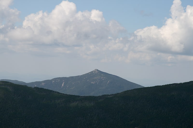
Mount Passaconaway
Mountain in New Hampshire. Mount Passaconaway is a 4,043 ft mountain in the Sandwich Range Wilderness of the White Mountain National Forest in Grafton County, New Hampshire, near Waterville Valley. It is named after Passaconaway, a 16th-century sachem of the Pennacook tribe, whose name was also attached to a small village in Albany, where the northern trailhead is now located.
It is ranked 42nd in elevation on the list of 48 White Mountains four-thousand footers. On the original 1931 list of 4000-footers, it was ranked 26th, with an elevation of 4,116 feet (1,255 m), although the 1931 topographic map shows it as 4,060 feet (1,240 m). The 1987 USGS topographic map indicates it is 4,043 feet, while the elevation recorded in the USGS Geographic Names Information System is 4,019 feet (1,225 m).
The thickly wooded, unmarked summit may be approached from trailheads to the north (on the Kancamagus Highway) or from Wonalancet to the south.
Passaconaway was originally named "North Whiteface" by Arnold Guyot, who probably was the first white person to ascend it. State geologist Charles Henry Hitchcock gave it its present name in honor of Passaconaway, a Pennacook chieftain. Passaconaway's children, Wonalancet and Nanomocomuck, have their names memorialized by the spurs of the mountain.[33]
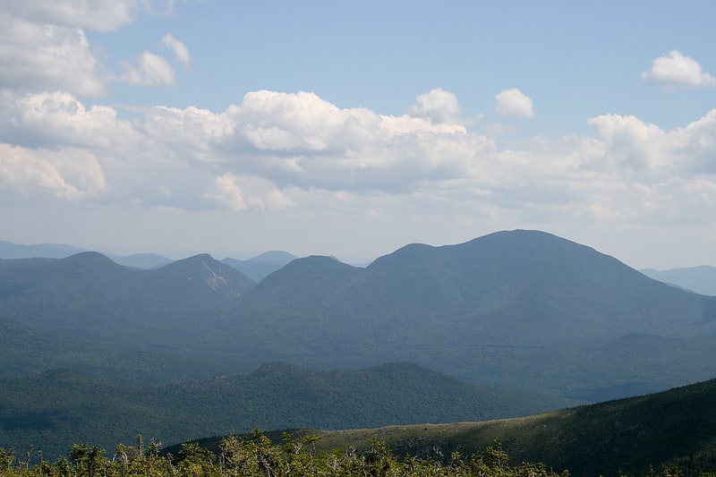
Presidential Range
Mountain range in New Hampshire. The Presidential Range is a mountain range located in the White Mountains of the U.S. state of New Hampshire. Containing the highest peaks of the Whites, its most notable summits are named for American presidents, followed by prominent public figures of the 18th and 19th centuries. The Presidential Range is notorious for having some of the worst weather on Earth, mainly because of the unpredictability of high wind speeds and whiteout conditions on the higher summits. Because of the poor weather conditions, the Presidential Range is often used for mountaineering training for those who go on to climb some of the world's highest mountains, including K2 and Everest.
Mount Washington, long home of the highest winds recorded on the surface of the Earth at 231 mph (372 km/h), is the tallest at 6,288 ft (1,917 m), followed by neighboring peaks Mount Adams at 5,793 ft (1,766 m) and Mount Jefferson at 5,712 ft (1,741 m). The range is almost entirely in Coos County.[34]
Mount Field
Mountain in New Hampshire. Mount Field is a mountain located in Grafton County, New Hampshire. The mountain is named after Darby Field, who in 1642 made the first known ascent of Mount Washington. Mount Field is the highest peak of the Willey Range of the White Mountains. Mt. Field is flanked to the northwest by Mount Tom, and to the southwest by Mount Willey.
Mt. Field stands on the borders of three watersheds. On its northeast side, it drains into the Saco River, and thence into the Gulf of Maine in Maine. On the south side, it drains into the North Fork Pemigewasset River, and thence into the East Branch, Pemigewasset River, and Merrimack River, which reaches the sea in Massachusetts. On the west side, Field drains into the Zealand River, and thence into the Ammonoosuc River, Connecticut River, and into Long Island Sound in Connecticut.[35]
Address: 44°11.77′N 71°26.00′W, 03574 Bethlehem