Discover 11 hidden attractions, cool sights, and unusual things to do in White Clouds Wilderness (United States). Don't miss out on these must-see attractions: D. O. Lee Peak, Born Lakes, and Merriam Peak. Also, be sure to include Castle Peak in your itinerary.
Below, you can find the list of the most amazing places you should visit in White Clouds Wilderness (Idaho).
Table of Contents
D. O. Lee Peak
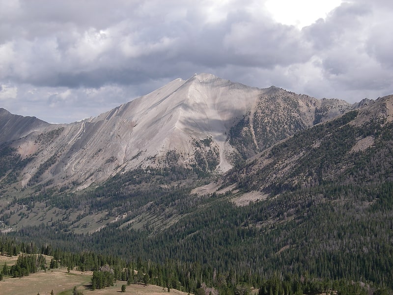
Peak in Idaho. D. O. Lee Peak, also known as Lee Peak, at 11,347 feet above sea level, is the third-highest peak in the White Cloud Mountains of the U.S. state of Idaho. It is one of the White Cloud Peaks and the 56th-highest peak in Idaho. It was named after Challis native David Oliver Lee, the first United States Forest Service ranger to be assigned to the Sawtooth Wilderness.
The peak is located 13 miles (21 km) southeast of Stanley in Sawtooth National Recreation Area of Custer County. It is situated 1.25 miles (2.01 km) south-southwest of Calkins Peak, its line parent, and rises to the west of Cirque, Sapphire, Cove, and the Born Lakes.[1]
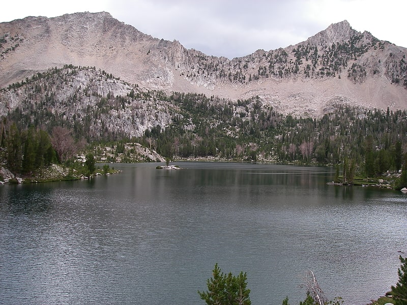
Born Lakes
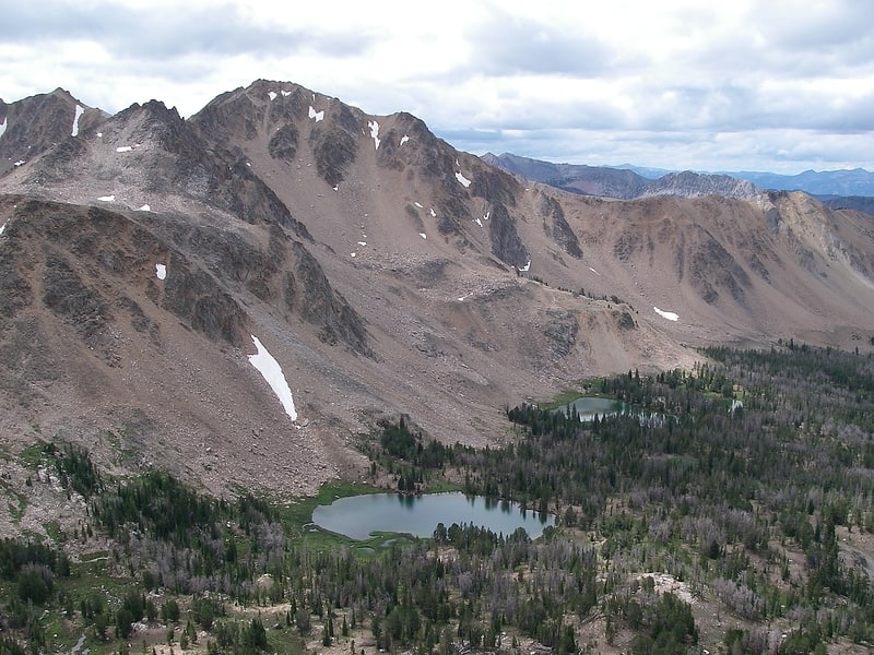
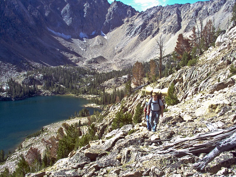
Lake in Idaho. The Born Lakes are a chain of eleven alpine and glacial Paternoster lakes in Custer County, Idaho, United States, located in the White Cloud Mountains in the Sawtooth National Recreation Area. The lakes are located on the upper portion of the Warm Springs Creek watershed, a tributary of the Salmon River. The Born Lakes surrounded by Patterson, Blackmon, and Lonesome Lake Peaks. Sawtooth National Forest trail 671 leads to the lakes. The individual lakes do have official names, and many of them have partially or nearly completely filled in with sediment.[2]
Merriam Peak
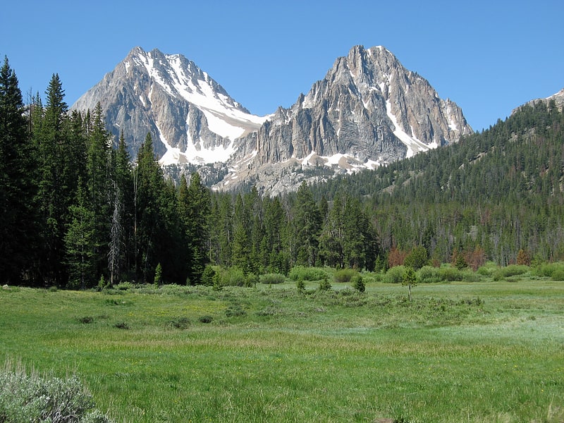
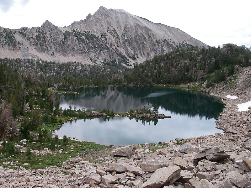
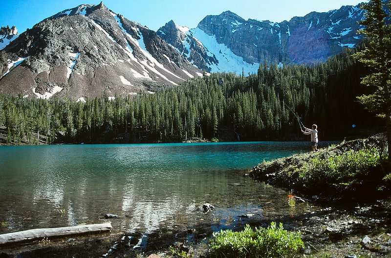
Peak in Idaho. Merriam Peak, at 10,920 feet is one of the peaks of the White Cloud Mountains of Custer County, Idaho. It was named for John H. Merriam who played an instrumental role in protecting the area from being mined for molybdenum. Merriam Peak is located in the middle of the range just north of Castle Peak, the highest point in the range. The peak is located in the White Clouds roadless area of Sawtooth National Recreation Area.
Merriam Peak is in the watershed of Little Boulder Creek, which is a tributary of the East Fork of the Salmon River. Castle Lake is at the peak's southern base, separating it from Castle Peak. Baker Lake is east of the peak, while Noisy and Quiet lakes are north and west of the peak, respectively.[3]
Castle Peak
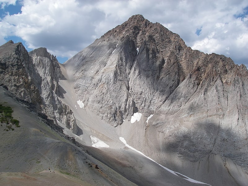
Mountain in Idaho. Castle Peak is a mountain in the western United States, the highest peak in the White Cloud Mountains of central Idaho and the Idaho Batholith. Located in Custer County, it is the 25th highest peak in the state, and the ninth most prominent.
Castle Peak is within the Cecil D. Andrus–White Clouds Wilderness, which is part of Sawtooth National Recreation Area in Custer County. The towns of Stanley and Challis are both about 21 miles (34 km) away, and Ketchum-Sun Valley area is about 27 miles (43 km) from the peak.
Castle Peak is managed by the U.S. Forest Service and the area surrounding the peak can be easily accessed. Camping is permitted anywhere is Sawtooth National Forest and the lakes surrounding Castle Peak provide excellent places to stay. The peak rises to the northeast of Chamberlain Basin and south of Castle Lake and Merriam Peak. There are trails from parking area to the vicinity of Castle Peak, although no trails go up the peak itself. The easiest route up Castle Peak is as class 3 scramble from the Chamberlain Basin.
A proposed open-pit molybdenum mine at the base of Castle Peak became a leading issue in the 1970 gubernatorial race, and advanced the formation of the Sawtooth NRA in 1972. In a rematch of the 1966 election, Cecil Andrus defeated incumbent Don Samuelson to become the state's first Democratic governor in nearly a quarter century, and Republicans did not regain the governorship until January 1995.[4]
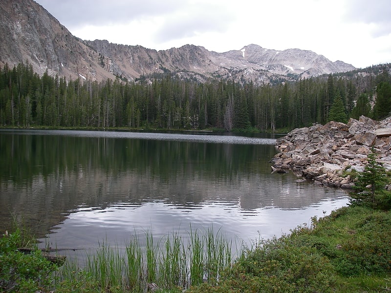
Quiet Lake
Lake in Idaho. Quiet Lake is an alpine lake in Custer County, Idaho, United States, located in the White Cloud Mountains in the Sawtooth National Recreation Area. While no trails lead to the lake, it can be accessed from Sawtooth National Forest trail 047.
Quiet Lake is northeast of Merriam Peak, upstream of Baker and Noisy Lakes, and downstream of Cornice, Emerald, Glacier, and Rock Lakes.[5]
Scoop Lake
Lake in Idaho. Scoop Lake is an alpine lake in Custer County, Idaho, United States, located in the White Cloud Mountains in the Sawtooth National Recreation Area. The lake is accessed from Sawtooth National Forest trail 683.
Scoop Lake is northwest of Merriam Peak and located in the lower section of the Boulder Chain Lakes Basin.[6]
Hatchet Lake
Lake in Idaho. Hatchet Lake is an alpine lake in Custer County, Idaho, United States, located in the White Cloud Mountains in the Sawtooth National Recreation Area. The lake is named for its distinct hatchet shape as seen from above.
Hatchet Lake is northeast of Merriam Peak and located in the lower section of the Boulder Chain Lakes Basin. The lake is accessed from Sawtooth National Forest trail 683.[7]
Baker Lake
Lake in Idaho. Baker Lake is an alpine lake in Custer County, Idaho, United States, located in the White Cloud Mountains in the Sawtooth National Recreation Area. The name is derived from the fact that the lake is adjacent to mining claims held by the Baker family for many years.
Baker Lake is just east of Merriam Peak and downstream of several other lakes including Castle, Cornice, Emerald, Glacier, Noisy, Quiet, Rock, Scree, and Shallow Lakes. The lake is accessed from Sawtooth National Forest trail 047.[8]
Hummock Lake
Lake in Idaho. Hummock Lake is an alpine lake in Custer County, Idaho, United States, located in the White Cloud Mountains in the Sawtooth National Recreation Area. The lake is accessed from Sawtooth National Forest trail 683.
Hummock Lake is northwest of Merriam Peak and located in the lower section of the Boulder Chain Lakes Basin.[9]
Shelf Lake
Lake in Idaho. Shelf Lake is an alpine lake in Custer County, Idaho, United States, located in the White Cloud Mountains in the Sawtooth National Recreation Area. The lake is named for a distinct rock shelf extending around the south and west shores of the lake.
The lake is accessed from Sawtooth National Forest trail 683. Shelf Lake is northeast of Merriam Peak and located in the lower section of the Boulder Chain Lakes Basin.[10]
Crater Lake
Lake in Idaho. Crater Lake is an alpine lake in Custer County, Idaho, United States, located in the White Cloud Mountains in the Sawtooth National Recreation Area. The lake is accessed from an old dirt road along Livingston Creek.
Crater Lake is just north of the Chinese Wall and is surrounded by several old mines.[11]