Discover 35 hidden attractions, cool sights, and unusual things to do in Tatra National Park (Slovakia). Don't miss out on these must-see attractions: Štrbské pleso, Rysy, and Starý Smokovec. Also, be sure to include Kriváň in your itinerary.
Below, you can find the list of the most amazing places you should visit in Tatra National Park (Prešovský).
Table of Contents
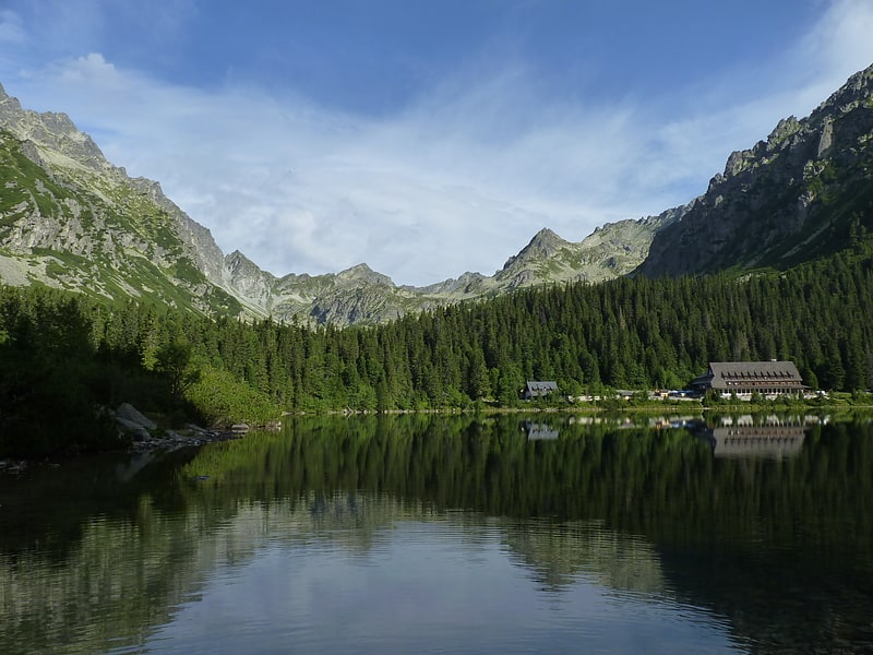
Štrbské pleso
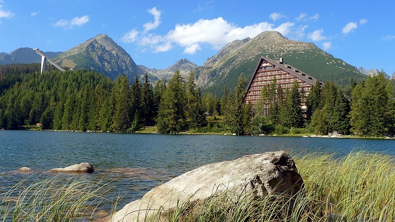
Lake in Slovakia. Štrbské pleso is a picturesque mountain lake of glacial origin and a top tourist destination in the High Tatras, Slovakia. It is the second-largest glacial lake on the Slovak side of the High Tatras, after Veľké Hincovo pleso. Maximum depth is 20 metres.[1]
Address: Štrbské pleso, 059 85 Štrbské Pleso
Rysy
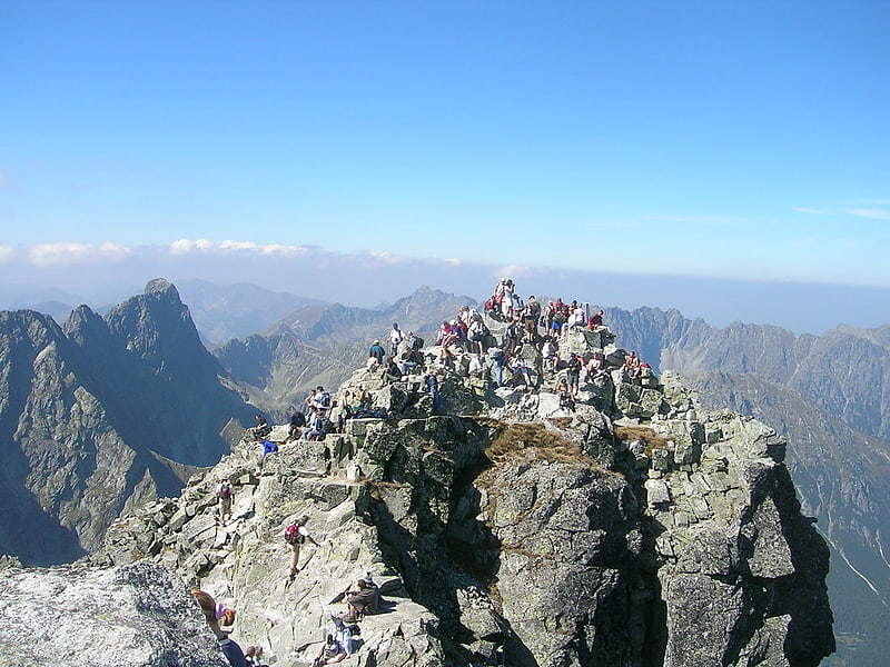
Highest mountain in Poland for trekking. Rysy is a mountain in the crest of the High Tatras, eastern part of the Tatra Mountains, lying on the border between Poland and Slovakia. Rysy has three summits: the middle at 2,501 m; the north-western at 2,500 m; and the south-eastern at 2,473 m. The north-western summit is the highest point of Poland and belongs to the Crown of Polish Mountains; the other two summits are on the Slovak side of the border.[2]
Address: Poland and Slovakia border, Tatra National Park
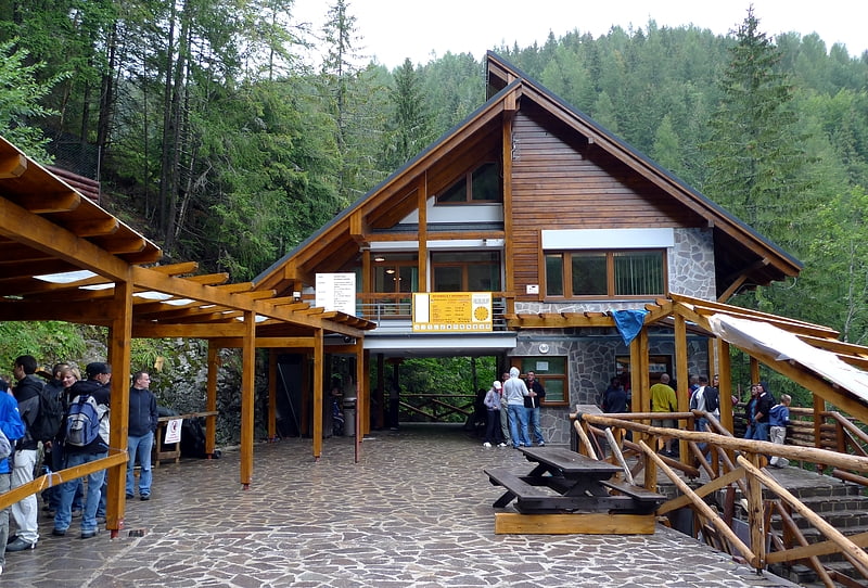
Starý Smokovec
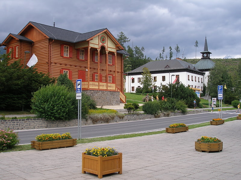
Town in Slovakia. Starý Smokovec is a part of the town of Vysoké Tatry in northern Slovakia in the Tatras. Its name is pronounced approximately "Star-EE Smoke-oh-vets", meaning "Old Smokovec".
Starý Smokovec is a popular resort for skiing and hiking. It also forms the junction of the Tatra Electric Railway train line, connecting Poprad, Tatranská Lomnica and Štrbské Pleso.
Amongst the more important buildings in the district are the sanatorium and the Grand Hotel. It is connected by the Starý Smokovec–Hrebienok funicular to the small ski resort of Hrebienok at 1285 m.[3]
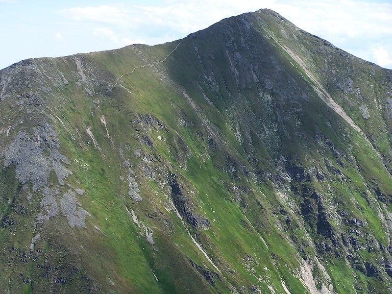
Kriváň
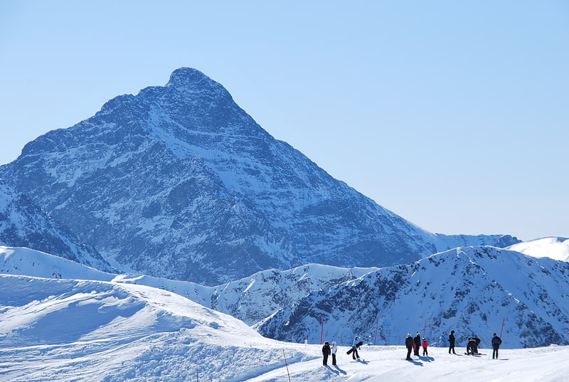
Mountain in Slovakia. Kriváň is a mountain in the High Tatras, Slovakia, that dominates the upper part of the former Liptov County. Multiple surveys among nature lovers have ranked it as the country's most beautiful peak. Readily accessible along maintained marked trails and with the exceptional vistas afforded from its summit, it is the hikers' favorite mountain in the western part of the High Tatras. Kriváň has also been a major symbol in Slovak ethnic and national activism for the past two centuries. It has been referenced in works of art from 19th-century literature, through paintings, film documentaries, to a Polish rock track. A country-wide vote in 2005 selected it to be one of the images on Slovakia's euro coins.[4]
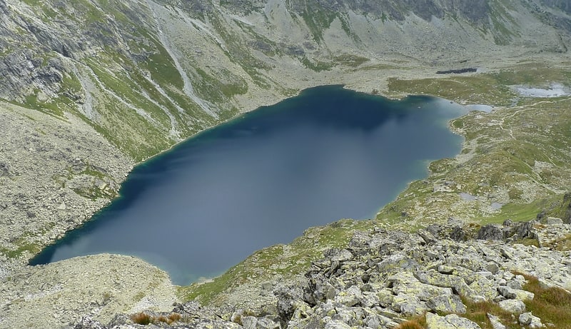
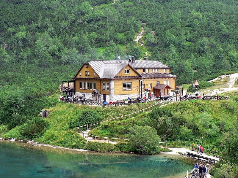
Popradské pleso
Lake in Slovakia. Popradské pleso is a mountain lake of glacial origin located in the High Tatras, Slovakia. It is situated right on the Tatranská magistrála hiking path, at an altitude of 1,494 metres.
Popradské pleso is one of the most visited spots in High Tatras and a starting point for many popular hikes including to Rysy and Kôprovský štít. Near to the lake there is Symbolic Cemetery, built in a memory of the victims of the High Tatras.
Drone video of Popradské pleso[5]
Address: Popradské pleso, Tatra National Park
Belianska Cave
Also known as: Belianska jaskyňa
Tourist attraction in Vysoké Tatry, Slovakia. Belianska Cave is a stalactite cave in the Slovak part of the Tatra mountains, the largest and the only one open to the public in the Tatras. It is located above the settlement of Tatranská Kotlina, which is a part of the town of Vysoké Tatry.
The cave was discovered in the 18th century, although it is presumed that it was used by pre-historic people. The cave was opened in 1884 and electrically lit in 1896.
Entrance to the cave is located at an altitude of 890 metres. The cave is 3,641 m long, with two circuits available to the visitors, with the longer one having the length of 1,752 m.[6]
Address: Tatranska Kotlina, 059 54 Tatranska Lomnica
Skalnaté pleso
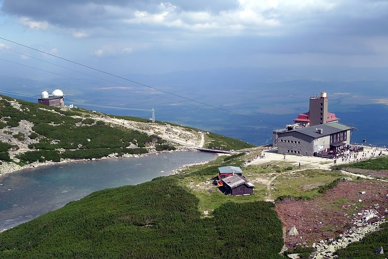
Lake in Slovakia. Skalnaté pleso is a lake located in the High Tatras mountains in the north of Slovakia.[7]
Skalnaté pleso Observatory
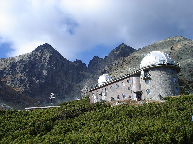
Also known as: Observatórium Skalnaté pleso
Astronomical observatory. The Skalnaté pleso Observatory is an astronomical and meteorological observatory in the Tatra Mountains of Slovakia. It is located at an altitude of 1,786 metres on the south-eastern slopes of Lomnický štít near Tatranská Lomnica. The observatory is named after a nearby mountain lake.[8]
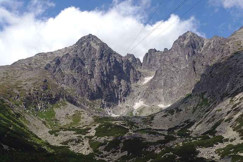
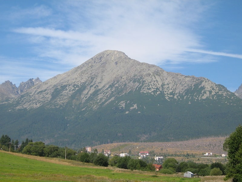
Gerlachovský štít
Imposing mountain range summit. Gerlachovský štít, informally referred to as Gerlach, is the highest peak in the High Tatras, in Slovakia, and in the Carpathian Mountains. Its elevation is usually listed at 2654.4 m above mean sea level. The pyramidal shape of the massif is marked by a huge cirque. Despite its relatively low elevation, Gerlachovský štít features a vertical rise of approximately 2,000 metres above the valley floor.
Mistaken for an average mountain in the rugged High Tatras range in the more distant past, it has since played a symbolic role in the eyes of the rulers and populations of several Central European nations, to the point that between the 19th and mid-20th century, it had four different names with six name reversals. Due to geopolitical changes, it managed to be the highest mountain of the Kingdom of Hungary, and of Czechoslovakia, Slovakia and then Czechoslovakia again within the span of less than three decades of the 20th century.
Gerlachovský štít shares its geology and ecology with the rest of the High Tatras, but provides a worthwhile environment for biologists as the highest ground anywhere in Europe north of the parallel approximately linking Munich, Salzburg, and Vienna. With the travel restrictions imposed by the Eastern Bloc, the mountain was particularly treasured by Czechs, East Germans, Hungarians, Poles, and Slovaks as the loftiest point available for them to climb. Although local authorities have since restricted access to the peak, it continues to attract its share of visitors.[9]
Volovec
Mountain in Europe. Volovec or Wołowiec is a mountain in the Western Tatras at the border of Slovakia and Poland. It lies on the Main Ridge of Western Tatras between Ostrý Roháč and mountain Deravá, standing over three valleys: Chochołowską, Roháčska and Jamnícka.
It offers views over the Polish Western Tatras, and Slovak Roháče. Janusz Chmielowski wrote in 1898: "The summit is extremely interesting (...), in the south rises the jagged group of Rohacz / Roháče (...), toward the east the High Tatras just like a giant rocky island (...) On the north stands the dome of Babia Góra. On the west lie below the Roháčske Ponds."[10]
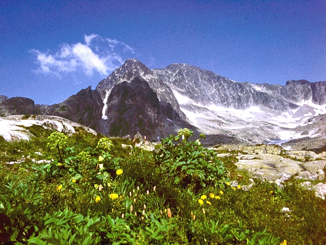
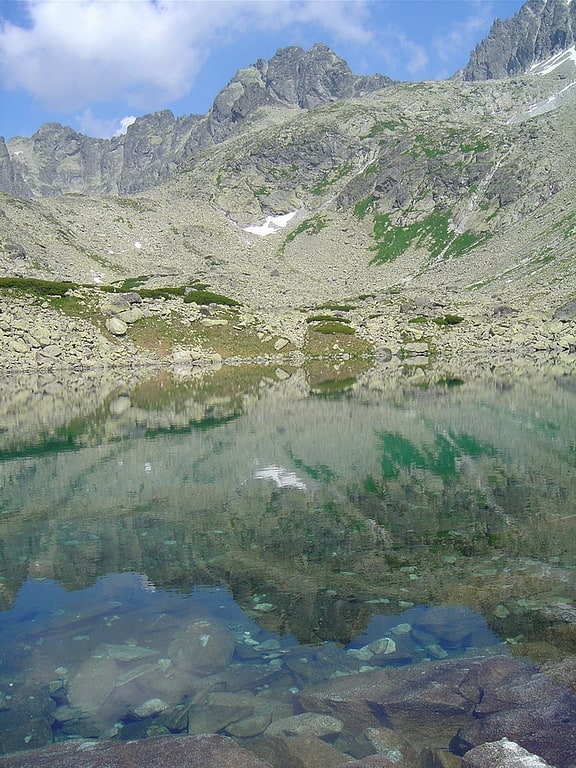
Veľké Hincovo pleso
Lake in Slovakia. Veľké Hincovo pleso is the biggest and deepest mountain lake of glacial origin in the High Tatras, Slovakia. The maximum depth is 53 metres. Its surface remains frozen for around 270 days per year.[11]
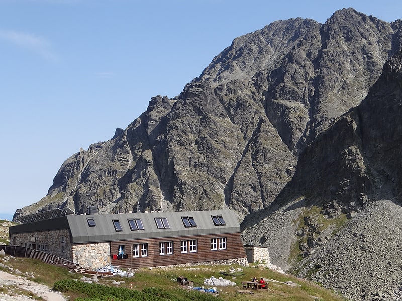
Bilíkova chata
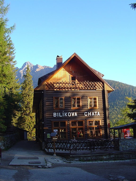
Hostel Pod Siodłek - a shelter at Smokowiecka Kazalnica in the Slovak part of the High Tatras, located at an altitude of 1255 m a.s.l. 5 minutes below the upper field of the off -road queue to the Smokowieckie saddle.
Address: Starý Smokovec - Hrebienok, 062 01 Vysoké Tatry
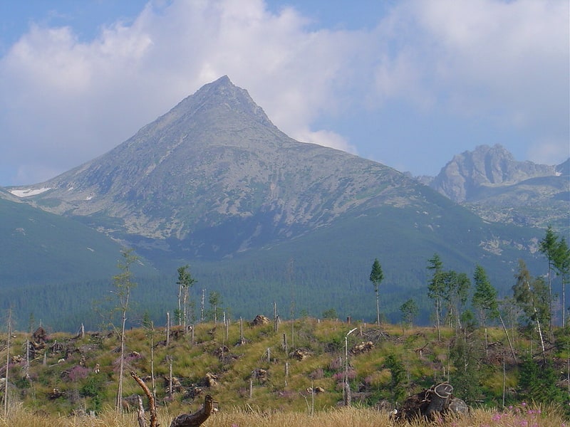
Lomnický štít
Mountain in Slovakia. Lomnický štít is one of the highest and most visited mountain peaks in the High Tatras mountains of Slovakia. Connected by cable car to Tatranská Lomnica, its summit is 2634 metres above sea level, making it the second highest peak in the High Tatras after Gerlachovský štít.
Local shoemaker and amateur miner Jakab Fábry stated he made an ascent around 1760–1790, but the first recorded ascent was made by the English traveler Robert Townson and guide on 16 August 1793. He measured the elevation of the peak to be 2633 m, a meter below the actual elevation. The first winter ascent was made in 1891.
In the past, Lomnický štít was called as Vater (Father), Grossvater (Grandfather), Königsberg (King's Mountain), Królowa Tatr and Królowa Tatrzańska (Princess of the Tatra), Petra altissima kesmarkiensis and allerhöchster Kaisermärkerfels (Highest cliff of Kežmarok), höchste Kaisermärker Spitze (Highest peak of Kežmarok), késmárki hegyek (Hills of Kežmarok), Kesmarker Spitze or Lumnitzer Spitze (Peak of Kežmarok or Peak of Lomnica).
Since 1940, tourists have reached the peak by cable car. They are allowed to stay on the peak for 50 minutes. The cable car system is normally closed in the month of May for annual maintenance. It is also possible to climb the peak from Lomnický Saddle, but this is only permitted with a mountain guide.
There is a solar observatory and weather station permanently manned year round at the terminus of the cable car.[12]
Chata pri Zelenom Plese
A hostel on the Zielony Kieżmarski Staw - a hostel in the Slovak High Tatras, in the Zielona Kieżmarska Valley, located on the banks of Zielona Staw Kieżmarski at an altitude of about 1550 m a.s.l.
Rainerova chata
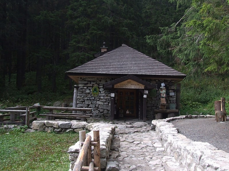
Rainer Chatka, Chata Rainer - a former hostel for tourists, located at an altitude of 1301 m a.s.l. In the Cold Water Valley, at the intersection of the Oldoleśna Valley and the Little Cold Water Valley in the Slovak High Tatras in Staroleśna Polana. The first tourist hostel erected on the southern side of the Tatra Mountains and the oldest shelter building in the Tatra Mountains.
Skalnatá chata
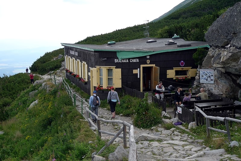
The Łomnickie Hostel - Tourist Hostel in the High Tatras in Slovakia, near the Łomnicki Staw in the Łomnicka Valley, located at an altitude of 1725 m a.s.l.
The beginnings of the hostel dating back to 1841, then a rock colleague was created here as a shelter for tourists, it is located at the back of today's hostel. She became a regular shelter in 1914 when it was expanded and rebuilt.
The hostel today has 12 beds. Chatar of the hostel in the years 1995-2020 was Nosicz (carrier) by Laca Kulang. It belongs to the Record of Nosiczów: he brought a load of 207 kg to the Zamkovsko shelter (Zamkovského Chata), and for a dozen or so years of his career he brought over 1,000 tonnes of loads to various shelters.
Address: Tatranská Lomnica, Tatra National Park
Slavkovský štít
Mountain in Slovakia. Slavkovský štít is the fourth highest mountain peak that can be reached on a marked trail in the High Tatra mountains in Slovakia. Its summit is 2452 metres above sea level. It can be reached by foot on a walking trail in about four and a half hours from Starý Smokovec. The first recorded ascent was by Juraj Buchholtz in 1664 and it took the group of 12 members 2 days, while only 4 of them reached the summit.
In 19th century it was considered to build Observatory and Meteorological Station on the summit together with a lift going up from Starý Smokovec. The project turned out to be technically unrealistic.[13]
Gerlachovská veža
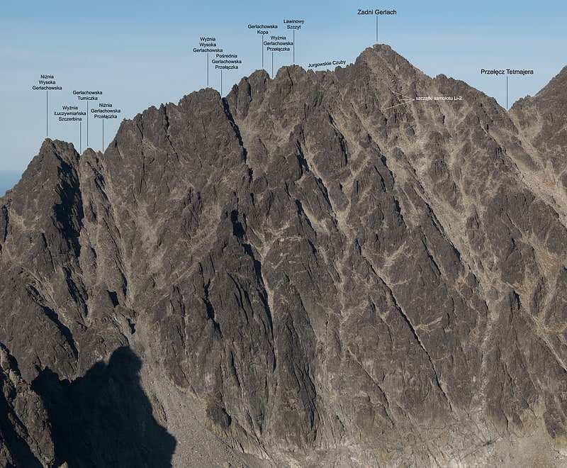
Mountain in Slovakia. Gerlachovská veža is a mountain in the Northern ridge Zadni Gerlach in the main ridge of the Slovak High Tatras. From Veľká Litvorová veža it is separated by Nižná Gerlachovská lávka, and from the Malá Litvorová veža the mountain is bounded by Vyšná Lučivnianska lávka. At the top of the mountain there are no marked trails for tourists, only Taterniks are able to gain access to the top of the peak.
In the direction of the Velická Valley, the mountain falls to the ridge. Towards to the Kačacia Valley the mountain forms a spectacular rib shaped rock when joining the valley.[14]
Ľadový štít
Ľadový štít is the third highest of the Tatra Mountains, in Slovakia, and in the whole 1,500 km long Carpathian mountain chain, as well as in northern and eastern Central Europe.[15]
Klin Mountain
Also known as: Klin
Peak in Europe. Klin is a peak in the Western Tatras, on the border between Slovakia and Poland. Its summit is at 2,176 m AMSL. It is the highest peak in Polish Western Tatras. The foreground is a classic split ridge or doppelgrat, spreading under tension due to deep erosion in the valleys either side. The finest example in the Tatra is between Kamienista and Smreczynski Wierch nearby.[16]
Bystrá Mountain
Also known as: Bystrá
Mountain in Slovakia. Bystrá is the highest mountain in the Western Tatras in Slovakia, near the Polish border. It is 2,248 meters high and surrounded by the valleys of Kamenistá, Račkova and Bystrá.[17]
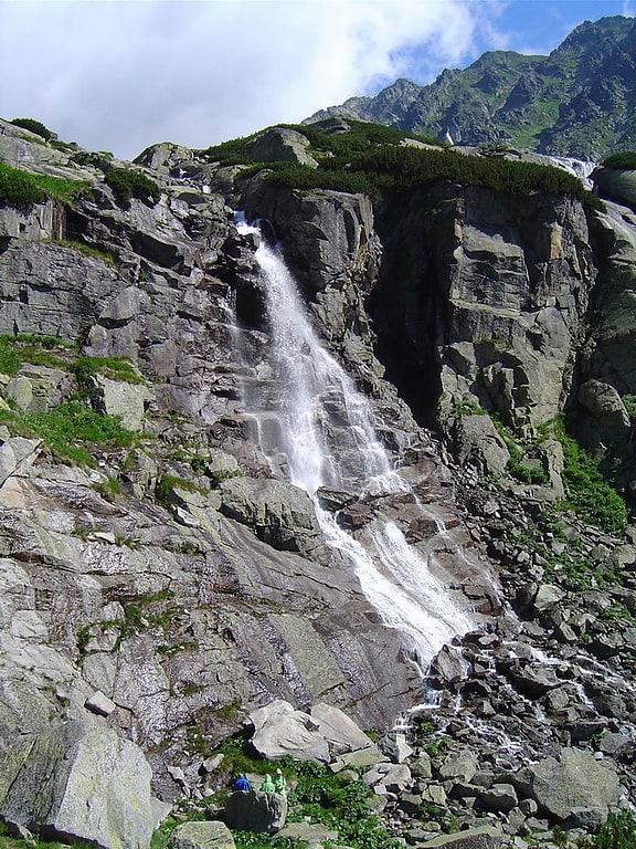
Kmeťov
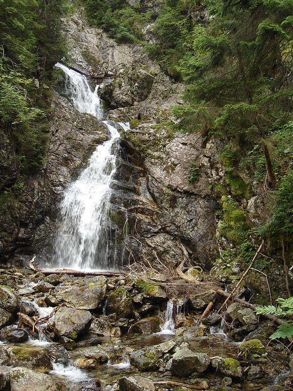
Hiking area in Vysoké Tatry, Slovakia. Kmeťov is glacial waterfall in the High Tatras at about 1,245 metres in Poprad District, Slovakia. At about 80 metres, Kmeťov is the highest waterfall in Slovakia.[18]
Končistá
Mountain in Slovakia. Končistá is a mountain in the Tatra Mountains, Slovakia.[19]
Batizovský štít
Mountain in Slovakia. Batizovský štít is a 2,448 metres high double peak mountain in High Tatras in Slovakia. Batizovský štít, just like Batizovská dolina, Batizovské pleso or the village Batizovce are named after the local 13th century aristocrat Batiz from the Mariáš dynasty, who used to be the owner of Mengusovská or Batizovská dolina and established the village of Batizovce.
Batizovský štít isn't accessible for tourists by a marked trail, but trail passes around the Batizovské pleso lake under the mountain. The solid rock makes it one of the best climbing spots in High Tatras containing dozens of routes in different grades of difficulty. You can however find an official tourist trail leading close to the peak, offering astonishing views to Gerlachovský štít, Končistá and Kačací štít.[20]
Zbojnícka chata
Zbójnickie shelter - a shelter in the Slovak High Tatras, in the Staroleśna Valley at an altitude of around 1960 m a.s.l.
The first building that was built here was a cottage erected in 1907–1908. They were built by the Hungarian Board of State Forests for hunting purposes, but in 1910 he made available to tourists. At the beginning it was undeveloped, it housed one room with bunks, benches and stove. In 1924, the hostel was taken over by the Czechoslovakian tourists' club - they were rebuilt and the current name of the Zbojnícka Chata was given. Later, further renovations were carried out - the last one took place after the fire on June 14, 1998 and ended at the end of 1999. Voluntary donations collected among Slovak society were in the reconstruction. During the renovation, next to the burnt building there was a large tent in which tourists could also sleep. Today the shelter has 16 beds. Zbójnicka Chata is only supplied by the nosiczów. Chatar of the hostel in 2010 was ľudovít Záhor.
It took its name from nearby Zbójnicki ponds. Formerly, by Polish mountaineers, she was called the corpse because of the cold, moisture and disorder. The current Polish name is Kalaka Słowacka, it was not used before World War II.
Address: Starý Smokovec, 062 01 Vysoké Tatry
Chata pod Rysmi
The hostel near Rysami, also called the hostel under the scale - the Tatra shelter located in the upper part of the Żabiej Mięguszowiecka valley in the Slovak High Tatras. This shelter, known mainly thanks to the convenient location under Rysami, lies at an altitude of 2241 m a.s.l.
The cottage is open only in the summer season (from June 16 to October 31). No road or lift leads to the shelter, it is supplied only by porters (so -called bullshit) or tourists who receive tea with raspberry juice for bringing a load of 5-10 kg. A small amount of electricity is obtained from solar batteries, while the water comes from melted snow or at the end of the season from a stream located below. At the bottom of the cottage there is a dining room and a buffet, while in the attic a room with sleeping places. The attraction is the toilet cabin suspended over the abyss distant a minute from the shelter. As at 2022, Chatar is known to Nosicz Viktor Beránek.
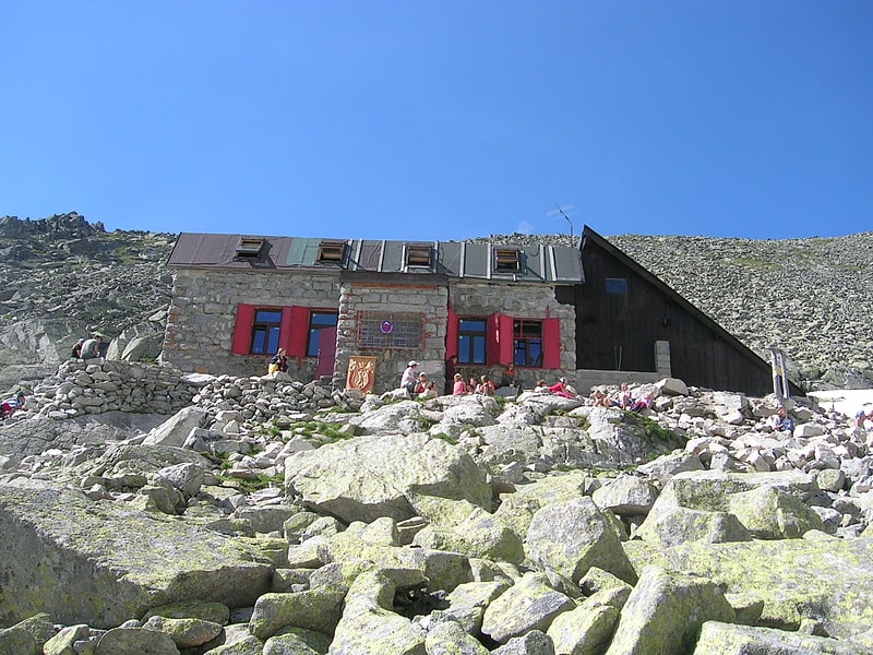
Téryho chata
Téry's hostel - a mountain shelter located in the Slovak part of the High Tatras, on the border of the Little Cold Water Valley and the Valley of Five Ponds. Chata is located at the height of 2015 m a.s.l. And it is the highest shelter in the Tatra Mountains throughout the year.
Address: P.O.Box 6, 062 01 Vysoké Tatry
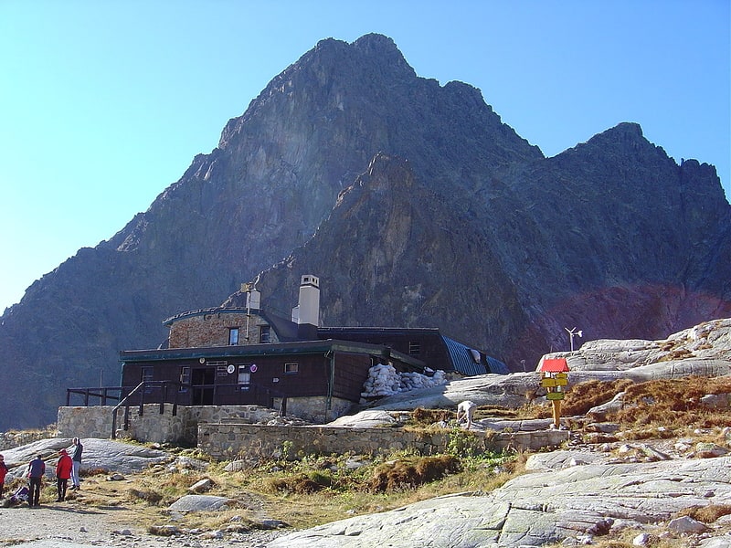
Zamkovského chata
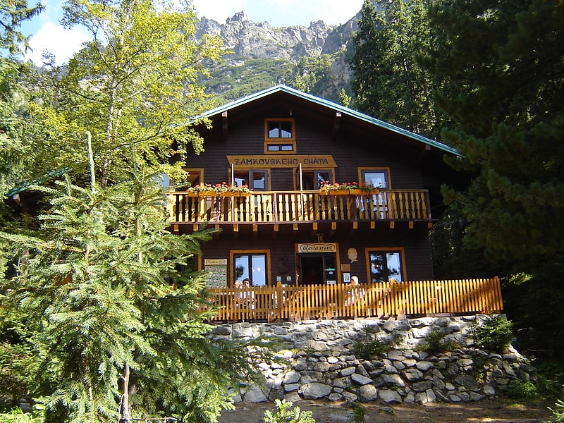
Zamkovski Hostel - Tatra shelter located at an altitude of 1467 m a.s.l. in the Slovak part of the High Tatras, in the lower part of the small cold water valley.
Address: Malá Studená dolina, Tatra National Park
Skok waterfall
SKOK waterfall - a waterfall on the Młynica stream in the Młynicka Valley in the Slovak High Tatras. It is located above the indirect clearing, and below the clearing below. The name of the waterfall comes from the word SKOK, which in Slovak and in the Podhale dialect means a waterfall, in South Slavic languages rock threshold, fault, accumulation. It is located on a high rock threshold parting the central part of this valley. It has a height of about 25 m. At large water on the upper edge of the waterfall threshold, the waterfall breaks down, throwing a water shower forward. The most effective waterfall is at the beginning of the Tatra summer, i.e. in June, it throws an average of 880 liters of water per second. The amount of water flowing down it is very variable, in March, for example, it is only 54 l/s. A terrifying impression was made by a waterfall during a great flood in 1958, when about 30,000 flowed it. liters of water per second, and this water fought large stones.
There are two ponds in the immediate vicinity of the waterfall; Above the threshold, the pond over the jump, from which the water supply water flows, below the threshold is the pond under the jump. A yellow tourist trail leads next to the waterfall. He overcomes the steep rock threshold; The most exposed places are secured with chains.
Address: Štrbské pleso, 059 85 Vysoké Tatry
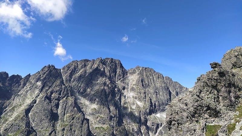
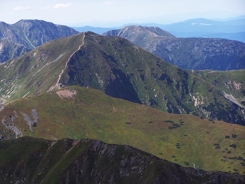
High Tatras
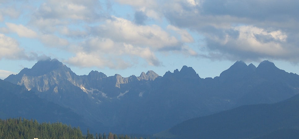
Also known as: Vysoké Tatry
Mountain range in Slovakia. The High Tatras or High Tatra Mountains, are a mountain range along the border of northern Slovakia in the Prešov Region, and southern Poland in the Lesser Poland Voivodeship. They are a range of the Tatra Mountains chain.[21]
Chata Plesnivec
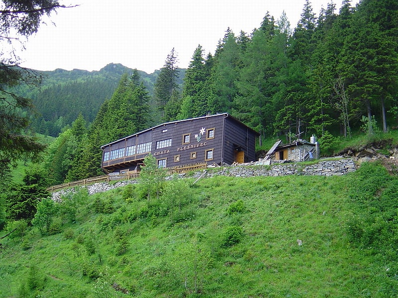
Hostel Pod Szarotka, Szarotka - the only tourist hostel located on the slopes of the Bielsko Tatras. It is located in the valley up to seven sources at an altitude of 1290 m a.s.l. At the feet of Bujaaczy Wierch.
Lomnický štít peak

Also known as: Lomnický štít
Mountain summit and 1940's observatory. Lomnický štít is one of the highest and most visited mountain peaks in the High Tatras mountains of Slovakia. Connected by cable car to Tatranská Lomnica, its summit is 2634 metres above sea level, making it the second highest peak in the High Tatras after Gerlachovský štít.
Local shoemaker and amateur miner Jakab Fábry stated he made an ascent around 1760–1790, but the first recorded ascent was made by the English traveler Robert Townson and guide on 16 August 1793. He measured the elevation of the peak to be 2633 m, a meter below the actual elevation. The first winter ascent was made in 1891.
In the past, Lomnický štít was called as Vater (Father), Grossvater (Grandfather), Königsberg (King's Mountain), Królowa Tatr and Królowa Tatrzańska (Princess of the Tatra), Petra altissima kesmarkiensis and allerhöchster Kaisermärkerfels (Highest cliff of Kežmarok), höchste Kaisermärker Spitze (Highest peak of Kežmarok), késmárki hegyek (Hills of Kežmarok), Kesmarker Spitze or Lumnitzer Spitze (Peak of Kežmarok or Peak of Lomnica).
Since 1940, tourists have reached the peak by cable car. They are allowed to stay on the peak for 50 minutes. The cable car system is normally closed in the month of May for annual maintenance. It is also possible to climb the peak from Lomnický Saddle, but this is only permitted with a mountain guide.
There is a solar observatory and weather station permanently manned year round at the terminus of the cable car.[22]
Address: ____ _ _______ ______, 06201 Vysoke Tatry
Fatra-Tatra Area
Also known as: Pásmo jadrových pohorí
Mountain belt. The Fatra-Tatra Area or the Tatra-Fatra Belt of core mountains is a part of the Inner Western Carpathians, a subprovince of the Western Carpathians. Most of the area lies in Slovakia with small parts reaching into Austria and Poland. The highest summit of the whole Carpathians, the Gerlachovský štít at 2,655 m, lies in the High Tatras range which belongs to this area.
The Fatra-Tatra Area is from the northern side bounded by Pieniny Klippen Belt. Mountains of the area are located in two ranges. The external range consists of Hainburg Hills, Malé Karpaty (Pezinok part), Považský Inovec, Strážovské vrchy, Malá Fatra, Tatras (Western, High and Belianske Tatry). Inner range consists of Tribeč, Žiar, Veľká Fatra, Chočské vrchy, Ďumbier part of Nízke Tatry and massif of Smrekovica in the Branisko. The southern boundary of Area is the Čertovica line, south of which is the Vepor Belt.
The Tatra-Fatra Belt consists of Tatric alpine crystalline basement and its autochthonous sedimentary cover, over which the Subtatric nappes (Fatric and Hronic) were thrust.
The name core mountains is derived from the structural element, resistant crystalline basement rocks, preserved in the core of horsts, often forming the highest peaks of the mountains.[23]
Jahňací Štít
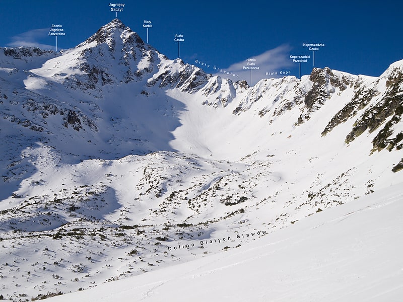
Lamba peak - a peak with a height of 2230 or 2229 m located in the Slovak part of the High Tatras, most northeast of the high -east massif of the High Tatra Mountains. It has two vertices connected by almost a horizontal ridge, of which the southwest is higher.
Symbolický cintorín
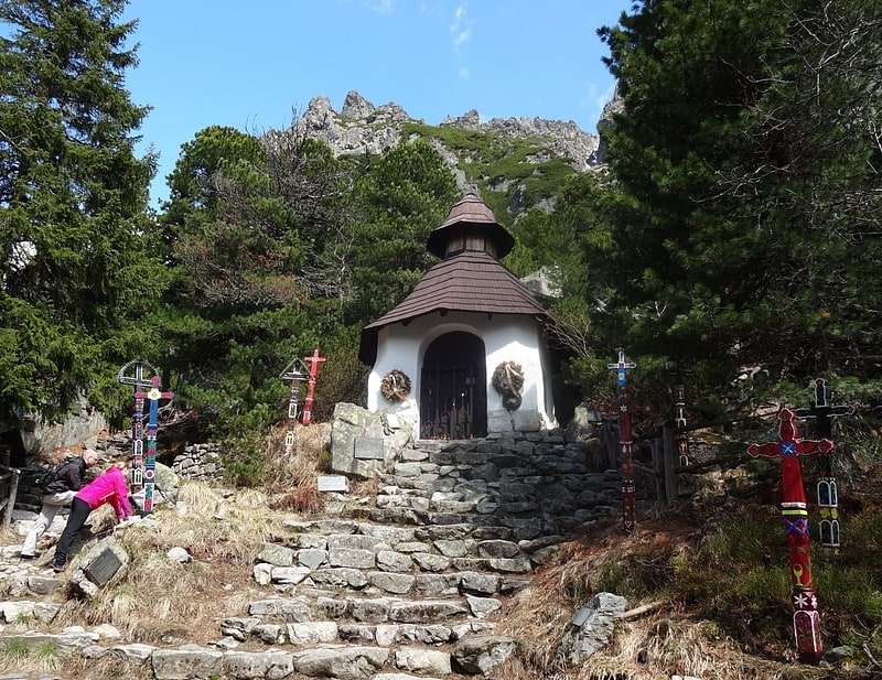
The Tatra symbolic cemetery, formerly a symbolic cemetery of the victims of the Tatra Mountains - a symbolic cemetery located on the western slopes of Osterwa in the High Tatras. It is located southeast of Poprad's pond at the outlet of the Złomisk Valley to the main branch of the Mięguszowiecka Valley.
The design of the cemetery in 1922 was put out by the Czech mountaineer, skier and painter, Otakar Štáfl. Construction moved forward thanks to the help of KSST, later KSTL. The place was chosen in 1934. Two years later, a stone chapel of the Robert Vosyka project was created, the whole was opened on August 11, 1940. The ceremony was attended by the President of Slovakia, Jozef Tiso. One of the main creators of the cemetery was Alojz Lutonský. A motto was placed in the cemetery: mŕtvym on a souvenir, Živým pre výstrahu (dead to souvenir, living as a warning).
Štáfl was guided by the idea of abandoning the plaques of the victims of the Tatra Mountains in the places of their tragic death. First of all, commemorative plaques placed in various parts of the Tatra Mountains were collected here by the families of the dead, later new ones were added. Later, 60 painted wooden crosses made by a sculptor from the village of Detva, Jozef Fekiač-šumni, and his younger brother Ján. Currently, there are about 300 boards commemorating over 400 people in the cemetery. Among them you can find Polish names. The boards commemorate, among others Klemens Bachleda, Mieczysław Karłowicz, Wiesław Stanisławski, Witold Wojnar, Tadeusz Strumiłło, Jan Długosz, brothers Jerzy and Wojciech Biederman, as well as TOPR rescuers Janusz Kubica and Stanisław Mateja Torbiarz and pilots of "Sokol" Bogusław Arendarczyk and Janusz Rybicki, who died in the air catastrophe, in the Olczyska Valley. There are plaques dedicated to people associated with the Tatras who died elsewhere, e.g. in other mountains. In this way they were commemorated, among others The originator of the Otakar Štáfl cemetery and his wife Vlasta Štáflová, Wawrzyniec Żuławski, Stanisław Groński, Jerzy Kukuczka, Piotr Morawski, Samuel Skierski, Wanda Rutkiewicz (5 May 2012), Aleksander Ostrowski (November 11, 2016).
From 1969, the cemetery has been looked after by the Slovak Tatra National Park. In 1970, the object was entered in the register of national souvenirs. New boards have been installed since 2003 by employees of the Tanap Field Service Center. They are decided by the Commission at the Park Directorate.
The cemetery is symbolic (there are no bodies buried here) and international - it commemorates the victims of the mountains of various nationalities.