Discover 7 hidden attractions, cool sights, and unusual things to do in Sturbridge (United States). Don't miss out on these must-see attractions: Old Sturbridge Village, Tantiusques, and East Brimfield Dam. Also, be sure to include Wells State Park in your itinerary.
Below, you can find the list of the most amazing places you should visit in Sturbridge (Massachusetts).
Table of Contents
Old Sturbridge Village
Museum in Sturbridge, Massachusetts. Old Sturbridge Village is a living museum located in Sturbridge, Massachusetts which recreates life in rural New England during the 1790s through 1830s. It is the largest living museum in New England, covering more than 200 acres. The Village includes 59 antique buildings, three water-powered mills, and a working farm. Third-person costumed interpreters demonstrate and interpret 19th-century arts, crafts, and agricultural work. The museum is popular among tourists and for educational field trips.[1]
Tantiusques
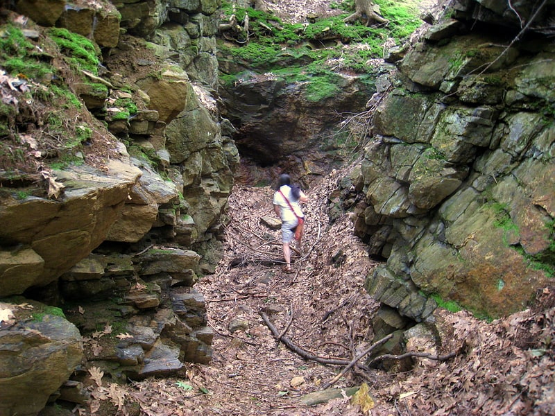
Hiking area in Sturbridge, Massachusetts. Tantiusques is a 57-acre open space reservation and historic site registered with the National Register of Historic Places. The reservation is located in Sturbridge, Massachusetts, and is owned and managed by The Trustees of Reservations; it is notable for its historic, defunct graphite mines. This is a rural area with much of the adjacent and surrounding area undeveloped and forested. The reservation is entirely forested with oak-hickory forest and red maple in the wet areas and mountain laurel abundant throughout the understory. The name Tantiusques comes from a Nipmuc word meaning “the place between two low hills." The Nipmuc used the graphite to make ceremonial paints. The property also contains the ruins of a 19th-century period house that belonged to a mine worker of mixed African American and Native American ancestry.[2]
Address: Leadmine Road, 01566 Sturbridge
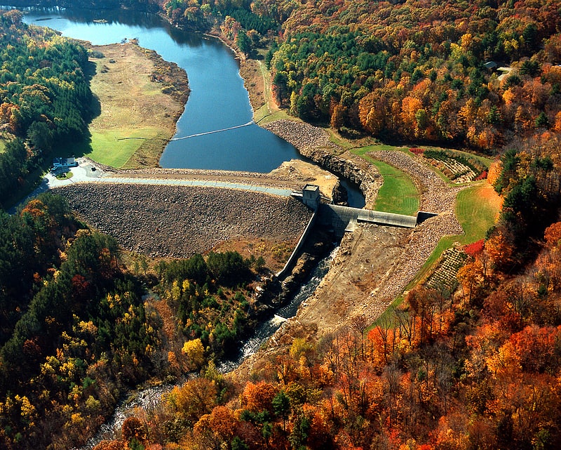
East Brimfield Dam
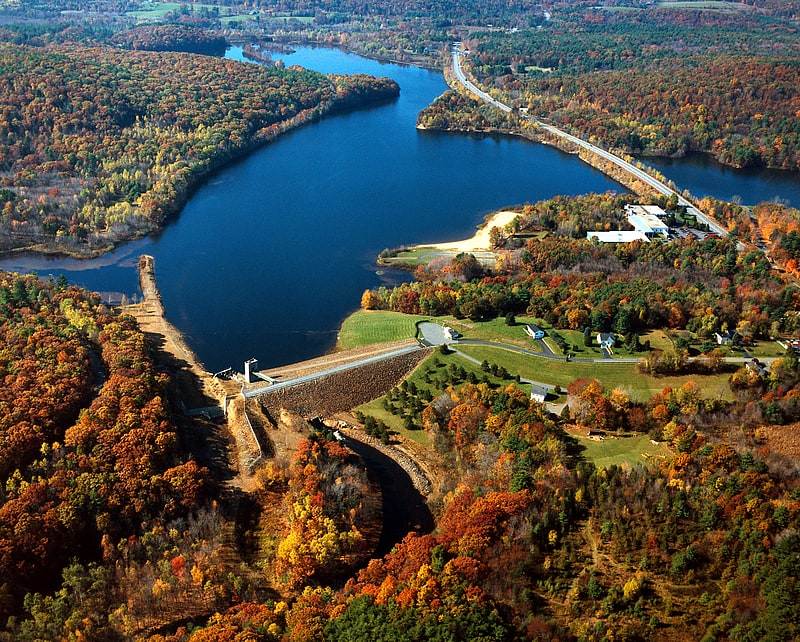
The East Brimfield Dam is located on the Quinebaug River in Sturbridge, Massachusetts, approximately 20 miles southwest of Worcester, Massachusetts.
Designed and constructed by the United States Army Corps of Engineers, this dam substantially reduces flooding along the Quinebaug and Thames rivers. Construction of the project began in 1958 with completion in 1960 at a cost of $6,580,000.
The East Brimfield Reservoir, located in Sturbridge and Brimfield to its west, lies within the Quinebaug River Watershed and is part of the Thames River Basin. Access to the site is available from US Route 20.[3]
Wells State Park
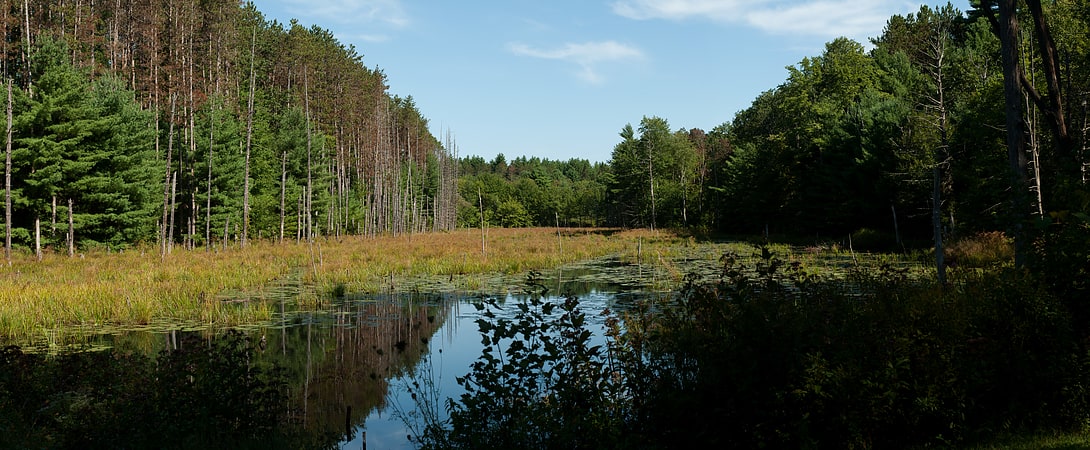
State park in Sturbridge, Massachusetts. Wells State Park is a public recreation area located off Route 49 in the town of Sturbridge, Massachusetts. The state park includes frontage on Walker Pond and the scenic metamorphic rock cliff face of Carpenter Rocks. Terrain is rugged with ledges interspersed between wetlands. Woodlands are of the oak-hickory forest and northern hardwood forest types with groves of eastern white pine. The park is managed by the Massachusetts Department of Conservation and Recreation.[4]
Address: Rte. 49, Sturbridge
Westville Dam
The Westville Dam is located on the Quinebaug River between Southbridge and Sturbridge, about 1.3 miles west of the Southbridge town center and 18 miles southwest of Worcester, Massachusetts.
Designed and constructed by the United States Army Corps of Engineers, this dam substantially reduces flooding along the Quinebaug and Thames rivers. Construction of the project began in June 1960 with completion in August 1962 at a cost of US$5.6 million.
The Westville reservoir is located within the Quinebaug River Watershed and is part of the Thames River Basin. Access to the site is available from Interstate 84 and State Route 131.[5]
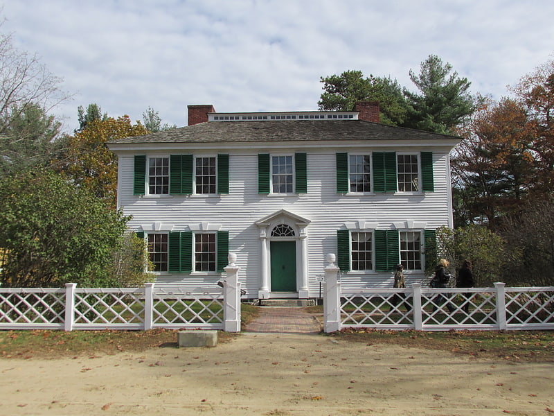
Oliver Wight House
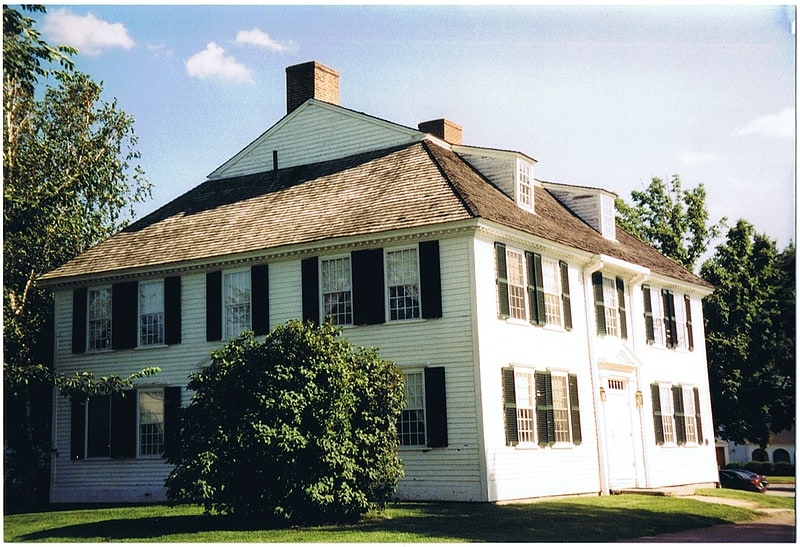
The Oliver Wight House is a historic house located on Main Street in Sturbridge, Massachusetts. Built in the 1780s, the house was first occupied by local cabinet maker Oliver Wight and his family. It was added to the National Register of Historic Places in 1982. The Georgian style dwelling was operated as a motor lodge by Old Sturbridge Village until 2006 and has been reopened as a restaurant.[6]
Sturbridge Common Historic District
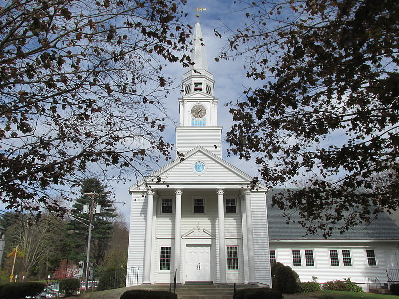
Historical place in Sturbridge, Massachusetts. The Sturbridge Common Historic District encompasses the historic center of Sturbridge, Massachusetts. Encompassing some 138 acres, the district is focused around the town common, which was laid out when the town established in 1738. The district is roughly linear, extending along Main Street from its junction with Interstate 84 eastward to Hall Road. The district also extends for short distances along Haynes, Maple, and Charlton Streets. Although most of the properties in the district are residential, the institutional properties, including the 1838 Greek Revival Town Hall, the 1896 Joshua Hyde Library building, and the 1922 Federated Church. The oldest building in the district is the c. 1772 Publick House, a tavern which has dominated the south side of the district since its construction.
The district was listed on the National Register of Historic Places in 1977.[7]