Discover 6 hidden attractions, cool sights, and unusual things to do in Rogue River–Siskiyou National Forest (United States). Don't miss out on these must-see attractions: Applegate Lake, Coquille River Falls, and Mount Emily. Also, be sure to include McKee Bridge in your itinerary.
Below, you can find the list of the most amazing places you should visit in Rogue River–Siskiyou National Forest (Oregon).
Table of Contents
Applegate Lake
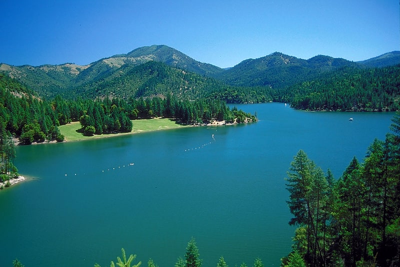
Reservoir in Oregon. Applegate Lake is a 988-acre reservoir located in the Rogue River–Siskiyou National Forest about 27 miles southwest of Medford in the U.S. state of Oregon. It is 16 miles south of Oregon Route 238 along Applegate River Road and slightly north of the Oregon–California border. The lake is an impoundment of the Applegate River about 46 miles from its confluence with the Rogue River.[1]
Coquille River Falls
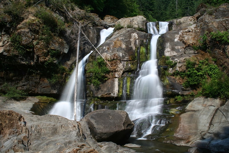
Waterfall in Oregon. Coquiller River Falls, is a two-tier waterfall located in the far north tip of the Rogue River – Siskiyou National Forest, just east of Port Orford, on the Oregon Coast in Coos County, in the U.S. state of Oregon. It totals 115 feet fall in two drops: the upper falls is 50 feet high and the lower tier, the tallest drop, is 65 feet. There are approximately 180 feet from the upper tier to the bottom drop of the waterfall.[2]
Mount Emily
Mountain in Oregon. Mount Emily is a mountain in the Klamath Mountains of southwestern Oregon in the United States. It is located in southern Curry County in the extreme southwest corner of the state, near Brookings, approximately 5 miles from the Pacific Ocean and 5 miles from the California state line.[3]
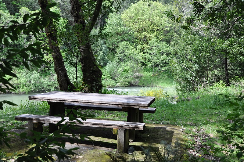
McKee Bridge
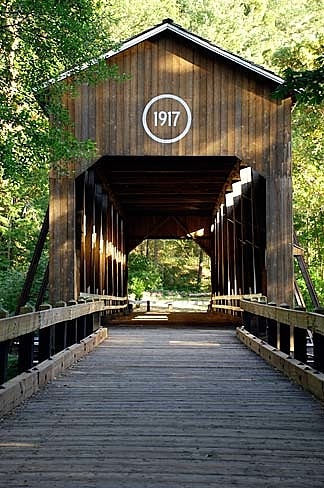
Bridge. The McKee Bridge is a covered bridge in Jackson County in the U.S. state of Oregon. Built on land donated by Adelbert McKee, a stage station operator, the bridge originally carried a road over the Applegate River that linked the Blue Ledge Copper Mine to Jacksonville. The site originally included an ore-hauler rest stop, about halfway between the mine and the city, where relief horses were stationed. The bridge, about 30 miles north of the California border, carried mining and logging traffic from the year of its construction, 1917, through 1956. An unincorporated community, McKee Bridge, is near the bridge.
Since 1956, area residents, assisted at times by government funding, have maintained the bridge, which is used by pedestrians but not by motor vehicles. McKee Picnic Ground in the Rogue River – Siskiyou National Forest is at the west end of the bridge along the river. The picnic ground and bridge are about 8.5 miles (13.7 km) south of Ruch along Applegate Road.
The McKee Bridge Historical Society, a nonprofit organization dedicated to maintaining the pedestrian bridge, lists the height of the bridge at 45 feet (14 m), which makes it the highest of the four remaining covered bridges in Jackson County. It is also the longest and oldest of the four.
Closed completely for three years because of rot in structural components as well as damage to the roof, the bridge reopened in June 2015 after major renovations. Grants totaling about $600,000 from the Federal Highway Administration, supplemented by matching funds of about $60,000 raised by the McKee Bridge Historical Society, paid for the project. Mowat Construction Company of Woodinville, Washington, carried out the rehabilitation.[4]
Address: McKee Bridge Rd, 97530 Jacksonville
Coquille Myrtle Grove State Natural Site
State park in Coos County, Oregon. Coquille Myrtle Grove State Natural Site is a state park administered by the Oregon Parks and Recreation Department in the U.S. state of Oregon. The park, bordering the Powers Highway between Myrtle Point and Powers, in Coos County, features a swimming hole and sandy beach along the South Fork Coquille River. Other amenities include parking, picnic tables, restrooms, and access to fishing but no drinking water.
The Save the Myrtlewoods organization donated the land for the park in 1950. Subject to occasional flooding, the 7-acre (2.8 ha) park contains a stand of Oregon myrtle trees. The Oregon myrtle, also known as California laurel or Pacific myrtle, is a slow-growing hardwood often turned into lumber to make furniture, cabinets, and specialty items such as plates and bowls. Many of the larger stands, found at low elevation along the Pacific coast between lower California and Coos Bay, have been cut.[5]
Bigfoot trap
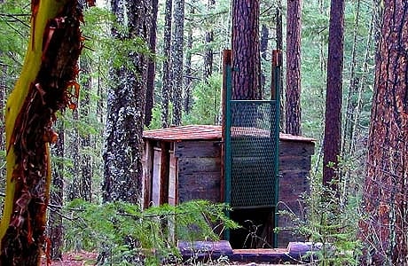
The Bigfoot trap is located in the Rogue River–Siskiyou National Forest in the southern part of Jackson County, Oregon, 3.1 miles from the California border. Believed to be the only one of its kind, the trap was designed in 1974 to capture Bigfoot, a purported ape-like creature said to live in the forests of the Pacific Northwest. It failed to accomplish this, and was abandoned in the early 1980s.
Today, the trap is maintained as a novelty by the United States Forest Service as it sits along the Collings Mountain hiking trail and sees hundreds of visitors annually.[6]