Discover 20 hidden attractions, cool sights, and unusual things to do in Rocky Mountain National Park (United States). Don't miss out on these must-see attractions: Bear Lake, Longs Peak, and Dream Lake. Also, be sure to include Sprague Lake in your itinerary.
Below, you can find the list of the most amazing places you should visit in Rocky Mountain National Park (Colorado).
Table of Contents
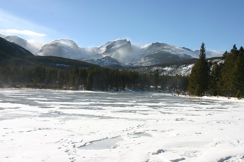
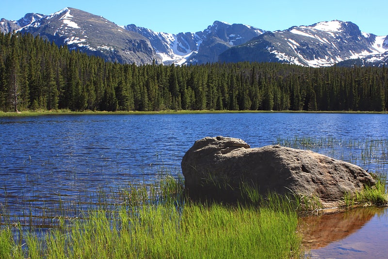
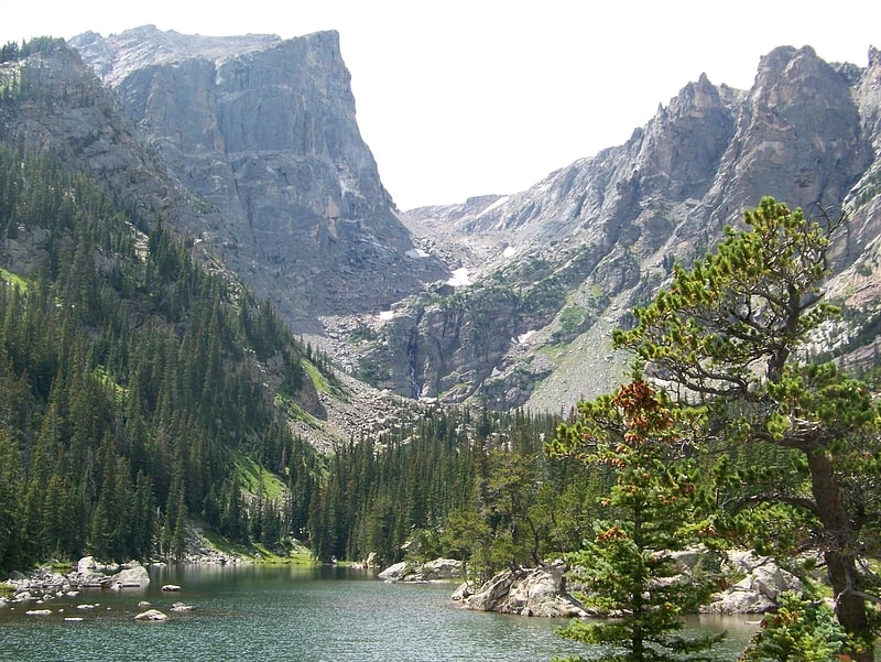
Bear Lake
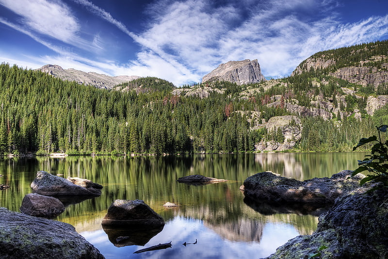
Lake in Colorado. Bear Lake is a scenic trailhead and destination in Rocky Mountain National Park. Sitting at an elevation of 9,450 feet, the alpine lake rests beneath the sheer flanks of Hallett Peak and the Continental Divide at 40.31324°N 105.648222°W / 40.31324; -105.648222. Several trails, from easy strolls to strenuous hikes, start from the lake. The Bear Lake Road is open year-round, though it may temporarily close due to adverse weather conditions. An ample parking lot is provided close to the lake. The Bear Lake Road is approximately 10 miles long and starts close to the Beaver Meadows Entrance station of the Rocky Mountain National Park.
The lake was formed during the ice age by a glacier. Several moraines can be found downhill of Bear Lake.[1]
Address: Bear Lake, 80517 Estes Park
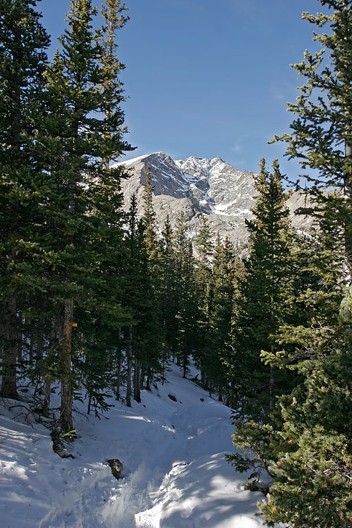
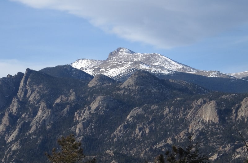
Longs Peak
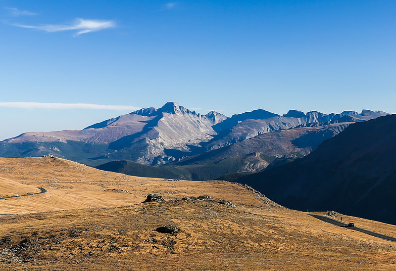
Snow-capped national park mountain peak. Longs Peak is a high and prominent mountain in the northern Front Range of the Rocky Mountains of North America. The 14,259-foot fourteener is located in the Rocky Mountain National Park Wilderness, 9.6 miles southwest by south of the Town of Estes Park, Colorado, United States. Longs Peak is the northernmost fourteener in the Rocky Mountains and the highest point in Boulder County and Rocky Mountain National Park. The mountain was named in honor of explorer Stephen Harriman Long and is featured on the Colorado state quarter.[2]
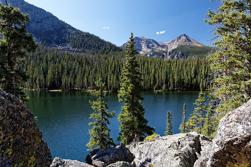
Dream Lake
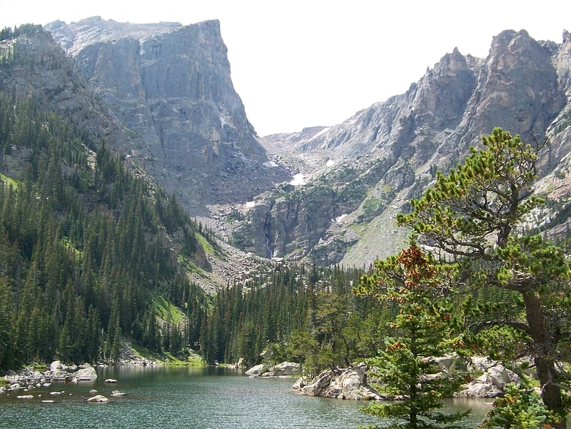
Alpine lake in Colorado. Dream Lake is a high alpine lake located in Rocky Mountain National Park in northern Colorado, located east of the continental divide.
The lake is accessed via the popular Bear Lake trail head and is at the base of Hallett's Peak, and is well known for its stunning views caused by surrounding steep cliffs, and a popular destination for casual hiking.[3]
Address: Dream Lake, Rocky Mountain National Park
Sprague Lake
Lake in Colorado. Sprague Lake is a scenic lake in Rocky Mountain National Park, located on the south side of Glacier Creek, about two miles south of the Hollowell turnoff. The half-mile walk around the lake is wheelchair accessible and features boardwalks and bridges with views of Flattop Mountain and Hallet Peak. The lake is popular for Brook trout fishing.
The area is named after Abner Sprague, who started a homestead there in 1874. Later, he opened a lodge for dude ranching, hunting, and fishing. To improve the fishing, he dammed the far end of the lake. The area became part of Rocky Mountain National Park in 1915 and continued to serve guests as the Sprague Hotel. In 1919, guests paid $6.00 per room with a private bath, and $1.00 for regular meals. The hotel, which no longer exists, stood near the present-day parking lot.[4]
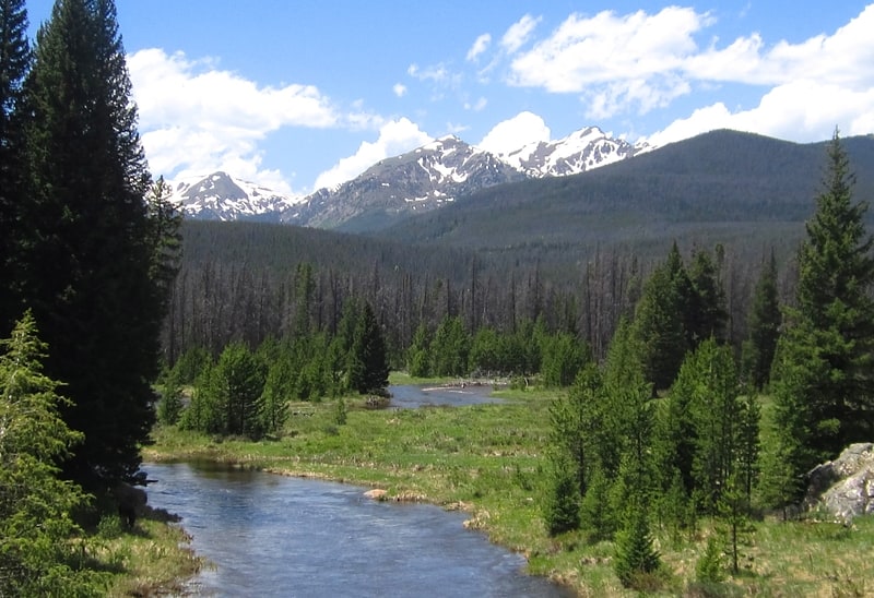
Poudre Lake
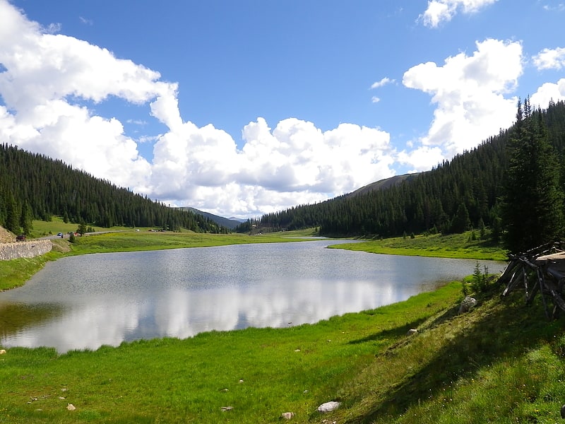
Lake in Colorado. Poudre Lake is an alpine lake and a main source of Poudre River. It is located just a few feet East of the Continental Divide in Larimer County, Colorado.
U.S. Route 34 passes the lake and crosses the Continental Divide at Milner Pass at the southwest end of the lake.
It is a "dead lake", as fish cannot survive in it because it freezes completely during the winter months.[5]
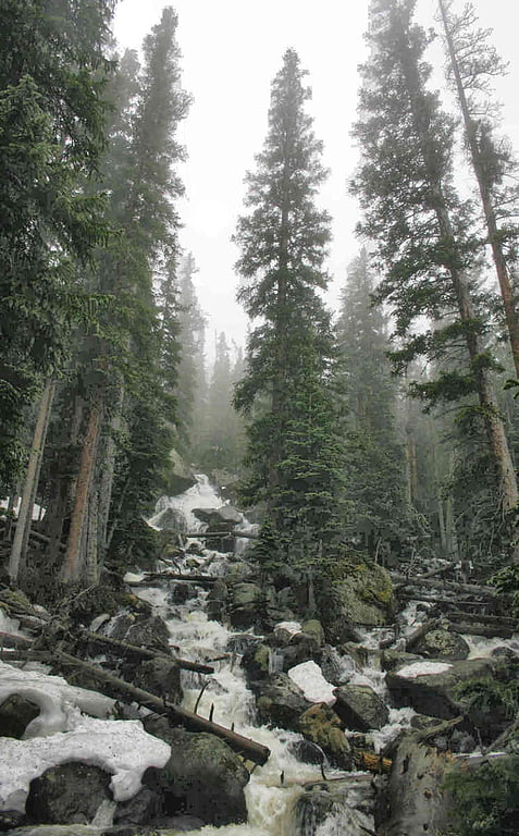
Chasm Falls
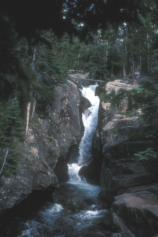
Waterfall in Colorado. Chasm Falls is a waterfall with a 25-foot drop located on the Fall River in Rocky Mountain National Park.[6]
Moraine Park Museum and Amphitheater
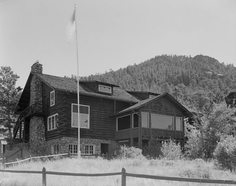
Museum. The Moraine Park Museum and Amphitheater, also known as the Moraine Park Lodge and the Moraine Park Visitor Center, are located in Moraine Park, a glaciated meadow between two moraines in Rocky Mountain National Park.
The two structures were built to serve visitors to the park, and are listed on the National Register of Historic Places. The museum was built in 1923 by Imogene Green MacPherson as the center of her private tourist development, and was then known as the Moraine Park Lodge. The National Park Service purchased the property in 1931 and demolished the surrounding cabins in following years. The amphitheater was designed and built in 1935, with the design by the NPS Branch of Plans and Designs and the construction by the Civilian Conservation Corps. The lodge was reworked in 1934-35. Both structures adhere to the National Park Service Rustic design ethic of the time, with stone and log construction.
Imogene Green MacPherson first homesteaded the site in Moraine Park in 1903, naming the land "Hillcrest". In 1905, newly married, she expanded with a lodge, dining hall, stable and some cabins for guests. Paying guest began to arrive in 1910. Mrs. MacPherson continued to operate the resort after the death of her husband in 1919, and was involved in the campaign for the establishment of Rocky Mountain National Park. After her death in 1928, her family continued to run the lodge until its purchase by the Park Service.
The amphitheater is built about one hundred feet from the lodge, with seating interspersed with trees. A projection booth and screen once existed, but were removed. An elaborate arrangement of stone gutters and culverts provides drainage.
The Moraine Park Lodge adjoins the William Allen White Cabins historic district.
The museum features interactive natural history exhibits, with themes including geologic processes, glaciation, weather and climate, ecosystems, and human impact. The park offers environmental education programs based on similar themes. The lodge building was listed on the National Register of Historic Places on October 8, 1976. The listing was expanded to include the amphitheater on June 15, 2005.[7]
Address: Bear Lake Road, Rocky Mountain National Park
Bierstadt Lake
Lake in Colorado. Bierstadt Lake is located in Larimer County, Colorado and within the Rocky Mountain National Park. Near McHenrys Peak and Longs Peak, there are "spectacular views" of the Continental Divide at the lake. The Bierstadt Lake Trailhead is located about 6.5 miles from the turn-off at U.S. Route 36 into the Rocky Mountain National Park. During the summer, shuttle buses provide transportation to the trailhead.
The lake sits atop a lateral moraine on the side and end of Bartholf Glacier and drains into Mill Creek. It is named for Albert Bierstadt, a noted landscape artist, whose 1870s paintings of Longs Peak and Bierstadt Lake are among the Denver Art Museum's collection.[8]
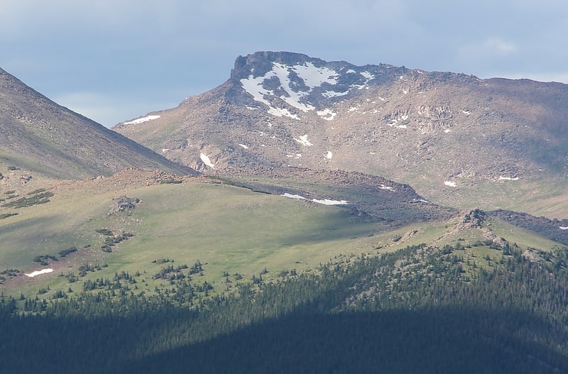
Hallett Peak
Mountain in Colorado. Hallett Peak is a mountain summit in the northern Front Range of the Rocky Mountains of North America. The 12,720-foot peak is located in the Rocky Mountain National Park Wilderness, 10.1 miles southwest by west of the Town of Estes Park, Colorado, United States, on the Continental Divide between Grand and Larimer counties.[9]
Twin Sisters Peaks
Mountain in Colorado. The Twin Sisters Peaks are mountains in Colorado, located in the Front Range in Larimer County, Colorado, straddling Rocky Mountain National Park and Roosevelt National Forest.[10]
Powell Peak
Powell Peak is a summit in Grand County, Colorado, in the United States. With an elevation of 13,176 feet, Powell Peak is the 512th highest summit in the state of Colorado.
The peak was named for John Wesley Powell.[11]
Ypsilon Mountain
Mountain in Colorado. Ypsilon Mountain, elevation 13,520 ft, is in the Mummy Range of Rocky Mountain National Park in northern Colorado. The mountain, along with Mount Chiquita, is most easily accessed from a trailhead on Fall River Road to the south.[12]
Wild Basin
Picnic ground in Boulder County, Colorado. Wild Basin a region in the southeast corner Rocky Mountain National Park in Colorado, United States. The primary entrance is located north of Allenspark off State Highway 7.
A dirt road leads to a ranger station, parking and horseback or hiking trails. The trail to Bluebird Lake and Ouzel Lake follows the North St. Vrain Creek (which is a tributary of the South Platte River) passing Calypso Cascades and Ouzel Falls along the way, leading to Ouzel Lake and Bluebird Lake. Both Ouzel Falls and Ouzel Lake are named after a North American species of bird, Cinclus mexicanus, also known as a dipper. Other trails lead to Thunder Lake, Finch Lake, and Pear Lake.[13]
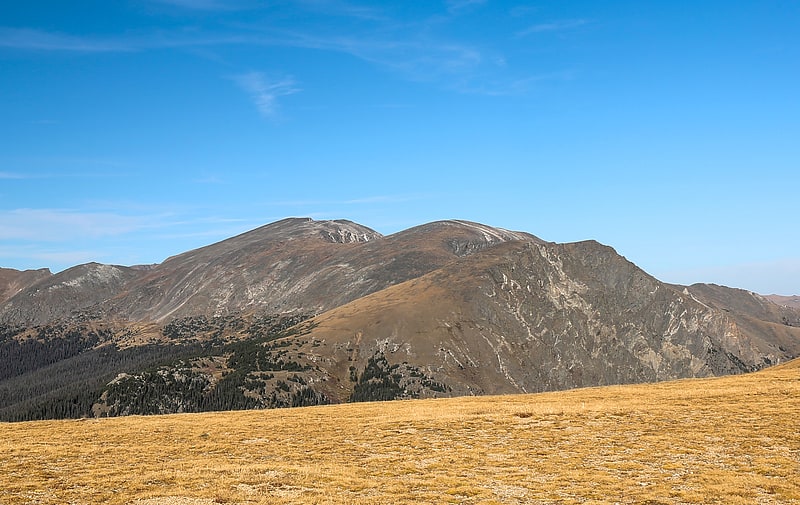
Hagues Peak
Summit in Colorado. Hagues Peak is the highest summit of the Mummy Range in the Rocky Mountains of North America. The 13,573-foot thirteener is in the Rocky Mountain National Park Wilderness, 9.9 miles northwest of the Town of Estes Park, Colorado, United States. Hagues Peak is the highest point in Larimer County, Colorado.[14]
Mount Ida
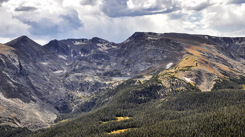
Mountain in Colorado. Mount Ida is a mountain summit in the northern Front Range of the Rocky Mountains of North America. The 12,874-foot peak is located in the Rocky Mountain National Park Wilderness, 13.4 miles west of the Town of Estes Park, Colorado, United States, on the Continental Divide between Grand and Larimer counties. The mountain was probably named after Mount Ida on Crete.[15]
Mount Chiquita
Mountain in Colorado. Mount Chiquita is a mountain summit in the Mummy Range of the Rocky Mountains of North America. The 13,075-foot thirteener is located in Rocky Mountain National Park, 9.8 miles northwest by west of the Town of Estes Park in Larimer County, Colorado, United States.
Tourists can reach Mount Chiquita via Chapin Pass which is an 8.0 kilometer out and back trail located near Estes Park, Colorado that features beautiful wild flowers and is rated as moderate. The trail is primarily used for hiking and running and is accessible year-round.[16]
Mummy Mountain
Mountain in Colorado. Mummy Mountain is a high mountain summit in the Mummy Range of the Rocky Mountains of North America. The 13,430-foot thirteener is located in the Rocky Mountain National Park, 8.5 miles northwest by north of the Town of Estes Park in Larimer County, Colorado, United States.[17]
Fern Lake
Lake in Colorado. Fern Lake is an alpine lake in Larimer County, Colorado, United States. It is a major source for the Big Thompson River.[18]
Alpine Visitor Center
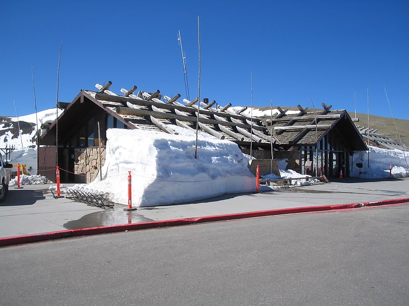
Visitor center in Larimer County, Colorado. Rocky Mountain National Park's Alpine Visitor Center is located at 11,796 feet above sea level at Fall River Pass, one mile west of the highest point on Trail Ridge Road and four miles east of the Continental Divide at Milner Pass in the U.S. state of Colorado. It is the highest visitor center in the National Park System.
The Alpine Visitor Center includes restrooms, exhibits on the alpine tundra ecosystem, and a gift shop operated by the park's non-profit partner organization, the Rocky Mountain Conservancy. The visitor center opens around Memorial Day and closes around mid-October due to snow and the extreme winter environment. In mid-summer, the visitor center is also usually accessible by Old Fall River Road, a 9-mile dirt road open to one-way, uphill vehicle traffic.
Views from the Alpine Visitor Center include the Mummy Range, the Fall River Valley, and Trail Ridge to the east and the Never Summer and Medicine Bow ranges to the west and north. Hiking opportunities include the 1/4-mile round-trip Alpine Ridge Trail, commonly referred to as "Huffer's Hill," and the 8-mile round-trip Ute Trail to Milner Pass. Park Rangers provide park orientation and interpretive programs on the alpine tundra.
Additional gift and food services at Fall River Pass are provided at the concession-operated "Trail Ridge Store and Cafe."[19]
Address: Rocky Mountain National Park, 80517 Rocky Mountain National Park
Kawuneeche Valley
Kawuneeche Valley, also known as Kawuneeche or Coyote Valley, is a marshy valley of the Colorado River near its beginning. It is located on the west side of Rocky Mountain National Park in Colorado. The axis of the valley runs almost directly north to south. Kawuneeche means "valley of the coyote" in Arapaho language and there is a Coyote Valley Trail head by US Route 34 in the western half of the park. Coyotes still live here, as do wapiti, mule deer, moose, and mountain lion.
Along the main part of valley runs the lower section of the Trail Ridge Road - the highest continuous paved road in the United States.[20]