Discover 10 hidden attractions, cool sights, and unusual things to do in Prescott National Forest (United States). Don't miss out on these must-see attractions: Out of Africa Wildlife Park, Mingus Mountain, and Mingus Lookout Complex. Also, be sure to include Thumb Butte in your itinerary.
Below, you can find the list of the most amazing places you should visit in Prescott National Forest (Arizona).
Table of Contents
Out of Africa Wildlife Park

Wildlife park in Camp Verde, Arizona. Out of Africa Wildlife Park is a wildlife park and zoo in Camp Verde, Arizona. It was opened to the public in 2005.
Dean Harrison is the owner.[1]
Address: 3505 W State Route 260, Prescott National Forest
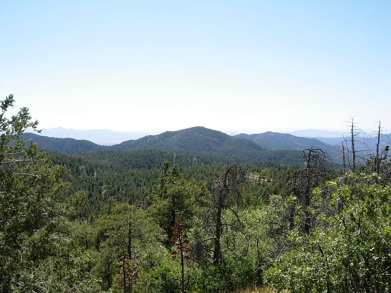
Mingus Mountain
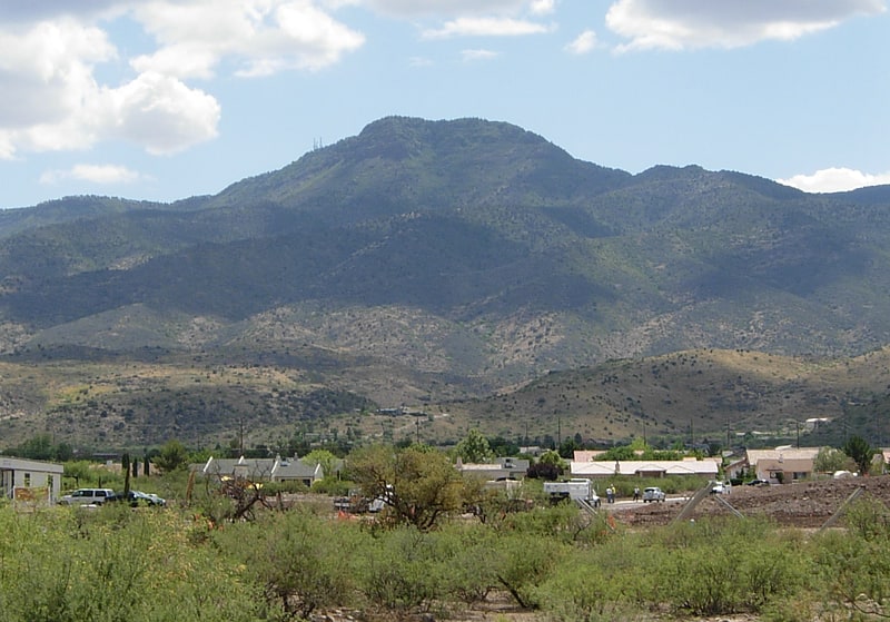
Mountain in Arizona. Mingus Mountain is a mountain located in the U.S. state of Arizona in the Black Hills mountain range. It is located within the Prescott National Forest traversed by State Route 89A approximately midway between Cottonwood and Prescott. The summit can be reached via Forest Service roads that branch off from State Route 89A. From the mountain, there are views of the Verde Valley, Sycamore Canyon Wilderness and the towns of Cottonwood, Jerome, and Clarkdale. The Woodchute Wilderness, north of the summit of 89A, also offers views and hiking trails. There are several National Forest campgrounds in the area and it is the transmitter location for Prescott full-service television station KAZT-TV and several low-power television stations serving Cottonwood, Clarkdale, Camp Verde and Prescott Valley. Mingus Mountain is also the premier flying site of the Arizona Hang Gliding and Paragliding Association.
According to the book, Roadside History of Arizona, by Marshall Trimble, "Mingus Mountain was named for Joseph and Jacob Mingus, two brothers who settled in the area in the 1880s and later operated a sawmill near the base of the mountain". Another source attributes the name to William Mingus (d. 1911, Prescott, Arizona), a pioneer prospector who lived and worked on Mingus Mountain in the 1870s.
The Mingus Lookout Complex is a complex of fire tower and associated buildings at the top of the mountain, and is listed on the National Register of Historic Places.[2]
Mingus Lookout Complex
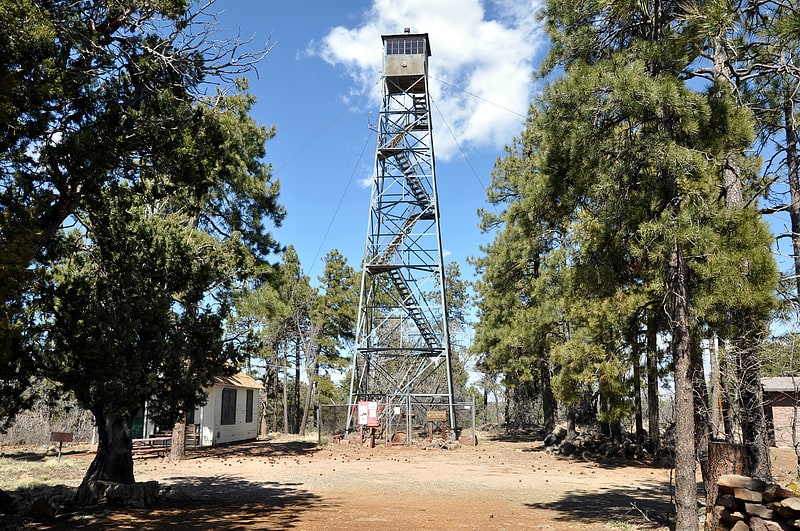
Mingus Lookout Complex is a fire tower lookout complex atop Mingus Mountain in Prescott National Forest, in Arizona. It was listed on the National Register of Historic Places in 1988.
The fire tower is a 60 feet (18 m) Pacific Coast Steel tower built in 1935. It replaced a 41 feet (12 m) wooden tower. The tower has a 7 feet (2.1 m) by 7 feet (2.1 m) wooden cab with an overhanging front porch and a gable roof.
It was listed on the National Register along with 41 other fire lookout towers in a batch in 1998.[3]
Thumb Butte
Park, Relax in park
Address: 3200 Thumb Butte Rd, Prescott National Forest
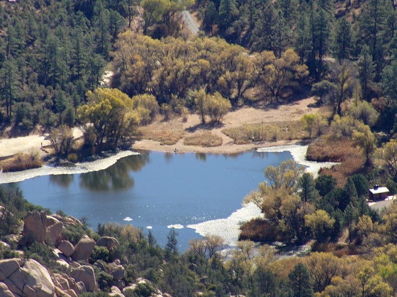
Lynx Lake
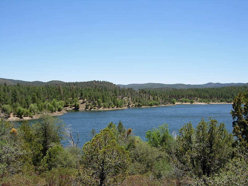
Reservoir in Arizona. Lynx Lake, Arizona, is a 55-acre reservoir located within Prescott National Forest, approximately 5 miles east of Prescott, Arizona, in the Bradshaw Mountains. The lake is located at 5,530 feet elevation and is stocked for fishing. It is one of the most popular recreation areas in central Arizona. Mild weather, the cool ponderosa pine forest, trout fishing, boating, mountain hiking, horseback riding, archaeological sites, and bird watching attract visitors from throughout Arizona. The lake was formed in 1952, when a dam was put in Lynx Creek, 6 miles below Walker, Arizona.[4]
Lonesome Valley
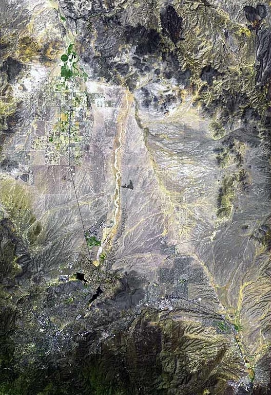
Valley in Arizona. Lonesome Valley is a 23-mile long valley located in central-north Yavapai County, Arizona; the valley is an extension southeastwards from Chino Valley, the location of the Big Chino Wash, which becomes the Verde River at Paulden, Arizona; Paulden is located at the northwest terminus of Lonesome Valley. A small sub-valley is located on the northeast perimeter of Chino Valley, Arizona, located in the center-northwest of Lonesome Valley. The valley is named Little Chino Valley, and is the small valley link between Chino Valley, northwest, and Lonesome Valley, southeast.
The notable landforms of Granite Mountain lie west-southwest, and Granite Dells are at the southwest perimeter. The massif of the Black Hills (Yavapai County) form the east border of Lonesome Valley.
An important water divide is at the south terminus region of the valley at the north of Prescott Valley, Arizona, separating the Verde River watershed from the Agua Fria River watershed; both watersheds are north tributaries to the Gila River, flowing west across central-south Arizona.[5]
Perkinsville Bridge
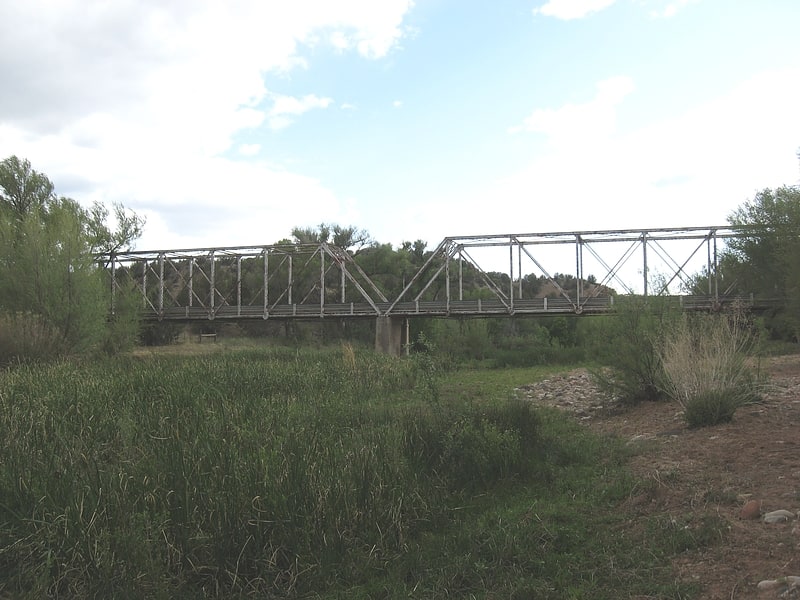
Bridge in Yavapai County, Arizona. The Perkinsville Bridge over the Verde River was established in 1936 when it was moved from the San Carlos Indian Reservation over the Gila River. The current structure was constructed from spans of the San Carlos Bridge which was built in 1913 and then rebuilt in 1921 after damage due to flooding. It was listed on the National Register of Historic Places in 1989.[6]
Bradshaw Mountains
Mountain range in Arizona. The Bradshaw Mountains are a mountain range in central Arizona, United States, named for brothers Isaac and William D. Bradshaw after their deaths, having been formerly known in English as the Silver Mountain Range.[7]
Santa Maria Mountains
Mountain range in Arizona. The Santa Maria Mountains are a 16-mi long mountain range in central-northwest Arizona, and in northwest Yavapai County. The range lies in a region of mesas and mountain ranges in the northwest of Arizona's transition zone. The Santa Maria Mountains lie east of the transition zone's northwest perimeter, the parallel Aquarius and Mohon Mountains.
The townsite of Tucker, Arizona lies 8 mi east, and is located just west of Chino Valley, AZ. Tucker lies in the center-east of the small Williamson Valley.[8]
Granite Basin Lake
Reservoir in Arizona. Granite Basin Lake is a reservoir located near Prescott, in Yavapai County, North Central Arizona. It is in the Prescott National Forest, adjacent to the Granite Mountain Wilderness Area.[9]