Discover 11 hidden attractions, cool sights, and unusual things to do in Coconino National Forest (United States). Don't miss out on these must-see attractions: Bell Rock, O'Leary Peak, and Lava River Cave. Also, be sure to include Courthouse Butte in your itinerary.
Below, you can find the list of the most amazing places you should visit in Coconino National Forest (Arizona).
Table of Contents
Bell Rock
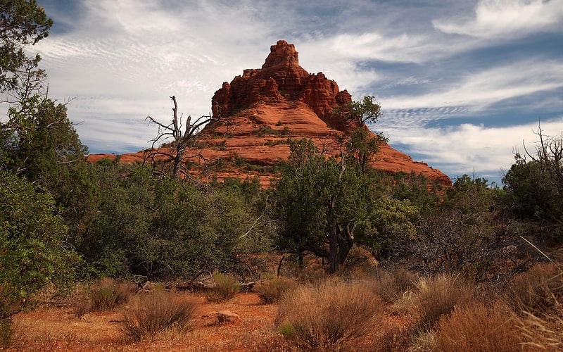
Iconic bell-shaped butte and hiking path. Bell Rock is a butte just north of the Village of Oak Creek, Arizona, south of Sedona in Yavapai County. With an elevation at its summit of 4,919 feet, it is just west of Courthouse Butte. Its panoramic views make it a popular landmark and tourist attraction.
The most popular route is a moderate hike that reaches a small plateau on the northwest face of the butte. A challenging unmarked trail must be taken to reach the summit.[1]
O'Leary Peak
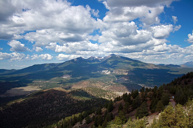
Peak in Arizona. O'Leary Peak is an extinct Pleistocene lava dome volcano within the San Francisco volcanic field, north of Flagstaff, Arizona, and to the northwest of Sunset Crater National Monument. A fire lookout tower was built on a subsidiary eastern peak. It has an elevation of 8,919 feet.[2]
Lava River Cave
Lava tube in Arizona. Lava River Cave is a lava tube in northern Arizona's Coconino National Forest. At approximately 0.75-mile long, it is the longest cave of its kind known in Arizona. The cave was discovered by some lumbermen in 1915 and has historically been referred to as "Government Cave" due to its location on the eastern edge of Government Prairie and southeast of Government Peak. Today, Lava River Cave is freely accessible to the general public.
Geologists believe the cave was formed sometime between 650,000 and 700,000 years ago when molten lava erupted from a volcanic vent in nearby Hart Prairie. The top, sides and bottom of the flow cooled and solidified, while lava in the middle flowed out, leaving a hollow space to form the cave. Examples of both ʻAʻā and Pāhoehoe basaltic lava can be seen in the cave.
The cave is mostly dry, but due to the temperature change, there is a lot of condensation on the walls, ceiling and floor near the entrance, which makes it slippery. Temperatures inside are around 40 °F during the summer, and it is not uncommon for some of the rocks to be covered with ice. The cave can range in height from 30 feet to only 2 to 3 feet, although the latter only at a side passage that rejoins the main tunnel. There are no light sources inside. It is recommended visitors have sturdy hiking boots, warm clothing, and multiple sources of light.
Litter and graffiti have been problems since the late 1960s. A major restoration effort was organized in May 1991. Almost all the litter was packed out and much of the graffiti removed at that time. Dogs should not be taken in the cave since there are only limited and very slow biological processes to render their urine and feces unobjectionable.
The entrance to the cave is around 14 miles west of Flagstaff, Arizona. Being in Coconino National Forest, the cave is managed by the United States Forest Service. While the cave is open year-round, the dirt roads which lead there may be impassable to cars in winter months or during wet weather conditions. There are no entrance or use fees.[3]
Address: Coconino National Forest, Coconino National Forest
Courthouse Butte
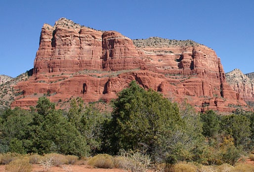
Butte in Arizona. Courthouse Butte is a butte just north of the Village of Oak Creek, Arizona, south of Sedona in Yavapai County. Summit elevation is 5,454 feet. It is just east of Bell Rock.
Geologically, Courthouse Butte is composed of horizontally bedded sedimentary rock of the Permian Supai Formation.[4]
Knoll Lake
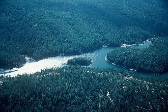
Lake in Arizona. Knoll Lake is part of the Blue Ridge Ranger District of the Coconino National Forest. It gets its name from a rocky island located in the middle of the lake. Knoll Lake is located in Leonard Canyon, Arizona, along the Mogollon Rim. This 75-acre lake is located at 7,340 feet elevation and is closed to visitors in the winter months. Bald eagles may be seen during the winter months if the roads are open late into the season. The facilities are maintained by Coconino National Forest division of the USDA Forest Service.[5]
Oak Creek Canyon
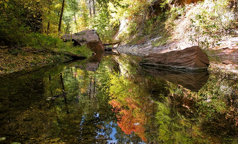
River gorge with swimming and fishing. Oak Creek Canyon is a river gorge located in northern Arizona between the cities of Flagstaff and Sedona. The canyon is often described as a smaller cousin of the Grand Canyon because of its scenic beauty. State Route 89A enters the canyon on its north end via a series of hairpin turns before traversing the bottom of the canyon for about 13 miles until the highway enters the town of Sedona.[6]
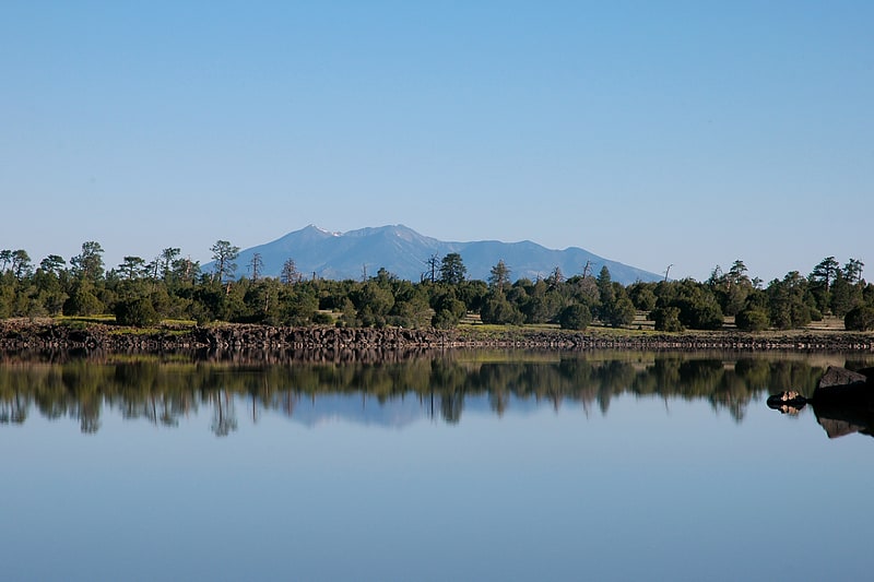
Lake Mary
Lake in Arizona. Lake Mary may refer to one of two reservoirs in northern Arizona southeast of Flagstaff. The name may also be used to refer to the two lakes as a whole. The pair of lakes impound the intermittent Walnut Creek upstream from Walnut Canyon. Recreational facilities at both lakes are maintained under the authority of the Coconino National Forest.[7]
Ashurst Lake
Lake in Arizona. Ashurst Lake is a small lake located on the Anderson Mesa 20 miles southeast of Flagstaff. It is one of the few natural lakes in the state of Arizona, the bulk of which reside in the area.
Unlike similarly sized lakes in the North Central Arizona region, Ashurst is fed by more reliable springs and has a reputation for retaining water even during long dry periods. The lake is regularly stocked with rainbow trout and thus a common destination for local anglers. Ashurst Lake is also considered a favorable fishing location for Northern Pike. The facilities are maintained under the authority of the Coconino National Forest.
The lake has two campgrounds, Ashurst Lake on the west shore and Forked Pine on the east shore.[8]
Lowell Discovery Telescope
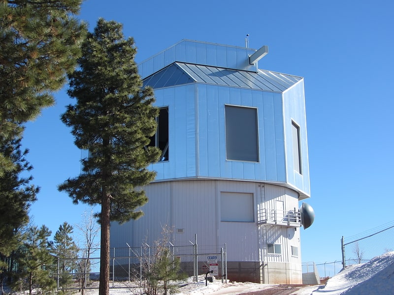
The Lowell Discovery Telescope, formerly the Discovery Channel Telescope, is a 4.3 m aperture telescope owned and operated by Lowell Observatory. The LDT was built at a dark sky site in the Coconino National Forest near Happy Jack, Arizona. Happy Jack is located at an elevation of 2,360 m and is approximately 65 km south-south-east of Flagstaff. The project was initially a partnership between Discovery Communications and Lowell Observatory. The research partnerships have been extended to include Boston University, The University of Maryland, The University of Toledo, and Northern Arizona University. The telescope cost $53 million. It significantly augments Lowell Observatory's observational capability and enables pioneering studies in a number of important research areas.
With its 4-meter class primary mirror, the Lowell Discovery Telescope is the fifth largest telescope in the continental United States (as of 2019).
Final construction of the telescope was completed by February 2012 and first light images were taken in April 2012.[9]
Red Rock-Secret Mountain Wilderness
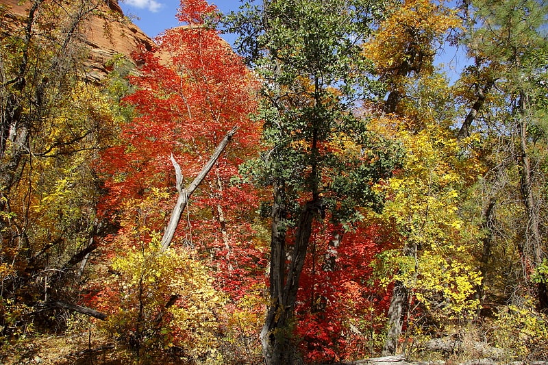
Hiking area in Yavapai County, Arizona. The Red Rock-Secret Mountain Wilderness is a 47,195-acre wilderness area located within the Coconino National Forest in the U.S. state of Arizona.
The wilderness is predominantly wind and water sculpted pinnacles, windows, arches, and slot canyons, and the red-rock cliffs of the Mogollon Rim that mark the edge of the Colorado Plateau. Bordered on the east by Sycamore Canyon Wilderness, the high mesas of Secret Mountain and Wilson Mountain jut out into the lower country and canyons as deep as 1,500 feet (457 m) drain into Oak Creek and the Verde River.
Prehistoric rock art and abandoned cliff dwellings can be found in the wilderness.[10]
V Bar V Heritage Site
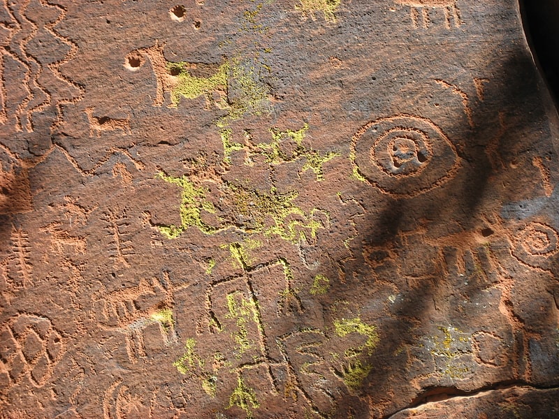
Historical place in Yavapai County, Arizona. The V Bar V Heritage Site is the largest known petroglyph site in the Verde Valley of central Arizona, and one of the best-preserved. The rock art site consists of 1,032 petroglyphs in 13 panels. Acquired by the Coconino National Forest in 1994, the site is protected and kept open to the public by the US Forest Service. Volunteers from the Verde Valley Archaeological Society and the Friends of the Forest provide interpretive tours and on-site management.
A visitor center, restroom and bookstore, operated by the Forest Service and the Arizona Natural History Association, is located on site. The fenced petroglyph site is an easy half-mile walk from the parking lot. For most of the year, there is a resident on-site custodian.[11]