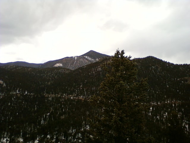
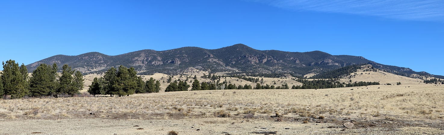
Discover 11 hidden attractions, cool sights, and unusual things to do in Pike National Forest (United States). Don't miss out on these must-see attractions: Pikes Peak, Cheyenne Mountain, and Mount Democrat. Also, be sure to include Devil's Head Lookout in your itinerary.
Below, you can find the list of the most amazing places you should visit in Pike National Forest (Colorado).
Table of Contents
Pikes Peak
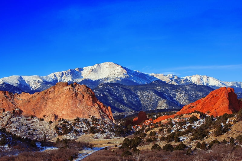
Prominent mountain for hiking and climbing. Pikes Peak is the highest summit of the southern Front Range of the Rocky Mountains, in North America. The ultra-prominent 14,115-foot fourteener is located in Pike National Forest, 12 miles west of downtown Colorado Springs, Colorado. The town of Manitou Springs lies at its base.
The mountain is named in honor of American explorer Zebulon Pike (though he was unable to reach the summit). The summit is higher than any point in the United States east of its longitude.[1]
Address: Highway 24, 80809 Colorado Springs
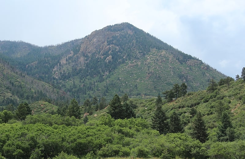
Cheyenne Mountain
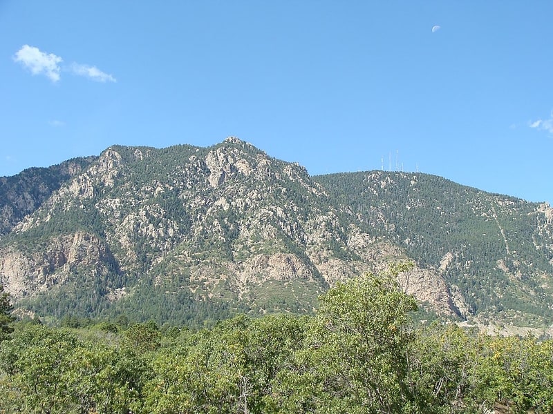
Peak in Colorado. Cheyenne Mountain is a triple-peaked mountain in El Paso County, Colorado, southwest of downtown Colorado Springs. The mountain serves as a host for military, communications, recreational, and residential functions. The underground operations center for the North American Aerospace Defense Command was built during the Cold War to monitor North American airspace for missile launches and Soviet military aircraft. Built deep within granite, it was designed to withstand the impact and fallout from a nuclear bomb. Its function broadened with the end of the Cold War, and then many of its functions were transferred to Peterson Air Force Base in 2006.
Homesteading on the mountain began in 1867 and the mountain was the site of resorts and retreats beginning in the 1880s. Spencer Penrose, who built The Broadmoor in 1918, bought many of the properties on the mountain and built the Cheyenne Mountain Zoo, Cheyenne Mountain Highway, Will Rogers Shrine of the Sun, a lodge on one of the mountain peaks, and a retreat at Emerald Valley. The site of the lodge has become a wilderness Cloud Camp and Emerald Valley is now the site of The Broadmoor's Ranch at Emerald Valley. Land on Cheyenne Mountain that had once been owned by The Broadmoor is now the site of luxury homes. A community, Overlook Colony, that began in 1911 still resides on the mountain.
The two parks on and at the base of Cheyenne Mountain are Cheyenne Mountain State Park and North Cheyenne Cañon Park. A noticeable feature on the top of one of Cheyenne Mountain's peaks is an antenna farm with transmitters for cellular phone, radio, television, and law enforcement purposes.[2]
Mount Democrat
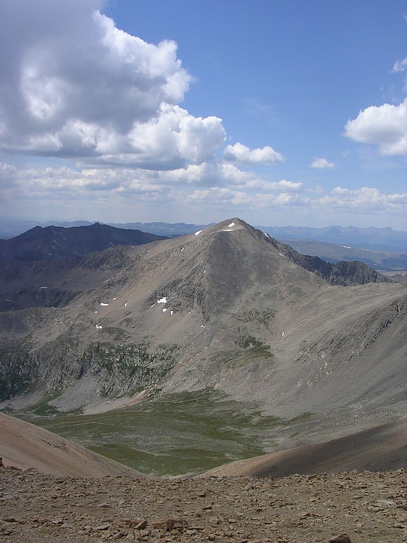
Mountain in Colorado. Mount Democrat is a high mountain summit in the Mosquito Range of the Rocky Mountains of North America. The 14,155-foot fourteener is located 5.4 miles northwest of the Town of Alma, Colorado, United States, on the Continental Divide separating San Isabel National Forest and Lake County from Pike National Forest and Park County.[3]
Devil's Head Lookout
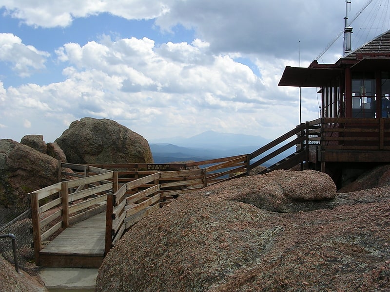
Tourist attraction in Douglas County, Colorado. Devil's Head Lookout is a U.S. Forest Service fire lookout tower at the summit of Devils Head in Douglas County, Colorado. Located on a large pinnacle of Pikes Peak granite, the fire lookout point lies within the Pike National Forest and is accessed by hiking the Devils Head National Recreation Trail.
The station was first established in 1912, with the original tower built in 1919. In the summer of 1951, the old tower was dismantled and current structure was built. In 1991, Devil's Head Lookout was added to the National Register of Historic Places. Sitting at the highest point of Rampart Range, the fire lookout is the last remaining such structure to be in service along the Front Range of Colorado.
The view from the current structure extends at least 100 miles in every direction on clear days.
The lookout (elev. 9748 feet, or 2971 m) can be accessed via easy/moderate trail (2.8 miles, or 4.5 km round trip) with elevation gain of 951 feet, or 290 m. The last stretch is a climb on 143 stairs. The access is from Rampart Range Road, a 14.5-km dirt road (easily accessible by passenger cars) from CO67. Note that the road to the trailhead is always closed to vehicles during the winter and typically does not open until April or May.[4]
Blodgett Peak
Mountain in Colorado. Blodgett Peak is a mountain summit in El Paso County, Colorado. Blodgett Peak is located in Pike National Forest. and at its base is Blodgett Peak Open Space of Colorado Springs.[5]
Meyer–Womble Observatory
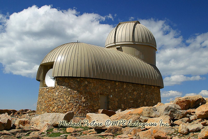
Astronomical observatory. Meyer–Womble Observatory is an astronomical observatory owned and operated by the University of Denver. It is located near the summit of Mount Evans in the Arapaho National Forest approximately 60 kilometers west of Denver, Colorado. At an elevation of 4,326 meters, it is the third-highest optical/infrared observatory in the world, and was the highest until the Indian Astronomical Observatory opened in 2001.
Through a gift of $3.8 million from the estate of William Womble, construction of the facility began in 1995 and was completed in 1996. Eric Meyer, M.D. an anesthesiologist who designed the dual-aperture 0.72 m (28 in) f/21 Ritchey-Chretien telescope, and his wife, Barbara, donated $1 million and brought the optical components personally from Chicago. The optical/infrared telescopes saw first light in August 1997.
During the 2011–12 winter, the dome over the telescope was damaged by high winds, allowing snow to enter the observing area. The telescope was secured in early April 2012 by a mountaineer who hiked to the summit. A complete inspection of the damage did not take place until the road to the summit opened in May. During the following summer, the remains of the old dome were demolished and a new dome was fabricated. Installation of the new structure occurred on October 20, 2012.[6]
Mount Silverheels
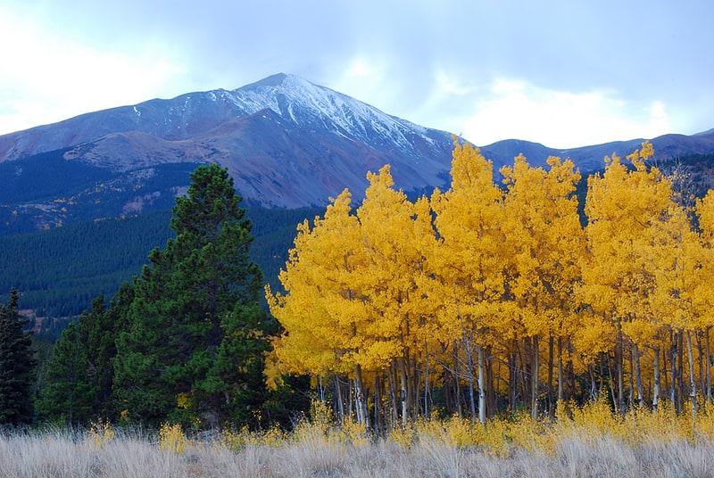
Mountain in Colorado. Mount Silverheels is a high and prominent mountain summit in the Front Range of the Rocky Mountains of North America. The 13,829-foot thirteener is located in Pike National Forest, 4.9 miles northeast of the Town of Alma in Park County, Colorado, United States.
Mount Silverheels is just east of two fourteeners: Mount Bross and Mount Lincoln.[7]
Devils Head
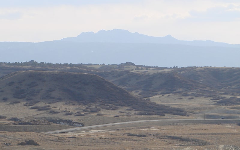
Mountain in Colorado. Devils Head is a mountain summit in the Rampart Range of the Rocky Mountains of Colorado. The 9,749-foot peak is located in Pike National Forest, 14.2 miles southwest by south of the community of Sedalia in Douglas County, Colorado, United States.[8]
Mount Rosa
Mountain in Colorado. Mount Rosa is a mountain summit of the Pikes Peak Massif in the southern Front Range of the Rocky Mountains of North America. The 11,504-foot peak is located in Pike National Forest, 12.8 miles southwest by west of downtown Colorado Springs in Teller County, Colorado, United States.[9]
Mount Buckskin
Mountain in Colorado. Mount Buckskin is a high mountain summit in the Mosquito Range of the Rocky Mountains of North America. The 13,872-foot thirteener is located in Pike National Forest, 4.9 miles west-northwest of the Town of Alma in Park County, Colorado, United States.[10]
Thirtynine Mile Mountain
Summit in Colorado. Thirtynine Mile Mountain, elevation 11,553 ft, is a summit in the Front Range of the Pike National Forest in central Colorado.[11]