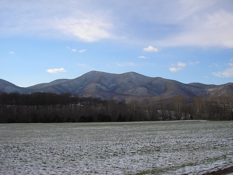
Discover 9 hidden attractions, cool sights, and unusual things to do in Mount Pleasant National Scenic Area (United States). Don't miss out on these must-see attractions: Crabtree Falls, The Priest Mountain, and Haines Chapel. Also, be sure to include The Blackburn Gallery in your itinerary.
Below, you can find the list of the most amazing places you should visit in Mount Pleasant National Scenic Area (Virginia).
Table of Contents
Crabtree Falls
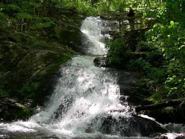
Waterfall in Virginia. Crabtree Falls is one of the tallest sets of waterfalls in the United States east of the Mississippi River. It is located in the George Washington National Forest in Nelson County, Virginia, off of Virginia State Route 56. The name of the falls is thought to have come from William Crabtree, who settled in this part of Virginia in 1777. L.A. Snead, former US Assistant Fuel Administrator, environmentalist and notable Nelsonian, spearheaded negotiations to secure land surrounding Crabtree Falls after it was almost developed as a resort area in the late 1960s. Using personal and Congressional funds, the land deals were completed and the deeds transferred by LA Snead on June 3, 1968, to the National Forest System. This assured benefit for future generations of this magnificent Nelson County treasure.
The set of waterfalls is often credited with being 1,200 feet (370 m) high, but topographic maps show the total drop to be closer to 1,000 feet (300 m). Crabtree Falls is a series of cascading waterfalls, with five major cascades, the tallest of which drops about 400 feet (120 m), and several smaller cascades, all over a total distance of approximately 2,500 feet (760 m) horizontally. The cascade with a 400-foot (120 m) drop also gives Crabtree Falls the title of tallest vertical drop in a waterfall east of the Mississippi River. However, the title of tallest free-fall vertical drop goes to Fall Creek Falls in Tennessee's Fall Creek Falls State Park.
There is a trail to the waterfall maintained by the United States Forest Service called the Crabtree Falls Trail. Twenty-nine people have fallen to their deaths from leaving the trail to climb too close to the waterfalls. Recent deaths occurred April 2013, June 2015, and most recently, August 29, 2015.[1]
Address: Rte. 56, Mount Pleasant National Scenic Area
The Priest Mountain
Mountain in Virginia. The Priest is a mountain in Nelson County, Virginia. The peak of the mountain is the highest point in the county. The mountain is on a spur off the main Blue Ridge Mountains, about 3.5 miles east of Maintop Mountain, located in the Priest Wilderness of the George Washington National Forest.
The Priest stands within the watershed of the Tye River, which drains into the James River. The north side of The Priest drains into Coxs Creek, thence into the Tye River. The south side of The Priest drains into Rocky Run, thence into the Tye. The west side of The Priest drains into Shoe Creek, thence into the Piney River and the Tye River.
The Appalachian Trail, a 2,193-mile (3,529.29-km) National Scenic Trail from Georgia to Maine, runs across the summit of The Priest. The summit is reachable via the Appalachian Trail from a trail head along Virginia State Route 56. The hike gains 3000 vertical feet from base to summit.
Crabtree Falls flows down the Priest's northwest slope. The Crabtree Falls trail and Forest Development Road 826 can be used for access to the Appalachian Trail and the Priest's summit.[2]
Haines Chapel
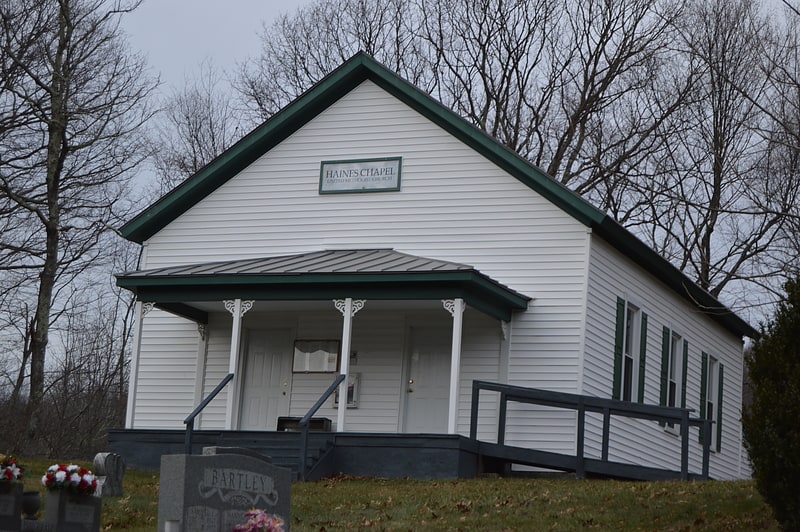
Cemetery. Haines Chapel, together with the South Mountain Cemetery, is a historic property located near the Blue Ridge Parkway in Rockbridge and Nelson Counties in the U.S. state of Virginia. The site is located just west of the parkway and north of Virginia Route 56. The cemetery apparently began as a family cemetery in the 18th century; its oldest dated grave marker is a modern one dated 1793, although the oldest legible stone gives a date of 1857. The chapel, a simple wood-frame building constructed in 1914, stands on the Nelson County side of the property. Its interior contains well-preserved period woodwork, and is largely in original condition, including a period piano and organ. It is still used occasionally for services and special occasions, and the cemetery is also open to new burials.
The church and cemetery were listed on the National Register of Historic Places in 2014.[3]
The Blackburn Gallery

Museum, Classes and workshops, Art gallery, Shopping
Address: 18 Pheasant Run, 22980 Nellysford
Saint Mary's Wilderness
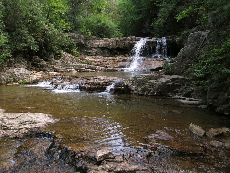
Park in Raphine, Virginia. Saint Mary's Wilderness is a U.S. Wilderness Area in the George Washington and Jefferson National Forests. The wilderness area is located next to the Blue Ridge Parkway near the Parkway's northern terminus and consists of 9,826 acres. Saint Mary's Wilderness is the largest Virginia Wilderness on national forest land. Saint Mary's Wilderness ranges in elevation from about 1,780 feet to 3,640 feet. The area has about 14 miles of hiking trails within or near its boundaries.
Saint Mary's Wilderness includes the drainages of Cellar Hollow, Spy Run, and the upper part of the Saint Mary's River. Each waterway is a tributary of the South River; via the Maury and James rivers, which are part of the Chesapeake Bay watershed.[4]
Macedonia Methodist Church
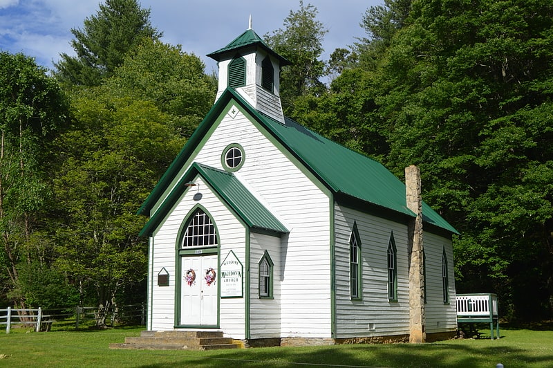
Church. Macedonia Methodist Church is a historic Methodist church located at Coffeytown, near Vesuvius, Amherst County, Virginia. It was built in 1896, and is a one-story, frame church building with vernacular Gothic Revival style influences. It sits on a random rubble stone foundation and has a gable roof with front bell tower. The interior features original unpainted American chestnut beaded board paneling on the walls and ceiling.
It was added to the National Register of Historic Places in 2011.[5]
River Bluff
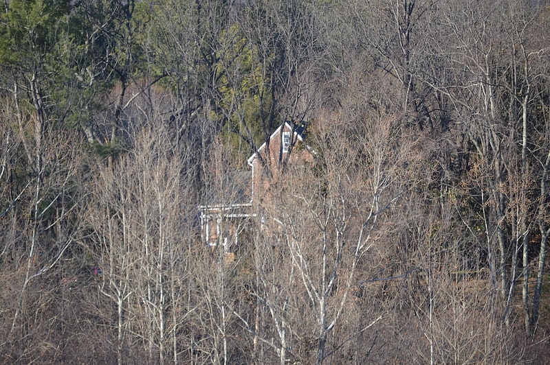
River Bluff is a historic home located near Wintergreen, Nelson County, Virginia. It is sited on a steep bank overlooking the South Fork of the Rockfish River. It is a three-part Flemish bond brick house consisting of a two-story central pavilion with one-story flanking wings. The main block was constructed about 1785, and the house achieved its final form by about 1805.
It was listed on the National Register of Historic Places in 1980.[6]
Mt. Torry Furnace
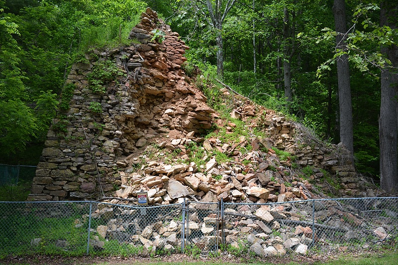
Mt. Torry Furnace, also known as Virginia Furnace, is a historic iron furnace located at Sherando, Augusta County, Virginia. It was built in 1804, and is a stone square trapezoid measuring 30 feet at the base and 40 feet tall. The original cold-blast charcoal stack was converted for hot blast in 1853. It shut down in 1855, then was reactivated in 1863 to support the Confederate States Army. The furnace was destroyed in June 1864 during the American Civil War by Brigadier General Alfred N. Duffié, then rebuilt in January 1865. It operated until 1884.
It was listed on the National Register of Historic Places in 1974.[7]
Elk Hill
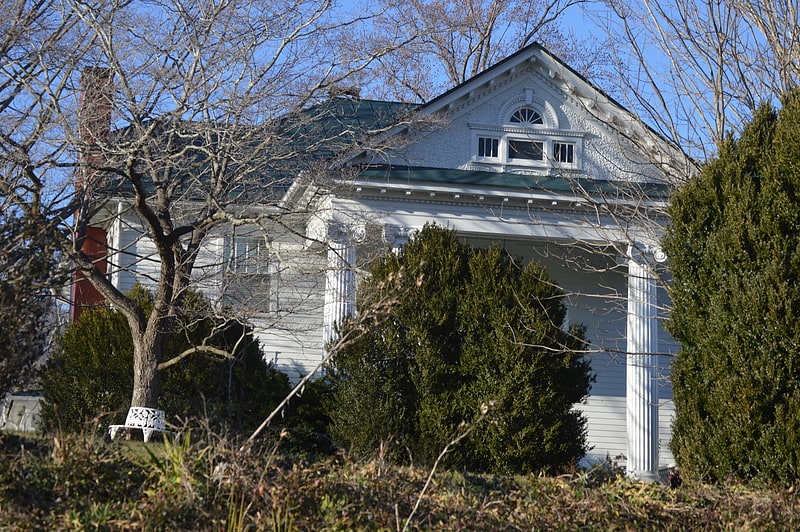
Elk Hill is a historic house and farm complex located near Nellysford, Nelson County, Virginia. It is one of the earliest extant farms in Nelson County. The 173-acre rural farm bounded in part by the South Fork of the Rockfish River and Reid's Creek. The main house is a substantial two-story, three-bay wide frame dwelling with a central hall plan, with the original portion built between 1790 and 1810. The house underwent a series of 19th-century additions and a major remodeling in 1902 in the neoclassical style. The contributing outbuildings include: smokehouse, built in the last quarter of the 18th century; tobacco barn, built circa 1790-1810; 19th century chicken house, two seat outhouse, and double crib barn; garages built in 1902 and in 1955; and a stone boundary/retaining wall, built in the last quarter of the 18th century.
It was listed on the National Register of Historic Places in 2007.[8]