Discover 9 hidden attractions, cool sights, and unusual things to do in Maroon Bells–Snowmass Wilderness (United States). Don't miss out on these must-see attractions: Maroon Bells, Castle Peak, and Capitol Peak. Also, be sure to include Pyramid Peak in your itinerary.
Below, you can find the list of the most amazing places you should visit in Maroon Bells–Snowmass Wilderness (Colorado).
Table of Contents
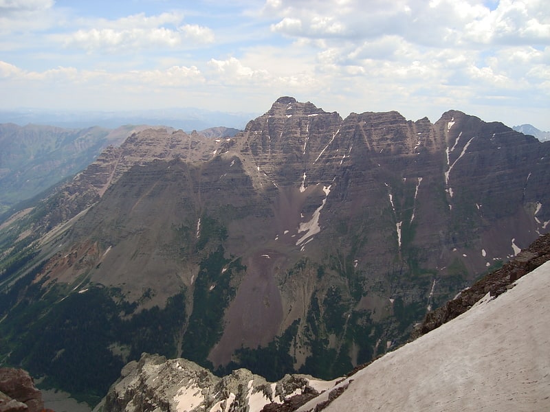
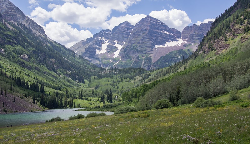
Maroon Bells
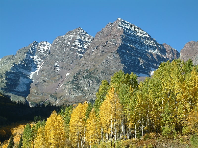
Famous mountain peaks with a shuttle. The Maroon Bells are two peaks in the Elk Mountains, Maroon Peak and North Maroon Peak, separated by about half a kilometer. The mountains are on the border between Pitkin County and Gunnison County, Colorado, United States, about 19 kilometres southwest of Aspen. Both peaks are fourteeners. Maroon Peak, at 4,317 metres, is the 27th highest peak in Colorado. North Maroon Peak, at 4,273 metres, is the 50th highest. The view of the Maroon Bells to the southwest from the Maroon Creek valley is very heavily photographed. The peaks are located in the Maroon Bells–Snowmass Wilderness of White River National Forest. Maroon Bells-Snowmass Wilderness was one of five areas in Colorado designated as wilderness in the original Wilderness Act of 1964. The Wilderness area surrounds the extremely popular Maroon Bells Scenic Area, which is a major access point for Wilderness travel.[1]
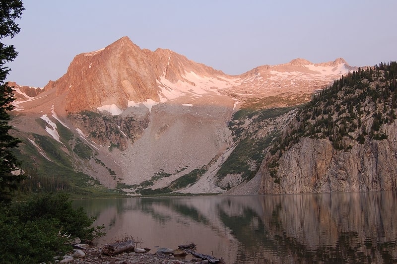
Castle Peak
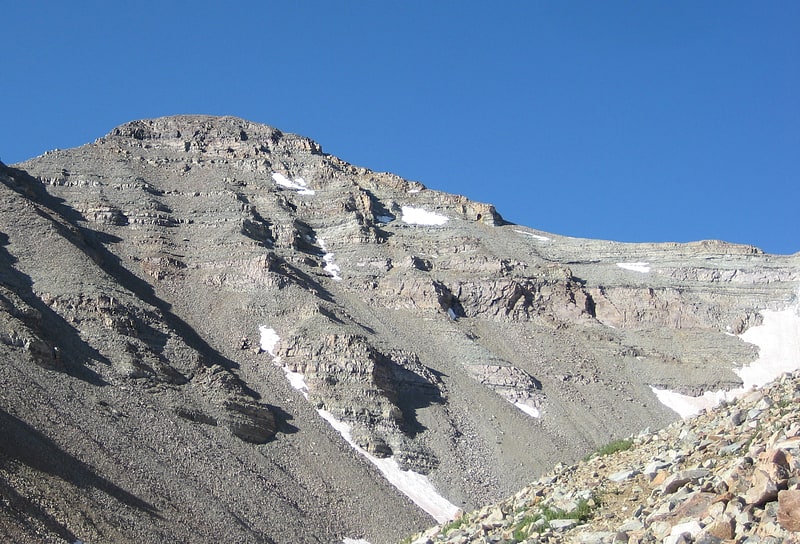
Mountain. Castle Peak is the ninth highest summit of the Rocky Mountains of North America and the U.S. state of Colorado. The prominent 14,279-foot fourteener is the highest summit of the Elk Mountains and the Maroon Bells-Snowmass Wilderness. The peak is located 11.6 miles northeast by north of the Town of Crested Butte, Colorado, United States, on the drainage divide separating Gunnison National Forest and Gunnison County from White River National Forest and Pitkin County. The summit of Castle Peak is the highest point of both counties.[2]
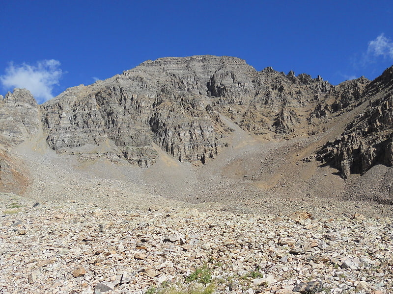
Capitol Peak
Mountain in Colorado. Capitol Peak is a high and prominent mountain summit in the Elk Mountains range of the Rocky Mountains of North America. It is the 52nd highest mountain in North America. The 14,137-foot fourteener is located in the Maroon Bells-Snowmass Wilderness of White River National Forest, 8.7 miles east by south of the community of Redstone in Pitkin County, Colorado, United States.[3]
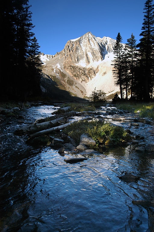
Pyramid Peak
Mountain in Colorado. Pyramid Peak is a fourteen thousand foot mountain in the U.S. state of Colorado. It is the 47th highest mountain peak in Colorado, and 78th highest peak in the United States. It is located in the Elk Mountains in southeastern Pitkin County, approximately 12 miles southwest of Aspen. The summit somewhat resembles a ragged square pyramid and is visible from the Roaring Fork River valley north of Aspen along the canyon of Maroon Creek.
Like many of the peaks in the Elks, Pyramid Peak is quite steep, especially compared to more gentle fourteeners such as Mount Elbert. For example, the peak's summit rises 4,000 feet (1,200 m) above Crater Lake to the northwest in only 1.2 miles (1.9 km), and 4,400 feet (1,300 m) above East Maroon Creek to the east of the peak in the same horizontal distance.[4]
Snowmass Mountain
Mountain in Colorado. Snowmass Mountain is a 14,099-foot-high mountain in the U.S. state of Colorado, and the thirty-fourth highest mountain peak in the state. Located in the Elk Mountains within the Maroon Bells-Snowmass Wilderness of the White River National Forest, it lies along the border between Pitkin and Gunnison counties, west of Aspen and southwest of the town of Snowmass Village.
Snowmass Mountain is named for the large snowfield that lies on its eastern slopes. Snowmass Mountain should not be confused with the Snowmass ski area, located outside Snowmass Village; nor with nearby Snowmass Peak, a lower but more visually striking peak that towers over Snowmass Lake. Hagerman Peak sits between Snowmass Mountain and Snowmass Peak and is also often mistaken for Snowmass Mountain.[5]
Snowmass Peak
Peak in Colorado. Snowmass Peak in the U.S. state of Colorado dominates the view from Snowmass Lake. It is often mistaken for Snowmass Mountain, the thirty-fourth highest mountain peak in the state, as well as for Hagerman Peak. Snowmass Peak is not really a peak but the lower end of Hagerman Peak's east ridge. Natural forced perspective causes the optical illusion that Snowmass Peak is higher than Hagerman Peak though it is actually 221 ft shorter than Hagerman's summit. This illusion combined with its striking rise behind Snowmass Lake justifies it being a named point on USGS topographical maps. It is located in the Elk Mountains, within the Maroon Bells-Snowmass Wilderness of the White River National Forest. It lies along the border between Pitkin and Gunnison counties, west of Aspen and southwest of the town of Snowmass Village.[6]
Mount Sopris
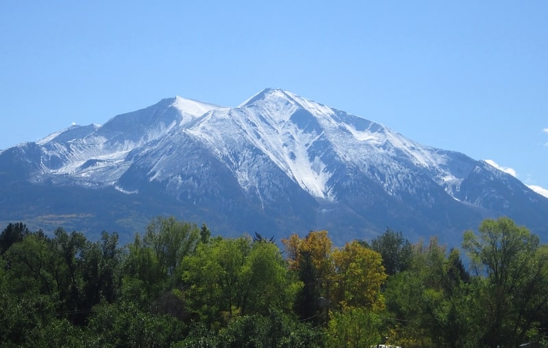
Summit in Colorado. Mount Sopris is a twin-summit mountain in the northwestern Elk Mountains range of the Rocky Mountains of North America. The prominent 12,965-foot mountain is located in the Maroon Bells-Snowmass Wilderness of White River National Forest, 6.6 miles north by northeast of the community of Redstone in Pitkin County, Colorado, United States.[7]
Elk Mountains
Mountain range in Colorado. The Elk Mountains are a high, rugged mountain range in the Rocky Mountains of west-central Colorado in the United States. The mountains sit on the western side of the Continental Divide, largely in southern Pitkin and northern Gunnison counties, in the area southwest of Aspen, south of the Roaring Fork River valley, and east of the Crystal River. The range sits west of the Sawatch Range and northeast of the West Elk Mountains. Much of the range is located within the White River National Forest and the Gunnison National Forest, as well as the Maroon Bells-Snowmass Wilderness and Raggeds Wilderness. The Elk Mountains rise nearly 9,000 ft. above the Roaring Fork Valley to the north.
The highest peaks in the range are its fourteeners, Castle Peak (14,265 ft), Maroon Peak (14,156 ft), Capitol Peak (14,130 ft), Snowmass Mountain (14,092 ft), Pyramid Peak (14,018 ft), and North Maroon Peak (14,014 ft). Maroon Peak and North Maroon Peak are collectively known as the Maroon Bells, a popular destination for recreation alpinism. Mount Sopris (12,953 ft) sits at the northwest end of the range and dominates the skyline of the lower Roaring Fork Valley and the town of Carbondale, Colorado, serving as an unofficial symbol of the area.
Additional notable peaks in the range include:
- Cathedral Peak, 13,943 ft (4,250 m), near Pyramid Peak
- Hagerman Peak, 13,841 ft (4,219 m), near Snowmass Mountain
- Snowmass Peak, 13,620 ft (4,151 m), near Hagerman Peak
- Clark Peak, 13,580 ft (4,139 m), near Capitol Peak
- Treasure Mountain, 13,528 ft (4,123 m), southwest of the Maroon Bells
- Mount Owen, 13,058 ft (3,980 m), high point of the Ruby Range
- Mount Sopris, 12,965 ft (3,952 m), north west of Capitol Peak
- Chair Mountain, 12,721 ft (3,877 m), high point of The Raggeds
- Crested Butte, 12,162 ft (3,706 m), home of Crested Butte Mountain Resort
- Whitehouse Mountain, 11,975 ft (3,650 m), northwest of Treasure Mountain
The range provides a formidable barrier to travel and is traversed only by backroad passes and trails, including Schofield Pass, Pearl Pass, and Taylor Pass. State Highway 133 traverses McClure Pass, at the western end of the range. The range has been the site of mining activity since the days of the Colorado Silver Boom, which saw the founding of mining towns such as Aspen and Ashcroft. In the late 19th century, the western and southern flank of the range became the site of intense coal mining activity which continues to the present day. Treasure Mountain, overlooking the town of Marble, is home to the famous Yule Marble Quarry. Quarried marble was used to create The Tomb of the Unknowns, the Lincoln Memorial, Denver Post Office and other buildings. The range receives a great deal of snowfall due to its position to the west of the continental divide and the westerly origin of many winter storms. This is exploited by the ski areas in the vicinity of Aspen, which are located on the flanks of smaller mountains alongside the Roaring Fork Valley.[8]
Cathedral Peak
Mountain in Colorado. Cathedral Peak is a high mountain summit in the Elk Mountains range of the Rocky Mountains of North America. The 13,950-foot thirteener is located in the Maroon Bells-Snowmass Wilderness of White River National Forest, 11.1 miles south by west of the City of Aspen in Piktin County, Colorado, United States.[9]