Discover 15 hidden attractions, cool sights, and unusual things to do in Lake Tahoe Basin Management Unit (United States). Don't miss out on these must-see attractions: Eagle Lake, Horsetail Falls, and Cal Neva Lodge & Casino. Also, be sure to include Angora Lakes in your itinerary.
Below, you can find the list of the most amazing places you should visit in Lake Tahoe Basin Management Unit (Nevada).
Table of Contents
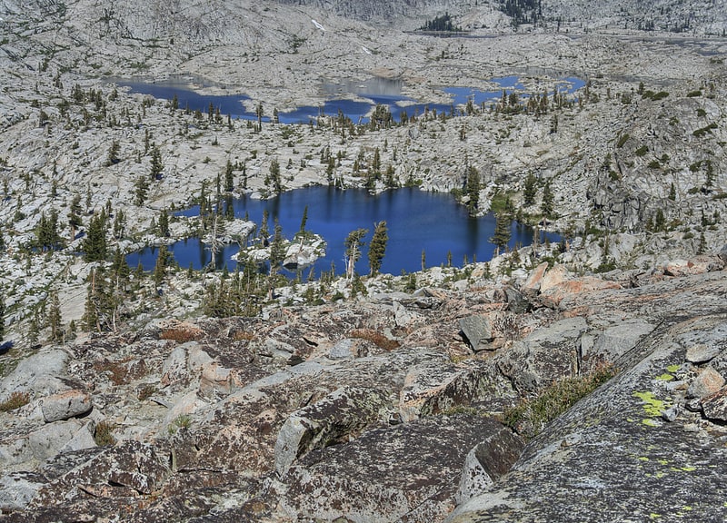
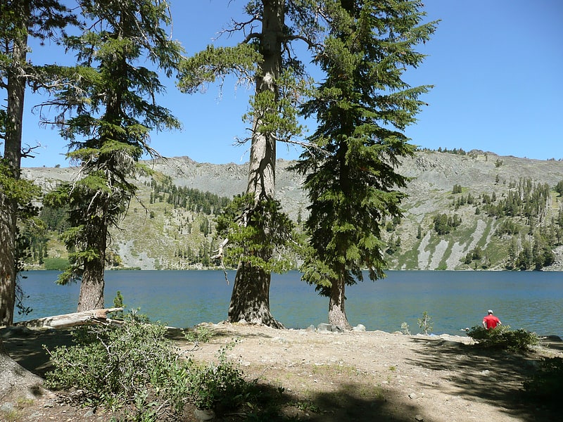
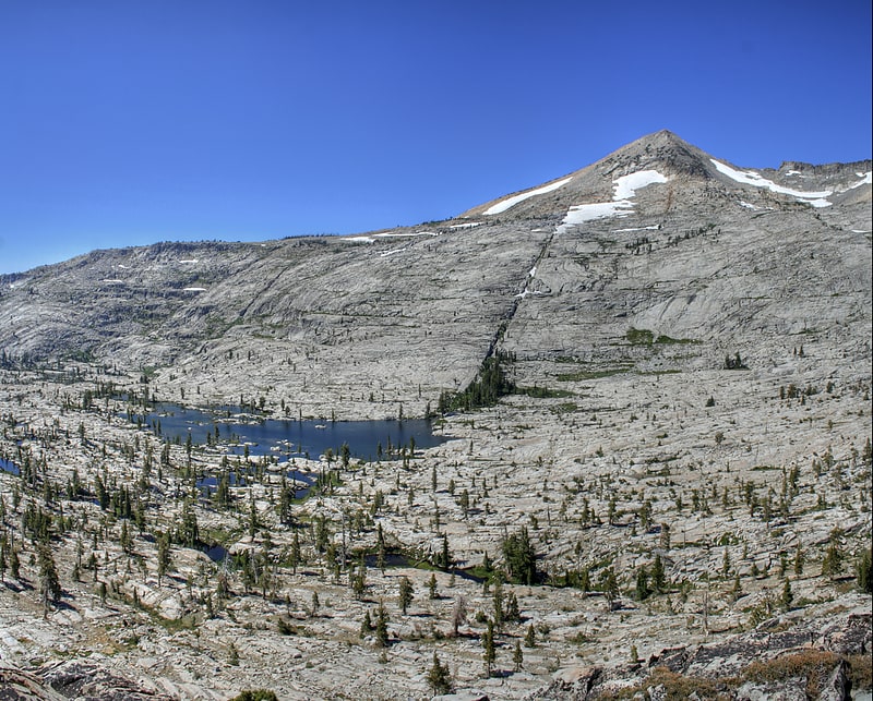
Eagle Lake
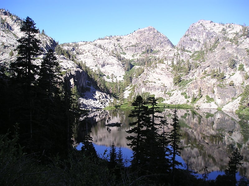
Lake in California. Eagle Lake is a backcountry lake in the Sierra Nevada mountain range, to the west of Lake Tahoe in the Desolation Wilderness. It can be reached by hiking west out of the Eagle Lake trailhead on HWY 89 at Emerald Bay State Park.[1]
Horsetail Falls
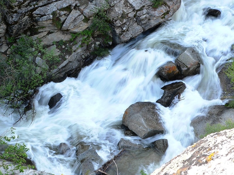
Waterfall in California. Horsetail Falls is a waterfall in the Sierra Nevada mountain range, to the west of Lake Tahoe in the Desolation Wilderness of El Dorado County, California, United States. It falls in stages for nearly 500ft. It can be reached by hiking north out of the Twin Bridges trailhead on U.S. Route 50. There is a forest service parking area designated to the area.
It is located at 38°49′40.28″N 120°7′23.87″W.[2]
Cal Neva Lodge & Casino
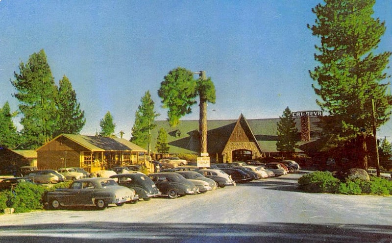
Cal Neva Resort & Casino, previously known as the Calneva Resort and Cal-Neva Lodge, is a resort and casino straddling the border between Nevada and California on the shores of Lake Tahoe. The original building was constructed in 1926, and became famous when the national media picked up a story about actress Clara Bow cancelling checks she owed to the Cal-Neva worth $13,000 in 1930. After burning down in a fire in 1937, the structure was rebuilt in only 30 days. In 1960, entertainer Frank Sinatra purchased the resort with several others, including singer Dean Martin and Chicago mobster Sam Giancana.
Under Sinatra, the Celebrity Room was added alongside a helipad and it opened year round. His ownership gradually increased over the following two years until he owned 50 percent outright. But Giancana's attendance at the property first provoked a rift between Sinatra and share holder Hank Sanicola, and later resulted in Sinatra's gambling license being suspended by the Nevada Gaming Control Board. Sinatra initially leased the property to Jack L. Warner and later in 1968 to a group of investors. It passed through the hands of a series of investment groups until 1976 when it was bought by Kirk Kerkorian. The property closed for renovations in 2013 and has not reopened since. Larry Ellison purchased the property out of bankruptcy in 2018.[3]
Address: Lake Tahoe Basin Management Unit, 2 Stateline Road, Crystal Bay, Nevada, United States
Angora Lakes
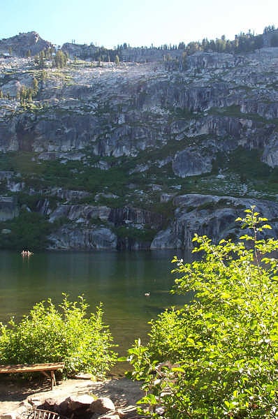
Lake in California. The Angora Lakes are two small freshwater lakes in the Sierra Nevada and Lake Tahoe Watershed ~1,200 ft in elevation above Fallen Leaf Lake and Lake Tahoe. It is the location of the Angora Lakes Resort, a small summer outdoor recreation location. The lakes were named for a herd of Angora goats that used to graze in the area.
To reach Angora Lakes from Hwy 89, take the Fallen Leaf Lake Rd. turnoff for approximately 2 miles (3.2 km). (Alternate route: Lake Tahoe Blvd. to Tahoe Mountain Rd.) Turn left and climb to the top of the one-lane road and look for the dirt road and a sign reading "1214". From there an at times steep and at times paved road leads to fantastic vistas and ends in the Angora Lakes trailhead parking lot. There is a 1-mile (1.6 km) uphill hike to Angora Lake.[4]
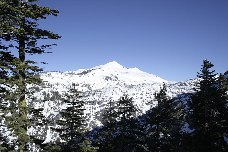
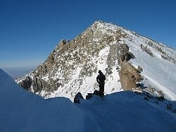
Mount Tallac
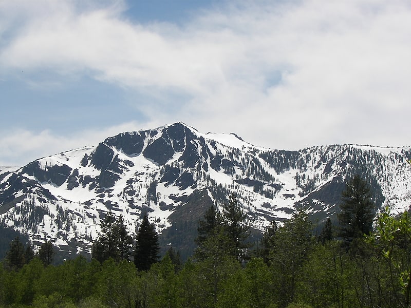
Mountain in California. Mount Tallac is a mountain peak southwest of Lake Tahoe, in El Dorado County, California. The peak lies within the Desolation Wilderness in the Eldorado National Forest. It is quite visible from State Routes 89 and 28, and U.S. Route 50. A "cross of snow" is clearly visible on the mountain's face during the winter, spring, and early summer months.
The mountain is shown on maps of the Whitney Survey as Chrystal Peak. In 1877, the Wheeler Survey named the peak "Tallac", after the Washo word "daláʔak", meaning 'big mountain'.
An estimated 10,000 climb the peak each year via routes approaching the summit from Desolation Wilderness to the west, Fallen Leaf Lake to the East, and access roads from the north. Wilderness permits are required to hike Mount Tallac. But for day hiking, permits are free and self-issued at the trailhead. There is a quota for overnight hikes on Mount Tallac (and throughout Desolation Wilderness), but there is no quota for day hiking.
The opening sequence of the TV series Bonanza was filmed at the McFaul Creek Meadow, with Mount Tallac in the background.[5]
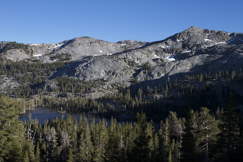
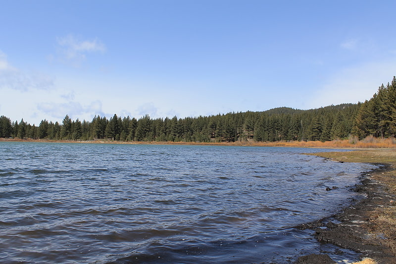
Fallen Leaf Lake
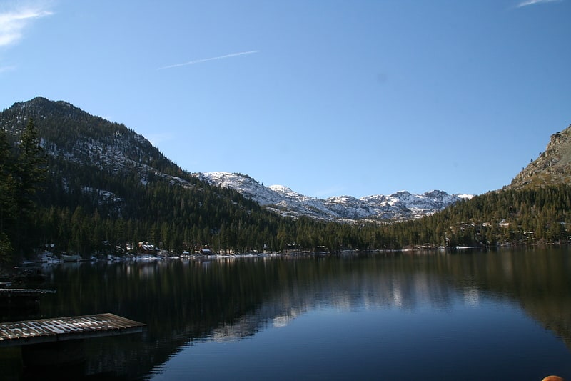
Lake in California. Fallen Leaf Lake is a mountain lake located in El Dorado County, California, near the California–Nevada state border, about one mile south west of the much larger Lake Tahoe. It is approximately aligned north-to-south and oval in shape, measuring approximately 2.9 miles on the long axis and 0.9 miles on the short axis. The lake was created by at least two glaciers that traveled northward down the Glen Alpine Valley. If the glacier had continued instead of stopping, Fallen Leaf Lake would be a bay of Lake Tahoe, similar to nearby Emerald Bay. A terminal moraine is visible at the north end of the lake on the northeast edge.[6]
Waca Lake
Lake in California. Waca Lake is a backcountry lake in the Desolation Wilderness in the Sierra Nevada mountain range of California. It lies just south of Lake Aloha.[7]
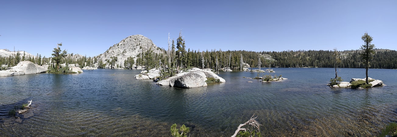
Lake Aloha
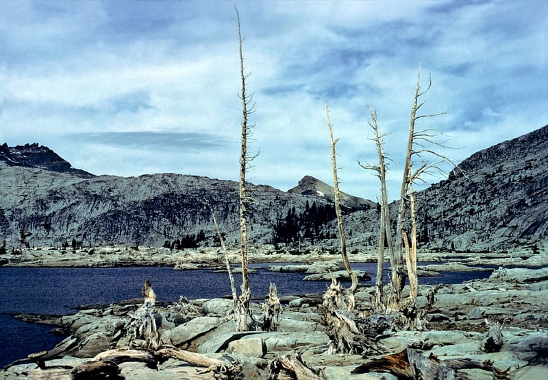
Reservoir in California. Lake Aloha is a large shallow backcountry reservoir located at an elevation of 8,116 feet in the Sierra Nevada Range, west of Lake Tahoe in El Dorado County, in eastern California.
The reservoir is located in Desolation Valley, within the federally protected Desolation Wilderness area. The shortest and easiest approach is from Echo Lake by the Pacific Crest Trail. Alternately, it can be reached by the Glen Alpine Springs Trailhead, near the city of South Lake Tahoe. There is a moderate gain in elevation as you head west. From the south, Lake Aloha can be reached by the Ralston Peak Trail or cross country through Horsetail Falls and Desolation Valley. To reach the base of Price and Pyramid Peaks, in the Crystal Range of the Sierra Nevada, you have to traverse the Lake Aloha area.
The primary outflow from Lake Aloha is Pyramid Creek, which flows south for roughly four miles before it empties into the South Fork American River near Twin Bridges.
Pyramid Creek was first dammed to create Lake Aloha in 1875, creating a year-round water source for grazing cattle and inundating a collection of natural lakes known as the Medley Lakes. The dam was later raised and several auxiliary dams were constructed up to 1955.[8]
Pyramid Peak
Mountain in California. Pyramid Peak is a mountain in the California's Sierra Nevada in the Crystal Range to the west of Lake Tahoe. It is the highest point in the Desolation Wilderness. With an elevation gain of almost 4,100 feet, the Rocky Canyon route is the mountain's most popular approach although it is very arduous. To the east, at the base of the peak, lies Pyramid Lake.[9]
Lake of the Woods
Lake in California. The Lake of the Woods is a backcountry glacial lake in the Desolation Wilderness of the Eldorado National Forest, southwest of Lake Tahoe, in El Dorado County, California. It lies just southeast of Lake Aloha.
The lake is accessible by hiking west out of the Glen Alpine Springs Trailhead, Echo Lake (California) Trailhead or north out of the Twin Bridges Trailhead. The lake is known to contain Rainbow Trout and Brook Trout.[10]
Ralston Peak
Mountain in California. Ralston Peak is a mountain in the Sierra Nevada mountain range to the west of Lake Tahoe within the Desolation Wilderness in El Dorado County, California. Ralston Peak is a very popular mountain to summit for the views of the wilderness area as it lies very near U.S. Route 50. The closest trailhead to the summit can be found in Camp Sacramento a few miles west of Echo Summit. Ralston Peak can also be accessed from the Pacific Crest Trail between Echo Lake and Lake Aloha. Starting at the nearest trailhead, this route is significantly longer than the trail from Camp Sacramento. But the altitude gain on this route is much less, and the trail is much less steep.[11]
Gilmore Lake
Lake in California. Gilmore Lake in California is a backcountry lake in the Sierra Nevada mountain range, to the west of Lake Tahoe in the Desolation Wilderness. It can be reached by hiking west out of the Glen Alpine Springs trailhead near the town of South Lake Tahoe. This lake offers great fishing for Lake trout.[12]
Pyramid Lake
Lake in California. Pyramid Lake is a lake in the backcountry of the Desolation Wilderness in the Sierra Nevada Mountains of El Dorado County, California.[13]
Silver Peak
Mountain in California. Silver Peak is a mountain in the Sierra Nevada mountain range at the north end of the Crystal Mountains, to the east of Lake Tahoe. It is located in the Desolation Wilderness in El Dorado County, California.[14]
Spooner Lake
Reservoir in Nevada. Spooner Lake is a man-made reservoir located just north of the intersection of Highway 50 and Highway 28 near Spooner Summit, a pass in the Carson Range of the Sierra Nevada leading to Carson City, Nevada from Lake Tahoe. It is located in Lake Tahoe – Nevada State Park.[15]