Discover 11 hidden attractions, cool sights, and unusual things to do in Great Sandy Biosphere Reserve (Australia). Don't miss out on these must-see attractions: Double Island Point Light, Gympie Cemetery, and Pacific Islander Hospital and Cemetery site. Also, be sure to include Hervey Bay Botanic Gardens in your itinerary.
Below, you can find the list of the most amazing places you should visit in Great Sandy Biosphere Reserve (Queensland).
Table of Contents
Double Island Point Light
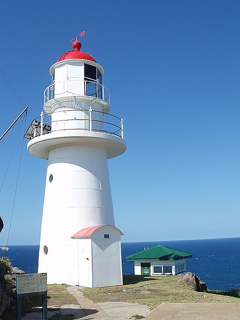
Lighthouse. Double Island Point Light is an active lighthouse located at the summit of Double Island Point, a coastal headland within the Cooloola section of the Great Sandy National Park. It is located at the southern end of Wide Bay, 70 kilometres north of Noosa Heads, Queensland, Australia.
Though the location was indicated for a lighthouse in 1864, it was only constructed in 1884, by W. P. Clark, who constructed other Queensland lighthouses. Upgrades to the kerosene fueled light and the lens occurred in 1923 and 1925. Major reconstruction occurred in 1933 when the light was converted to 110 V electricity, significantly increasing its luminosity, and new cottages replaced the originals. In 1980 the light was converted to 240 V and finally, solar conversion took place in 1991. Double Island Point Light became automatic the following year.
The lighthouse is typical for Queensland, made of timber frame clad with galvanized iron plates, painted white with a red dome. It is surmounted by an original Chance Brothers lantern with a modern VRB-25 self-contained rotating beacon mounted inside. It is surrounded by several auxiliary structures. The two lighthouse keepers' cottages, hardwood framed and sheeted with asbestos cement, are at a lower level, with a few other buildings. The site is positioned in the Great Sandy National Park, but there is no public access to the lighthouse.[1]
Gympie Cemetery
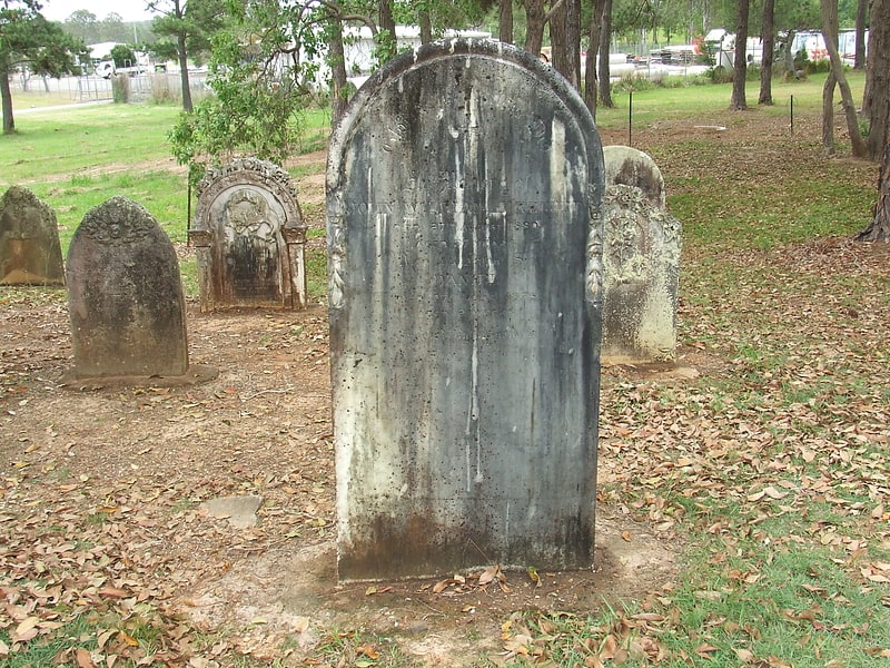
Cemetery in Gympie, Australia. Gympie Cemetery is the cemetery for Gympie, Queensland, Australia. The cemetery is located on Corella Road and is managed by the Gympie Cemetery Trust.[2]
Pacific Islander Hospital and Cemetery site
Cemetery. Pacific Islander Hospital and Cemetery site is a heritage-listed archaeological site of a former hospital and private cemetery at the corner of Bluebell Road East and Gernich Road, Tinana, Fraser Coast Region, Queensland, Australia. It was built from 1883 to 1888. It is also known as Pacific Islander Hospital and Cemetery site, South Sea Islander Hospital and Cemetery site, and Pacific Islander Hospital, Maryborough. It was added to the Queensland Heritage Register on 27 October 2017.[3]
Hervey Bay Botanic Gardens
Garden, Park, Relax in park
Address: Elizabeth St, 4655 Urangan
Howard War Memorial
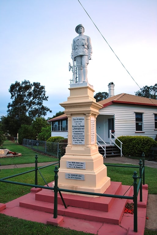
War memorial in Howard, Australia. Howard War Memorial is a heritage-listed memorial at William Street, Howard, Fraser Coast Region, Queensland, Australia. It was built in 1921. It was added to the Queensland Heritage Register on 21 October 1992.[4]
Urangan Pier
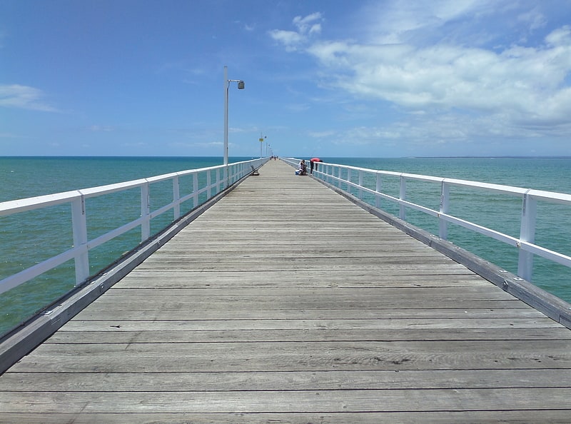
Pier in Urangan, Australia. Urangan Pier is a historic pier in Urangan, Hervey Bay, Queensland, Australia.
It is a former deep-water, cargo-handling facility originally built to facilitate the export of sugar, timber and coal. The pier, served by the extension of the railway line from Pialba, was used for the transfer of cargo between rail and ships. It was built between 1913 and 1917, originally to a length of 1124 metres. The pier was closed in 1985, and 239 metres of it was demolished. However, due to public outcry, 868 metres of the pier was left, and the land was given to the Hervey Bay City Council (now the Fraser Coast Regional Council).
By 2009 the last 220-metre section of the pier had been fully restored, and the original timber pylons had been replaced with steel pylons with a plastic covering.[5]
Traveston Powder Magazine
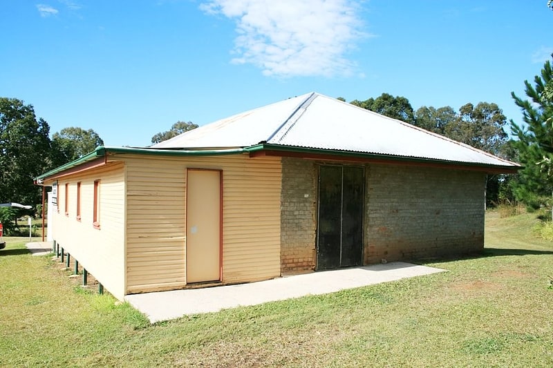
Gunpowder magazine. Traveston Powder Magazine is a heritage-listed gunpowder magazine incorporated within the Traveston Soldiers' Memorial Hall at 7 Traveston Road, Traveston, Gympie Region, Queensland, Australia. It was built in 1887 by Queensland Department of Public Works. It was added to the Queensland Heritage Register on 10 June 2011.[6]
Original Maryborough Town Site
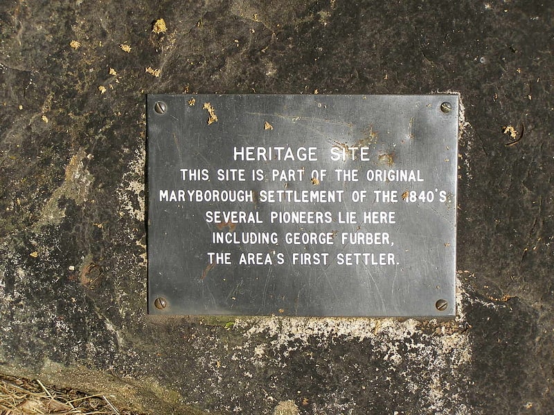
Archaeological site in Australia. Original Maryborough Town Site is a heritage-listed archaeological site at Russell Street, Maryborough, Fraser Coast Region, Queensland, Australia. It was added to the Queensland Heritage Register on 4 September 2007.[7]
Commissioner Bidwill's Grave
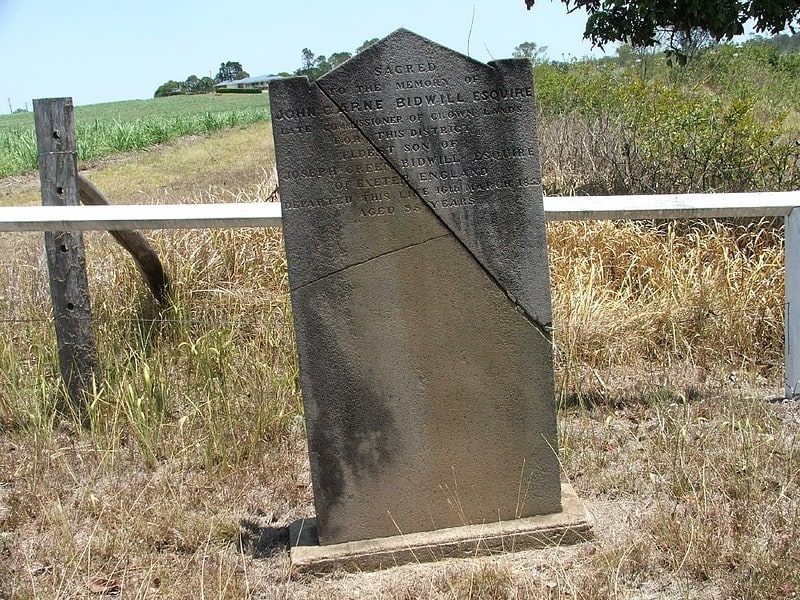
Historical landmark in the Tinana, Queensland, Australia. Commissioner Bidwill's Grave is a heritage-listed lone grave of John Carne Bidwill at Cran Road, Tinana, Fraser Coast Region, Queensland, Australia. It was built in 1853. It was added to the Queensland Heritage Register on 30 April 1997.[8]
Brooklyn House
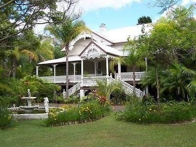
Tourist attraction in Howard, Australia. Brooklyn House is a heritage-listed residence at 11 William Street, Howard, Fraser Coast Region, Queensland, Australia.
It is associated with Member of the Queensland Legislative Assembly Colin Rankin and his daughter Australian Senator Annabelle Rankin.[9]
Address: 23 William St, Great Sandy Biosphere Reserve
Cedar Pocket Dam
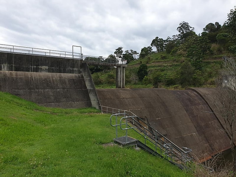
Body of water. The Cedar Pocket Dam is a partially concrete gravity and rock and earth-fill embankment dam with an un-gated spillway located across the Deep Creek in the Wide Bay–Burnett region of Queensland, Australia. The main purpose of the dam is for irrigation, where the dam provides regulated water supplies along Deep Creek, a tributary of the Mary River.[10]