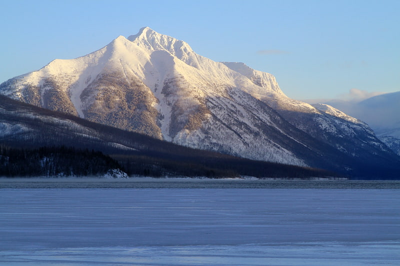
Discover 35 hidden attractions, cool sights, and unusual things to do in Glacier National Park (United States). Don't miss out on these must-see attractions: Cosley Lake, Grinnell Lake, and Redrock Lake. Also, be sure to include Avalanche Lake in your itinerary.
Below, you can find the list of the most amazing places you should visit in Glacier National Park (Montana).
Table of Contents
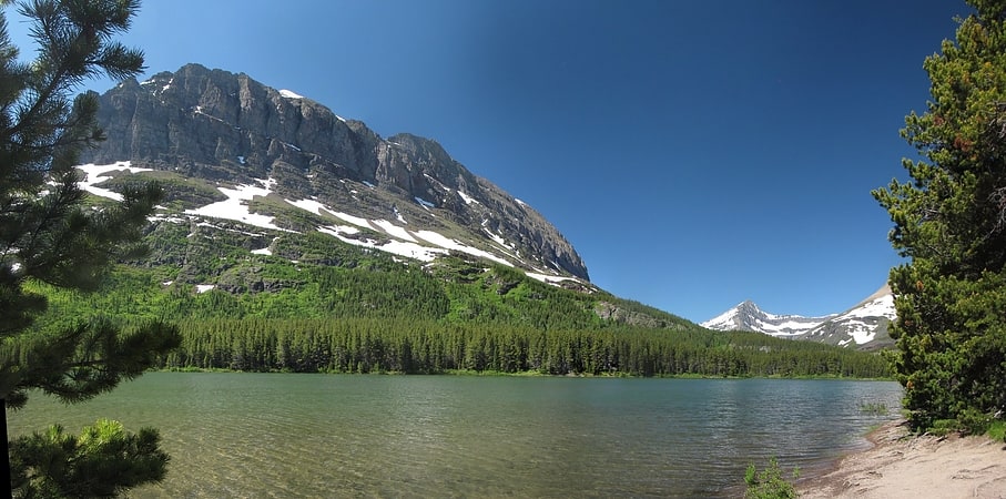
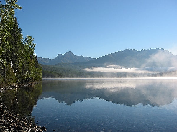
Cosley Lake
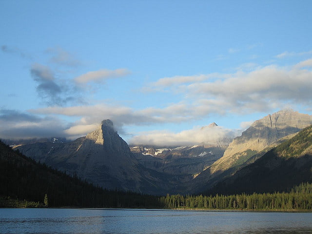
Lake in Montana. Cosley Lake is located in Glacier National Park, in the U. S. state of Montana. Cosley Lake is.35 miles northeast of Glenns Lake and between Bear Mountain to the north and Cosley Ridge to the south.[1]
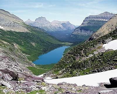
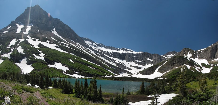
Grinnell Lake
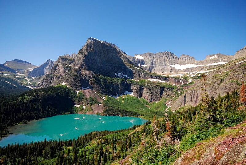
Lake in Montana. Grinnell Lake is located in Glacier National Park, in the U. S. state of Montana. Named after George Bird Grinnell, the lake has an opaque turquoise appearance from the rock flour which is transported to the lake from Grinnell Glacier. Grinnell Lake is accessible via the Grinnell Glacier Trail and is 3.2 miles from the Many Glacier Hotel. It lies below the north face of Angel Wing.[2]
Redrock Lake
Lake in Montana. Redrock Lake is located in Glacier National Park in the U. S. state of Montana. Mount Wilbur is west of Redrock Lake. Prior to entering Redrock Lake, Swiftcurrent Creek tumbles over Redrock Falls, which can be reached after an easy 1.8 miles hike by way of the Swiftcurrent Pass Trail.[3]
Avalanche Lake
Lake in Montana. Avalanche Lake is located in Glacier National Park, in the U. S. state of Montana. Avalanche Lake is southwest of Bearhat Mountain and receives meltwater from Sperry Glacier. Avalanche Lake is a 2 miles hike from the trailhead along the Trail of the Cedars. When measured in August 1910, the maximum depth of the lake was 63 feet near the upper end.[4]
Grinnell Falls
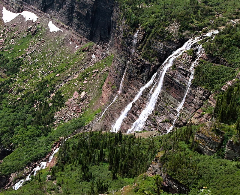
Grinnell Falls is a waterfall in Glacier National Park, Montana, US. Grinnell Falls have several major drops in its 960 feet descent from Grinnell Glacier with the highest estimated at 280 ft. The falls are in the Many Glacier region of the park, between Mount Grinnell and Angel Wing.[5]
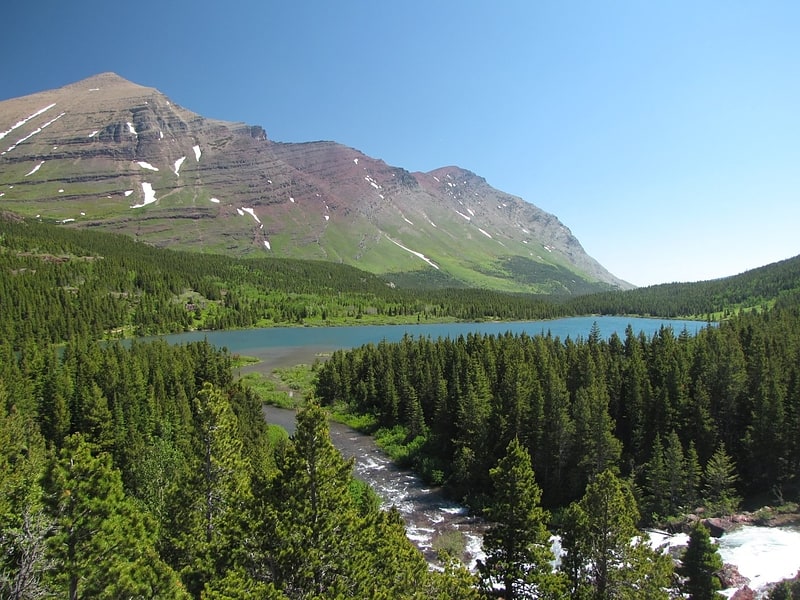
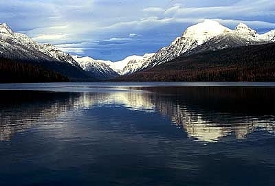
Swiftcurrent Lake
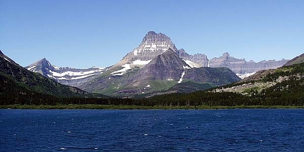
Lake in Montana. Swiftcurrent Lake is located in the Many Glacier region of Glacier National Park, in the U.S. state of Montana. The Many Glacier Hotel, the largest hotel in the park, is along the east shore of the lake. Many hiking trails originate from the area and scenic tour boats provide access to the lake for visitors.
Swiftcurrent Lake lies at 4,878 feet (1,487 m) above sea level. Nearby lakes include the much larger Lake Sherburne to the east and Lake Josephine to the immediate southwest. The mountains immediately west of the lake rise 3,000 feet (910 m) above the lake. The fast disappearing Grinnell Glacier is one of several glaciers and snowfields that provide water for the streams that replenish the lake. Mount Gould, Grinnell Point and Mount Wilbur are the largest mountains immediately west of the lake. It consists of two basins, each between 15 feet (4.6 m) and 30 feet (9.1 m) in depth.[6]
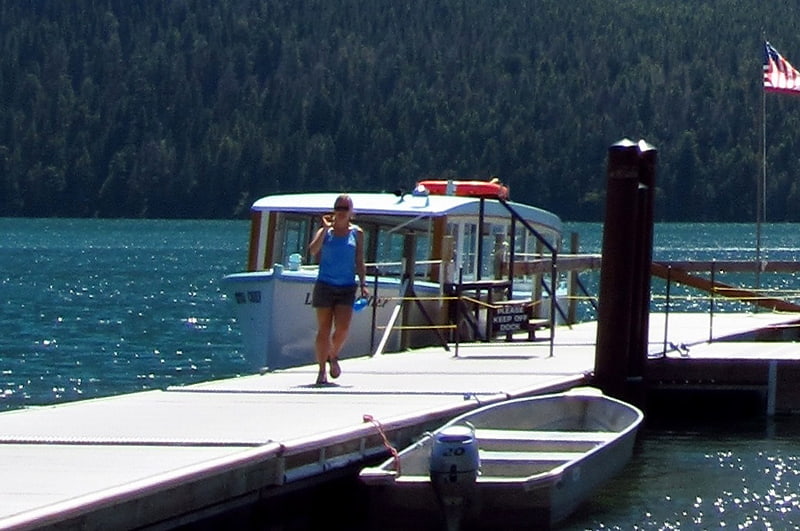
Morning Eagle
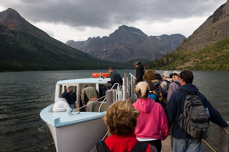
The Morning Eagle is a tour boat located on Lake Josephine in Glacier National Park. The vessel was constructed in 1945, by J.W. Swanson and Arthur J. Burch. The Morning Eagle was originally named Big Chief and was launched on Swiftcurrent Lake. The name was changed in 1960 and the vessel was moved to Lake Josephine. It was listed on the National Register of Historic Places in 2018. All of the vessel's maintenance is conducted on-site.[7]
Upper Grinnell Lake
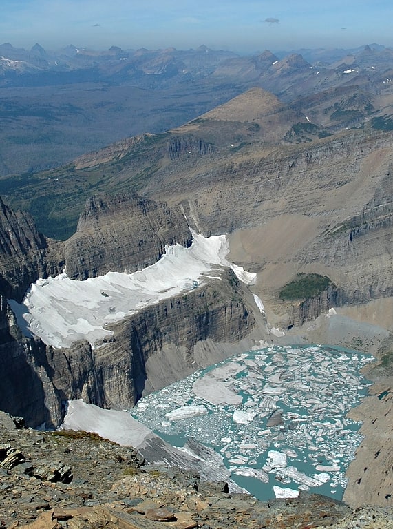
Lake in Montana. Upper Grinnell Lake is located in Glacier National Park, in the U. S. state of Montana. Upper Grinnell Lake is a proglacial lake which formed in the 1930s as Grinnell Glacier retreated. The lake is often filled with small icebergs which have been breaking off Grinnell Glacier. Upper Grinnell Lake can be reached by trail and is a 5.5 miles hike from the Many Glacier Hotel.[8]
Fishercap Lake
Lake in Montana. Fishercap Lake is located in Glacier National Park, in the U. S. state of Montana. Mount Wilbur is west of Fishercap Lake. The lake is almost adjacent to the Swiftcurrent Auto Camp Historic District.[9]
Gunsight Lake
Lake in Montana. Gunsight Lake is located in Glacier National Park, in the U.S. state of Montana. The lake is surrounded by high peaks including Fusillade Mountain to the north and Gunsight Mountain to the west. Mount Jackson rises more than 4,700 feet above Gunsight Lake to the south.[10]
Lake Josephine
Lake in Montana. Lake Josephine is located in Glacier National Park, in the U. S. state of Montana. Swiftcurrent Lake is immediately to the northeast of Lake Josephine and the two lakes are separated by a short stream. Lake Josephine is accessible via the Grinnell Glacier Trail which follows the west shoreline of the lake for 1 mile.[11]
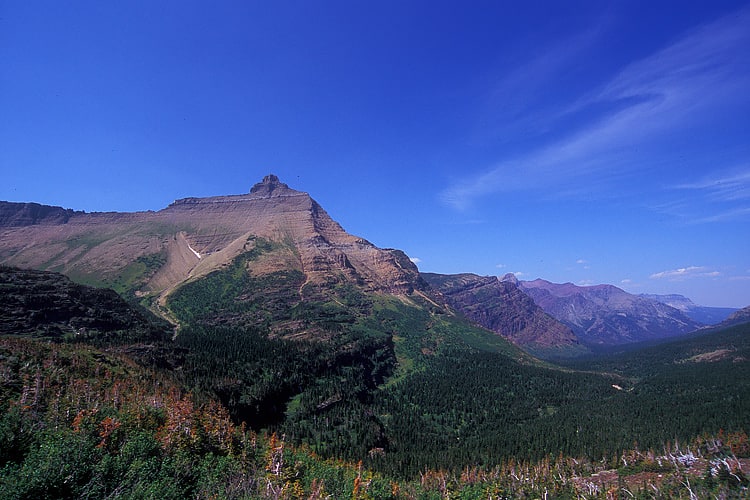
Heavy Runner Mountain
Heavy Runner Mountain is located in the Lewis Range, Glacier National Park in the U.S. state of Montana. The summit is a little over a mile east-northeast of Reynolds Mountain and is easily seen from the Going-to-the-Sun Road as well as Logan Pass. The mountain is named for the Blackfeet Indian Chief, Heavy Runner, who was massacred along with most of his encampment by Col. Eugene M. Baker's detachment on the Marias River on January 23, 1870.[12]
Sinopah Mountain

Mountain in Montana. Sinopah Mountain is located in the Lewis Range, Glacier National Park in the U.S. state of Montana. Sinopah Mountain rises prominently to the west of Two Medicine Lake. Sinopah means, ""kit fox" in Blackfeet, was the Indian wife of Hugh Monroe and daughter of Lone Walker, a powerful Blackfeet chief."[13]
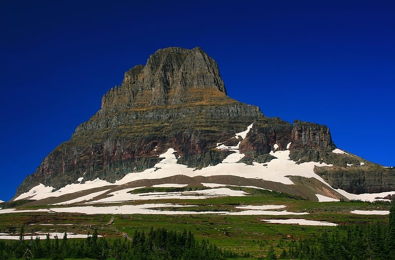
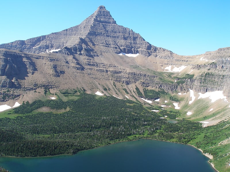
Mount Siyeh
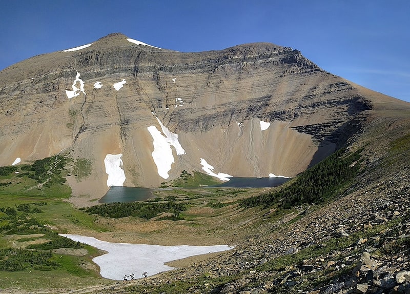
Peak in Montana. Mount Siyeh, with a height of 10,019 feet, is the fifth tallest and one of six peaks over 10,000 feet in Glacier National Park, Montana, United States. Mount Siyeh was named after a Blackfeet Indian, Sai-yeh, whose name means "Crazy Dog" or "Mad Wolf."
Mount Siyeh stands about two miles east of the Continental Divide, within the watershed of the Saint Mary River, which drains into the Saskatchewan River, and ultimately into Hudson Bay.
Mount Siyeh is rather easily accessible from a variety of different routes. It can be ascended via a long scree scramble from the Preston Park area, or from Piegan Pass via Cataract Mountain. The summit can also be reached via a long hiking/mountaineering route dubbed the "Skyline Experience"; this route starts from the Many Glacier Hotel and involves 5.5 miles (9 km) ridge walk and includes the summits of Wynn Mountain (8,404 feet (2,562 m)) and Cracker Peak (9,833 feet (2,997 m)) before reaching the top of Siyeh. Route Descriptions can be found on Summitpost or in A Climbers Guide to Glacier National Park.[14]
Bullhead Lake
Lake in Montana. Bullhead Lake is located in Glacier National Park, in the U. S. state of Montana. Mount Wilbur is North of Bullhead Lake.[15]
Triple Divide Peak
Mountain in Montana. Triple Divide Peak is located in the Lewis Range, part of the Rocky Mountains in North America. The peak is a feature of Glacier National Park in the state of Montana in the United States. The summit of the peak, the hydrological apex of the North American continent, is the point where two of the principal continental divides in North America converge, the Continental Divide of the Americas and the Northern or Laurentian Divide.[16]
Little Matterhorn
Little Matterhorn is a 7,886-foot elevation mountain summit located in the Lewis Range, of Glacier National Park in the U.S. state of Montana. The nearest higher peak is Edwards Mountain, 0.9 miles to the south. Precipitation runoff from the mountain drains into creeks which empty into Lake McDonald. Based on the Köppen climate classification, Little Matterhorn has an alpine climate characterized by long, usually very cold winters, and short, cool to mild summers. Temperatures can drop below −10 °F with wind chill factors below −30 °F.[17]
Stanton Mountain
Stanton Mountain is a 7,750 feet mountain summit located in the Livingston Range, of Glacier National Park in the U.S. state of Montana. Stanton Mountain rises more than 4,500 feet above the northern shore of Lake McDonald. The mountain's name refers to Mrs. Lottie Stanton who lived near the west side of the park in the late 1800s, and with her husband operated a livery stable in historic Demersville. She was a pioneering woman who followed the construction camps during the railroad building days. The mountain's name was officially adopted in 1929. In the late 1800s it was known as Mt. Lottie Stanton. The nearest higher peak is Mount Vaught, 1.38 miles to the northeast. Precipitation runoff from the mountain drains into tributaries of the Flathead River.[18]
Hidden Lake
Lake in Montana. Hidden Lake is located in Glacier National Park, in the U. S. state of Montana.
Hidden Lake is surrounded by numerous peaks, including Bearhat Mountain to the southwest, Dragons Tail to the south, Clements Mountain to the north, and Reynolds Mountain to the east. Hidden Lake is a popular day hike destination, with the Hidden Lake overlook a 1.5-mile (2.4 km) hike from Logan Pass, and the lakeshore adding another 1.5 miles (2.4 km) one way.[19]
Address: 7024 Kniffen Road, Glacier National Park
Saint Mary Visitor Center
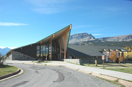
Building. The Saint Mary Visitor Center in Glacier National Park, with the connected Saint Mary Checking Station and Entrance Station was constructed at the east entrance to the Going-to-the-Sun Road during the Mission 66 park facilities improvement program. It was designed by Burt L. Gewalt of the Kalispell, Montana architectural firm Brinkman and Lenon, and was completed in 1967. The complex uses common Mission 66 themes such as native stone, and glulam timber construction, combined with a dramatic roof structure that echoes the mountain peaks in the background. The stone in the walls came from the Going-to-the-Sun Road. The view of the "St. Mary" webcam on the Glacier National Park official website is broadcast from the center and shows the westward-facing view over St. Mary Lake, which includes a distant view of Logan's Pass. There is also an osprey nest about one hundred meters to the east of the building, which can be viewed from the visitor parking lot and from the park's osprey webcam.
The complex consists of the main visitor center, with a connected entrance station. Two checking stations or kiosks are located in the roadway. Recent renovations have restored the original teal, ebony and peach color scheme, which had been obscured by the application of standard National Park Service brown paint.[20]
Address: US Rt 89 & Going To The Sun Road, 59417 Saint Mary
Lincoln Lake
Lake in Montana. Lincoln Lake is located in Glacier National Park, in the U. S. state of Montana. Lincoln Lake is.25 miles downstream from Lake Ellen Wilson but sits more than 1,300 feet lower in elevation. A series of cascades including Beaver Chief Falls can be found between the two lakes.[21]
Two Medicine Lake
Lake in Montana. Two Medicine Lake is located in Glacier National Park, in the U. S. state of Montana. It is approximately 2 miles long and.33 miles wide. Sinopah Mountain dominates the western terminus of the lake, while immediately to the north, Rising Wolf Mountain rises over 4,450 feet above the lake. Several hiking trails begin at the eastern end of the lake, which is accessible by vehicle. The National Historic Landmark Two Medicine Store and the National Register of Historic Places Swanson Boathouse structures are also near the eastern side of the lake. A short outlet stream connects Two Medicine Lake with Pray Lake to the northeast.[22]
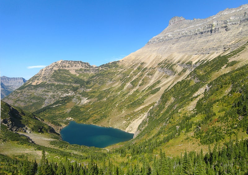
Cracker Lake
Lake in Montana. Cracker Lake is located in Glacier National Park, in the U. S. state of Montana. Located at the head of a canyon, the waters of Cracker Lake are an opaque turquoise from rock flour originating from Siyeh Glacier. To the south of Cracker Lake lies Mount Siyeh which rises more than 4,000 feet above the lake. Cracker Peak to the southeast and Allen Mountain to the north are other prominent peaks nearby. Cracker Lake is a 6.1-mile hike from the Many Glacier Hotel.[23]
Glenns Lake
Lake in Montana. Glenns Lake is located in Glacier National Park, in the U. S. state of Montana. Glenns Lake is a long narrow lake located between Cosley Ridge and Whitecrow Mountain in the northeastern region of Glacier National Park. Mokowanis Lake is.50 miles south of Glenns Lake.[24]
Mount Gould
Peak in Montana. Mount Gould is a peak on the Continental Divide in Glacier National Park, Montana, United States. It is the highest point of the Garden Wall, a distinctive ridge of the Lewis Range. It is most notable for its huge, steep east face, which drops 4,000 ft in only one-half mile. This face provides a backdrop to Grinnell Lake, and is often photographed.
Mount Gould was named in 1887 by George Bird Grinnell for his hunting companion, George H. Gould, and the name was officially adopted in 1929 by the United States Board on Geographic Names.
The first recorded ascent of Mount Gould was in 1920, by Frank B. Wynn, Harry R. Horn, Henry H. Goddard, and party. They used the West Face route, which is the easiest and most commonly used route today. It starts from the Highline Trail, which skirts the west side of the peak, and involves some rock scrambling but no technical climbing.
Climbing the sheer East Face of Mount Gould is theoretically possible; however the brittle, loose nature of the rock in Glacier National Park makes the ascent highly technical, unpleasant, and dangerous.[25]
Kintla Lake
Scenic lake for kayaking and fishing. Kintla Lake is a lake in the northwestern portion of Glacier National Park in Montana. The lake is located in a rather remote portion of the park, close to the Canada–United States border. The lake is a 40 mi drive from the west entrance along bumpy dirt roads. At 1,698 acres, Kintla Lake is only slightly smaller than Bowman Lake, and is the fourth largest lake in the park.
Kintla originates from the Kutenai word for "sack". Kutenai legend states that a man had apparently drowned in one of the lakes which likened the lake to a sack where "once you got in, you couldn't get out".
Canoeing and kayaking are ideal on the lake, as no motorized watercraft are allowed. There is a quiet campground on the lake, and it is rarely filled because of its remote location. Fishing is also popular on the lake, because of the trout found in it. There are also options for day hikes and extended hikes into the backcountry in the area.[26]
Bowman Lake
Secluded lake with dramatic views. Bowman Lake is in the northwestern portion of Glacier National Park in Montana. The lake is accessed via a 6 miles unpaved road from the small town of Polebridge. At 1,706 acres, Bowman Lake is the third largest lake in the park, after Lake McDonald and Saint Mary Lake.
The campground is located close to the shore, and the trees along the site provide privacy. Day users have access to the picnic ground, and there are several hiking trails within the area. Fishing, canoeing, and kayaking are also popular on the lake which is of a glacially cold temperature. Motorized boats of 10 horsepower (7 kW) or less are allowed on the lake. Because of the long, bumpy road, recreational vehicles and truck/trailer combinations are not recommended.[27]
Reynolds Mountain
Mountain in Montana. Reynolds Mountain is located in the Lewis Range, Glacier National Park in the U.S. state of Montana. Reynolds Mountain is situated along the Continental Divide and is easily seen from Logan Pass by looking due south from the pass. Hidden Lake is located below Reynolds Mountain to the west. Reynolds is a class 2 climb via the southwestern talus slope route that allows many people to easily climb the peak. The mountain was named for Charles E. Reynolds, a writer for Forest and Stream magazine, and assistant to the magazine's editor, George Bird Grinnell, who named many of the features in Glacier National Park. The mountain's name was officially adopted in 1910 by the U.S. Board on Geographic Names.[28]
Pollock Mountain
Mountain in Montana. Pollock Mountain is located in the Lewis Range, Glacier National Park in the U.S. state of Montana. Pollock Mountain is situated along the Continental Divide and is one of the peaks along the Garden Wall and is approximately.6 miles south of Bishops Cap. The mountain was named by Ross Carter for William C. Pollock, a member of the Indian Commission who along with Walter M. Clements and George Bird Grinnell negotiated with the Blackfeet to consummate the treaty that enabled the Federal Government to purchase the "Ceded Strip" of land, which included all of what is now Glacier National Park to the east of the Continental Divide.[29]
Clements Mountain
Mountain in Montana. Clements Mountain is located in the Lewis Range, Glacier National Park in the U.S. state of Montana. Clements Mountain rises to the west of Logan Pass and above the Hidden Lake Trail which leads to Hidden Lake just west of the continental divide. The peak was named after Walter M. Clements who had worked to set up a treaty between the Blackfeet and the U.S. Government for the purchase of tribal lands east of the continental divide which later became part of the park.[30]
Little Chief
Little Chief is a 1926 boat plying Saint Mary Lake, renamed from Rising Wolf in 1990 after a major restoration. It is a 45 feet long boat which is 12 feet wide, made of planked cedar on an oak frame. Its stem and keel are made of fir and it has a steel stem band.
It is USCG-rated to carry 49 passengers and two crew members, and is registered at 13 gross tons and 10 net tons.
It was listed on the National Register of Historic Places in 2016 as "Rising Wolf".
The "Little Chief" name is a reference to Little Chief Mountain.[31]
Swiftcurrent Mountain
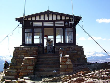
Mountain in Montana. Swiftcurrent Mountain is located in the Lewis Range, Glacier National Park in the U.S. state of Montana. Swiftcurrent Mountain is situated along the Continental Divide. The historic Swiftcurrent Fire Lookout is at the top of the mountain.[32]
Ptarmigan Falls
Ptarmigan Falls is a waterfall located in Glacier National Park, Montana, US. Ptarmigan Falls has a series of cascades and at least one drop of over 30 feet as it descends downstream along Ptarmigan Creek. The falls can only be seen by hiking west on the Ptarmigan Trail from Swiftcurrent Auto Camp Historic District in the Many Glacier region of the park.[33]
Oldman Lake
Lake in Montana. Oldman Lake is located in Glacier National Park, in the U. S. state of Montana. Oldman Lake is immediately east of Mount Morgan and north of Flinsch Peak. Oldman Lake is a 5.7-mile hike from the Two Medicine Store.[34]
Stoney Indian Lake
Lake in Montana. Stoney Indian Lake is located in Glacier National Park, in the U. S. state of Montana. Stoney Indian Lake is northeast of Wahcheechee Mountain and south of Stoney Indian Peaks.[35]