Discover 8 hidden attractions, cool sights, and unusual things to do in Black Forest National Park (Germany). Don't miss out on these must-see attractions: All Saints Waterfalls, Badener Höhe, and Buhlbachsee. Also, be sure to include Schliffkopf in your itinerary.
Below, you can find the list of the most amazing places you should visit in Black Forest National Park (Baden-Württemberg).
Table of Contents
All Saints Waterfalls
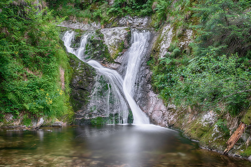
Also known as: Allerheiligen-Wasserfälle
Tourist attraction in Oppenau, Germany. The All Saints Waterfalls are located in the Black Forest on the territory of the town of Oppenau in the German state of Baden-Württemberg at an elevation of about 500 m above NN. The Lierbach stream, also called the Grindenbach, cascades, as a natural waterfall, down seven steps, a total drop of 83 metres. Due to the scouring of the rocks under the cataract which have formed basin-like holes known as Gumpen or kolks), the falls are also called the Büttensteiner Waterfalls or Sieben Bütten.[1]
Badener Höhe
Mountain in Germany. The Badener Höhe is a mountain in the Northern Black Forest in the German state of Baden-Württemberg. It lies within the borough of Baden-Baden and municipality of Forbach. With a height of 1,002.5 m above sea level, it is the highest point in the borough of Baden-Baden.[2]
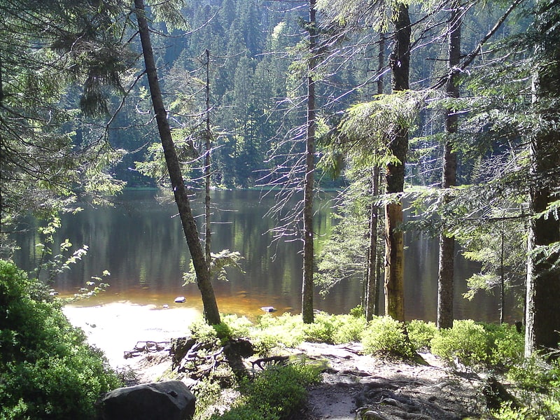
Buhlbachsee
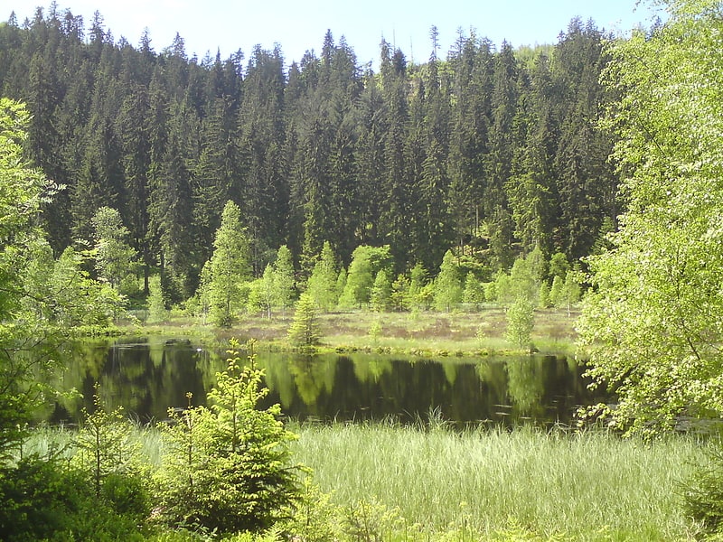
Tarn in Germany. The Buhlbachsee is a tarn in the northern Black Forest on the southwestern edge of the parish of Baiersbronn in the county of Freudenstadt in Baden-Württemberg. Since 1 January 2014 it has been part of the Black Forest National Park.
The tarn lies around 4.5 kilometres southeast of the summit of the Schliffkopf in the Buhlbach valley and less than half a kilometre northeast of the Black Forest High Road. The lake can be reached on foot over various paths including from Kniebis, Baiersbronn-Obertal or from the Black Forest High Road.
The tarn is about 160 metres wide and almost circular in shape. Only in the northeast, where the Buhlbach stream, which enters from the southwest, leaves the lake again is there a "nose" that gives it a length of about 200 metres. There is an island in the lake, about 0.7 hectares in area, which is covered in birch trees.
Like all tarns the Buhlbachsee was formed by a glacier. After the last ice age, which ended in the Black Forest about 10,000 years ago, it was left behind.[3]
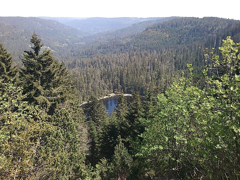
Schliffkopf
Mountain in Germany. The Schliffkopf is a mountain in the Northern Black Forest between Baiersbronn, Ottenhöfen and Oppenau. It is 1,053.6 m above sea level. The Schliffkopf lies on the Black Forest High Road in the National Park and is the site of an eponymous four-star "wellness" hotel. Various long-distance paths, including the West Way, run over the Schliffkopf.
At the end of June 2003 a nature trail, the Lothar Path (Lotharpfad), was opened at the Schliffkopf on the topic of storm damage. Along an 800-metre-long educational and experience trail, visitors can see how this ten-hectare area, heavily damaged by Hurricane Lothar in 1999, has gradually recovered and been recolonized. The Lothar Path runs along footbridges, ladders and steps and shows how the forces of nature act, how nature deals with destruction in such an area and what naturally regrows.
The Schliffkopf is a source region for the Acher and the Murg.[4]
Wildsee
Tarn in Germany. Wildsee is a small tarn within a cirque in the Black Forest near Baiersbronn, Germany. It is part of the Black Forest National Park and the Wilder See - Hornisgrinde Nature Reserve.[5]
Seekopf
Mountain in Germany. The Seekopf is a mountain on the main chain of the Northern Black Forest in Germany between the Upper Rhine Plain and the Murg valley, above Seebach. It is 1,054.2 m above sea level and lies on the boundary of the counties of Ortenaukreis and Freudenstadt in the state of Baden-Württemberg.
The mountain ridge, the upper area of which is formed of bunter sandstone, belongs to the natural region known as Grindenschwarzwald and Enzhöhen. The Black Forest High Road (B 500) runs along its western flank and, below the eastern mountainside, is a tarn, the Wildsee. The West Way runs over the mountain leading to Ruhestein, 1.5 kilometres to the southwest. The Seekopf lies within the Black Forest National Park, established in 2014.
On the summit plateau is the grave of Julius Euting, a well-known orientalist and co-founder of the Vosges Club.[6]
Huzenbacher See
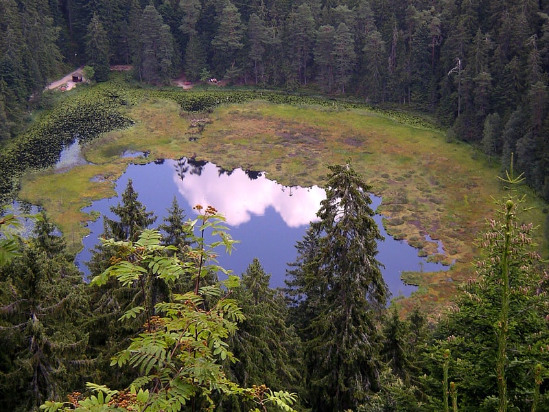
Tarn in Germany. The Huzenbacher See is a tarn in the Northern Black Forest in southwestern Germany. It lies within the municipal territory of Baiersbronn around seven kilometres north of the village itself at a height of 747 metres in the Black Forest National Park. It is steeped in legend and is also known today for its yellow water lilies, the flowers of which may be seen from mid to late July.
The tarn was formed about 25,000 to 30,000 years ago. From the 18th century it was used as Schwallwasser i.e. for the floating of logs downstream as part of the timber rafting industry. In 1895 a weir was built at the outflow of the tarn in order to be able to regulate the water level better. This raised the lake by about 2 metres and gave it a depth of 7 to 8 metres. By raising the water level the surface of the land by the shore was loosened and floated up. Part of the lake is still covered by e web of moss, roots and young trees today. A similar phenomenon has occurred at the tarns of Nonnenmattweiher and the Kleiner Arbersee.
In the night of 1 July 2012 a storm caused severe damage in the forest district of Baiersbronn; the wood on the eastern shore of the Huzenbacher See being destroyed.[7]
Hoher Ochsenkopf
Mountain in Germany. The Hoher Ochsenkopf is a mountain in the Northern Black Forest in the municipality of Forbach in south Germany. At 1,054.5 m above sea level it is the highest point in Forbach and also in the county of Rastatt. The mountain, whose domed summit or kuppe was already a nature reserve lies in the Black Forest National Park which was founded in 2014. Its name recalls its former use as wood pasture.[8]