Discover 11 hidden attractions, cool sights, and unusual things to do in Alpine National Park (Australia). Don't miss out on these must-see attractions: Mount Feathertop, Mount Bogong, and Vallejo Gantner Hut. Also, be sure to include Mount Cobbler in your itinerary.
Below, you can find the list of the most amazing places you should visit in Alpine National Park (Victoria).
Table of Contents
Mount Feathertop
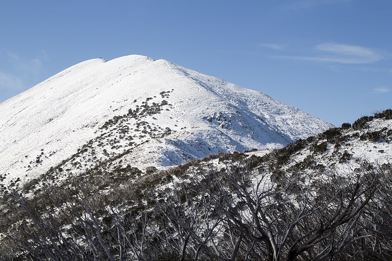
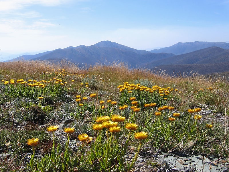
Mountain in Australia. Mount Feathertop is the second-highest mountain in the Australian state of Victoria and is part of the Australian Alps and is located within the Alpine National Park. It rises to 1,922 metres and is usually covered in snow from June to September. Unlike most mountains in the Australian Alps, Mount Feathertop has steep summit slopes instead of a rounded summit dome. Snow remaining in the summit gullies until late spring gives the appearance of feathers, hence the name.
Mount Feathertop's proximity to the Mount Hotham ski resort has led to it becoming a popular backcountry skiing destination. A large and highly dangerous snow cornice usually forms along the summit ridge in winter and early spring, the collapse of which has claimed the lives of a number of people who have (sometimes unwittingly) stood on it or too close to it. It is also known for its often dangerously icy slopes on which skiers and walkers have lost their footing with fatal results.[1]
Mount Bogong
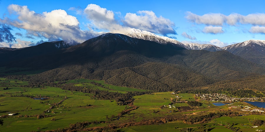
Highest mountain in Victoria. Mount Bogong, located in the Alpine National Park and part of the Victorian Alps of the Great Dividing Range, is the highest mountain in Victoria, Australia, at 1,986 metres above sea level.
The Big River separates the massif of the mountain from the Bogong High Plains to the south. From the nearby town of Mount Beauty to its summit, Mount Bogong rises more than 1,600 metres (5,200 ft), thus making it one of the highest peaks in Australia not only in terms of its elevation above sea level, but also in terms of actual base-to-summit prominence.
Mount Bogong is a popular backcountry skiing mountain through winter but only has snow for the mid winter-spring months. It is around 30 kilometres (19 mi) by road and walking track or 12 kilometres (7.5 mi) direct to Mount Beauty. Falls Creek and Mount Hotham ski resorts are also nearby. Camping is relatively safe below the treeline but the summit ridgeline is very exposed.
Emergency shelter is also available at Bivouac Hut on the Staircase Spur, and at Cleve Cole, above Camp Creek on the broad ridge to the south of the summit, and Michell's Hut on the Eskdale Spur.[2]
Vallejo Gantner Hut
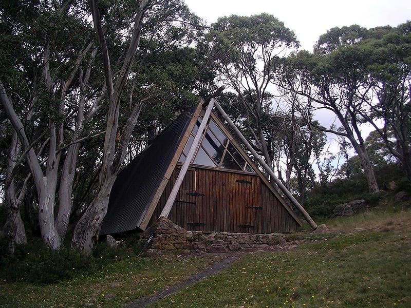
Tourist attraction in Howitt Plains, Australia. The Vallejo Gantner Hut is located at Macalister Springs near Mount Howitt and the Crosscut Saw. The construction commenced in late 1968. The hut was built as a memorial following the death of a young man named Vallejo Gantner.
Vallejo Gantner was born in San Francisco and moved with his family to Melbourne, Australia at the age of 12. He was a student at Melbourne Grammar School and was involved in outdoor activities throughout his student life. He was killed at the age of 19 when his shotgun accidentally discharged while hunting rabbits.
His mother Neilma Gantner asked the Victorian State Government permission to construct the hut as a memorial to her son. The hut was built with considerable difficulty due to poor access and adverse weather conditions over a two-year period from 1970–1971 with the help of friends from student days at Melbourne Grammar School and from other schools.
The hut was designed by architect David McGlashen. Its unusual triangular design like a hiking tent readily sheds snow in winter.
The hut is a popular destination for bushwalkers in summer and for cross country skiers in winter and is known colloquially as "Gantner's", and amongst many students from the local schools including Timbertop simply as "Mac Springs". It is now within the boundaries of the Alpine National Park.
In 2013, Parks Victoria unveiled the "loo with a view", at Macalister Springs, which uses a sealed tank system to ensure no waste or seepage into the local environment. The project cost $50,000 including design, construction and installation..
The site is listed in the Victorian Heritage Register.[3]
Mount Cobbler
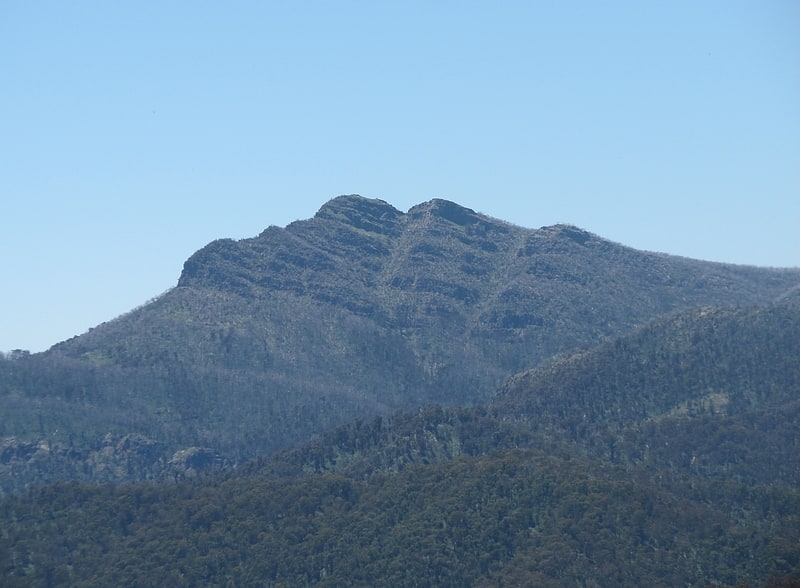
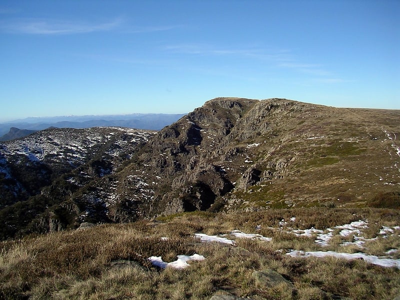
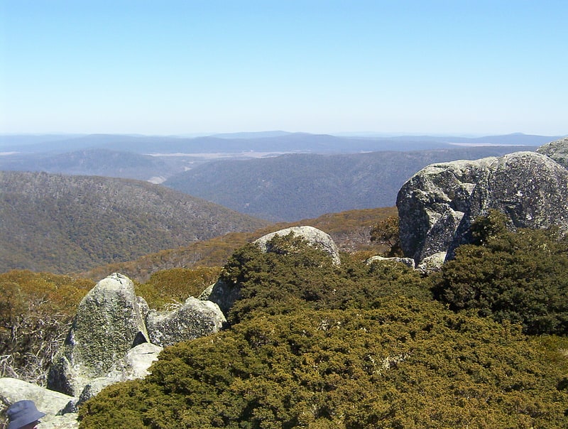
Mountain in Australia. Mount Cobbler is a mountain located in the Alpine National Park to the east of Mansfield in north-eastern Victoria, Australia. Its summit rises to 1,628 metres above sea level. The peak and surrounding Cobbler land system are composed of sedimentary rocks, dating to the Lower Carboniferous period, some 359 to 318 million years ago.
Nearby Lake Cobbler, which has a camping area, is accessible by a four-wheel drive track. From there is a walking track to the summit, and another to Dandongadale Falls, which drops 255 metres (837 ft) from the plateau and is the highest waterfall in Victoria. The 5-kilometre (3-mile) walk to the summit is moderate to steep. Surrounding peaks include Mount Typo to the north-east, Mount Koonika and Mount Speculation to the south-east, and Mount Stirling to the south-west.
Tree species occurring on the surrounding plateau include Mountain Gum (Eucalyptus dalrympleana), Snow Gum (E. pauciflora) and Broad-leaved Peppermint (E. dives). Heathland, shrubland and patches of herbfield are found on the rocky escarpments, with species including Alpine Shaggy-pea (Podolobium alpestre) and Mountain Beard-heath (Acrothamnus hookeri).
Annual rainfall ranges between 1,250–1,500 millimetres (49–59 in), with snowfalls regularly experienced in winter.[4]
Lake Tali Karng
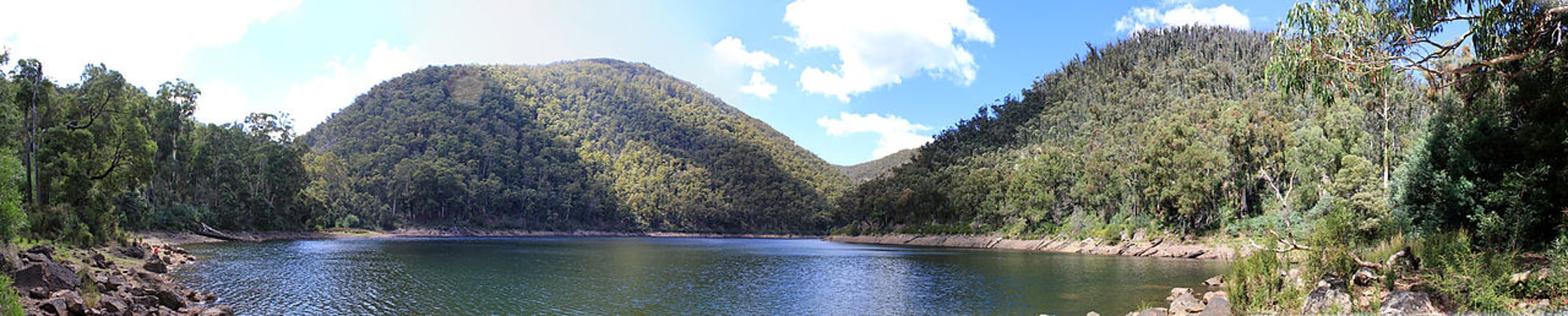
Lake in Australia. Lake Tali Karng is a natural lake in the Alpine region of Victoria, in eastern Australia. At 14 hectares in area and 51 metres in depth, it is the only deep lake in Victoria. It was formed by a landslide 1,500 years ago.
Unlike alpine lakes in the Snowy Mountains, Lake Tali Karng is the only permanent, deep, highland lake in Australia that is not of glacial or volcanic origin. It was formed by debris falling from the Sentinel, which is 700 metres (2,300 ft) above the valley. The landslide dammed the Wellington River with the area of the landslide now known as the Valley of Destruction. The lake has no stream outlet, and has never been known to overflow, with water seeping away through the Valley of Destruction.
Two creeks feed the lake, Snowden Creek and Nigothoruk Creek. Nigothoruk Creek has three waterfalls, collectively called the Snowden Falls. There is no vegetation in the lake itself because the water is slightly acidic. Its maximum depth is 51 metres (167 ft) and, due to the minimal sunlight falling on it, together with the snow-melt which feeds it, it remains cold throughout the year.[5]
Bogong High Plains
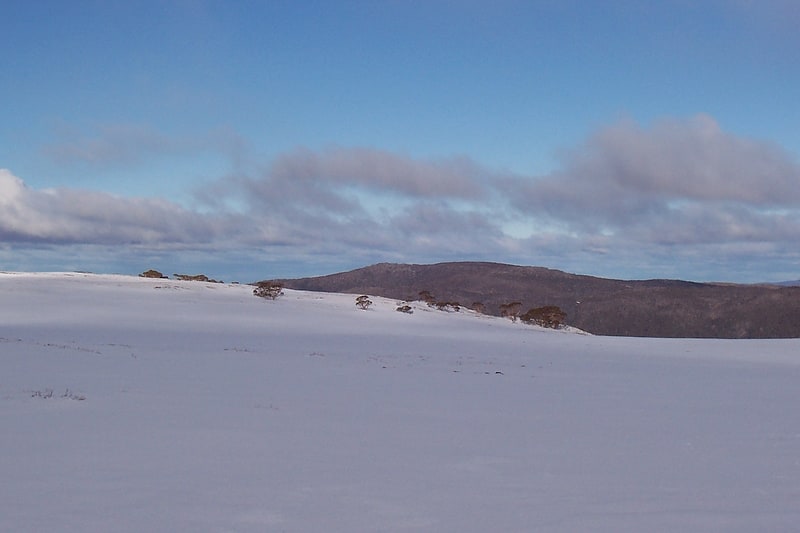
Mountain range in Australia. The Bogong High Plains, part of the Victorian Alps of the Great Dividing Range, are a section of plains located in the Alpine National Park in the Australian state of Victoria and are situated south of Mount Bogong.
In winter this area is one of the largest snow-covered areas in Australia and can be easily accessed from the Hotham Alpine Resort and Falls Creek ski resort. The area is very popular for both summer and winter time activities. Ski touring and all types of cross-country skiing are possible through most winter months. A trail called Australian Alps Walking Track is popular for hiking in summer and cross-country skiing in winter. Mountain biking and bushwalking are common in summer. Local towns and villages provide the best possibility for exploring the areas, including Mount Beauty and Harrietville.[6]
Mount Buggery
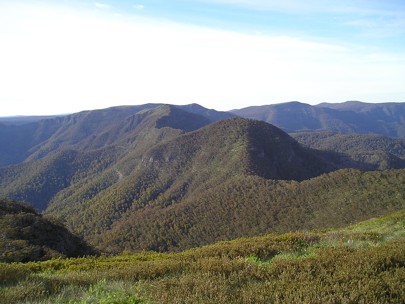
Mountain in Australia. Mount Buggery is a mountain located in the Alpine Shire within the Alpine National Park in the alpine region of Victoria, Australia. The mountain is located on the end of a ridgeline known as the Crosscut Saw between Mount Speculation and Mount Howitt, both located 4 kilometres to the south of Mount Buggery.
The summit of Mount Buggery rises in the range of 1,583–1,598 metres (5,194–5,243 ft) above sea level.[7]
Australian Alps National Parks and Reserves
National park. The Australian Alps National Parks and Reserves is a group of eleven protected areas consisting of national parks, nature reserves and one wilderness park located in the Australian Capital Territory, New South Wales and Victoria and which was listed as a "place" on the Australian National Heritage List on 7 November 2008 under the Environment Protection and Biodiversity Conservation Act 1999. The listing which covers an area of 16,531.80 square kilometres, contains the vast majority of alpine and sub-alpine environments in Australia. The listing includes the following protected areas - Alpine, Baw Baw, Brindabella, Kosciuszko, Mount Buffalo, Namadgi and Snowy River national parks; the Avon Wilderness Park, and the Bimberi, Scabby Range and Tidbinbilla nature reserves.[8]
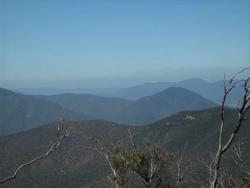
Mount Howitt
Mount in Australia. Mount Howitt, also known as Toot-buck-nulluck in the Gunai language, is a mountain in Victoria, Australia, named for Alfred William Howitt. Located in the Wonangatta Moroka Unit of the Alpine National Park approximately 170 km north-east of Melbourne.
The mountain is a popular bushwalking destination due to its views and relatively easy access in summer via several trails, including the Australian Alps Walking Track. The closest point to a road is via MacAlister Springs and the Howitt Plains, a distance of about seven kilometres. There is also a longer and more difficult hike up the West Spur. It climbs from the Howqua River, which is generally accessed via Mount Stirling. In winter road closures restrict access to trailheads no closer than 15 km (9.3 mi) away making the area popular with remoteness-seeking back country and cross country skiers.[9]
Victorian Alps
Mountain range. The Victorian Alps, also known locally as the High Country, is a large mountain system in the southeastern Australian state of Victoria. Occupying the majority of eastern Victoria, it is the southwestern half of the Australian Alps, the tallest portion of the Great Dividing Range. The Yarra and Dandenong Ranges, both sources of rivers and drinking waters for Melbourne, are branches of the Victorian Alps.
The promise of gold in the mid-1800s, during the Victorian Gold rush led to the European settlement of the area. The region's rich natural resources brought a second wave of agricultural settlers; the foothills around the Victorian Alps today has a large agrarian sector, with significant cattle stations being sold recently for over thirty million dollars. The Victorian Alps is also the source of many of Victoria's water ways, including Murray and Yarra Rivers and the Gippsland Lakes. The valleys beneath the high plains are surrounded by wineries and orchards because of this abundance water. The region is also home to Victoria's largest national park, the Alpine National Park, which covers over 646,000 hectares (1,600,000 acres). The establishment of the Alpine National Park has meant that economic activities such as mining, logging and agriculture are limited, to preserve the natural ecosystem for visitors. Tourism within the region centres around snow sports in winter and various outdoor activities during the summer months.
The Australian Alps is an Interim Biogeographic Regionalisation for Australia sub-bioregion of approximately 519,866 hectares (1,284,620 acres), and an administrative sub-region of Victoria bordering the Gippsland and Hume regions.[10]
Australian Alps montane grasslands
The Australian Alps montane grasslands is a montane grassland ecoregion of south-eastern Australia, restricted to the montane regions above 1300 metres.[11]