Discover 5 hidden attractions, cool sights, and unusual things to do in Moogerah Peaks National Park (Australia). Don't miss out on these must-see attractions: Frog Buttress, Mount Greville, and Mount Moon. Also, be sure to include Mount Edwards in your itinerary.
Below, you can find the list of the most amazing places you should visit in Moogerah Peaks National Park (Queensland).
Table of Contents
Frog Buttress

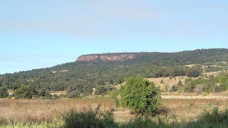
Campground in Mount French, Australia. Frog Buttress is a cliff on the north-west side of Mount French, in the Moogerah Peaks National Park near the town of Boonah in Queensland, Australia. It became famous when local rock climbers Rick White and Chris Meadows discovered it in 1968. Since then, 400 routes have been established by climbers including Henry Barber, Kim Carrigan and Tobin Sorenson.
The buttress is small by world climbing standards: 400m wide, 50m high in the middle, and 20m at its ends. However, it is formed of rhyolite columns, with superb climbing up the many cracks, corners and aretes between them. Most of the cracks are smooth sided and parallel, necessitating the use of many spring-loaded camming devices and efficient crack climbing technique.
There are now over 400 documented routes with grades ranging from 4 to 32 on the Ewbank Scale. The style of climbing is staunchly traditional using natural protection, with very few sport routes. There are bolts on faces and arêtes and in most cases climbers need to bring their own brackets. Top-roping is difficult due to the fragile clifftop and is considered somewhat unethical at this largely 'purist' crag. Historically, some climbs were initialled at the bottom for easy route-finding, although this practice is now discouraged.
Climbing is best in winter, as during the summer months it quickly becomes too hot to spend much time on the rock, and midday climbing is not recommended. A good strategy is to get in a morning climb, and then head off to the Dugandan Pub, about 9 kilometres away in Boonah, for food and beer.
There are (showerless) camping facilities above the cliff for $4.85 per night, but one needs to book ahead.[1]
Mount Greville
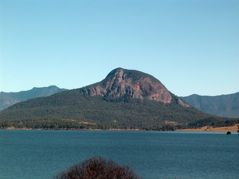
Mountain in Australia. Mount Greville is a cone-shaped and deeply fissured mountain in South East Queensland, Australia. The mountain rises 720 m above sea level and is part of the Moogerah Peaks National Park. It lies approximately 100 km south west of Brisbane just outside the town of Boonah. Other prominent peaks in this Scenic Rim group of mountains includes Mount Edwards, Mount Moon and Mount French.
The local Uragapul people call this mountain, Meebatboogan, meaning place where the eagles rest. In 1828, the mountain was named after the Scottish botanist Robert Kaye Greville by the European explorer Allan Cunningham.
Palm Gorge is situated on Mount Greville. This narrow gorge contains a nearly pure stand of Piccabeen Palms.
The easiest path to the summit is via the south-eastern track which passes through stands of Eucalyptus dura at higher altitudes. After rain, climbing the mountain can be dangerous due to slippery rocks and the path's proximity to sheer cliffs.
Mount Greville Is widely known to resemble a Kangaroo.[2]
Mount Moon
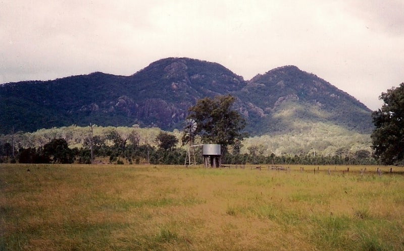
Mountain in Australia. Mount Moon is a lightly timbered, dome-shaped mountain in the Scenic Rim, Queensland, Australia. Its Indigenous name is Kibbobum. The mountain rises 784 metres above sea level and is part of the Teviot Range and is within the Moogerah Peaks National Park. It is within the locality of Croftby in the Scenic Rim Region local government area.
It lies approximately 100 km south west of Brisbane just outside the town of Boonah.
The mountain was established as a national park in 1953.
The peak is a rhyolite plug. The rise features a craggy landscape dominated by a prominent fracture that has been enlarged by erosion. Access to the mountain is via private property only, for which permission must be obtained.[3]
Mount Edwards
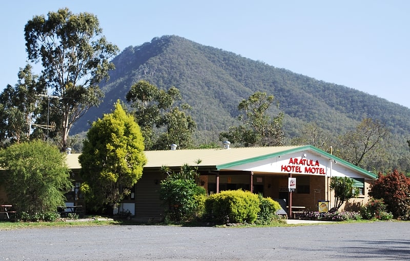
Mountain in Australia. Mount Edwards is a mountain in South East Queensland, Australia. The mountain rises 634 metres above sea level and is part of the Moogerah Peaks National Park. It lies within its namesake locality Mount Edwards, approximately 100 km south west of Brisbane approximately 17 km from the town of Boonah. The mountain is the closest of the Moogerah Peaks to the Cunningham Highway and is 9 km south of Aratula. Other prominent peaks in this Scenic Rim group of mountains includes Mount French, Mount Moon and Mount Greville.
Explorer John Oxley named the mountain Mount Banister in 1824. Later renamed in 1828 by Alan Cunningham after Lieutenant George Edwards.
The Indigenous name, given by the Yugara people, is Wummun.
The summit is accessed by walking track that starts across the Moogerah Dam wall. The 2.7 km walk to the top affords views across Fassifern Valley.
Between Mount Edwards and Little Mount Edwards (363 m) to the east, is Reynolds Creek which flows through a steeply sloped gorge.[4]
Mount French
Mountain in Australia. Mount French is a mountain in South East Queensland, Australia. The mountain rises 579 m above sea level and is part of the Moogerah Peaks National Park. It lies approximately 100 km west of Brisbane in the locality of Mount French west of the town of Boonah in the Scenic Rim Region. Other prominent peaks in the Scenic Rim group of mountains include Mount Edwards, Mount Moon and Mount Greville.
The traditional owners of the mountain, the Ugarapul people, named the two peaks Punchagin (the southern peak) and Mee-bor-rum (the northern peak).
In 1827, Patrick Logan named the peak Mount Dumaresq. The name was changed after Allan Cunningham named another mountain with the same name, coincidentally on the same day.
It is best known as a popular destination for rockclimbers and is the home of Frog Buttress. It was first developed by Rick White and company during the late 1960s and 1970s. There are also some easy walks around the top of the cliffs from the picnic area. One track leads to the constructed lookout called Logans Lookout which overlooks the Fassifern Valley.
Access to the mountain top is via sealed road. There are numerous self-registration camping sites, barbecues places, picnic tables, a single block of toilets, a car park and tap water is provided.[5]