Discover 6 hidden attractions, cool sights, and unusual things to do in Wooroonooran National Park (Australia). Don't miss out on these must-see attractions: Josephine Falls, Mount Bartle Frere, and Mount Bellenden Ker. Also, be sure to include Bellenden Ker Range in your itinerary.
Below, you can find the list of the most amazing places you should visit in Wooroonooran National Park (Queensland).
Table of Contents
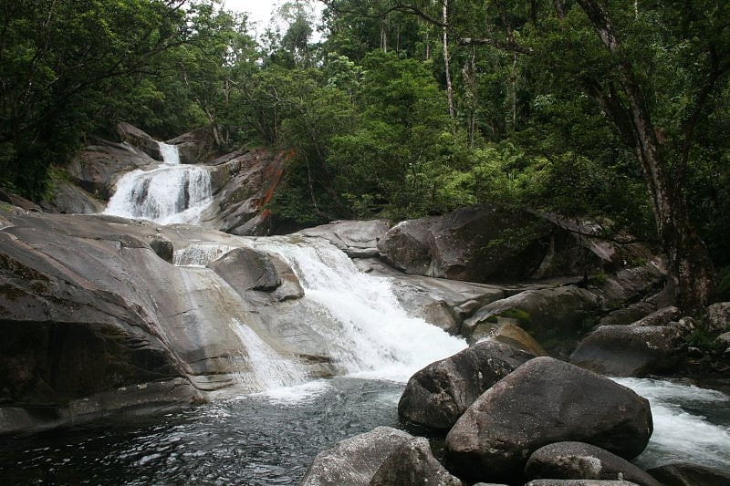
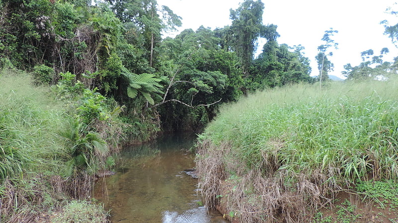
Josephine Falls
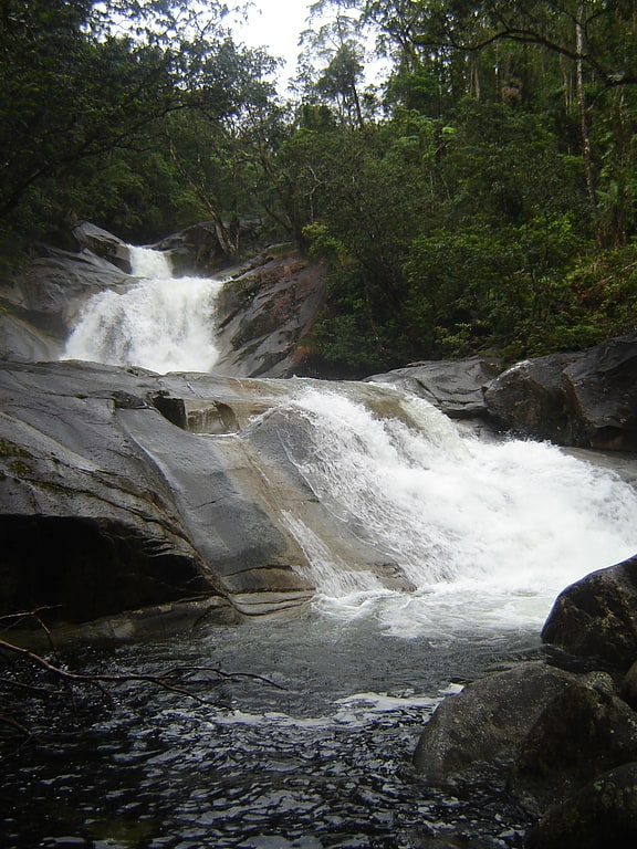
Cascade in Australia. The Josephine Falls is a tiered cascade waterfall on the Josephine Creek located in Wooroonooran, Cairns Region in the Far North region of Queensland, Australia.[1]
Mount Bartle Frere
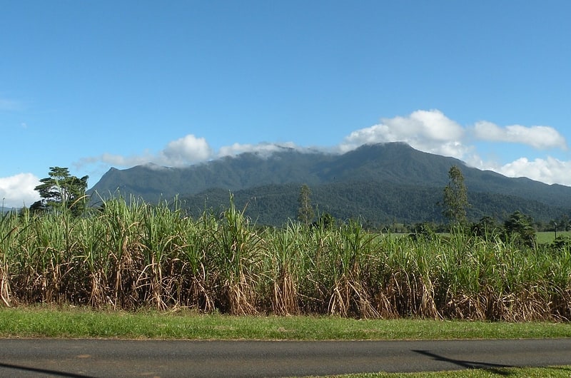
Mountain in Australia. Mount Bartle Frere is the highest mountain in Queensland at an elevation of 1,611 metres. The mountain was named after Sir Henry Bartle Frere, a British colonial administrator and then president of the Royal Geographical Society by George Elphinstone Dalrymple in 1873. Bartle Frere was British Governor of Cape Colony at the outset of the Anglo-Zulu War.
It is located 51 kilometres (32 mi) south of Cairns in the Wooroonooran National Park southwest of the town of Babinda on the eastern edge of the Atherton Tablelands. Mount Bartle Frere is part of the Bellenden Ker Range and the watershed of Russell River.
The foothill to summit is entirely covered by rainforest, ranging from typical tropical rainforest in the lowlands to low cloud forest at the cooler summit, where temperatures are up to 10 °C (18 °F) lower than on the coast. Despite the treacherous climb, reaching the top offers an expansive view of the surrounding area.[2]
Mount Bellenden Ker
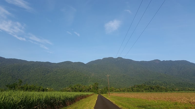
Mountain in Australia. Mount Bellenden Ker is the second-highest mountain in Queensland, Australia, with a height of 1,593 metres. It is named after the botanist John Bellenden Ker Gawler. Located 60 km south of Cairns near Babinda, it is adjacent to Mount Bartle Frere, the state's highest peak, part of the Bellenden Ker Range which is also known as the Wooroonooran Range. The two mountains dominate the Josephine Falls section of the Wooroonooran National Park. Both peaks are made of resistant granite and are remnants of an escarpment that has been eroded by the Russell and Mulgrave Rivers.
Several television transmitter towers have been built on the mountain. The only access to the television transmitter site and the mountain top weather station is by a privately owned cable car.[3]
Bellenden Ker Range

Range in Australia. The Bellenden Ker Range, also known as the Wooroonooran Range is a coastal mountain range in Far North Queensland, Australia. Part of the Great Dividing Range it is located between Gordonvale and Babinda.
The whole of the range falls within the Wet Tropics World Heritage Area and is covered in richly diverse world heritage listed wet tropical forests, including species of flora and fauna endemic to the range. The range also forms part of the Wooroonooran Important Bird Area, identified as such by BirdLife International because it supports populations of a range of bird species endemic to Queensland's Wet Tropics. Most of the range is also a gazetted protected area named Wooroonooran National Park.
Queensland's two highest mountains, Mount Bartle Frere (1622 m) and Mount Bellenden Ker (1593 m) form part of this range, and Walshs Pyramid (922 m) (one of the highest free-standing natural pyramids in the world) is located at the range's northern end.[4]
Wooroonooran
Locality in Australia. Wooroonooran is a locality split among the Cairns Region, the Cassowary Coast Region, and the Tablelands Region in Queensland, Australia. In the 2016 census, Wooroonooran had no population.[5]
Ngatjan
Locality in Australia. Ngatjan is a locality split between the Cassowary Coast Region and the Cairns Region, Queensland, Australia. In the 2016 census, Ngatjan had no population. The term is derived from the ethnonym of the local Ngatjan people.[6]