Discover 15 hidden attractions, cool sights, and unusual things to do in Wasatch–Cache National Forest (United States). Don't miss out on these must-see attractions: Bridal Veil Falls, Snowbasin, and Tony Grove Lake. Also, be sure to include Beaver Mountain in your itinerary.
Below, you can find the list of the most amazing places you should visit in Wasatch–Cache National Forest (Utah).
Table of Contents
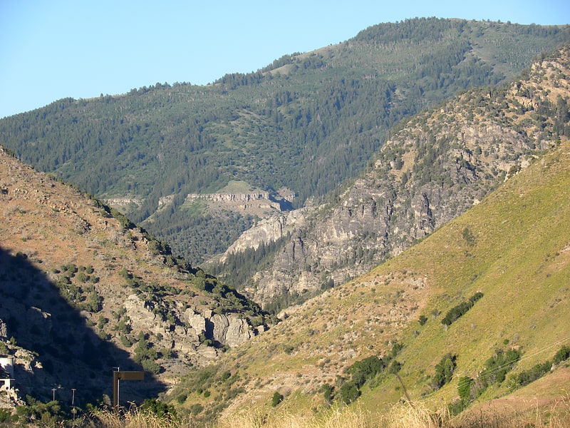
Bridal Veil Falls
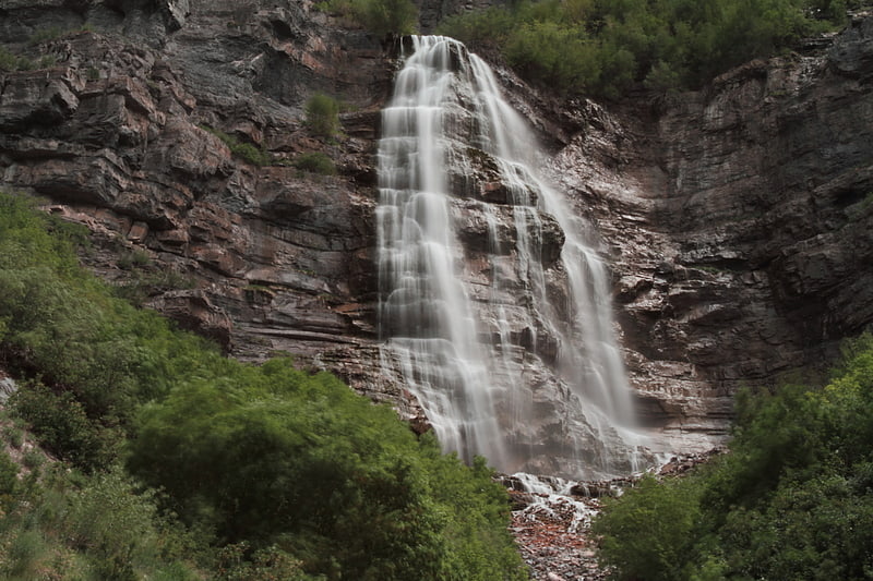
Waterfall in Utah. Bridal Veil Falls is a 607-foot-tall double cataract waterfall in the south end of Provo Canyon, close to US189 in Utah, United States. Battle Creek Falls is on the same mountain side, approximately 10 miles north of Bridal Veil Falls.[1]
Address: Provo Canyon, Wasatch–Cache National Forest
Snowbasin
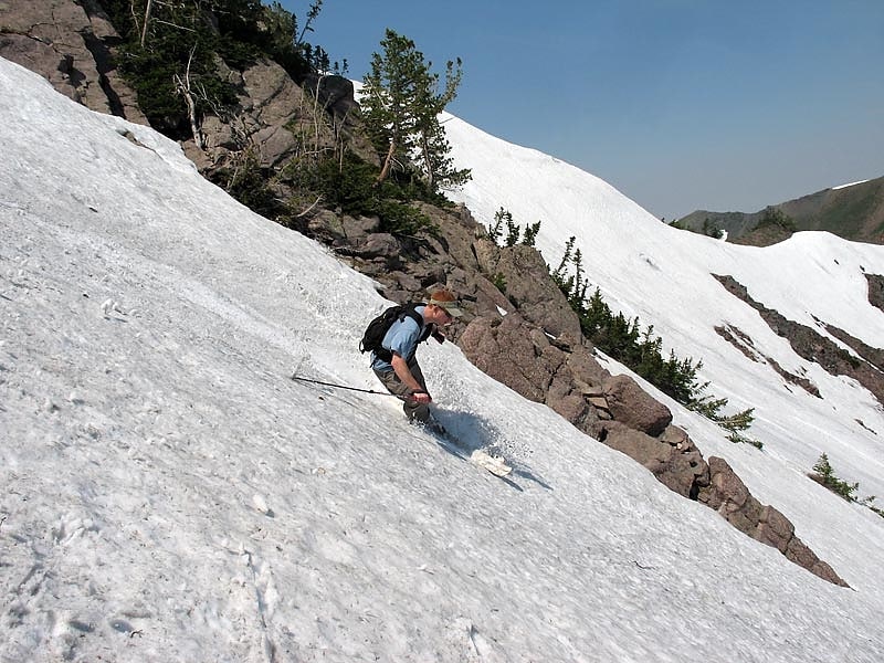
Longtime spot for skiing and snowboarding. Snowbasin Resort is a ski resort in the western United States, located in Weber County, Utah, 33 miles northeast of Salt Lake City, on the back side of the Wasatch Range.
Opened 83 years ago in 1939, as part of an effort by the city of Ogden to restore the Wheeler Creek watershed, it is one of the oldest continually operating ski resorts in the United States. One of the owners in the early days was Aaron Ross. Over the next fifty years Snowbasin grew, and after a large investment in lifts and snowmaking by owner Earl Holding, Snowbasin hosted the 2002 Winter Olympic alpine skiing races for downhill, combined, and super-G. The movie Frozen was filmed there in 2009.
Snowbasin is located on Mount Ogden at the west end of State Route 226, which is connected to I-84 and SR-39 via SR-167 (New Trappers Loop Road).[2]
Address: 3925 E. Snowbasin Rd., 84317 Huntsville
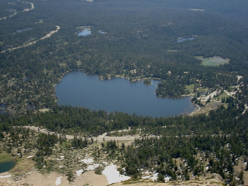
Tony Grove Lake
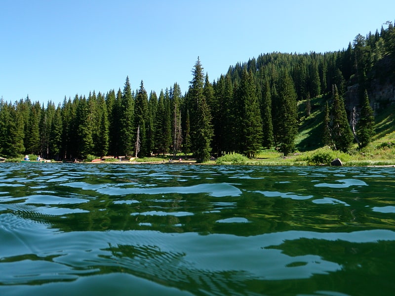
Lake in Utah. Tony Grove Lake is a lake in Cache County, Utah. The Tony Grove Lake Campground is located on the southeast shore of the lake. The lake and campground are situated on the Logan Canyon Scenic Byway. A 5–6 mi paved road climbs to a height of 8,048 feet to reach Tony Grove Lake and the Mount Naomi Wilderness area.
A historic marker at the lake states that Tony Grove's name derived from its popularity with wealthy residents of Logan in the late 19th and early 20th centuries.
The Mt. Naomi Wilderness Area was designated in 1984, and covers 45,000 acres (180 km2). This region embraces some of the most rugged and spectacular country in the Bear River Range. The area around this glacial lake explodes into wildflowers in the early summer.
Many trails throughout the area offer wildlife viewing. Access and parking for the White Pine Lake Trail, Coldwater Spring Trail, Naomi Peak Trail and High Creek Trail is located at the Tony Grove Lake parking lot.[3]
Beaver Mountain
Ski area in the Cache County, Utah. Beaver Mountain is a ski area in the western United States, in northern Utah. First opened 83 years ago in 1939, it is located near the summit of Logan Canyon in the Bear River Mountains, west of Bear Lake and near the border with Idaho. While smaller and less developed than a number of Utah ski resorts, Beaver Mountain is very popular with residents of nearby Logan, Utah State University, the surrounding Cache Valley, and the Bear Lake region, including southeastern Idaho.
The slopes of the mountain are predominantly east-facing, and it receives somewhat less snowfall than those resorts facing west. Since it does not currently employ snowmaking equipment, the ski area is entirely dependent upon the (usually) ample natural snowfall, and therefore often opens several weeks later than most other resorts in Utah.
"The Beav" is located 27 miles (43 km) northeast of Logan, just a mile (1.6 km) off of US-89, the Logan Canyon Scenic Byway, a national scenic byway. Garden City, Utah is the closest town, which is about ten to fifteen minutes away. The Idaho border (42nd parallel) is less than three miles (5 km) north and Bear Lake is approximately six miles (10 km) due east. Salt Lake City is 110 miles (180 km) south.
The ski area is owned and operated by the Seeholzer family: founded by Harry (1902–1968) and succeeded by son Ted (1932–2013), it continues as a family operation under Ted's son Travis.[4]
Address: Logan Canyon, Highway 89, 84323 Logan
Mirror Lake
Lake in Utah. Mirror Lake is a lake in the high Uinta Mountains in Utah. It is a popular fishing and recreation spot. The lake contains three species of trout: rainbow, brook, and tiger. The lake has a Forest Service campground, picnic facilities, and a boat ramp for non-motorized watercraft. Access to the lake is by the Mirror Lake Highway, which is only open during the summer.
The lake's name comes from the near-perfect reflection of the surrounding mountains and trees seen from a roadside overlook or from the shore. The shoreline is owned by the Uinta-Wasatch-Cache National Forest.
Mirror Lake includes the adjacent Mirror Lake Campground, with latrines, day-use areas and 94 campsites. The water that enters the lake is overflow from Pass Lake located just above Mirror Lake. The outflow is the headwaters of the Duchesne River.[5]
Bald Mountain
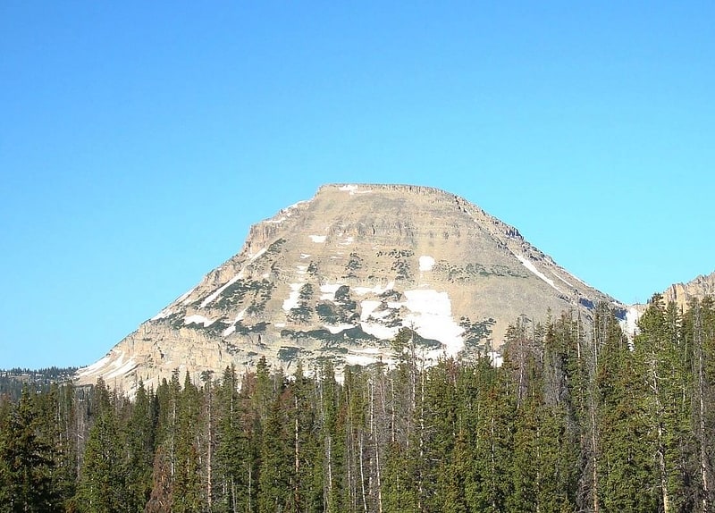
Peak in Utah. Bald Mountain is a 11,949-foot peak in the western Uinta Mountain Range in the Uinta-Wasatch-Cache National Forest on the border between Summit and Wasatch counties in northeastern Utah, United States.[6]
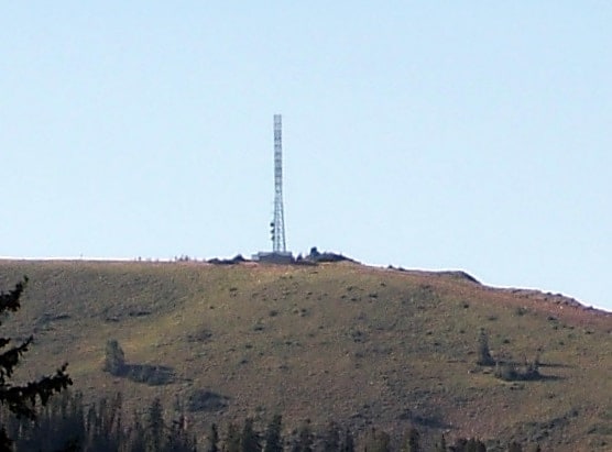
Francis Peak
Peak in Utah. Francis Peak, Elevation 9,560 feet, was named in honor of an early pioneer, Esther Charlotte Emily Weisbrodt Francis, who contributed to the colonization of the Morgan Valley in Morgan county in Utah. One of the taller peaks of the Wasatch Range, Francis Peak is located on the border between Morgan and Davis counties, approximately 18 miles north of Salt Lake City, Utah, United States.
The summit is seasonally accessible by hiking, biking, recreational vehicles, and automobile. The unpaved roads are mostly one lane, steep, switchbacked and cliff-hanging/rocky in spots, perhaps best handled by smaller 4 wheel drive vehicles. Views of the valleys below are spectacular. As of Summer 2021, Google maps proved accurate. Download your GPS plan beforehand since cell service on the mountain is sketchy and there are unmarked side roads. Vehicles can access the peak via Skyline Drive in Bountiful and Farmington Canyon Road in Farmington. Camping sites, trails, small ponds, wildlife and great vistas are part of this rugged natural setting.
Atop the peak are domed radar towers constructed in 1959 and operated by the Federal Aviation Administration and Air National Guard.[7]
Mount Ogden
Peak in Utah. Mount Ogden is a peak in Weber County, Utah, United States in the northern Wasatch Range.
Mount Ogden has an elevation of 9,579 feet (2,920 m). The peak is popular with hikers and can be accessed via trails in three nearby canyons: Beus, Waterfall, and Taylor Canyons. The summit's eastern face also has technical crack and face climbing routes. The summit accommodates several large radio towers and a helipad.
Mount Ogden's eastern slope is home to Snowbasin Ski Resort, where the 2002 Olympics downhill ski races were held. The resort also provides private road access to the peak.[8]
Ben Lomond Mountain
Peak in Utah. Ben Lomond, just north of Ogden, Utah, is a peak in the northern portion of the Wasatch Mountains. A popular trail passes over its summit, accessible from four different trailheads to the north, south, and east.
It is often referred to by locals as Ben Lomond Peak, Mt. Ben Lomond, and Ben Lomond Mountain. The usage Mount Ben Lomond is technically a redundancy as the prefix Ben, which is found in front of many Scottish mountains including Ben Lomond after which this mountain was named, actually means mount - Scottish mountains whose name begins Ben are never preceded by Mount. The USGS has it labeled as Ben Lomond on maps.
Ben Lomond stands out along the Wasatch Front because the mountain range appears to run east and west along the Wasatch Range, while most mountains appear to run south and north. Two miles northwest of Ben Lomond is Willard Peak, with an elevation of 9,764 feet (2,976 m). Northwest of Willard Peak is Inspiration Point. A dirt road travels 14 miles (23 km) from Mantua, Utah to Inspiration Point. The road is usually not passable until July due to deep snow that resists melting due to the area's northern exposure. Atop Inspiration Point on a clear day, one can see Salt Lake City to the south, Willard Bay and the Great Salt Lake to the west, and the city of Logan, Utah to the northeast.
From Inspiration Peak one can hike or bike to the summit of Ben Lomond, and then continue east to a trailhead on North Ogden Pass. The trail is listed as one of the top mountain bike rides in Utah. The distance from the North Ogden trailhead to the summit of Ben Lomond is approximately 9 miles (14 km).
Ben Lomond was named after the mountain Ben Lomond in the Scottish Highlands. Mary Wilson Montgomery, an early settler, thought the mountain range resembled the Munro.
According to some sources, the Paramount Pictures logo, known as Majestic Mountain, was modeled after Ben Lomond. It is said that William W. Hodkinson, the co-founder of Paramount and a native of the Ogden area, initially drew the image on a napkin during a meeting in 1914.[9]
Humpy Peak
Peak in Utah. Humpy Peak is a peak located in the Uinta Mountain Range in northern Utah. It is approximately 27.56 miles south of Evanston, Wyoming and 21.29 miles east of Coalville, Utah. The summit has an elevation of 10,875 feet.[10]
American Fork Canyon
American Fork Canyon is a canyon in the Wasatch Mountains of Utah, United States. The canyon is famous for the Timpanogos Cave National Monument, which resides on its south side. It is named after the American Fork River which runs through the bottom of the canyon.
The area is accessed by State Route 92, through what is officially called the "Alpine Loop Scenic Byway." Visitors entering American Fork Canyon from the west can follow SR-92 up the canyon to the summit of the Alpine Loop, down the east side of Mount Timpanogos, past Sundance Ski Resort and then out into Provo Canyon to the south. Spurs off SR-92 take visitors to Tibble Fork Reservoir and Cascade Springs. A well-maintained gravel road continues east from Cascade Springs to Midway.
This area is home to many hiking, biking and equestrian trails with several established campgrounds. Tibble Fork Reservoir and Silver Lake Flats Reservoir are popular camping and fishing spots in the summer as well as offering excellent snowmobiling, snowshoeing, cross-country skiing and backcountry skiing during the winter months.[11]
Causey Reservoir
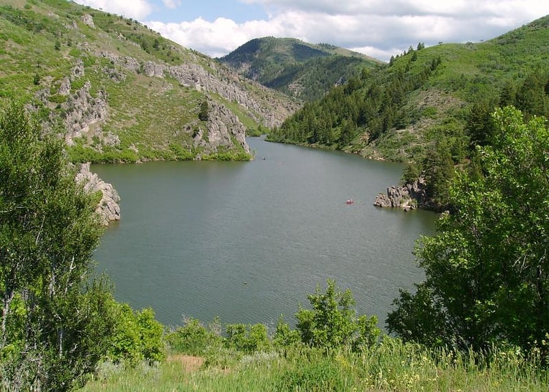
Reservoir in Utah. Causey Reservoir is a reservoir located 15 miles northeast of Ogden, Utah, United States just off Utah State Route 39.[12]
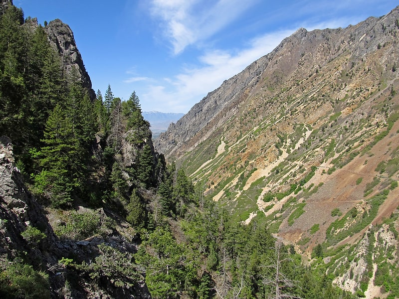
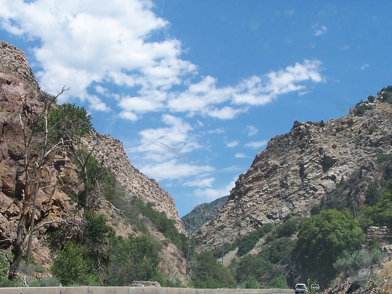
Logan Canyon
Logan Canyon is in the western United States in northeastern Utah, a canyon that cuts its way through the Bear River Mountains, a branch of the Wasatch Range. It is popular for both summer and winter activities, especially rock-climbing, hiking, camping, fishing, snowmobiling, and skiing, at the Beaver Mountain ski resort. The canyon rises to an elevation of approximately 7,800 feet above sea level, after a vertical climb of about 2,900 feet. Just beyond the summit is a steep road leading into Bear Lake Valley and scenic overlooks that provide views of deep blue Bear Lake. The western terminus is at Logan in Cache County and the eastern terminus is at Garden City in Rich County.[13]
Ogden Canyon
Ogden Canyon is a canyon in the Wasatch Range in eastern Weber County, Utah, United States, just east of Ogden.[14]
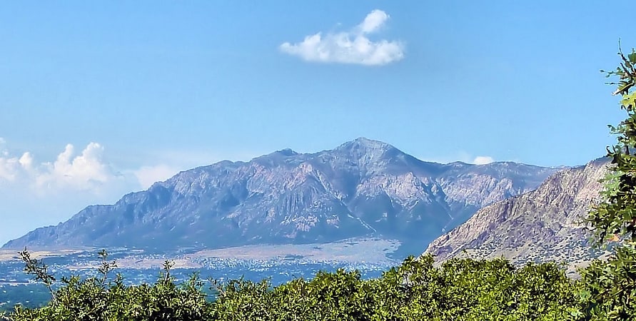
Mount Nebo
Mountain in Utah. Mount Nebo is the southernmost and highest mountain in the Wasatch Range of Utah, in the United States, and the centerpiece of the Mount Nebo Wilderness, inside the Uinta National Forest. It is named after the biblical Mount Nebo, overlooking Israel from the east of the Jordan river, which is said to be the place of Moses' death.
Mount Nebo has two summits: the northern summit reaches 11,933 feet (3,637 m), and the southern summit reaches 11,882 feet (3,622 m). Early surveys placed the southern peak as the highest, but the mountain was resurveyed in the 1970s and the northern peak was found to be higher. It is the county high point of Utah County.
Mount Nebo is an "ultra", one of 128 ultra-prominent peaks in the United States having more than 1,500 metres (4,900 ft) of topographic prominence. The mountain is typically partially or completely covered in snow from mid-October until July. Nearby towns include Payson, Nephi, and Provo.
A substantial trail leads to the south summit, accessible from starting points on the east or west of the mountain. Another trail accesses the north summit, starting northeast of the mountain. A "bench trail" runs along the east side of the mountain from north to south at roughly 9,000 feet elevation. All of these trails are popular with hikers, though strenuous; many are dangerous places for horseback riders. One old-time local rider warns: "There's dead horses in every canyon on that mountain!"
The Mount Nebo Scenic Byway is a federally designated National Scenic Byway which departs I-15 at Payson and travels south through the Mount Nebo Wilderness, climbing to over 9,000 feet before rejoining the interstate at Nephi. The route features panoramic views of Mount Nebo, the Utah Valley, and Utah Lake far below. There are numerous trailheads along the route for the hiking enthusiast, including a short walk to the "Devil's Kitchen", an area which has been described as a "mini Bryce Canyon".[15]