Discover 7 hidden attractions, cool sights, and unusual things to do in Ricketts Glen State Park (United States). Don't miss out on these must-see attractions: Pennsylvania State Game Lands Number 13, Lake Jean, and North Mountain. Also, be sure to include Red Rock Mountain in your itinerary.
Below, you can find the list of the most amazing places you should visit in Ricketts Glen State Park (Pennsylvania).
Table of Contents
Pennsylvania State Game Lands Number 13
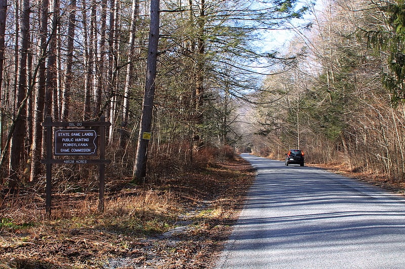
Hunting preserve in Pennsylvania. Pennsylvania State Game Lands Number 13 are Pennsylvania State Game Lands in Columbia County and Sullivan County, in Pennsylvania, in the United States. They have an area of 49,529 acres. The game lands are mountainous and contain streams such as West Branch Fishing Creek and its tributaries. The main game animals in the area include bear, deer, grouse, turkey, and waterfowl. The game lands are adjacent to Pennsylvania State Game Lands Number 57.[1]
Lake Jean
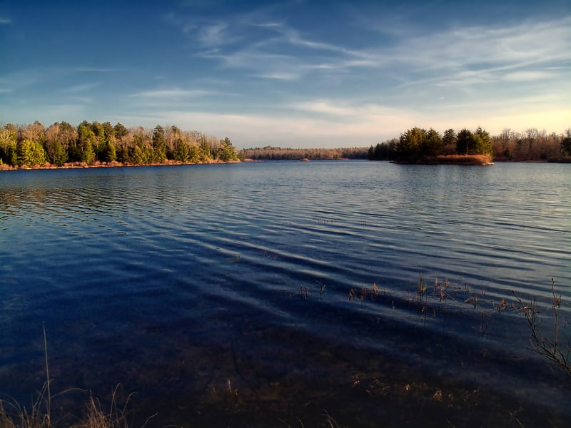
Lake in Pennsylvania. Lake Jean is a lake in Luzerne County and Sullivan County, in Pennsylvania, in the United States. It has a surface area of approximately 245 acres and is situated in Colley Township, Sullivan County and Fairmount Township, Luzerne County. The lake's main inflow is the outlet of Ganoga Lake. Lake Jean is fairly shallow, with an average depth of 5.9 feet. It is in the watershed of Fishing Creek. The main rock formations in the lake's watershed include Burgoon Sandstone and the Mauch Chunk Formation. The lake is dammed by the Lake Jean Dam and is owned by the Pennsylvania Department of Conservation and Natural Resources.
Lake Jean historically had a low pH due to impairment by atmospheric deposition. The lake has become less acidic, but continues to be impaired by mercury. Its watershed has an area of 1,998 acres (809 ha), including the lake itself. The majority of the watershed is forested, though there are a few other land uses. The lake was named by Colonel R. Bruce Ricketts in 1905 after Jean Holberton Ricketts, his eldest daughter. A new dam was created for it in the 1950s. In 2015, the lake was partially drained so that repair work could be done on the control tower of the Lake Jean Dam.
Lake Jean is stocked with trout and contains various species of warmwater game fish and panfish. The large tracts of forest in the lake's watershed are mainly deciduous, but there is some coniferous forest. The lake is listed on the Luzerne County Natural Areas Inventory. Its main uses are recreation and fishing and it is one of the common destinations of visitors to Ricketts Glen State Park, in which it is located.[2]
North Mountain
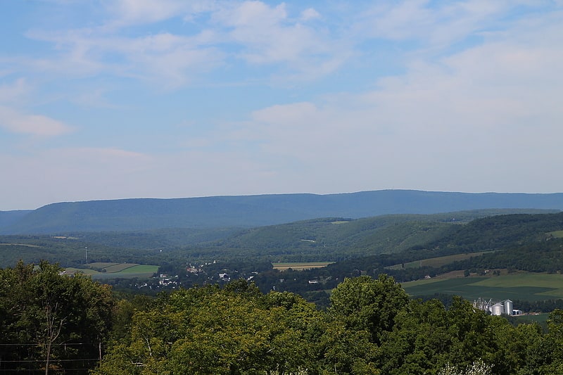
Ridge in Pennsylvania. North Mountain is a 2,584-foot ridge primarily located in Davidson Township of Sullivan County in the U.S. state of Pennsylvania. Its summit is that county's highest point, the 10th highest among the state's 67 counties. Portions also extend into neighboring Lycoming, Luzerne, and Wyoming counties. The mountain has a topographic isolation of 57.99 miles. U.S. Route 220 passes near the mountain. The mountain once had a prolific population of animals, including grouse, deer, and bears.
Historic industries on and around North Mountain include lumbering and ice cutting. Pennsylvania Route 487 goes over North Mountain. The mountain is also home to a fire tower known as the North Mountain Fire Tower.[3]
Red Rock Mountain
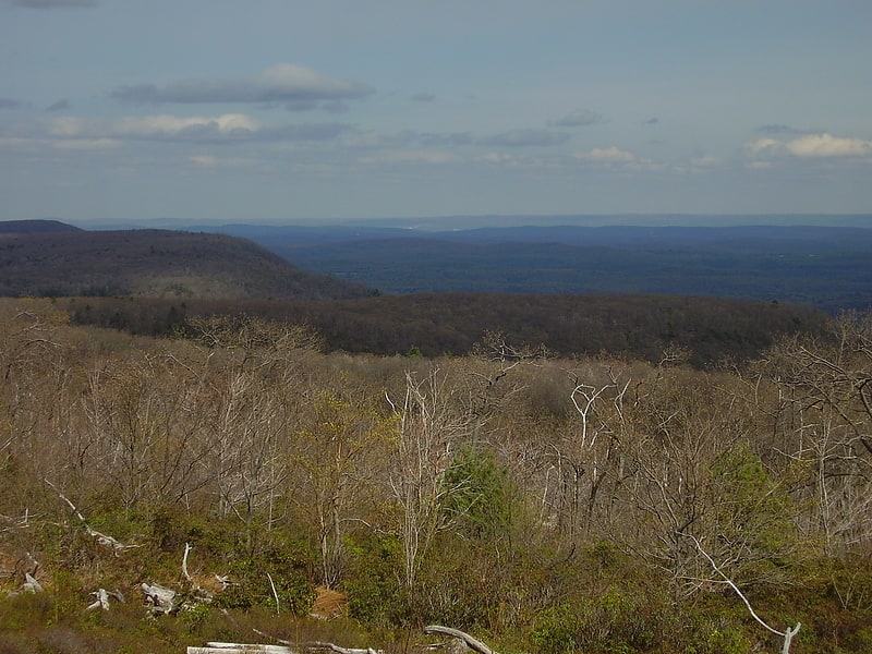
Mountain in Pennsylvania. Red Rock Mountain is a mountain located in Luzerne County, Pennsylvania. This summit is actually on the North Mountain escarpment. The escarpment in which Red Rock Mountain is located is a part of the Allegheny Plateau. This summit features a firetower, known as "Grandview" all located within the Ricketts Glen State Park.
The views from the top of the mountain are impressive and varied. To the south you view the Ridge and Valley Appalachians region, in the other three directions you look out over the deeply dissected Allegheny Plateau. Huckleberry and North Mountain summits may be seen to the west. These mountains are some of the higher peaks in this region of Pennsylvania.[4]
Red Rock Job Corps Center
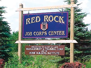
Technical school in Sweet Valley, Pennsylvania. Red Rock Job Corps Center is a Job Corps training center in Colley Township, Sullivan County, Pennsylvania, USA. Like all Job Corps centers, it provides vocational training and education at no cost to participants, who are 16 to 24 years old. The center opened in 1978 and uses the buildings of the former Benton Air Force Station, a Cold War radar facility which operated from 1951 to 1975. Red Rock is on Pennsylvania Route 487 within Ricketts Glen State Park, and is still the site of a Federal Aviation Administration radar used for Wilkes-Barre/Scranton International Airport. The Red Rock Job Corps Center has been recognized as one of the top Job Corps centers in the nation.[5]
Boston Run
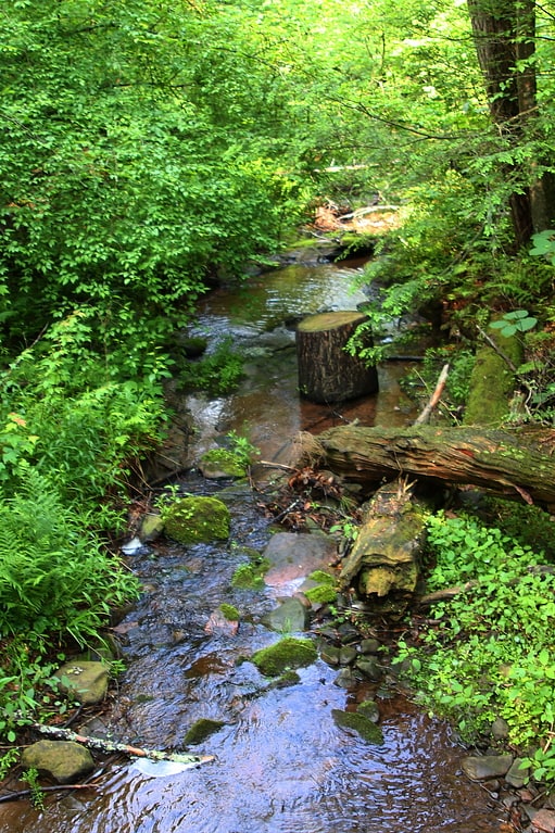
Tributary in Pennsylvania. Boston Run is a tributary of Kitchen Creek in Luzerne County, Pennsylvania, in the United States. It is approximately 1.2 miles long and flows through Fairmount Township. The watershed of the creek has an area of 0.66 square miles. Old-growth forests are in the vicinity and wild trout naturally reproduce in the stream. The surficial geology nearby features Wisconsinan Outwash, Wisconsinan Till, fill, and bedrock consisting of sandstone and shale.[6]
Cherry Run
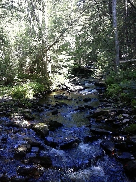
Tributary in Pennsylvania. Cherry Run is a tributary of South Branch Bowman Creek in Luzerne County, Pennsylvania, in the United States. It is approximately 2.1 miles long and flows through Fairmount Township and Ross Township. The watershed of the stream has an area of 1.65 square miles. The surficial geology in its vicinity consists of alluvial fan, alluvium, bedrock, Wisconsinan Till, wetlands, and a peat bog. The stream has cascades and contains wild trout.[7]