Discover 15 hidden attractions, cool sights, and unusual things to do in Pisgah National Forest (United States). Don't miss out on these must-see attractions: Upper Whitewater Falls, Rainbow Falls, and Black Balsam Knob. Also, be sure to include Moore Cove Falls in your itinerary.
Below, you can find the list of the most amazing places you should visit in Pisgah National Forest (North Carolina).
Table of Contents
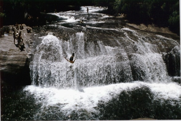
Upper Whitewater Falls
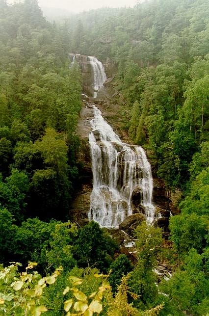
Waterfall in North Carolina. Upper Whitewater Falls is a waterfall in North Carolina on the Whitewater River. As with most of North Carolina's waterfalls, it is in the mountainous area of the state. There is a cluster of falls in the area where the borders of Georgia and the Carolinas come together. Whitewater Falls is part of that group, very close to the South Carolina border.
According to the U.S. Forest Service, "With a 411-foot plunge, Upper Whitewater Falls in North Carolina is the highest waterfall east of the Rockies."[1]
Rainbow Falls
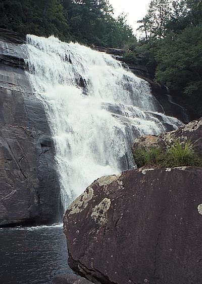
Waterfall in North Carolina. Rainbow Falls is a waterfall in Western North Carolina, located near Brevard. The falls is located on the Horsepasture River. It is on Pisgah National Forest land just outside Gorges State Park.[2]
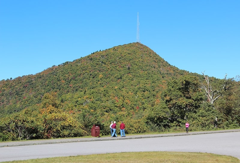
Black Balsam Knob
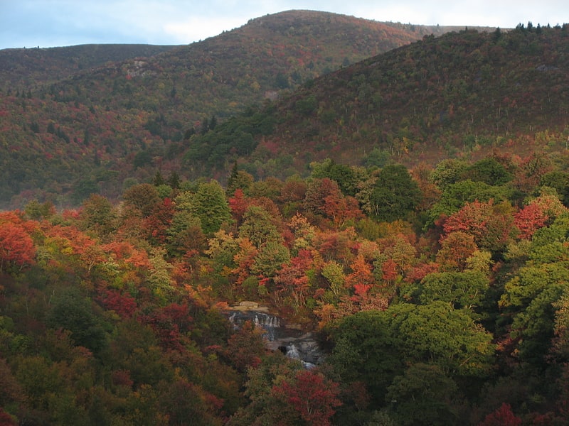
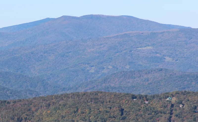
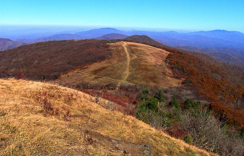
Mountain in North Carolina. Black Balsam Knob, also known as Black Balsam Bald, is in the Pisgah National Forest southwest of Asheville, North Carolina, near milepost 420 on the Blue Ridge Parkway. It is the second highest mountain in the Great Balsam Mountains. The Great Balsams are within the Blue Ridge Mountains, which are part of the Appalachian Mountains. It is the 23rd highest of the 40 mountains in North Carolina over 6000 feet.
The top of the mountain is a grassy bald that affords a panoramic view. The origin of grassy balds in southern Haywood county is a result of extensive clear-cut logging and locomotive fires in 1925 and 1942. These fires burned deep down into the mineral-rich topsoil slowing reforestation or stopping it altogether. Examples of this can also be found on many of its neighboring peaks and ridges. These features contribute to the area's popularity, but foot traffic also causes some ecological damage to the ecosystem. The Art Loeb Trail follows the grassy ridge of Black Balsam Knob.
Visible peaks from Black Balsam Knob include:
- Shining Rock in the Shining Rock Wilderness (3 miles northeast)
- Looking Glass Rock (5 miles southeast)
- Cold Mountain (6 miles north)
- Mount Pisgah (9.5 miles northeast)
- Mount Mitchell. On exceptionally clear days, Mount Mitchell, the highest point in the Eastern United States, is visible 45 miles north east.
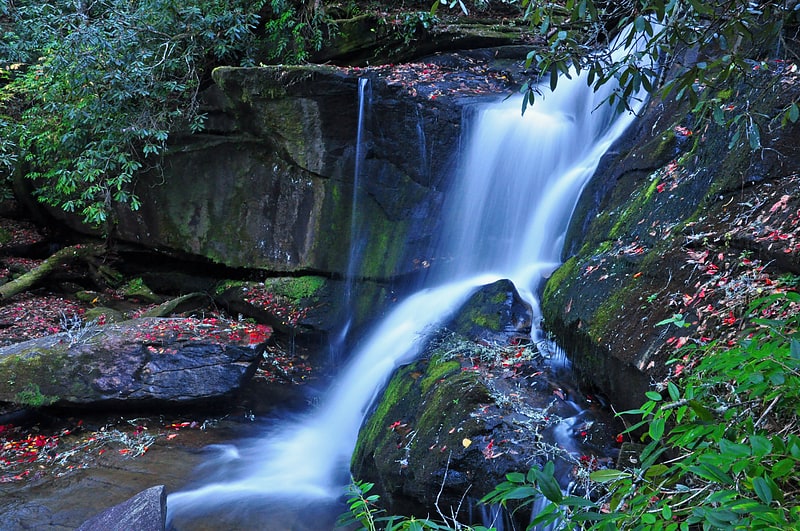
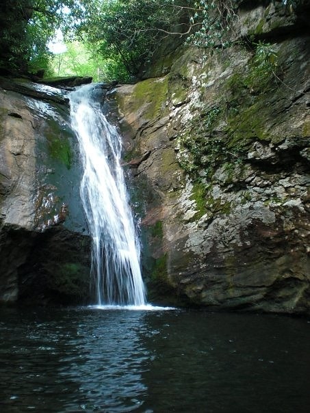
Moore Cove Falls
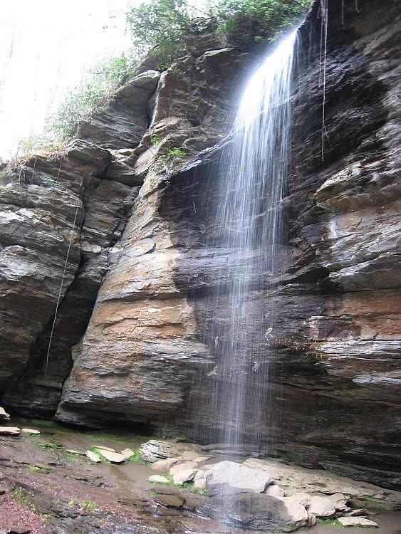
Waterfall in North Carolina. Moore Cove Falls is a waterfall in Pisgah National Forest in Western North Carolina, located near Brevard.[4]
Address: Hwy 276, Pisgah National Forest
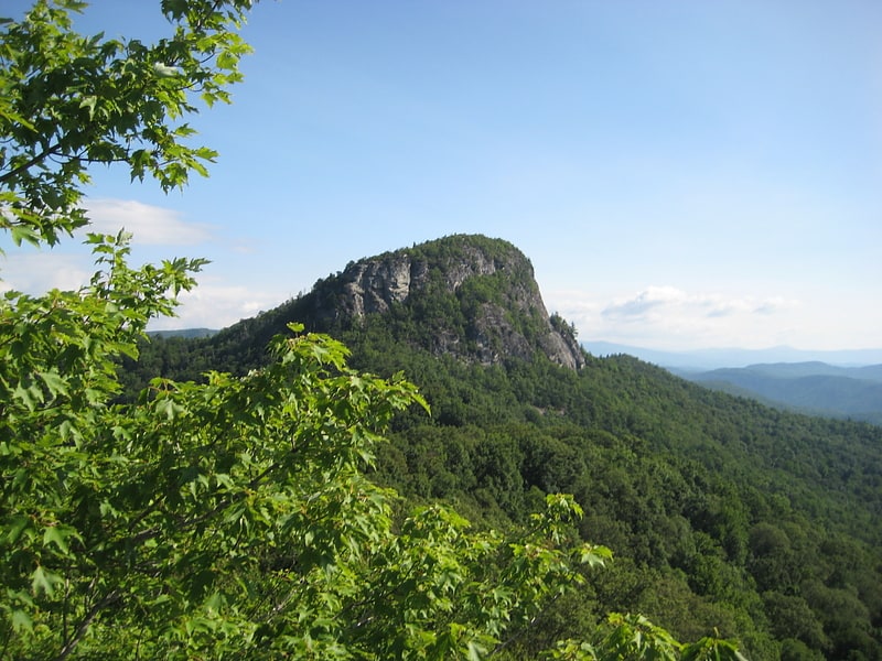
Looking Glass Rock
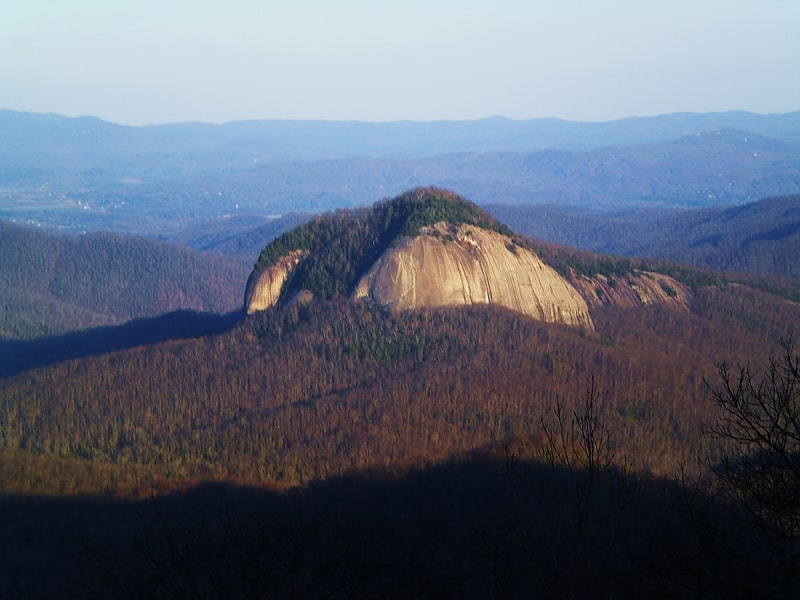
Mountain in North Carolina. Looking Glass Rock is a pluton monolith in the Appalachian Mountains of western North Carolina, United States.[5]
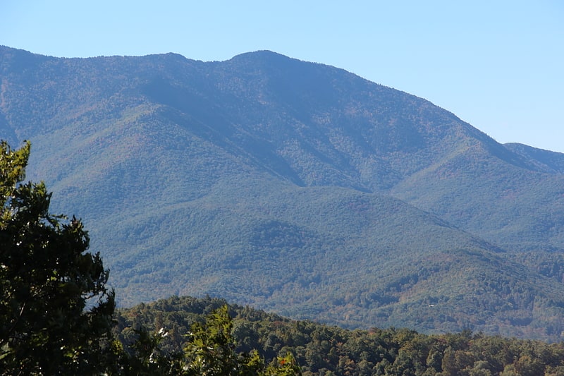
Mount Pisgah
Mountain in North Carolina. Mount Pisgah is a mountain in the Appalachian Mountain Range and part of the Blue Ridge Mountains of North Carolina, United States. The mountain's height is 5,721 feet above sea level, and it sits approximately 15 miles southwest of Asheville, near the crossing of the boundaries of Buncombe, Haywood, Henderson and Transylvania counties. It is located on the border of Buncombe and Haywood counties, close to the point where Henderson and Transylvania meet them, but not actually within the latter two counties. The mountain is easily accessible via a hiking trail from the Blue Ridge Parkway, near the Pisgah Inn.[6]
Cedar Rock Falls
Waterfall. Cedar Rock Falls is a waterfall in Transylvania County, North Carolina, USA.[7]
Slick Rock Falls
Waterfall in North Carolina. Slick Rock Falls is a waterfall in Western North Carolina, located near Brevard.[8]
Turtleback Falls
Waterfall in North Carolina. Turtleback Falls, also called Umbrella Falls, is a waterfall in Western North Carolina, located near Rosman. The falls is located on the Horsepasture River in the Pisgah National Forest. The falls is usually accessed by a hike starting in Gorges State Park which passes through Pisgah National Forest property.
Turtleback Falls is a popular place for swimming and people frequently slide over the falls into the Chug Hole during low water; however, the currents can be dangerous in higher flows and people have drowned at Turtleback, or have been swept downriver and over 125' Rainbow Falls.[9]
Courthouse Falls
Waterfall in North Carolina. Courthouse Falls is a waterfall in Western North Carolina, located near Balsam Grove.[10]
Table Rock
Mountain in North Carolina. Table Rock is a mountain in the east rim of Linville Gorge, part of Pisgah National Forest. It features a distinctive rock formation, and is a prominent peak in the area.
The peak makes for a quick hike from a nearby parking area, and is also very popular for rock climbing. It is described as having a "national reputation of being the best place to climb in the Southeastern U.S.", and the "hub of climbing activity in Linville Gorge".
Table Rock is also known for its flora. Botanists André Michaux and John Fraser found various plants in the area in the nineteenth century. Fraser discovered Fraser's Sedge near the mountain.
Table Rock has been described as "the most visible symbol in the region". Former North Carolina senator Sam Ervin said that he retired to the nearby town of Morganton to "watch the glorious sunsets over Table Rock". In addition, Jules Verne's novel Master of the World describes Table Rock, which is called Great Eyrie in the book, as "rising high above the valley to sometimes belch strange sounds and fire over the little village of Morganton".
A wildfire swept through the area in November 2013. At least one hundred firefighters were involved.[11]
Address: Old Table Rock Rd, Pisgah National Forest
Toms Creek Falls
Waterfall in North Carolina. Toms Creek Falls is a waterfall in the Pisgah National Forest in McDowell County, North Carolina, near the town of Marion.[12]
Grassy Ridge Bald
Mountain in North Carolina. Grassy Ridge Bald is a bald mountain in North Carolina and is part of the Roan Highlands, within the Pisgah National Forest. Its elevation reaches 6,184 feet and is on the boundary between Avery County, North Carolina and Mitchell County, North Carolina. The mountain generates feeder streams for the North Toe River.[13]
Bald Mountains
Mountain range in North Carolina. The Bald Mountains are a mountain range rising along the border between Tennessee and North Carolina in the southeastern United States. They are part of the Blue Ridge Mountain Province of the Southern Appalachian Mountains. The Bald Mountains stretch from the Pigeon River in the south to the Nolichucky River in the north, and comprise parts of Cocke County, Greene County, and Unicoi County in Tennessee and parts of Madison County and Yancey County in North Carolina. The Great Smoky Mountains border the range to the south, and the Unakas rise opposite the Nolichucky to the north. The range gets its name from the relatively frequent occurrence of grassy balds atop the more prominent summits.
The Cherokee National Forest and the Pisgah National Forest protect substantial sections of the Bald Mountains. The Appalachian Trail traverses the crest of the range. Populated areas within the range include Erwin and Del Rio in Tennessee and Hot Springs in North Carolina. The highest summit in the Bald Mountains is Big Bald, which rises to an elevation of 5,516 feet (1,681 m).[14]
Celo Knob
Peak in North Carolina. Celo Knob is the northernmost major peak in the Black Mountains of western North Carolina. It is located just north of Mount Mitchell State Park in the Pisgah National Forest. It is the first peak encountered while hiking the Black Mountain Crest Trail from Bowlens Creek. The trail passes to the southwest of the summit, which can be reached by various herd paths.[15]