Discover 6 hidden attractions, cool sights, and unusual things to do in Papahānaumokuākea Marine National Monument (United States). Don't miss out on these must-see attractions: Midway Atoll, Northwestern Hawaiian Islands, and Hawaiian tropical low shrublands. Also, be sure to include Tern Island in your itinerary.
Below, you can find the list of the most amazing places you should visit in Papahānaumokuākea Marine National Monument (Midway).
Table of Contents
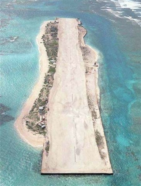
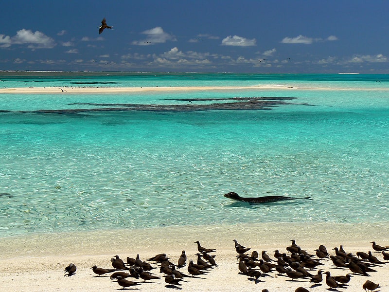
Midway Atoll
Atoll in the United States of America. Midway Atoll is a 2.4-square-mile atoll in the North Pacific Ocean. Midway Atoll is an insular area of the United States and is an unorganized and unincorporated territory. The largest island is Sand Island, which has housing and an airstrip. Immediately to the east of Sand Island across the narrow Brooks Channel is Eastern Island, which is uninhabited and has no facilities. Forming a rough, incomplete circle around the two main islands and creating Midway Lagoon is Spit Island, a narrow reef.
Roughly equidistant between North America and Asia, Midway is the only island in the Hawaiian Archipelago that is not part of the state of Hawaii. Unlike the other Hawaiian islands, Midway observes Samoa Time (UTC−11:00, i.e. eleven hours behind Coordinated Universal Time), which is one hour behind the time in the Hawaii–Aleutian Time Zone used in Hawaii. For statistical purposes, Midway is grouped as one of the United States Minor Outlying Islands. The Midway Atoll National Wildlife Refuge, encompassing 590,991.50 acres (239,165.77 ha) of land and water in the surrounding area, is administered by the United States Fish and Wildlife Service (FWS). The refuge and most of its surrounding area are part of the larger Papahānaumokuākea Marine National Monument.
From 1941 until 1993, the atoll was the home of Naval Air Facility Midway Island, which played a crucial role in the Battle of Midway, June 4–6, 1942. Aircraft based at the then-named Henderson Field on Eastern Island joined with United States Navy ships and planes in an attack on a Japanese battle group that sank four carriers, one heavy cruiser and defended the atoll from invasion. The battle was a critical Allied victory and a major turning point of the Pacific campaign of World War II.
About 40 people live on the atoll, mostly staff of the U.S. Fish and Wildlife Service and contract workers. Visitation to the atoll is possible only for business reasons (which includes permanent and temporary staff, contractors and volunteers) as the tourism program has been suspended due to budget cutbacks. In 2012, the last year that the visitor program was in operation, 332 people made the trip to Midway. Tours focused on both the unique ecology of Midway as well as its military history. The economy is derived solely from governmental sources and tourist fees. Nearly all supplies must be brought to the island by ship or plane, though a hydroponic greenhouse and garden supply some fresh fruits and vegetables.[1]
Northwestern Hawaiian Islands
The Northwestern Hawaiian Islands or Leeward Islands are the small islands and atolls in the Hawaiian island chain located northwest of the islands of Kauai and Niihau. Politically, they are all part of Honolulu County in the U.S. state of Hawaii, except Midway Atoll, which is a territory distinct from the State of Hawaii, and grouped as one of the United States Minor Outlying Islands. The United States Census Bureau defines this area, except Midway, as Census Tract 114.98 of Honolulu County. Its total land area is 3.1075 square miles. All the islands except Nihoa are north of the Tropic of Cancer, making them the only islands in Hawaii that lie outside the tropics.
The Northwestern or Leeward Hawaiian Islands include:
- Nihoa (Moku Manu) at 23°03′38″N 161°55′19″W
- Necker (Mokumanamana) at 23°34′N 164°42′W
- French Frigate Shoals (Kānemilohaʻi) at 23°52.134′N 166°17.16′W
- Gardner Pinnacles (Pūhāhonu) at 25°01′N 167°59′W
- Maro Reef (Nalukākala) at 25.415°N 170.590°W / 25.415; -170.590
- Laysan (Kauō) at 25.7675°N 171.7334°W / 25.7675; -171.7334
- Lisianski (Papaʻāpoho) at 26.064031°N 173.965802°W / 26.064031; -173.965802
- Pearl and Hermes Atoll (Holoikauaua) at 27.927687°N 175.737991°W / 27.927687; -175.737991
- Midway Atoll (Pihemanu) at 28°12′N 177°21′W - not part of the State of Hawaii
- Kure Atoll (Mokupāpapa) at 28°25′N 178°20′W
Hawaiian tropical low shrublands
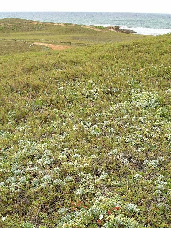
The Hawaiian tropical low shrublands are a tropical savanna ecoregion in the Hawaiian Islands.[3]
Tern Island
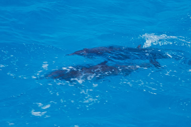
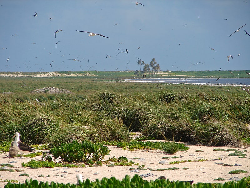
Island in Honolulu County, Hawaii. Tern Island is a tiny coral island located in the French Frigate Shoals in the Northwestern Hawaiian Islands, at 23.870°N 166.284°W / 23.870; -166.284, approximately 490 miles west north west of Oahu. It has a land area of 105,276 m2. The island provides a breeding habitat to 18 species of seabirds, threatened Hawaiian green sea turtles, and endangered Hawaiian monk seals. It is maintained as a field station in the Hawaiian Islands National Wildlife Refuge by the United States Fish and Wildlife Service.
The island has an airstrip over the length of the island, built in 1942. This has supported use by the U.S. Navy, Coast Guard, and wildlife services since that time, and various types of operations have been conducted from this location which is host to limited facilities for habitation.
The US Fish & Wildlife service closed its field station on the island at the end of 2012. There was a Naval base from 1942 to 1946, a Coast Guard Base from 1952 to 1979, and finally a Fish & Wildlife station from 1979 to 2012.[4]
French Frigate Shoals
Island in the Pacific Ocean. The French Frigate Shoals is the largest atoll in the Northwestern Hawaiian Islands. Its name commemorates French explorer Jean-François de La Pérouse, who nearly lost two frigates when attempting to navigate the shoals. It consists of a 20-mile-long crescent-shaped reef, twelve sandbars, and the 120-foot-high La Perouse Pinnacle, the only remnant of its volcanic origins. The total land area of the islets is 61.508 acres. Total coral reef area of the shoals is over 232,000 acres. Tern Island, with an area of 26.014 acres, has a landing strip and permanent habitations for a small number of people. It is maintained as a field station in the Hawaiian Islands National Wildlife Refuge by the United States Fish and Wildlife Service. The French Frigate Shoals are about 487 nautical miles northwest of Honolulu.
In the 20th century, the shoals were used by the Imperial Japanese Navy as part of an operation to attack Hawaii; afterwards, a small United States Navy base was established there to prevent it from being used again. After the war it was used by the United States Coast Guard for a LORAN radio navigation station. By the 21st century, it was primarily used for oceanographic and biological study as a nature reserve. Studies at the island helped establish the nature of plastic pollution, and in 2020 one island was designated as contaminated by plastic pollution from the ocean. The reefs are noted for having survived many Pacific storms, although these storms have damaged facilities, wildlife, and significantly reduced the area of some islands.[5]
World War II Facilities at Midway
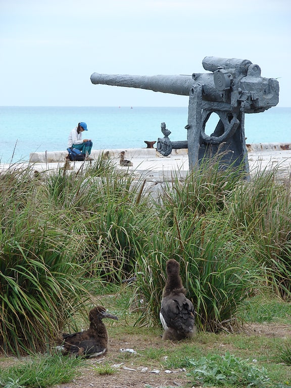
The World War II Facilities at Midway were built as part of the fortification leading up to World War II. The Midway Atoll's unique location halfway between the United States and Japan ensured it would hold a strategic position. This island was the site of the pivotal Battle of Midway which shifted the balance of sea power in the Pacific towards the United States.
The atoll's two main islands, Eastern Island and Sand Island, were both fortified by the Navy. Eastern Island, the smaller of the two islands, had three runways in a triangular configuration, and was defended by six coastal and dual-purpose batteries, armed with 3-, 5-, and 7-inch guns. Sand Island, one mile wide and two long, was completely developed by the Navy, but had no runways until after the war. At the time of the battle, Sand Island was defended by six batteries erected by the 6th Defense Battalion, and one by the 3d Defense Battalion. In clockwise order from the northwest corner of the island, these were: Battery C, two 5-inch guns; "naval" battery, two 3-inch guns; Battery F, four 3-inch guns; Battery A, two 5-inch guns; Battery D, four 3-inch guns; unnamed battery, two 7-inch guns; Battery A, two 5-inch guns; 3d Battalion Battery D, four 3-inch guns.
The military shut down all of its bases by 1993, handing over control to the United States Fish and Wildlife Service. The islands remain mostly uninhabited and unvisited. They are part of Papahānaumokuākea Marine National Monument.
Many of the facilities built by the Navy during the war deteriorated as the population of the Eastern and Sand Islands declined. Some facilities, such as the Eastern Island runways, were abandoned. New runways were built on Sand Island, in some cases destroying some of the surviving war defenses in the process. A number of the surviving elements of the atoll's defenses were designated a National Historic Landmark District in 1987. The following elements, all on Sand Island, comprise that designation:
- three ammunition magazines associated with Battery A: S-7113, S-7119, S-7121
- one and a half emplacements for 3-inch guns of 3d Battalion Battery D
- two ammunition magazines associated with 3d Battalion Battery D: S-7124, S-7125
- a concrete pillbox near S-7125
- two emplacements for the 3-inch naval battery
- one ammunition magazine near the naval battery: S-6194