Discover 9 hidden attractions, cool sights, and unusual things to do in Mount Gambier (Australia). Don't miss out on these must-see attractions: Blue Lake, Engelbrecht Cave, and Mount Schank. Also, be sure to include Cave Gardens in your itinerary.
Below, you can find the list of the most amazing places you should visit in Mount Gambier (South Australia).
Table of Contents
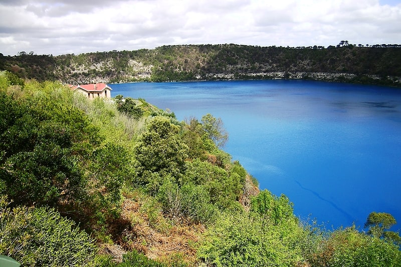
Blue Lake
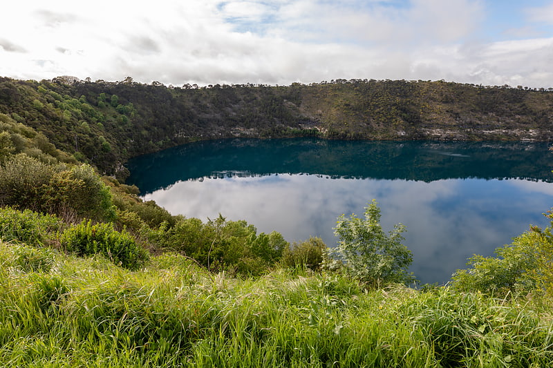
Lake in Australia. The Blue Lake is a large, monomictic, crater lake located in a dormant volcanic maar associated with the Mount Gambier maar complex. The lake is situated near Mount Gambier in the Limestone Coast region of South Australia, and is one of four crater lakes on Mount Gambier maar. Of the four lakes, only two remain, as the other two have dried up over the past 30 to 40 years as the water table has dropped.
Conflicting dates have been estimated for its last eruption, of 4,300 years ago, of 28,000 years ago, and most recently, a little before 6,000 years ago. If the youngest date is correct, this could be the most recent volcanic eruption on the Australian mainland.
Blue Lake is thought to be of an average depth of 72 m (236 ft), but in places reaches 75 m (246 ft) deep (but some unconfirmed values mention a 204 m (669 ft) maximum depth due to a natural cave section). The crater rim measures 1,200 by 824 m (3,937 by 2,703 ft), but the lake itself measures 1,087 by 657 m (3,566 by 2,156 ft). The surface of the lake is 17 m (56 ft) below the level of the main street of the nearby town. The Blue Lake supplies the town with drinking water.[1]
Engelbrecht Cave
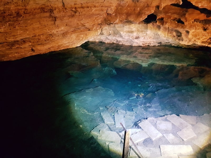
Cave in Australia. Engelbrecht Cave is a cave system in the Australian state of South Australia consisting of a sinkhole with two major passages located under the Mount Gambier urban area. It is owned by the local government area of City of Mount Gambier and has been developed as a tourism venue. Its dry extent is notable as a show cave while its water-filled extent is notable as two separate cave diving sites.[2]
Address: 26 Chute Street, 5290 Mount Gambier
Mount Schank
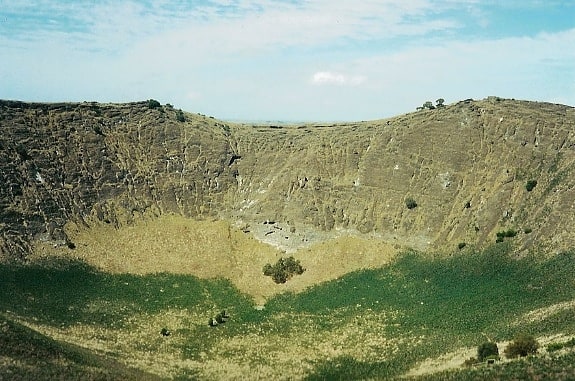
Volcano in Australia. Mount Schank is a 100 m high dormant volcano in the southeast corner of South Australia, near Mount Gambier. It was sighted by James Grant on 3 December 1800 and named after Admiral John Schank, designer of Grant's ship, HMS Lady Nelson.
Mount Schank is part of the Newer Volcanics Province, which is the youngest volcanic field in Australia. Mount Schank erupted about 5,000 years ago, around the same time as Mount Gambier. It is a very basic ash cone and the base of the crater does not extend below the water table, so there is no crater lake as with those at Mount Gambier. There are two small subsidiary craters adjacent to the main cone and some lava flows resulting from the eruption. The northern crater is circular, 300 m (980 ft) in diameter and 100 m (330 ft) deep, the older southern crater is 200 m (660 ft) in diameter and partially overlapped by the larger crater.
The local Aboriginal Bunganditj people witnessed Mount Schank's eruptions over time. Their creation story about the local volcanic landscape was recorded by a local woman, Christina Smith, in 1880. It tells the tale of Craitbul, a giant, who was looking for a place to live with his wife and two sons. They camped at Mount Muirhead and Mount Schank, but were scared away from both these camps by a moaning bird spirit. They fled to Mount Gambier, leaving their camp ovens (the volcanoes) burning. After some time, water came and filled their ovens, putting them out and driving the spirit away. They continued to live in a cave on the side of Mount Gambier.
The site is accessible from the Riddoch Highway about 20 km (12 mi) south of Mount Gambier; there is a small carpark and picnic table, and steps have been placed to facilitate the short but very steep walk to the rim of the crater. It is a fairly simple walk to traverse the rim, though the exposed situation can be treacherous in gusty weather.[3]
Cave Gardens
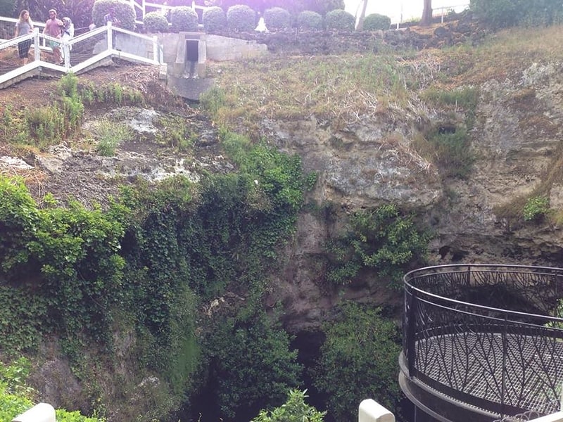
Park in Mount Gambier, Australia. The Cave Gardens are the garden located in the centre of Mount Gambier in the Australian state of South Australia that contain a 30-metre-deep cave. The cave was initially used as a water source for the town. In 1870 the area became a reserve, and by the 1890s trees, gas lamps and seating were installed in the area. On 2 August 2001, the Cave Gardens were declared a State Heritage area.[4]
Address: Watson Dr, 5290 Mount Gambier
Valley Lake
Lake in Australia. The Valley Lake is a monomictic volcanic crater lake in the Australian state of South Australia situated in the south of Mount Gambier, near the Blue Lake. The Lake is surrounded by a park situated on Davidson Drive. The shore of the lake features a children's playground, sporting facilities, BBQs and toilets. There is also a Conservation Park, as well as Centenary Tower at the top of the surrounding crater.[5]
Address: Davison Dr, Mount Gambier
Mount Gambier Community RSL
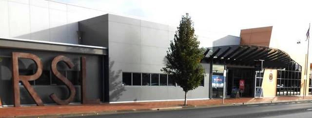
Military museum, Museum
Address: 16 Sturt St, 5290 Mount Gambier
Main Corner Complex
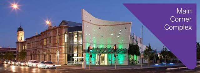
Civic center, Museum
Address: 1 Bay Rd, 5290 Mount Gambier
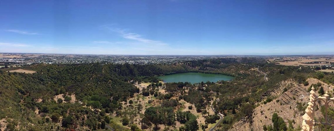
Mount Gambier Volcano
Mount Gambier is a maar complex in South Australia associated with the Newer Volcanics Province. It contains four lake-filled maars called Blue Lake, Valley Lake, Leg of Mutton Lake, and Brownes Lake. Both Brownes and Leg of Mutton lakes are dry in recent years, due to the lowering of the water table. It is one of Australia's youngest volcanoes, but estimates of the age have ranged from over 28,000 to less than 4,300. The most recent estimate, based on radiocarbon dating of plant fibers in the main crater suggests an eruption a little before 6000 years ago. It is believed to be dormant rather than extinct.
Mount Gambier is thought to have formed by a mantle plume centre called the East Australia hotspot which may currently lie offshore.
The mountain was sighted by Lieutenant James Grant on 3 December 1800 from the survey brig HMS Lady Nelson and named for Lord James Gambier, Admiral of the Fleet.
This area is part of the UNESCO-endorsed Kanawinka Geopark.
Of the original four lakes found within the maars, only two remain. The Leg of Mutton Lake (named for the outline of its shoreline) became permanently dry in the 1990s. Brownes Lake suffered a similar fate during the late 1980s. Both these lakes were quite shallow; their demise is attributed to the lowering of the water table as a result of many years of land drainage to secure farmland. Brownes Lake was the site of Henty's cattle years in the 1840s and was named after Doctor Browne who lived at nearby Moorak station. The water level has fluctuated over the years, with it having a recorded depth of 20 feet in 1899.
The city of Mount Gambier partially surrounds the maar complex.[6]
The Old Courthouse & Gallery
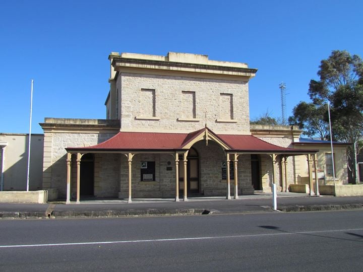
Museum
Address: 42 Bay Road, Mount Gambier