Discover 8 hidden attractions, cool sights, and unusual things to do in Mendocino National Forest (United States). Don't miss out on these must-see attractions: Anthony Peak, Saint John Mountain, and Lake Pillsbury. Also, be sure to include Howard Lake in your itinerary.
Below, you can find the list of the most amazing places you should visit in Mendocino National Forest (California).
Table of Contents
Anthony Peak
Mountain in California. Anthony Peak is a mountain located in the Mendocino National Forest north of Mendocino Pass and is part of the Northern Coast Ranges of Mendocino County, California, approximately 16 miles NE of Covelo. The summit is the highest point in Mendocino County, and averages 61.8 inches at peak snow pack depth annually.
The rare endemic wildflower known as Anthony Peak lupine (Lupinus antoninus) was named for this peak.
The peak was probably named for James Anthony, who owned a farm in the Round Valley district in 1874.[1]
Saint John Mountain
Mountain in California. Saint John Mountain is a mountain located in the Northern Coast Ranges of California. It is located just to the north of Snow Mountain in the Mendocino National Forest. The peak is high enough to receive snowfall in winter.[2]
Lake Pillsbury
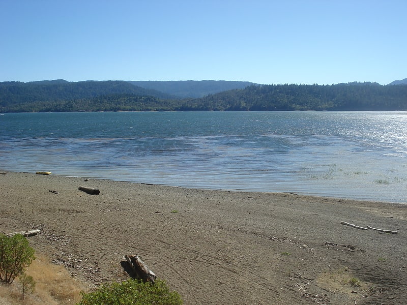
Lake in California. Lake Pillsbury is a lake in the Mendocino National Forest of Lake County, California, created from the Eel River and Hull Mountain watershed by Scott Dam. Elevation is 1,818 ft with 65 mi of shoreline and covering 2,003 acres. Activities in the Lake Pillsbury Recreation Area include powerboating, fishing, swimming, sailing, picnicking, hiking and hang gliding. There are two main access roads to the lake. At the north end of the lake is a small gravel airstrip. Over 400 homes including National Forest Recreational Residences ring the lake.[3]
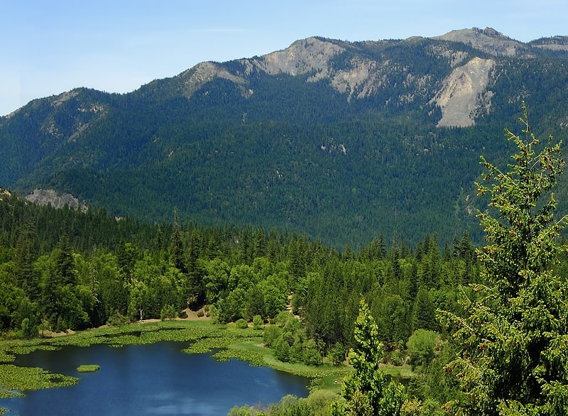
Howard Lake

Lake in California. Howard Lake is a natural lake in northwestern Mendocino County, California, located in the Mendocino National Forest at an elevation of 3,852 feet. It covers an area of 20 acres. The lake hosts a small campground and is a popular primitive camping experience. In some years, the U.S. Forest Service stocks the lake with rainbow trout.
Howard Lake should not be confused with the lake of the same name located 21 miles (34 km) to the southwest.[4]
Crabtree Hot Springs

Crabtree Hot Springs is a geological phenomenon in Lake County, California about 25 miles north of Upper Lake. It is located on private property and closed to the public. It lies at an elevation of 2,257 feet. There is a cluster of four natural hot springs at this location, in an isolated narrow winding steep walled canyon on the north bank of the Rice Fork of the Eel River, about one fourth mile downriver from its junction with Salt Creek. Three of the hot springs are aligned in one area at a large swimming hole, while the fourth hot spring is about 60 feet back upriver. The temperature of the hottest spring is 106 °F, with a flow rate of about 10 US gallons per minute.[5]
Rice Fork
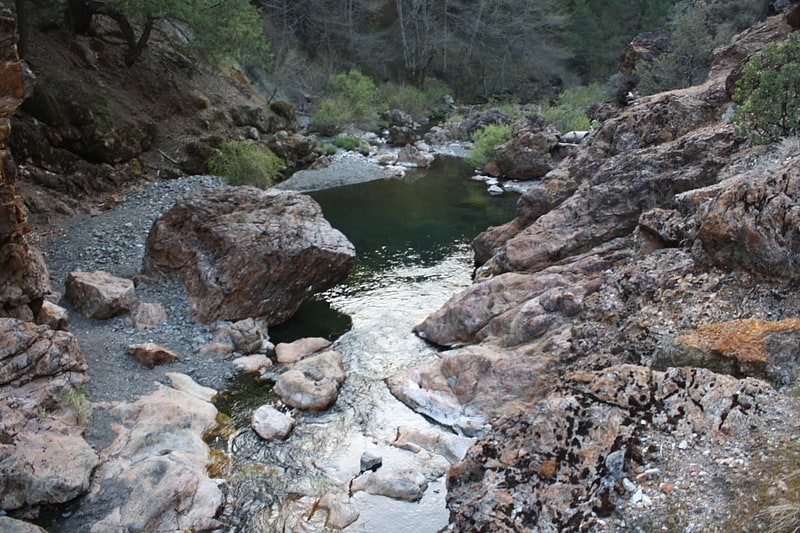
Tributary in California. The Rice Fork is a 22.7-mile-long tributary of the Eel River in Lake County, California. The Rice Fork begins on the upper northwest side of Goat Mountain, on the Colusa-Lake County line, at an elevation of over 6,000 feet. It quickly descends the steep western slope of the mountain, then bends northward, and flows northwesterly down a narrow winding steep walled canyon for about 18 miles, crossing two forest roads and adding many tributaries, ending its journey at the southern tip of Lake Pillsbury, at a varied elevation around 1,800 feet, depending on the lake level. Before the construction of Scott Dam in the 1920s, which formed Lake Pillsbury, the Rice Fork ran directly into the Eel River. It is one of Lake County's longest streams.
The many tributaries to Rice Fork are Salt Creek, French Creek, Parramore Creek, Bevans Creek, Bear Creek, Packsaddle Creek, Willow Creek, Deer Creek, Rice Creek, and Soda Creek.[6]
Mendocino Pass
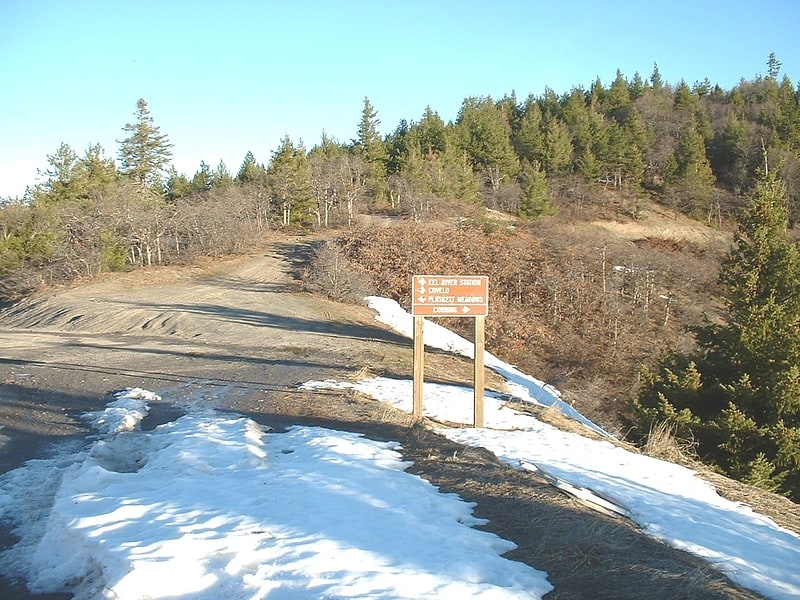
Mountain pass in California. Mendocino Pass is a mountain pass located in the Northern Coast Ranges in California. The pass, in the extreme northwest corner of Glenn County, is at an elevation of about 5,006 feet and at the gap, two dirt roads intersect. One of them is US Forest Highway 7, a dirt road connecting two disjointed sections of State Route 162. The pass and dirt roads are closed in winter due to heavy snowfall.[7]
Berryessa Snow Mountain National Monument
National monument. Berryessa Snow Mountain National Monument is a national monument of the United States comprising 330,780 acres of the California Coast Ranges in Napa, Yolo, Solano, Lake, Colusa, Glenn and Mendocino counties in northern California. Cache Creek Wilderness is located within the monument.[8]