Discover 4 hidden attractions, cool sights, and unusual things to do in Malheur National Forest (United States). Don't miss out on these must-see attractions: Magone Lake, Strawberry Range, and Allison Guard Station. Also, be sure to include Aldrich Mountains in your itinerary.
Below, you can find the list of the most amazing places you should visit in Malheur National Forest (Oregon).
Table of Contents
Magone Lake
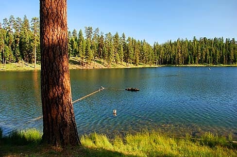
Body of water in Oregon. Magone Lake is a 30-acre body of water in the Malheur National Forest of eastern Oregon in the United States. The lake, at nearly 5,000 feet above sea level, is in Grant County, 10 miles north of the small city of John Day. It receives water from Lake Creek, which continues downstream from the lake and flows into East Fork Beech Creek in the John Day River watershed.
Among the few natural lakes in this part of Oregon, Magone Lake is popular for its recreational opportunities, particularly fishing, including ice fishing during the cold months. Rainbow trout and brook trout are abundant.
The United States Forest Service maintains a campground with single-family and group sites at the lake. A separate day-use area has picnic tables, changing rooms for swimmers, and a boat dock. Wildflower viewing, hiking, and mountain biking are other activities available nearby.[1]
Strawberry Range
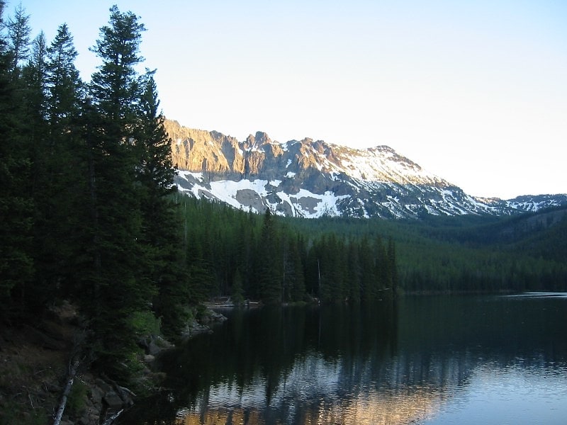
Mountain range in Oregon. The Strawberry Range, also known as the Strawberry Mountains, is a mountain range in the U.S. state of Oregon. It is east of John Day, within Malheur National Forest. The highest peak is Strawberry Mountain.
The Strawberry Range is part of the larger Blue Mountains range, and contains the Strawberry Mountain Wilderness. Pioneers named Strawberry Mountain after observing prolific wild strawberries growing in a nearby valley.
The area has extremely diverse ecological composition, which includes five of seven major life zones in North America. Indigenous populations of Rocky Mountain Elk exist as well as mule deer, antelope, black bear, cougar, California bighorn sheep, ruffed and blue grouse, pileated woodpecker, sharp-shinned hawk, bald eagle, pine marten, mink, beaver. There are 378 animal and 22 fish species present.
Mountain goats are seen at the higher elevations of the Palisades ridge as of Aug 7 2016. A hunting tag for mountain goats on the Strawberry Mountain was issued for the first time in 2014 by the Oregon Department of Fish and Wildlife.[2]
Allison Guard Station
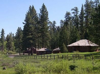
Building in Harney County, Oregon. The Allison Guard Station is a Forest Service compound consisting of eight rustic buildings located in the Malheur National Forest in the Ochoco Mountains of eastern Oregon. It was originally built as a district ranger station for the Snow Mountain Ranger District. It was later converted to a summer guard station. Today, it is an active Forest Service guard station with a crew of twelve fire fighters on station during the summer fire season. The station's oldest building, the Donnelly Cabin, is currently listed on the National Register of Historic Places as the "Allison Ranger Station". Most of the other buildings at the Allison Guard Station are eligible for historic designation, but are not yet listed on the National Register.[3]
Aldrich Mountains
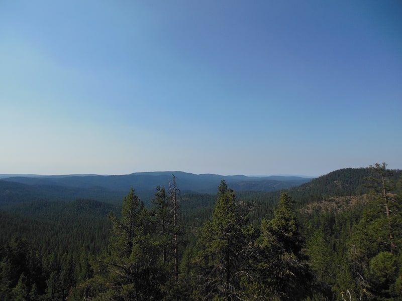
Mountain range in Oregon. The Aldrich Mountains are a mountain range in Grant County, Oregon, United States. An east–west range rising south of the John Day River valley, the mountains are bounded on the west by the South Fork John Day River, on the south by Murderers Creek and the Bear Valley, and on the east by Canyon Creek. Most of the Aldrich Mountains and the mountainous terrain south of them are contained within the Malheur National Forest. The highest point in the range is Fields Peak at 7,362 feet, and the nearest human settlement is Mount Vernon, located in the John Day River valley. Across the South Fork John Day River to the west are the Ochoco Mountains, while across Canyon Creek to the east is the Strawberry Range.[4]