Discover 11 hidden attractions, cool sights, and unusual things to do in Kosciuszko National Park (Australia). Don't miss out on these must-see attractions: Selwyn Snowfields, Mount Kosciuszko, and Kiandra. Also, be sure to include Guthega Power Station in your itinerary.
Below, you can find the list of the most amazing places you should visit in Kosciuszko National Park (New South Wales).
Table of Contents
Selwyn Snowfields
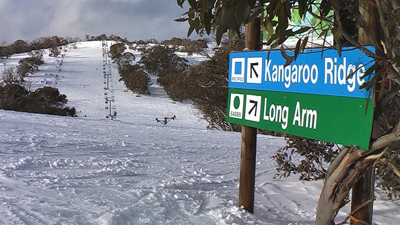
Ski resort in Cabramurra, Australia. Selwyn Snow Resort, formerly known as Selwyn Snowfields, is a ski resort located in the most northern part of the Snowy Mountains of New South Wales, Australia, in the Snowy Monaro Regional Council and Kosciuszko National Park. Selwyn Snow Resort is located near the town of Adaminaby and is close to Cabramurra, which is the highest town in Australia.[1]
Address: Private Bag 2, 2630 Cooma
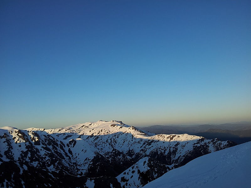
Mount Kosciuszko
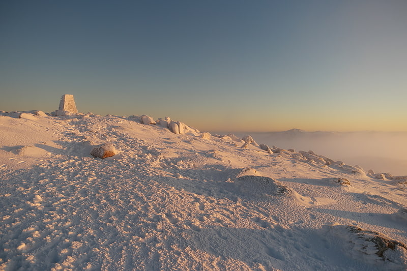
The tallest mountain in Australia. Mount Kosciuszko, previously spelled Mount Kosciusko, is mainland Australia's tallest mountain, at 2,228 metres above sea level. It is located on the Main Range of the Snowy Mountains in Kosciuszko National Park, part of the Australian Alps National Parks and Reserves, in New South Wales, Australia, and is located west of Crackenback and close to Jindabyne.[2]
Kiandra
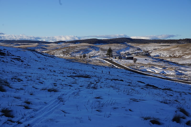
Town in Australia. Kiandra is an abandoned gold mining town and the birthplace of Australian skiing. The town is situated in the Snowy Mountains of New South Wales, Australia, in the Snowy Monaro Regional Council inside the Kosciuszko National Park. Its name is a corruption of Aboriginal 'Gianderra' for 'sharp stones for knives'. It was earlier called Gibson's Plains, named after Dr. Gibson, a settler in the district in 1839. For a century, Kiandra was Australia's highest town.
Kiandra lies approximately 90 kilometres (56 mi) north-west of Cooma on the Snowy Mountains Highway between Adaminaby and Talbingo. It sits at 1,400 metres (4,600 ft) above sea level and is situated on a high, treeless ridge on the banks of the Eucumbene River, which is snow-covered during winter and is subject to high winds. It lies in the Australian Alps montane grasslands bioregion according to Interim Biogeographic Regionalisation for Australia.
After decades of decline, restoration work on the remaining buildings at Kiandra took place from 2009 to 2020, including work on the historic Kiandra Courthouse Chalet and Wolgal Lodge fishing cottage being conducted by the NSW National Parks and Wildlife Service (NPWS) and volunteers, enabling occasional amenities and limited accommodation at Kiandra.
The remaining buildings in the town were either destroyed or severely damaged during the 2019–20 Australian bushfire season.[3]
Guthega Power Station
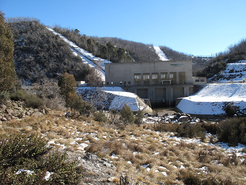
Hydroelectric power plant in Kosciuszko National Park, Australia. Guthega Power Station is located in the Snowy Mountains region of New South Wales, Australia. The power station's purpose is for the generation of electricity. It is the first to be completed and smallest of the initial seven hydroelectric power stations that comprise the Snowy Mountains Scheme, a vast hydroelectricity and irrigation complex constructed in south-east Australia between 1949 and 1974 and now run by Snowy Hydro.
This station is connected to the National Electricity Market via the TransGrid 330/132KV Substation @ the TransGrid 330KV Murray Switching Station, 1.56 kilometres (1.71 mi) South East of Khancoban.[4]
Mount Townsend
Mount in Australia. Mount Townsend, a mountain in the Main Range of the Great Dividing Range, is located in the Snowy Mountains region of New South Wales, Australia.
With an elevation of 2,209 metres (7,247 ft) above sea level, Mount Townsend is the second-highest peak of mainland Australia. Located in Kosciuszko National Park, the mountain is 3.68 kilometres (2.29 mi) north of Australia's highest mainland peak, Mount Kosciuszko.
Although lower than Mount Kosciuszko, Mount Townsend has a more craggy peak and is arguably more dominant than the relatively round-topped Mount Kosciuszko.
The confusion about swapping the names of Mount Kosciuszko and Mount Townsend was straightened out in 1940 by B. T. Dowd, a cartographer and historian of the NSW Lands Department. His study reaffirmed that the mountain named by Strzelecki as Mount Kosciuszko was indeed, as the NSW maps had always shown, Australia's highest summit. When Macarthur's field book of the historical journey was published in 1941 by C. Daley it further confirmed Dowd's clarification. This means that Targangil, mentioned in Spencer's 1885 article, was the indigenous name of Mount Townsend, not of Mount Kosciuszko.
Mount Townsend has a prominence of only 189m which is relatively low compared to other mountains worldwide. In the more stricter prominence cut off points, the most common of which being the 300m prominence rule, Townsend would not be classified as its own mountain, and instead a subsidiary peak. Due to Australia's much flatter topography than all other continents a prominence cut off point of 300m is almost never used instead opting for less strict definitions of 50m or 100m when classifying peaks. If using the 300m rule this makes Mount Bogong in Victoria the second highest mountain.
Mount Townsend is the second highest mountain in Australia.[5]
Lake Cootapatamba
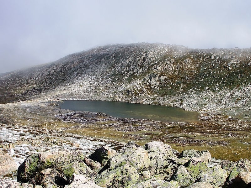
Tarn in Australia. Lake Cootapatamba is a post-glacial tarn in the Kosciuszko National Park, New South Wales, Australia.
Lake Cootapatamba is located at 2,048 metres, which is about 800 metres south of the summit of Mount Kosciuszko, the highest peak in Australia. It is the highest altitude lake in Australia. It is 400 metres long with a maximum depth of about 5 metres.[6]
Lake Albina
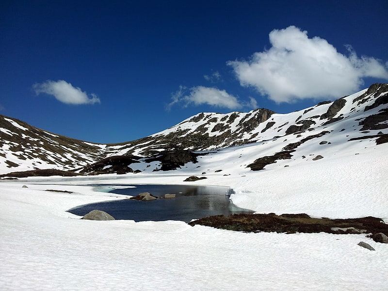
Lake in Australia. Lake Albina is a glacial lake in the Snowy Mountains region of New South Wales, Australia. The lake is located within the Kosciuszko National Park and the Australian Alps National Parks and Reserves.
Lake Albina is located about 2.5 kilometres (1.6 mi) north of Mount Kosciuszko, the highest mountain in Australia. The 6,600-square-metre (71,000 sq ft) lake is approximately 500 metres (1,600 ft) long and 50 metres (160 ft) wide. It is located in a ravine, with Mount Townsend to the west and Mount Lee and Mount Northcote to the east. Lake Albina drains northwards towards the Geehi River through Lady Northcote's canyon.[7]
Seaman's Hut
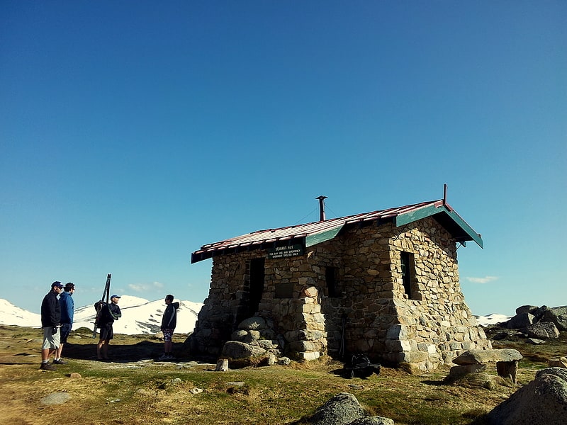
Alpine hut. Seaman's Hut is an alpine hut and memorial located in New South Wales, Australia. It was built following the death of two skiers, W. Laurie Seaman and Evan Hayes in 1928. Seaman's family built the hut to provide shelter to future users of the park, in order to prevent recurrence of a similar tragedy.
Seaman's hut is constructed from rock and has two rooms and a foyer for firewood storage. The floor is plank flooring.
It is located on Etheridge Range, 6 km from Charlottes Pass on the road to Mount Kosciusko.[8]
Yarrangobilly Caves
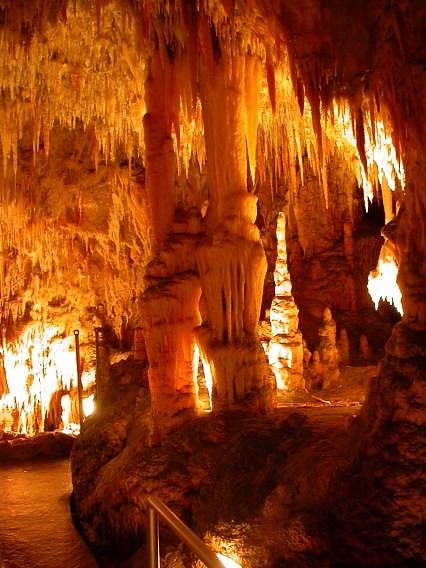
Cave in Australia. The Yarrangobilly Caves are located in a 12-kilometre-long karst region along the Yarrangobilly River valley in the north of Kosciuszko National Park, New South Wales, Australia. Discovered to British colonists by a cattleman, the Yarrangobilly Caves system includes several independent limestone caves formed over different time periods, from several million to a few hundred thousand years old. The older examples are in higher strata and have more speleothem decoration.
The caves are administered by the National Parks and Wildlife Service. Three lit show caves are regularly open to visitors, two for guided tours and the third for a self-guided tour. The caves complex also includes a 20-metre-long (66 ft) and up to 2.5-metre-deep (8 ft) 27 °C (81 °F) thermal pool, fed by natural warm-water springs, and a number of walking tracks.[9]
Great Dividing Range
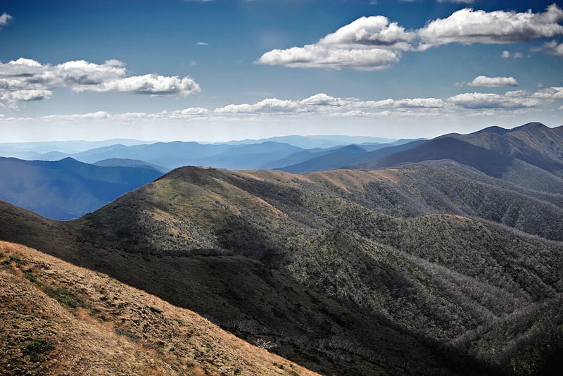
Cordillera in Australia. The Great Dividing Range, also known as the East Australian Cordillera or the Eastern Highlands, is a cordillera system in eastern Australia consisting of an expansive collection of mountain ranges, plateaus and rolling hills, that runs roughly parallel to the east coast of Australia and forms the fifth-longest land-based mountain chain in the world, and the longest entirely within a single country. It is mainland Australia's most substantial topographic feature and serves as the definitive watershed for the river systems in eastern Australia, hence the name.
The Great Dividing Range stretches more than 3,500 kilometres (2,175 mi) from Dauan Island in the Torres Strait off the northern tip of Cape York Peninsula, running the entire length of the eastern coastline through Queensland and New South Wales, then turning west across Victoria before finally fading into the Wimmera plains as rolling hills west of the Grampians region. The width of the Range varies from about 160 km (100 mi) to over 300 km (190 mi). The Greater Blue Mountains Area, Gondwana Rainforests and Wet Tropics of Queensland World Heritage Areas are located in the Range. The highest place in Australia, the 2,228 m (7,310 ft) Mount Kosciuszko, resides in the Snowy Mountains portion of southern Great Dividing Range.[10]
Main Range
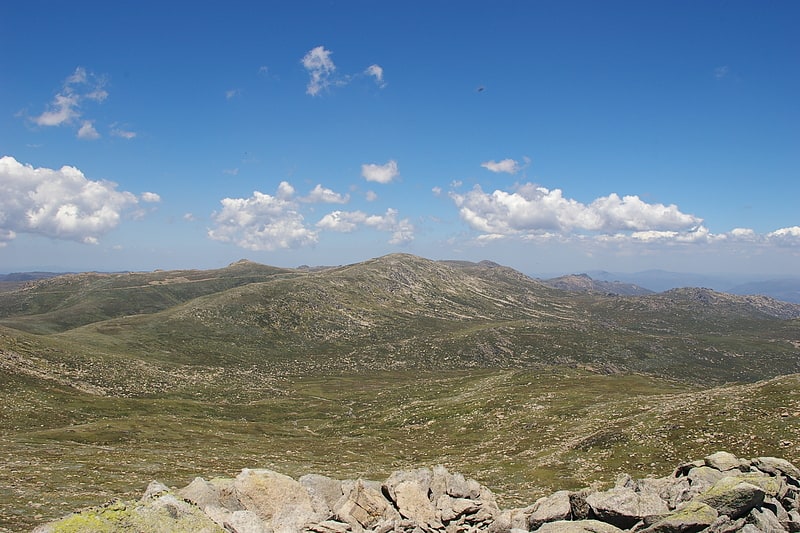
Mountain range. The section of the Great Dividing Range between the Ramshead Range and Dicky Cooper Bogong in the Snowy Mountains is known as the Main Range. It can also be used more generally for the peaks on or on short spurs off the range. It contains many of the highest peaks in mainland Australia. Some peaks on the Main Range include :
- The Ramsheads
- Mount Kosciuszko
- Muellers Peak
- Mount Townsend, Mount Alice Rawson and Abbotts Peak (on Abbotts Ridge)
- Mount Northcote, Mount Clark and Mount Lee
- Carruthers Peak
- Mount Twynam and Little Twynam
- Mount Anton and Mount Anderson
- Mount Tate
- Dicky Cooper Bogong