Discover 4 hidden attractions, cool sights, and unusual things to do in Kofa National Wildlife Refuge (United States). Don't miss out on these must-see attractions: Kofa Mountains, Castle Dome, and Castle Dome Mountains. Also, be sure to include New Water Mountains in your itinerary.
Below, you can find the list of the most amazing places you should visit in Kofa National Wildlife Refuge (Arizona).
Table of Contents
Kofa Mountains
Mountain range in Arizona. The Kofa Mountains of Yuma and La Paz counties in Arizona is the central mountain range of the Kofa National Wildlife Refuge. The range lies about 60 miles northeast of Yuma in the southwestern part of the state. Kofa Wilderness takes up 547,719 acres of the refuge, making it the second largest wilderness area in Arizona. The equally extensive Castle Dome Mountains comprise the southern refuge border; the western end of the Tank Mountains are in the southeast of the wildlife refuge, and the New Water Wilderness in the New Water Mountains ends the extension of the Kofa National Wildlife Refuge to the north. Scenic "King Valley" is south of the Kofa Mountains between the Castle Dome Mountains.
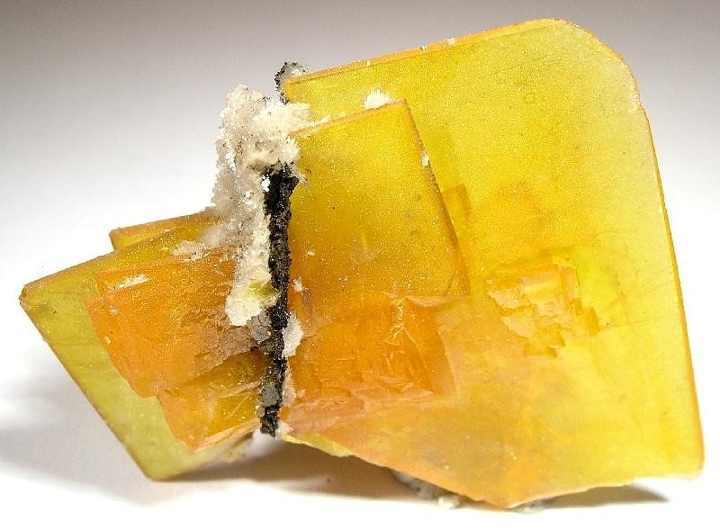
These mountains are home to a number of endemic or rare species including the Kofa Mountain Barberry Berberis harrisoniana. In addition, it contains the only native California fan palms in the state of Arizona located high up in Palm Canyon. These are relicts of the ice age when the range of California fan palms was much larger than its isolated groves today.
The Kofa Mountains are a northwest-southeast range with an extension northwards meeting the New Water Mountains. There are three major peaks in the high region: two in the west: Signal Peak at 4,877 feet (1,487 m) and Squaw Peak at 4,416 feet (1,346 m), and Polaris Mountain at 3,624 feet (1,105 m) in the south.
The closest community to the Kofa Mountains is Quartzsite, 30 miles northwest on Interstate 10. Access roads to the range depart a north-south stretch of US 95, five miles to the west. There are a number of winter homes in King Valley.
The wildlife refuge and the Kofa Mountains are arid and rugged volcanic remnant mountains of Tertiary age. They are home to one of the larger Desert Bighorn Sheep ranges. The wildlife refuge and the mountains are some of the hottest areas in the southwest Sonoran Desert.[1]
Castle Dome
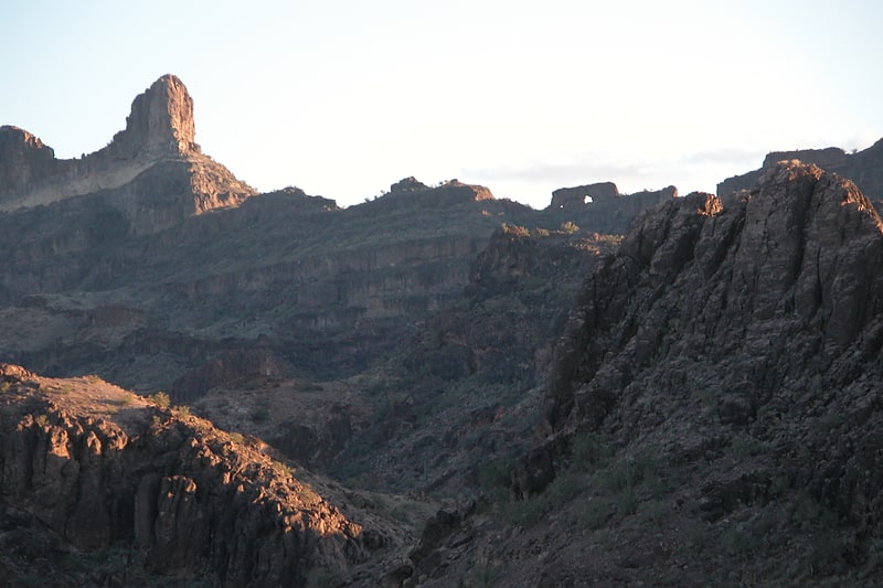
Mountain in Arizona. Castle Dome, or Castle Dome Peak is a prominent butte and high point of the Castle Dome Mountains northeast of Yuma, Arizona, in the northwestern Sonoran Desert.
The butte lies approximately 22 miles (35 km) east of the historical Castle Dome Landing on the Colorado River (site submerged by the Imperial Reservoir). It is located above and east of US Route 95 and the Castle Dome mining district. Castle Dome is noteworthy for its recreational use for day hiking. It is also often coated in winter or spring snowstorms as a white landform, with its loss of white being determined by season and duration of storm temperatures. Castle Dome's height is 3,791 feet (1,155 m).[2]
Castle Dome Mountains
Mountain range in Arizona. The Castle Dome Mountains are a mountain range in Yuma County, Arizona, within the Kofa National Wildlife Refuge. Castle Dome Peak, the high point of the range, is a prominent butte and distinctive landmark. The peak is 3,776 feet high, and is located at 33°05′04″N 114°08′36″W. Castle Dome was named by American soldiers at old Fort Yuma in the 1880s. Early Spanish explorers called the same peak Cabeza de Gigante, "Giant's Head."[3]
New Water Mountains
Mountain range in Arizona. The New Water Mountains is a mountain range in southwestern Arizona. The range is on the northern border of the Kofa National Wildlife Refuge as well as the northern Kofa Mountains.
It is a northwest–southeast trending range, about 20 miles (32 km) long. The southeast third of the range is in the Kofa Refuge, and the mountain range merges northwesterly into the Plomosa Mountains of southern La Paz County. The central part of the range is the New Water Mountains Wilderness with a lengthy east–west border on the northern Kofa National Wildlife Refuge of about 12 miles. The highest point is Black Mesa at 3,639 feet (1,109 m).
Three northerly routes access the mountain range; the central route accesses the Ramsey Mine and eventually the central dry wash on the north; other mines, such as the Republic Mine, are in these mountains, as well as some springs (Dripping Spring); also Brintley Well on a fourth westerly access route. The closest community to the north side of the mountain range is Brenda, Arizona east of Quartzsite. Brenda is on US 60, four miles (6.4 km) northeast of Interstate 10.[4]