Discover 4 hidden attractions, cool sights, and unusual things to do in Hanford Reach National Monument (United States). Don't miss out on these must-see attractions: Vernita Bridge, Rattlesnake Mountain, and Arid Lands Ecology Reserve. Also, be sure to include Wahluke Slope in your itinerary.
Below, you can find the list of the most amazing places you should visit in Hanford Reach National Monument (Washington).
Table of Contents
Vernita Bridge
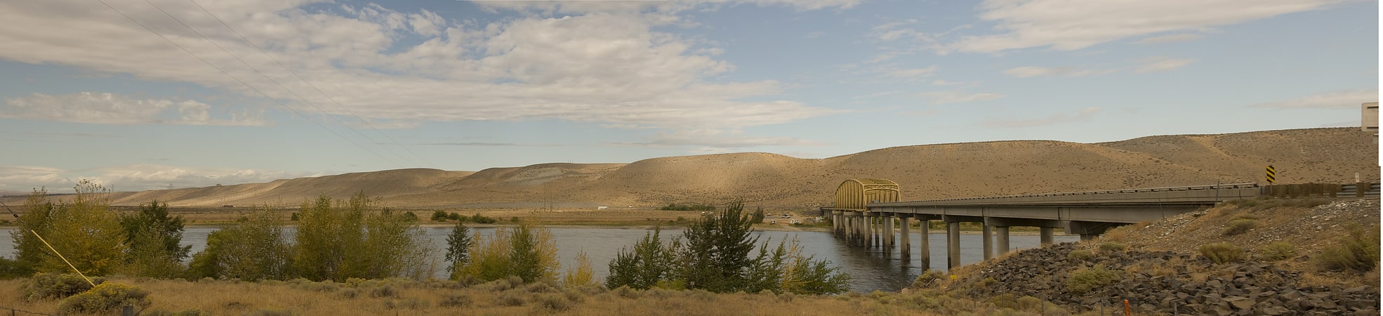
Truss bridge in Benton County, Washington. The Vernita Bridge is a bridge on Washington State Route 24 over the Columbia River between Grant County and Benton County, located approximately 10 miles south of Desert Aire and Mattawa, Washington. The bridge is in the Hanford Reach National Monument near the Hanford Site.[1]
Rattlesnake Mountain
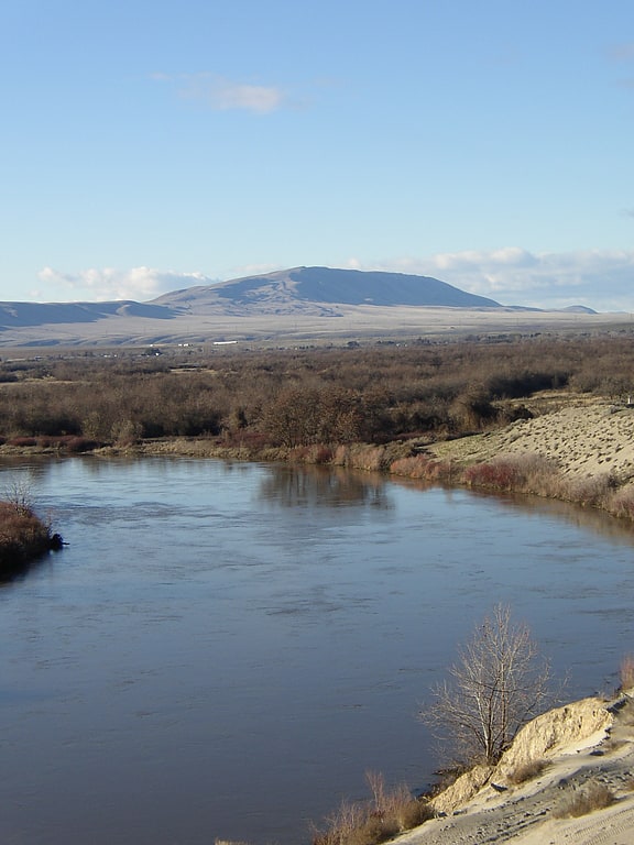
Ridge in Washington State. Rattlesnake Mountain is a 3,531 ft windswept treeless ridge overlooking the Hanford nuclear site. Parts of the western slope are privately owned ranchland, while the eastern slope is under the federal protection of the Arid Lands Ecology Reserve, a unit of the Hanford Reach National Monument, managed by the United States Fish and Wildlife Service. The mountain is the second highest point in Benton County, with its neighbor Lookout Summit surpassing it by only 98 ft.
Rattlesnake Mountain is notable for its high wind speeds, with the highest recorded being around 150 mph (241 kilometers per hour).[2]
Arid Lands Ecology Reserve
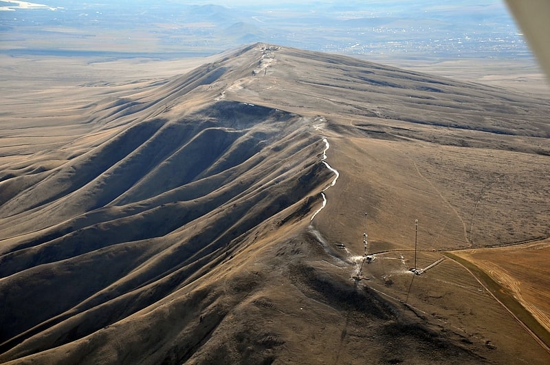
The Arid Land Ecology Reserve is the largest tract of shrub-steppe ecosystem remaining in the U.S. state of Washington. It is managed for the U.S. Department of Energy by the Pacific Northwest National Laboratory. The 320 km² area is a portion of the 1500 km² National Environmental Research Park located on the Hanford Site on the northwest boundary of Richland, Washington.
On June 27, 2000, a range fire destroyed most of the native sagebrush and bunchgrass as well as damaged the microbiotic crust. Though the US Fish and Wildlife Service has attempted to re-introduce native flora, the Arid Lands Ecology Reserve is currently dominated by non-native species such as cheatgrass, knapweeds, and Russian thistle (tumbleweed) which flourished after the 2000 fire. Other species such as spiny hop sage and Wyoming big sagebrush were decimated by the fire and in its aftermath.[3]
Wahluke Slope
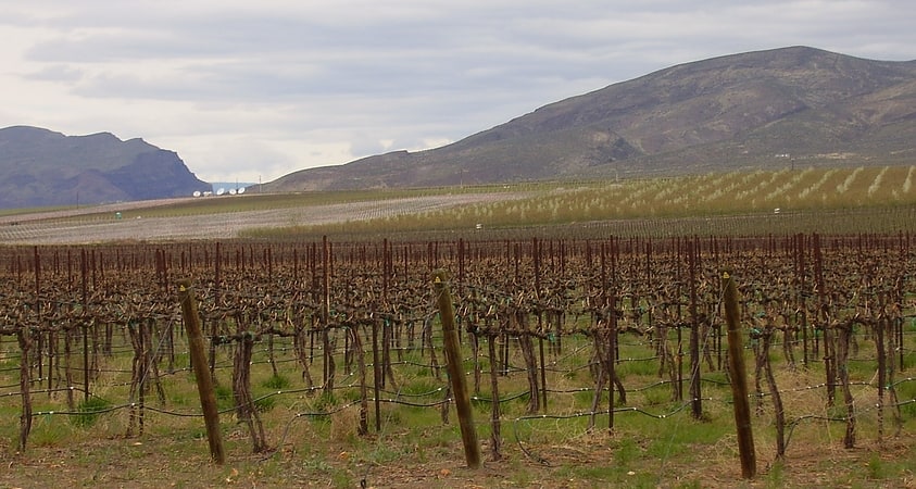
Geographical feature. Wahluke Slope is a geographic feature in Grant, Benton and Adams Counties of Eastern Washington. It is a broad, south-facing slope with a grade of about 8%, situated between the Saddle Mountains and the Columbia River's Hanford Reach. It has been described as "basically a 13-mile-wide gravel bar" created by the Glacial Lake Missoula floods at the end of the last ice age about 15,000 years ago. Much of the Slope, part of the Hanford Nuclear Reservation, was added to the Saddle Mountain National Wildlife Refuge in 1999. Much of the remainder is used for viniculture.[4]